


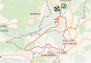

10,8 km | 16,4 km-effort

Benutzer


Kostenlosegpshiking-Anwendung
 SityTrail
IGN / Geografische Institute
SityTrail World
Die Welt öffnet sich für Sie
Tour Wandern von 9,2 km verfügbar auf Auvergne-Rhone-Alpen, Puy-de-Dôme, Ceyrat. Diese Tour wird von tracegps vorgeschlagen.
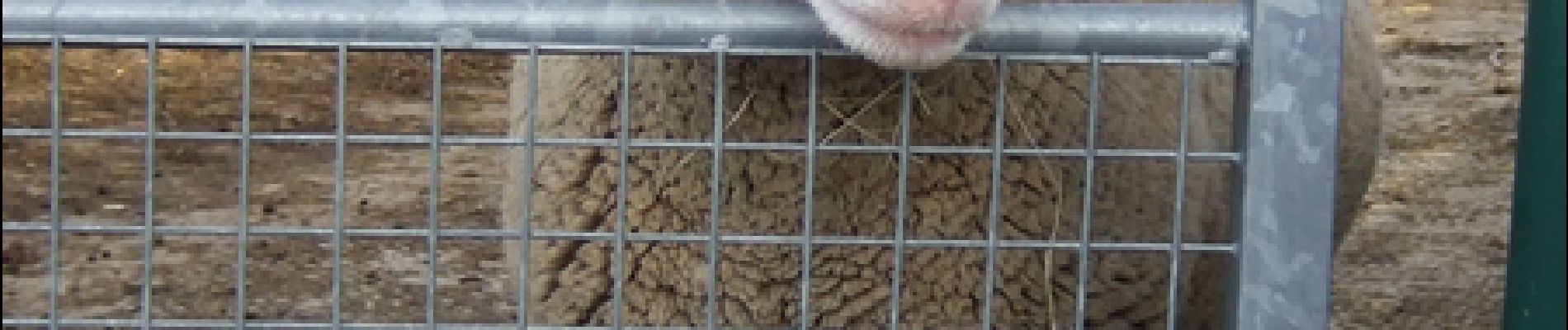
Balade autour du domaine de l'INRA où sont élevés, ovins, bovins et cervidés qui font l'objet d'études les plus diverses. Balade numérisée sur le terrain par Jean louis Phillipart. Retrouvez cette randonnée dans le topo Guide Chamina Autour de Clermont.


Wandern

Wandern

Wandern

Wandern

Wandern

Wandern

Zu Fuß

Zu Fuß

Zu Fuß