![](/images/other/stat-length.png)
![Tour Mountainbike Le Mas-de-Tence - Espace VTT FFC Le Velay des 3 Rivières - N°12 La Côte des Beaux - Le Mas de Tence - Photo](https://media.geolcdn.com/t/1900/400/ext.pjpeg?maxdim=2&url=https%3A%2F%2Fservices.sitytrail.com%2FGeolivesWS%2FDownloadMedia.ashx%3FTrailID%3D101775%26Media%3D2048_1.jpg)
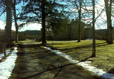
Espace VTT FFC Le Velay des 3 Rivières - N°12 La Côte des Beaux - Le Mas de Tence
tracegps
Benutzer
![Länge](/images/other/stat-length.png)
![Maximale Höhe](https://static1.geolcdn.com/siteimages/upload/files/1508320355ic_sort_altitude_max_24dp.png)
![Positive Höhendifferenz](https://static1.geolcdn.com/siteimages/upload/files/1508320355ic_sort_den_pos_24dp.png)
![Km-Effort](/images/other/stat-length.png)
![Min. Höhe](https://static1.geolcdn.com/siteimages/upload/files/1508320355ic_sort_altitude_min_24dp.png)
![Negative Höhendifferenz](https://static1.geolcdn.com/siteimages/upload/files/1508320355ic_sort_den_neg_24dp.png)
![Boucle](https://static1.geolcdn.com/siteimages/upload/files/16400158638029165_repeat_loop_refresh_sync_direction_icon.png)
![Mountainbike](https://static1.geolcdn.com/sitytour/trail-icons/202.png)
1h30
Schwierigkeit : Medium
![Scannen Sie diesen QR-Code, um die Tour in der SityTrail-Anwendung zu öffnen](https://capi.geolives.com/qq0zvz2zws4bq2lad0pu/sitytour/trails/101775/qr.png?size=200)
Kostenlosegpshiking-Anwendung
Über SityTrail
Tour Mountainbike von 13,7 km verfügbar auf Auvergne-Rhone-Alpen, Haute-Loire, Le Mas-de-Tence. Diese Tour wird von tracegps vorgeschlagen.
Beschreibung
Espace VTT FFC Le Velay des 3 Rivières Circuit labellisé par la Fédération Française de Cyclisme. La pratique du VTT constituant une des demandes majeures exprimées par les touristes et la population locale, la création d'un réseau de circuits V.T.T. a été décidée. 38 circuits ont été sélectionnés représentant 327 km de chemins ou sentiers appartenant au domaine public des communes. Enfin, pour parfaire la promotion de ce produit, le territoire est agréé, par la Fédération Française de Cyclisme (F.F.C.), Espace V.T.T. En contrepartie, cette recherche de qualité et ce label apporteront une notoriété importante à la région, auprès de tous les amateurs car l'Espace V.T.T. Velay des Trois Rivières bénéficie de la promotion faite par la F.F.C. et par Chamina, au niveau national. Le topo-guide est actuellement en vente dans le réseau Chamina, dans les Offices de Tourisme du territoire et auprès du Syndicat d’Initiative.
Ort
Kommentare
Touren in der Umgebung
![Tour Mountainbike Montregard - Espace VTT FFC Le Velay des 3 Rivières - N°15 Le Ruisseau de Trifoulou Montregard - Photo](https://media.geolcdn.com/t/375/260/ext.jpg?maxdim=2&url=https%3A%2F%2Fservices.sitytrail.com%2FGeolivesWS%2FDownloadMedia.ashx%3FTrailID%3D101816%26Media%3D2091_1.jpg)
![Mountainbike Mountainbike](https://static1.geolcdn.com/sitytour/trail-icons/202.png)
Mountainbike
![](/images/other/stat-length.png)
![](https://static1.geolcdn.com/siteimages/upload/files/16400158638029165_repeat_loop_refresh_sync_direction_icon.png)
![Tour Wandern Saint-André-en-Vivarais - 43 st André en vivarais - Photo](https://media.geolcdn.com/t/375/260/b18bf4ac-6e58-4ec7-bc78-fc1c78a343d6.jpg&format=jpg&maxdim=2)
![Wandern Wandern](https://static1.geolcdn.com/sitytour/trail-icons/101.png)
Wandern
![](/images/other/stat-length.png)
![](https://static1.geolcdn.com/siteimages/upload/files/16400158638029165_repeat_loop_refresh_sync_direction_icon.png)
![Tour Wandern Montregard - lalyret - Photo](https://media.geolcdn.com/t/375/260/ext.jpg?maxdim=2&url=https%3A%2F%2Fstatic1.geolcdn.com%2Fsiteimages%2Fupload%2Ffiles%2F1553511878bg_sport_marche.png)
![Wandern Wandern](https://static1.geolcdn.com/sitytour/trail-icons/101.png)
Wandern
![](/images/other/stat-length.png)
![](https://static1.geolcdn.com/siteimages/upload/files/16400158638029165_repeat_loop_refresh_sync_direction_icon.png)
![Tour Wandern Montregard - Rando t'est - Photo](https://media.geolcdn.com/t/375/260/d3922d2c-6cda-4628-a70a-b81ba71a6ff8.jpg&format=jpg&maxdim=2)
![Wandern Wandern](https://static1.geolcdn.com/sitytour/trail-icons/101.png)
Wandern
![](/images/other/stat-length.png)
![](https://static1.geolcdn.com/siteimages/upload/files/16400158638029165_repeat_loop_refresh_sync_direction_icon.png)
![Tour Wandern Le Chambon-sur-Lignon - Tence-170623 - CreuxLoup-RetourVVF - Photo](https://media.geolcdn.com/t/375/260/ext.jpg?maxdim=2&url=https%3A%2F%2Fservices.sitytrail.com%2FGeolivesWS%2FDownloadMedia.ashx%3FTrailID%3D777775%26Media%3Dfix__20170623092557.jpg)
![Wandern Wandern](https://static1.geolcdn.com/sitytour/trail-icons/101.png)
Wandern
![](/images/other/stat-length.png)
![](https://static1.geolcdn.com/siteimages/upload/files/16400158638029165_repeat_loop_refresh_sync_direction_icon.png)
![Tour Wandern Tence - Tence-170618 - RocheDruidique-Mazeaux - Photo](https://media.geolcdn.com/t/375/260/ext.jpg?maxdim=2&url=https%3A%2F%2Fservices.sitytrail.com%2FGeolivesWS%2FDownloadMedia.ashx%3FTrailID%3D775243%26Media%3Dfix__20170618111716.jpg)
![Wandern Wandern](https://static1.geolcdn.com/sitytour/trail-icons/101.png)
Wandern
![](/images/other/stat-length.png)
![](https://static1.geolcdn.com/siteimages/upload/files/16400158638029165_repeat_loop_refresh_sync_direction_icon.png)
![Tour Schneeschuhwandern Le Mas-de-Tence - Coup d'oeil à Montregard - Photo](https://media.geolcdn.com/t/375/260/ext.jpg?maxdim=2&url=https%3A%2F%2Fservices.sitytrail.com%2FGeolivesWS%2FDownloadMedia.ashx%3FTrailID%3D191465%26Media%3D15057_4.jpg)
![Schneeschuhwandern Schneeschuhwandern](https://static1.geolcdn.com/sitytour/trail-icons/504.png)
Schneeschuhwandern
![](/images/other/stat-length.png)
![](https://static1.geolcdn.com/siteimages/upload/files/16400158638029165_repeat_loop_refresh_sync_direction_icon.png)
![Tour Mountainbike Le Mas-de-Tence - Coup d'oeil à Montregard - Photo](https://media.geolcdn.com/t/375/260/ext.jpg?maxdim=2&url=https%3A%2F%2Fservices.sitytrail.com%2FGeolivesWS%2FDownloadMedia.ashx%3FTrailID%3D191464%26Media%3D15057_4.jpg)
![Mountainbike Mountainbike](https://static1.geolcdn.com/sitytour/trail-icons/202.png)
Mountainbike
![](/images/other/stat-length.png)
![](https://static1.geolcdn.com/siteimages/upload/files/16400158638029165_repeat_loop_refresh_sync_direction_icon.png)
![Tour Wandern Le Mas-de-Tence - Coup d'oeil à Montregard - Photo](https://media.geolcdn.com/t/375/260/ext.jpg?maxdim=2&url=https%3A%2F%2Fservices.sitytrail.com%2FGeolivesWS%2FDownloadMedia.ashx%3FTrailID%3D191463%26Media%3D15057_4.jpg)
![Wandern Wandern](https://static1.geolcdn.com/sitytour/trail-icons/101.png)
Wandern
![](/images/other/stat-length.png)
![](https://static1.geolcdn.com/siteimages/upload/files/16400158638029165_repeat_loop_refresh_sync_direction_icon.png)