![](/images/other/stat-length.png)
![Tour Mountainbike Camors - Espace VTT FFC La vallée du Blavet - Le circuit de l'eau en forêt de Camors - Photo](https://media.geolcdn.com/t/1900/400/ext.pjpeg?maxdim=2&url=https%3A%2F%2Fservices.sitytrail.com%2FGeolivesWS%2FDownloadMedia.ashx%3FTrailID%3D101724%26Media%3D1968_1.jpg)
Espace VTT FFC La vallée du Blavet - Le circuit de l'eau en forêt de Camors
tracegps
Benutzer
![Länge](/images/other/stat-length.png)
![Maximale Höhe](https://static1.geolcdn.com/siteimages/upload/files/1508320355ic_sort_altitude_max_24dp.png)
![Positive Höhendifferenz](https://static1.geolcdn.com/siteimages/upload/files/1508320355ic_sort_den_pos_24dp.png)
![Km-Effort](/images/other/stat-length.png)
![Min. Höhe](https://static1.geolcdn.com/siteimages/upload/files/1508320355ic_sort_altitude_min_24dp.png)
![Negative Höhendifferenz](https://static1.geolcdn.com/siteimages/upload/files/1508320355ic_sort_den_neg_24dp.png)
![Boucle](https://static1.geolcdn.com/siteimages/upload/files/16400158638029165_repeat_loop_refresh_sync_direction_icon.png)
![Mountainbike](https://static1.geolcdn.com/sitytour/trail-icons/202.png)
1h00
Schwierigkeit : Medium
![Scannen Sie diesen QR-Code, um die Tour in der SityTrail-Anwendung zu öffnen](https://capi.geolives.com/qq0zvz2zws4bq2lad0pu/sitytour/trails/101724/qr.png?size=200)
Kostenlosegpshiking-Anwendung
Über SityTrail
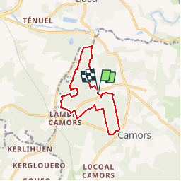
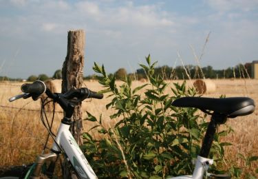
Tour Mountainbike von 11,3 km verfügbar auf Bretagne, Morbihan, Camors. Diese Tour wird von tracegps vorgeschlagen.
Beschreibung
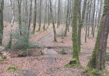
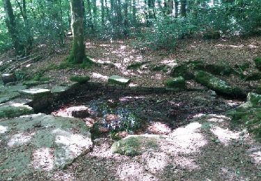
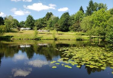
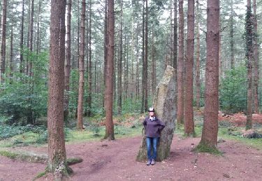
Espace VTT FFC La Vallée du Blavet Circuit labellisé par la Fédération Française de Cyclisme. La Vallée des Korrigans, le menhir de l'Étoile et le château en ruines du sinistre comte Conomore annoncent la couleur : ce pays vous réserve de belles promenades, empreintes de légendes. Que vous soyez à pied, à cheval ou en VTT, le massif forestier de Camors, d'où jadis furent issues des générations de bûcherons, en sera bien souvent le décor. Au cœur du bourg, un étrange mégalithe vous surprendra sûrement. Blottie entres les magnifiques forêts de Floranges et de Lanvaux, la commune de Camors vous promet un accueil chaleureux dans ce petit bourg, à quelques minutes des plus belles plages du Sud Morbihan, venez trouver calme et repos.
Ort
Kommentare
Touren in der Umgebung
![Tour Wandern Camors - PR_56_Camors_CA_03_Circuit1b_Tro-Bourk_20240126 - Photo](https://media.geolcdn.com/t/375/260/b5439ab5-6fb5-4321-891c-f40916bb8e7c.jpg&format=jpg&maxdim=2)
![Wandern Wandern](https://static1.geolcdn.com/sitytour/trail-icons/101.png)
Wandern
![](/images/other/stat-length.png)
![](https://static1.geolcdn.com/siteimages/upload/files/16400158638029165_repeat_loop_refresh_sync_direction_icon.png)
![Tour Wandern Camors - PR_56_Camors_BA_02_Circuit1b_De-L-Eau_20230218 - Photo](https://media.geolcdn.com/t/375/260/26c2393c-1d30-463e-8549-a7f32bee2231.jpg&format=jpg&maxdim=2)
![Wandern Wandern](https://static1.geolcdn.com/sitytour/trail-icons/101.png)
Wandern
![](/images/other/stat-length.png)
![](https://static1.geolcdn.com/siteimages/upload/files/16400158638029165_repeat_loop_refresh_sync_direction_icon.png)
![Tour Wandern Camors - PR_56_Camors_AA_01_Circuit1b_De-L'Etoile_20200726 - Photo](https://media.geolcdn.com/t/375/260/82aaeae4-747d-41a7-86e5-cd57c6a620aa.jpg&format=jpg&maxdim=2)
![Wandern Wandern](https://static1.geolcdn.com/sitytour/trail-icons/101.png)
Wandern
![](/images/other/stat-length.png)
![](https://static1.geolcdn.com/siteimages/upload/files/16400158638029165_repeat_loop_refresh_sync_direction_icon.png)
![Tour Wandern Camors - Circuit de l'Étoile.(forêt de Camors).11-07-16. - Photo](https://media.geolcdn.com/t/375/260/ext.jpg?maxdim=2&url=https%3A%2F%2Fservices.sitytrail.com%2FGeolivesWS%2FDownloadMedia.ashx%3FTrailID%3D596594%26Media%3Dfix__20160711170349.jpg)
![Wandern Wandern](https://static1.geolcdn.com/sitytour/trail-icons/101.png)
Wandern
![](/images/other/stat-length.png)
![](https://static1.geolcdn.com/siteimages/upload/files/16400158638029165_repeat_loop_refresh_sync_direction_icon.png)
![Tour Wandern Camors - Petit tour d'1h40 facile entre étangs, forêt et menhir - Photo](https://media.geolcdn.com/t/375/260/10e5ab03-cf10-4ae2-85ff-d3168d71a3af.jpg&format=jpg&maxdim=2)
![Wandern Wandern](https://static1.geolcdn.com/sitytour/trail-icons/101.png)
Wandern
![](/images/other/stat-length.png)
![](https://static1.geolcdn.com/siteimages/upload/files/16400158638029165_repeat_loop_refresh_sync_direction_icon.png)
![Tour Fahrrad Baud - Baud et la forêt de Camors - Photo](https://media.geolcdn.com/t/375/260/ext.jpg?maxdim=2&url=https%3A%2F%2Fservices.sitytrail.com%2FGeolivesWS%2FDownloadMedia.ashx%3FTrailID%3D832584%26Media%3Dfix__20170920114455.jpg)
![Fahrrad Fahrrad](https://static1.geolcdn.com/sitytour/trail-icons/200.png)
Fahrrad
![](/images/other/stat-length.png)
![](https://static1.geolcdn.com/siteimages/upload/files/16400158638029165_repeat_loop_refresh_sync_direction_icon.png)
![Tour Wandern Camors - Tro Bourk - Camors - Photo](https://media.geolcdn.com/t/375/260/ext.jpg?maxdim=2&url=https%3A%2F%2Fservices.sitytrail.com%2FGeolivesWS%2FDownloadMedia.ashx%3FTrailID%3D316653%26Media%3D17520_2.jpg)
![Wandern Wandern](https://static1.geolcdn.com/sitytour/trail-icons/101.png)
Wandern
![](/images/other/stat-length.png)
![](https://static1.geolcdn.com/siteimages/upload/files/16400158638029165_repeat_loop_refresh_sync_direction_icon.png)
![Tour Wandern Camors - Espace VTT FFC La vallée du Blavet - Le circuit de l'eau en forêt de Camors - Photo](https://media.geolcdn.com/t/375/260/ext.jpg?maxdim=2&url=https%3A%2F%2Fservices.sitytrail.com%2FGeolivesWS%2FDownloadMedia.ashx%3FTrailID%3D101723%26Media%3D1968_1.jpg)
![Wandern Wandern](https://static1.geolcdn.com/sitytour/trail-icons/101.png)
Wandern
![](/images/other/stat-length.png)
![](https://static1.geolcdn.com/siteimages/upload/files/16400158638029165_repeat_loop_refresh_sync_direction_icon.png)
![Tour sport Camors - M - Photo](https://media.geolcdn.com/t/375/260/ad7d5461-0e70-4f75-b943-b3472a85a1e9.jpg&format=jpg&maxdim=2)