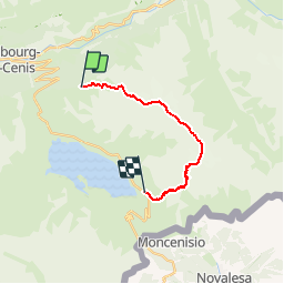
![](/images/other/stat-length.png)
![Tour Wandern Val-Cenis - Pointe de Roce-Lamet - Photo](https://media.geolcdn.com/t/1900/400/ext.pjpeg?maxdim=2&url=https%3A%2F%2Fservices.sitytrail.com%2FGeolivesWS%2FDownloadMedia.ashx%3FTrailID%3D101573%26Media%3D1697_2.jpg)
Pointe de Roce-Lamet
tracegps
Benutzer
![Länge](/images/other/stat-length.png)
![Maximale Höhe](https://static1.geolcdn.com/siteimages/upload/files/1508320355ic_sort_altitude_max_24dp.png)
![Positive Höhendifferenz](https://static1.geolcdn.com/siteimages/upload/files/1508320355ic_sort_den_pos_24dp.png)
![Km-Effort](/images/other/stat-length.png)
![Min. Höhe](https://static1.geolcdn.com/siteimages/upload/files/1508320355ic_sort_altitude_min_24dp.png)
![Negative Höhendifferenz](https://static1.geolcdn.com/siteimages/upload/files/1508320355ic_sort_den_neg_24dp.png)
![Boucle](https://static1.geolcdn.com/siteimages/upload/files/16400158638029165_repeat_loop_refresh_sync_direction_icon.png)
![Wandern](https://static1.geolcdn.com/sitytour/trail-icons/101.png)
9h30
Schwierigkeit : Sehr schwierig
![Scannen Sie diesen QR-Code, um die Tour in der SityTrail-Anwendung zu öffnen](https://capi.geolives.com/qq0zvz2zws4bq2lad0pu/sitytour/trails/101573/qr.png?size=200)
Kostenlosegpshiking-Anwendung
Über SityTrail
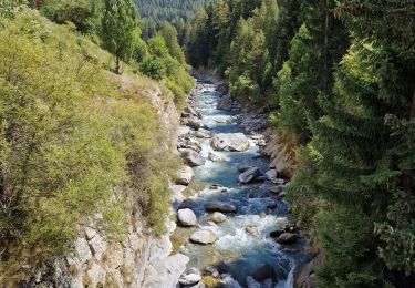
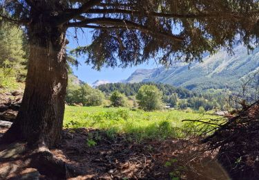
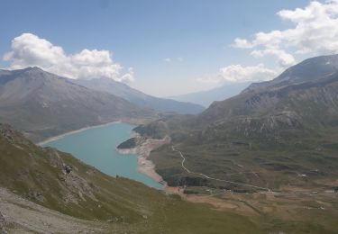
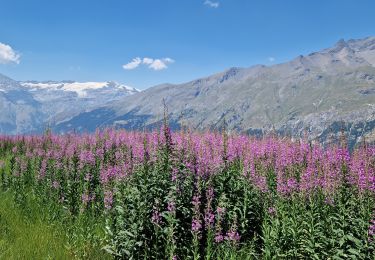
Tour Wandern von 14,1 km verfügbar auf Auvergne-Rhone-Alpen, Savoyen, Val-Cenis. Diese Tour wird von tracegps vorgeschlagen.
Beschreibung
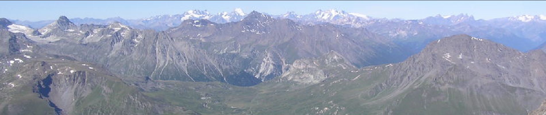
Départ des remontées mécaniques de Val Cenis, avec accès a la pointe de Ronce par le glacier de l'Arcelle neuve. L'arête est interminable avec le passage de plusieurs pointes (Pte de la Haie,Pte du Chapeau, Pte du Vieux) Une magnifique bambée pour ceux qui aiment les courses d'envergures.
Ort
Kommentare
Touren in der Umgebung
![Tour Wandern Val-Cenis - Le Collet - refuge de Vallombrun - la pierre aux pieds - Photo](https://media.geolcdn.com/t/375/260/f1c2cfa5-00f5-4e2e-8013-953500d02eea.jpg&format=jpg&maxdim=2)
![Wandern Wandern](https://static1.geolcdn.com/sitytour/trail-icons/101.png)
Wandern
![](/images/other/stat-length.png)
![](https://static1.geolcdn.com/siteimages/upload/files/16400158638029165_repeat_loop_refresh_sync_direction_icon.png)
![Tour sport Val-Cenis - L’ancien fort de la Turra - Photo](https://media.geolcdn.com/t/375/260/2f372af5-3d13-4f3d-be22-d2d73efaca61.jpg&format=jpg&maxdim=2)
sport
![](/images/other/stat-length.png)
![](https://static1.geolcdn.com/siteimages/upload/files/16400158638029165_repeat_loop_refresh_sync_direction_icon.png)
![Tour Wandern Val-Cenis - Montcenis lac fort de la Tura - Photo](https://media.geolcdn.com/t/375/260/03903eba-f11b-41f0-bc93-d99cacc6c53d.jpg&format=jpg&maxdim=2)
![Wandern Wandern](https://static1.geolcdn.com/sitytour/trail-icons/101.png)
Wandern
![](/images/other/stat-length.png)
![](https://static1.geolcdn.com/siteimages/upload/files/16400158638029165_repeat_loop_refresh_sync_direction_icon.png)
![Tour Wandern Val-Cenis - Col de la Met et Lac de l'Arcelle au départ du télésiège de Solert - Photo](https://media.geolcdn.com/t/375/260/fc51f4c9-cabd-4b7a-83d2-604413b6e3fa.jpg&format=jpg&maxdim=2)
![Wandern Wandern](https://static1.geolcdn.com/sitytour/trail-icons/101.png)
Wandern
![](/images/other/stat-length.png)
![](https://static1.geolcdn.com/siteimages/upload/files/16400158638029165_repeat_loop_refresh_sync_direction_icon.png)
![Tour Wandern Val-Cenis - La randonnée aux milles cascades - Photo](https://media.geolcdn.com/t/375/260/35052577-9dcd-467e-8718-4651b93ef3fb.jpg&format=jpg&maxdim=2)
![Wandern Wandern](https://static1.geolcdn.com/sitytour/trail-icons/101.png)
Wandern
![](/images/other/stat-length.png)
![](https://static1.geolcdn.com/siteimages/upload/files/16400158638029165_repeat_loop_refresh_sync_direction_icon.png)
![Tour Wandern Val-Cenis - Le Fort de la Turra - Photo](https://media.geolcdn.com/t/375/260/fb7e4b15-499e-46a6-93e3-9848cd5c0804.jpg&format=jpg&maxdim=2)
![Wandern Wandern](https://static1.geolcdn.com/sitytour/trail-icons/101.png)
Wandern
![](/images/other/stat-length.png)
![](https://static1.geolcdn.com/siteimages/upload/files/16400158638029165_repeat_loop_refresh_sync_direction_icon.png)
![Tour Wandern Val-Cenis - Les Corbaères - Photo](https://media.geolcdn.com/t/375/260/9162f738-609c-4472-a5d2-1cfa6bc710a0.jpg&format=jpg&maxdim=2)
![Wandern Wandern](https://static1.geolcdn.com/sitytour/trail-icons/101.png)
Wandern
![](/images/other/stat-length.png)
![](https://static1.geolcdn.com/siteimages/upload/files/16400158638029165_repeat_loop_refresh_sync_direction_icon.png)
![Tour Wandern Val-Cenis - fort de la Turra - col de la Beccia - Photo](https://media.geolcdn.com/t/375/260/519bc2cf-9575-4c95-8b89-a32fb03a43b6.jpg&format=jpg&maxdim=2)
![Wandern Wandern](https://static1.geolcdn.com/sitytour/trail-icons/101.png)
Wandern
![](/images/other/stat-length.png)
![](https://static1.geolcdn.com/siteimages/upload/files/16400158638029165_repeat_loop_refresh_sync_direction_icon.png)
![Tour Wandern Val-Cenis - Savoie_Val-Cenis_Lac de l'Arcelle - Photo](https://media.geolcdn.com/t/375/260/94347fc6-b8c5-42c0-a18f-2fed8afa226d.jpg&format=jpg&maxdim=2)
![Wandern Wandern](https://static1.geolcdn.com/sitytour/trail-icons/101.png)
Wandern
![](/images/other/stat-length.png)
![](https://static1.geolcdn.com/siteimages/upload/files/16400158638029165_repeat_loop_refresh_sync_direction_icon.png)
Nous n'avons fait que la pointe Ronce. L'accès à l'arrête ne se fait pas par ce col, il est tout en glace. Il faut passer plus à droite.