![](/images/other/stat-length.png)
![Tour Wandern Saint-Vincent-de-Cosse - St Viencent de Cosse - Bézenac - Photo](https://media.geolcdn.com/t/1900/400/ext.pjpeg?maxdim=2&url=https%3A%2F%2Fservices.sitytrail.com%2FGeolivesWS%2FDownloadMedia.ashx%3FTrailID%3D101287%26Media%3D781_1.jpg)
St Viencent de Cosse - Bézenac
tracegps
Benutzer
![Länge](/images/other/stat-length.png)
Länge
13,7 km
![Maximale Höhe](https://static1.geolcdn.com/siteimages/upload/files/1508320355ic_sort_altitude_max_24dp.png)
Maximale Höhe
272 m
![Positive Höhendifferenz](https://static1.geolcdn.com/siteimages/upload/files/1508320355ic_sort_den_pos_24dp.png)
Positive Höhendifferenz
452 m
![Km-Effort](/images/other/stat-length.png)
Km-Effort
19,8 km
![Min. Höhe](https://static1.geolcdn.com/siteimages/upload/files/1508320355ic_sort_altitude_min_24dp.png)
Min. Höhe
90 m
![Negative Höhendifferenz](https://static1.geolcdn.com/siteimages/upload/files/1508320355ic_sort_den_neg_24dp.png)
Negative Höhendifferenz
453 m
![Boucle](https://static1.geolcdn.com/siteimages/upload/files/16400158638029165_repeat_loop_refresh_sync_direction_icon.png)
Boucle
Ja
Erstellungsdatum :
2014-12-10 00:00:00.0
Letzte Änderung :
2014-12-10 00:00:00.0
![Wandern](https://static1.geolcdn.com/sitytour/trail-icons/101.png)
2h30
Schwierigkeit : Medium
![Scannen Sie diesen QR-Code, um die Tour in der SityTrail-Anwendung zu öffnen](https://capi.geolives.com/qq0zvz2zws4bq2lad0pu/sitytour/trails/101287/qr.png?size=200)
Kostenlosegpshiking-Anwendung
Über SityTrail
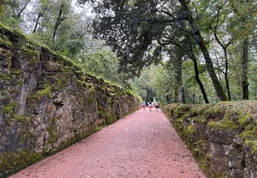
Tour Wandern von 13,7 km verfügbar auf Neu-Aquitanien, Dordogne, Saint-Vincent-de-Cosse. Diese Tour wird von tracegps vorgeschlagen.
Beschreibung
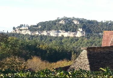
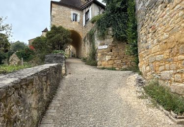
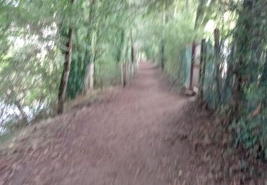
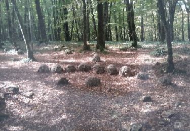
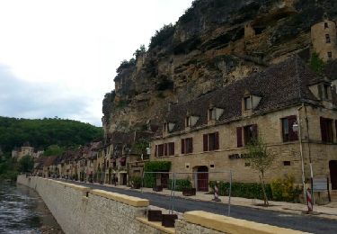
Belle architecture dans sa première moitié. Aucune difficulté particulière. Tout est expliqué sur le site Rando.eu
Ort
Land:
France
Region :
Neu-Aquitanien
Abteilung/Provinz :
Dordogne
Kommune :
Saint-Vincent-de-Cosse
Standort:
Unknown
Gehen Sie:(Dec)
Gehen Sie:(UTM)
351315 ; 4967034 (31T) N.
Kommentare
Touren in der Umgebung
![Tour Wandern Castelnaud-la-Chapelle - Castelnaud 14,5km - Photo](https://media.geolcdn.com/t/375/260/ext.jpg?maxdim=2&url=https%3A%2F%2Fservices.sitytrail.com%2FGeolivesWS%2FDownloadMedia.ashx%3FTrailID%3D1066189%26Media%3Dfix__20181103150326.jpg)
![Wandern Wandern](https://static1.geolcdn.com/sitytour/trail-icons/101.png)
Castelnaud 14,5km
Wandern
Medium
(1)
Castelnaud-la-Chapelle,
Neu-Aquitanien,
Dordogne,
France
![](/images/other/stat-length.png)
14,3 km | 18,3 km-effort
3h 41min
![](https://static1.geolcdn.com/siteimages/upload/files/16400158638029165_repeat_loop_refresh_sync_direction_icon.png)
Ja
![Tour Wandern Castelnaud-la-Chapelle - Périgord j2 Castelnaud - Photo](https://media.geolcdn.com/t/375/260/24da01e3-51b4-4959-999d-053c9737dbd0.jpg&format=jpg&maxdim=2)
![Wandern Wandern](https://static1.geolcdn.com/sitytour/trail-icons/101.png)
Périgord j2 Castelnaud
Wandern
Einfach
Castelnaud-la-Chapelle,
Neu-Aquitanien,
Dordogne,
France
![](/images/other/stat-length.png)
17,1 km | 24 km-effort
4h 38min
![](https://static1.geolcdn.com/siteimages/upload/files/16400158638029165_repeat_loop_refresh_sync_direction_icon.png)
Nein
![Tour Wandern Vézac - Boucle Beynac- La Roque Gageac - Photo](https://media.geolcdn.com/t/375/260/c8a62bb6-456c-4421-8ac7-a6b4d58db5d2.jpg&format=jpg&maxdim=2)
![Wandern Wandern](https://static1.geolcdn.com/sitytour/trail-icons/101.png)
Boucle Beynac- La Roque Gageac
Wandern
Medium
Vézac,
Neu-Aquitanien,
Dordogne,
France
![](/images/other/stat-length.png)
16,3 km | 22 km-effort
4h 20min
![](https://static1.geolcdn.com/siteimages/upload/files/16400158638029165_repeat_loop_refresh_sync_direction_icon.png)
Ja
![Tour Wandern Beynac-et-Cazenac - Perigor Beynac - Photo](https://media.geolcdn.com/t/375/260/a861afd5-735a-473e-a5f1-3f79378bc8ab.jpg&format=jpg&maxdim=2)
![Wandern Wandern](https://static1.geolcdn.com/sitytour/trail-icons/101.png)
Perigor Beynac
Wandern
Medium
Beynac-et-Cazenac,
Neu-Aquitanien,
Dordogne,
France
![](/images/other/stat-length.png)
16,3 km | 22 km-effort
4h 5min
![](https://static1.geolcdn.com/siteimages/upload/files/16400158638029165_repeat_loop_refresh_sync_direction_icon.png)
Ja
![Tour Motor Vézac - Jardin du château de Marquesac - Photo](https://media.geolcdn.com/t/375/260/ext.jpg?maxdim=2&url=https%3A%2F%2Fservices.sitytrail.com%2FGeolivesWS%2FDownloadMedia.ashx%3FTrailID%3D347730%26Media%3Dfix__20140923141715.jpg)
![Motor Motor](https://static1.geolcdn.com/sitytour/trail-icons/400.png)
Jardin du château de Marquesac
Motor
Sehr schwierig
Vézac,
Neu-Aquitanien,
Dordogne,
France
![](/images/other/stat-length.png)
5,3 km | 6,8 km-effort
4h 19min
![](https://static1.geolcdn.com/siteimages/upload/files/16400158638029165_repeat_loop_refresh_sync_direction_icon.png)
Ja
![Tour Wandern La Roque-Gageac - La Roque Gageac - Photo](https://media.geolcdn.com/t/375/260/ext.jpg?maxdim=2&url=https%3A%2F%2Fservices.sitytrail.com%2FGeolivesWS%2FDownloadMedia.ashx%3FTrailID%3D273016%26Media%3Dfix__20140502173626.jpg)
![Wandern Wandern](https://static1.geolcdn.com/sitytour/trail-icons/101.png)
La Roque Gageac
Wandern
Medium
La Roque-Gageac,
Neu-Aquitanien,
Dordogne,
France
![](/images/other/stat-length.png)
9,7 km | 14,6 km-effort
3h 15min
![](https://static1.geolcdn.com/siteimages/upload/files/16400158638029165_repeat_loop_refresh_sync_direction_icon.png)
Nein
![Tour Wandern Castelnaud-la-Chapelle - Balade autour de Castelnaud la Chapelle - Photo](https://media.geolcdn.com/t/375/260/ext.jpg?maxdim=2&url=https%3A%2F%2Fservices.sitytrail.com%2FGeolivesWS%2FDownloadMedia.ashx%3FTrailID%3D172935%26Media%3D14412_3.jpg)
![Wandern Wandern](https://static1.geolcdn.com/sitytour/trail-icons/101.png)
Balade autour de Castelnaud la Chapelle
Wandern
Medium
Castelnaud-la-Chapelle,
Neu-Aquitanien,
Dordogne,
France
![](/images/other/stat-length.png)
13,5 km | 19 km-effort
3h 30min
![](https://static1.geolcdn.com/siteimages/upload/files/16400158638029165_repeat_loop_refresh_sync_direction_icon.png)
Ja
![Tour Wandern Vézac - 2011-06-03 - 17h56m53 - Photo](https://media.geolcdn.com/t/375/260/ext.jpg?maxdim=2&url=https%3A%2F%2Fservices.sitytrail.com%2FGeolivesWS%2FDownloadMedia.ashx%3FTrailID%3D67099%26Media%3D20110603154850.jpg)
![Wandern Wandern](https://static1.geolcdn.com/sitytour/trail-icons/101.png)
2011-06-03 - 17h56m53
Wandern
Sehr leicht
(1)
Vézac,
Neu-Aquitanien,
Dordogne,
France
![](/images/other/stat-length.png)
1,2 km | 1,8 km-effort
Unbekannt
![](https://static1.geolcdn.com/siteimages/upload/files/16400158638029165_repeat_loop_refresh_sync_direction_icon.png)
Ja
![Tour Wandern Vézac - Château de Marqueyssac - Photo](https://media.geolcdn.com/t/375/260/b9e15253-79a4-442d-a1c8-a27b8cf42b2d.jpg&format=jpg&maxdim=2)
![Wandern Wandern](https://static1.geolcdn.com/sitytour/trail-icons/101.png)
Château de Marqueyssac
Wandern
Vézac,
Neu-Aquitanien,
Dordogne,
France
![](/images/other/stat-length.png)
3,1 km | 4,1 km-effort
53min
![](https://static1.geolcdn.com/siteimages/upload/files/16400158638029165_repeat_loop_refresh_sync_direction_icon.png)
Nein
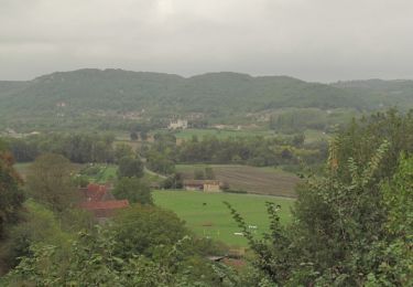
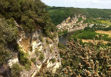
très jolie rando,de très beaux paysages et des villages typiques