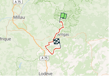
![](/images/other/stat-length.png)
![Tour Mountainbike Dourbies - DOURBIES -VISSEC - Photo](https://media.geolcdn.com/t/1900/400/ext.pjpeg?maxdim=2&url=https%3A%2F%2Fstatic1.geolcdn.com%2Fsiteimages%2Fupload%2Ffiles%2F1524743154velo.jpg)
DOURBIES -VISSEC
phcol
Benutzer
![Länge](/images/other/stat-length.png)
Länge
58 km
![Maximale Höhe](https://static1.geolcdn.com/siteimages/upload/files/1508320355ic_sort_altitude_max_24dp.png)
Maximale Höhe
1335 m
![Positive Höhendifferenz](https://static1.geolcdn.com/siteimages/upload/files/1508320355ic_sort_den_pos_24dp.png)
Positive Höhendifferenz
1012 m
![Km-Effort](/images/other/stat-length.png)
Km-Effort
73 km
![Min. Höhe](https://static1.geolcdn.com/siteimages/upload/files/1508320355ic_sort_altitude_min_24dp.png)
Min. Höhe
457 m
![Negative Höhendifferenz](https://static1.geolcdn.com/siteimages/upload/files/1508320355ic_sort_den_neg_24dp.png)
Negative Höhendifferenz
1446 m
![Boucle](https://static1.geolcdn.com/siteimages/upload/files/16400158638029165_repeat_loop_refresh_sync_direction_icon.png)
Boucle
Nein
Erstellungsdatum :
2019-01-15 13:32:53.365
Letzte Änderung :
2019-01-15 13:32:53.365
![Mountainbike](https://static1.geolcdn.com/sitytour/trail-icons/202.png)
4h43
Schwierigkeit : Medium
![Scannen Sie diesen QR-Code, um die Tour in der SityTrail-Anwendung zu öffnen](https://capi.geolives.com/qq0zvz2zws4bq2lad0pu/sitytour/trails/1010221/qr.png?size=200)
Kostenlosegpshiking-Anwendung
Über SityTrail
Tour Mountainbike von 58 km verfügbar auf Okzitanien, Gard, Dourbies. Diese Tour wird von phcol vorgeschlagen.
Beschreibung
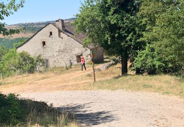
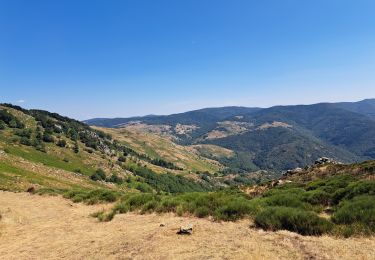
GTMC Dourbies Vissec Montée au Mont St Guiral par 10km de route et descente à Vissec par 6km de route.
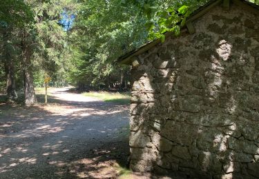
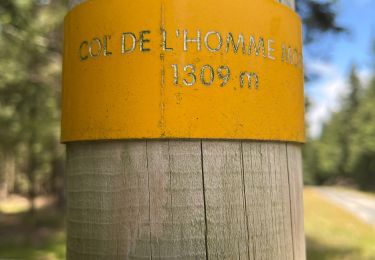
Portage au pied de St Guiral (100m)
Ort
Land:
France
Region :
Okzitanien
Abteilung/Provinz :
Gard
Kommune :
Dourbies
Standort:
Unknown
Gehen Sie:(Dec)
Gehen Sie:(UTM)
535737 ; 4879117 (31T) N.
Kommentare
Touren in der Umgebung
![Tour Wandern Dourbies - DOURBIE LE SUQUET - Photo](https://media.geolcdn.com/t/375/260/ext.jpg?maxdim=2&url=https%3A%2F%2Fmedia.geolcdn.com%2Ff%2F3aec8218-95f7-47b5-aefb-d575744fb544.jpg)
![Wandern Wandern](https://static1.geolcdn.com/sitytour/trail-icons/101.png)
DOURBIE LE SUQUET
Wandern
Medium
(1)
Dourbies,
Okzitanien,
Gard,
France
![](/images/other/stat-length.png)
12,5 km | 19,3 km-effort
4h 21min
![](https://static1.geolcdn.com/siteimages/upload/files/16400158638029165_repeat_loop_refresh_sync_direction_icon.png)
Ja
![Tour Wandern Dourbies - RANDO DOURBIE - Photo](https://media.geolcdn.com/t/375/260/ext.jpg?maxdim=2&url=https%3A%2F%2Fmedia.geolcdn.com%2Ff%2F14771d8a-2437-4736-82a2-63176b47cad0.jpg)
![Wandern Wandern](https://static1.geolcdn.com/sitytour/trail-icons/101.png)
RANDO DOURBIE
Wandern
Medium
(1)
Dourbies,
Okzitanien,
Gard,
France
![](/images/other/stat-length.png)
8,6 km | 12,7 km-effort
2h 55min
![](https://static1.geolcdn.com/siteimages/upload/files/16400158638029165_repeat_loop_refresh_sync_direction_icon.png)
Ja
![Tour Wandern Dourbies - Dourbies -Meyruis 23 km - deuxième étape tour du mont Aigual - Photo](https://media.geolcdn.com/t/375/260/ext.jpg?maxdim=2&url=https%3A%2F%2Fmedia.geolcdn.com%2Ff%2F52458433-a83a-4257-9972-4552b12cb0f6.jpg)
![Wandern Wandern](https://static1.geolcdn.com/sitytour/trail-icons/101.png)
Dourbies -Meyruis 23 km - deuxième étape tour du mont Aigual
Wandern
Medium
Dourbies,
Okzitanien,
Gard,
France
![](/images/other/stat-length.png)
23 km | 34 km-effort
8h 16min
![](https://static1.geolcdn.com/siteimages/upload/files/16400158638029165_repeat_loop_refresh_sync_direction_icon.png)
Nein
![Tour Wandern Trèves - st firmin - Photo](https://media.geolcdn.com/t/375/260/ext.jpg?maxdim=2&url=https%3A%2F%2Fstatic1.geolcdn.com%2Fsiteimages%2Fupload%2Ffiles%2F1553511878bg_sport_marche.png)
![Wandern Wandern](https://static1.geolcdn.com/sitytour/trail-icons/101.png)
![Tour Wandern Arrigas - Col de l’Homme mort le Saint Guiral - Photo](https://media.geolcdn.com/t/375/260/ext.jpg?maxdim=2&url=https%3A%2F%2Fmedia.geolcdn.com%2Ff%2F261f46b4-fe0a-4f99-bec2-77703f139aba.jpg)
![Wandern Wandern](https://static1.geolcdn.com/sitytour/trail-icons/101.png)
Col de l’Homme mort le Saint Guiral
Wandern
Schwierig
Arrigas,
Okzitanien,
Gard,
France
![](/images/other/stat-length.png)
9,9 km | 13 km-effort
4h 11min
![](https://static1.geolcdn.com/siteimages/upload/files/16400158638029165_repeat_loop_refresh_sync_direction_icon.png)
Ja
![Tour Wandern Lanuéjols - Commeiras - Photo](https://media.geolcdn.com/t/375/260/ext.jpg?maxdim=2&url=https%3A%2F%2Fmedia.geolcdn.com%2Ff%2Fdbaa3b33-bf1b-43cb-b30a-b330865bb26f.jpg)
![Wandern Wandern](https://static1.geolcdn.com/sitytour/trail-icons/101.png)
![Tour Wandern Dourbies - crête du Suquet - Photo](https://media.geolcdn.com/t/375/260/ext.jpg?maxdim=2&url=https%3A%2F%2Fmedia.geolcdn.com%2Ff%2F8fc2ffba-6eb5-43fe-a57f-f0d67ec43f0f.jpg)
![Wandern Wandern](https://static1.geolcdn.com/sitytour/trail-icons/101.png)
crête du Suquet
Wandern
Schwierig
Dourbies,
Okzitanien,
Gard,
France
![](/images/other/stat-length.png)
51 km | 71 km-effort
7h 50min
![](https://static1.geolcdn.com/siteimages/upload/files/16400158638029165_repeat_loop_refresh_sync_direction_icon.png)
Nein
![Tour Wandern Dourbies - Le Suquet - Dourbies - Photo](https://media.geolcdn.com/t/375/260/ext.jpg?maxdim=2&url=https%3A%2F%2Fservices.sitytrail.com%2FGeolivesWS%2FDownloadMedia.ashx%3FTrailID%3D214879%26Media%3D15426_6.jpg)
![Wandern Wandern](https://static1.geolcdn.com/sitytour/trail-icons/101.png)
Le Suquet - Dourbies
Wandern
Schwierig
Dourbies,
Okzitanien,
Gard,
France
![](/images/other/stat-length.png)
14,6 km | 24 km-effort
5h 30min
![](https://static1.geolcdn.com/siteimages/upload/files/16400158638029165_repeat_loop_refresh_sync_direction_icon.png)
Ja
![Tour Wandern Dourbies - Saint Guiral - Dourbies - Photo](https://media.geolcdn.com/t/375/260/ext.jpg?maxdim=2&url=https%3A%2F%2Fservices.sitytrail.com%2FGeolivesWS%2FDownloadMedia.ashx%3FTrailID%3D214878%26Media%3D15425_6.jpg)
![Wandern Wandern](https://static1.geolcdn.com/sitytour/trail-icons/101.png)
Saint Guiral - Dourbies
Wandern
Schwierig
Dourbies,
Okzitanien,
Gard,
France
![](/images/other/stat-length.png)
19 km | 28 km-effort
5h 30min
![](https://static1.geolcdn.com/siteimages/upload/files/16400158638029165_repeat_loop_refresh_sync_direction_icon.png)
Ja