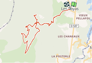

13,3 km | 19,9 km-effort


Benutzer


Kostenlosegpshiking-Anwendung
 SityTrail
IGN / Geografische Institute
SityTrail World
Die Welt öffnet sich für Sie
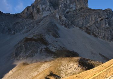
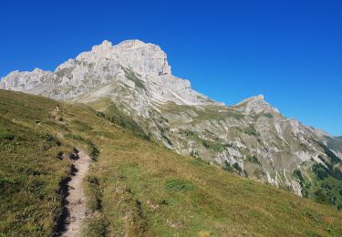
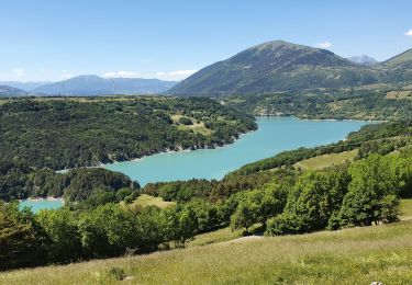
Tour Wandern von 13,6 km verfügbar auf Auvergne-Rhone-Alpen, Isère, Pellafol. Diese Tour wird von rigol05 vorgeschlagen.
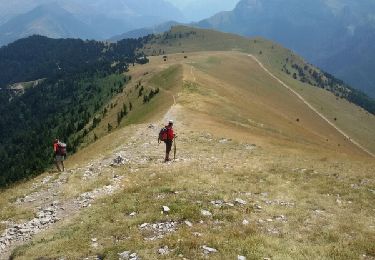
sortie du 19/07/2018Modification, du col de la Samblue remonter par la piste jusqu'au col des Faïsses. Le chemin emprunté n'est plus praticable.
Wandern

Wandern

Wandern
Zu Fuß
Wandern
Wandern
Wandern

Wandern