Startseite
World
NEW
Premium
Speichern Sie
Touren
Artikel
Hilfe - Unterstützung
Français
English
Nederlands
Español
Italiano
Deutsch
Verbindung
Startseite
World
Premium
Speichern Sie
Touren
Artikel
Hilfe - Unterstützung
SityTrail
>
POIs
>
GCV2WC
SityTrail
>
POIs
>
GCV2WC
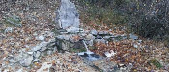
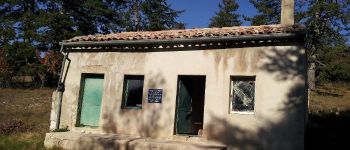
GCV2WC
Beschreibung
PERRACHE 1150 by BOBINES84, Mu
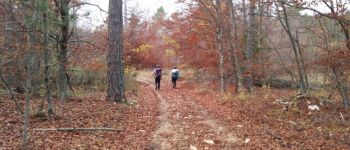
Foto-Galerie
Erkunden Sie GCV2WC mit den folgenden Touren...
tracegps
Col du Souffre et Lacs Mont-Coua
Wandern
Schwierig
(1)
Les Allues, Auvergne-Rhone-Alpen, Savoyen, France
25 km | 41 km-effort
7h 0min
Ja
tracegps
Benutzer
©
OpenStreetMap
contributors
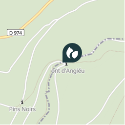
Ort
Land:
France
Region :
Provence-Alpes-Côte d'Azur
Abteilung/Provinz :
Vaucluse
Kommune :
Bédoin
Standort:
Unknown
Ort
44.136849968 / 5.31835
Erstellungsdatum :
2018-04-09 12:22:02.982
Letzte Änderung
2018-04-09 12:22:02.982
(0 Nachricht)
Kommentare
Bitte melden Sie sich an, um einen Kommentar oder eine Bewertung zu hinterlassen
POI's in der Nähe
tracegps
GCV2WC
BÉDOIN
Drailloun
Font d'Angiou
BÉDOIN
Drailloun
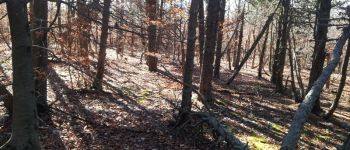
Forêt
SAULT
Drailloun
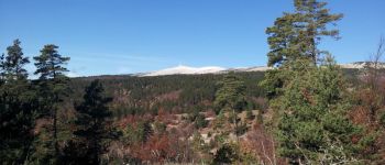
Mont Ventoux
SAULT
Drailloun
Pavillon du Rat
SAULT
Drailloun
Couleurs d'Automne
BÉDOIN
jccardon
Chalet Reynard
BÉDOIN
tracegps
004
BÉDOIN
Schließen
Meine Abonnements