Startseite
World
NEW
Premium
Speichern Sie
Touren
Artikel
Hilfe - Unterstützung
Français
English
Nederlands
Español
Italiano
Deutsch
Verbindung
Startseite
World
Premium
Speichern Sie
Touren
Artikel
Hilfe - Unterstützung
SityTrail
>
POIs
>
GC117XC
SityTrail
>
POIs
>
GC117XC
GC117XC
Beschreibung
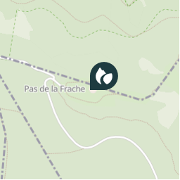
T1 (Bonus 1) Col de la Frache
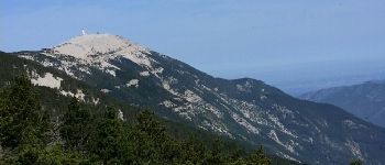
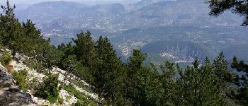
Foto-Galerie
Erkunden Sie GC117XC mit den folgenden Touren...
tracegps
Col du Souffre et Lacs Mont-Coua
Wandern
Schwierig
(1)
Les Allues, Auvergne-Rhone-Alpen, Savoyen, France
25 km | 41 km-effort
7h 0min
Ja
tracegps
Benutzer
©
OpenStreetMap
contributors
Ort
Land:
France
Region :
Provence-Alpes-Côte d'Azur
Abteilung/Provinz :
Vaucluse
Kommune :
Aurel
Standort:
Unknown
Ort
44.157883013 / 5.332967034
Erstellungsdatum :
2018-04-09 12:23:11.728
Letzte Änderung
2018-04-09 12:23:11.728
(0 Nachricht)
Kommentare
Bitte melden Sie sich an, um einen Kommentar oder eine Bewertung zu hinterlassen
POI's in der Nähe
tracegps
GC117XC
AUREL
MarcLEBARON
Photo 5
BRANTES
Cricounet84
Point 6
AUREL
MarcLEBARON
Photo 6
BRANTES
jccardon
Chalet Reynard
BÉDOIN
tracegps
004
BÉDOIN
tracegps
004
BÉDOIN
tracegps
004
BÉDOIN
Schließen
Meine Abonnements