


5,3 km | 8,3 km-effort
Garfield County : Entdecken Sie die besten Touren : 11 zu Fuß. Alle diese Touren, Trails, Routen und Outdoor-Aktivitäten sind in unseren SityTrail-Apps für Smartphones und Tablets verfügbar.
Wandern


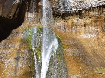
• Très belle balade avec à l'arrivée une superbe chute d'eau. 10.6 km AR
Wandern
• MAGNIFIQUE !!!
Auto
Wandern
Wandern
Wandern

Wandern
Wandern
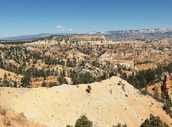
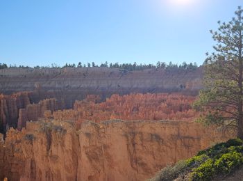
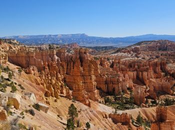
• superbe randonnée à Bryce canyon. départ de sunrise point et arrivée à sunset point. sublime balade au fond du canyon
Wandern
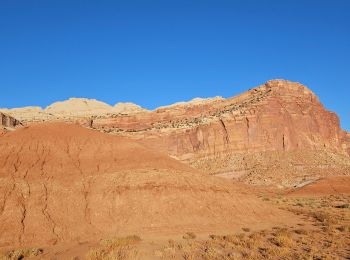
• A Capitol Reef
Wandern
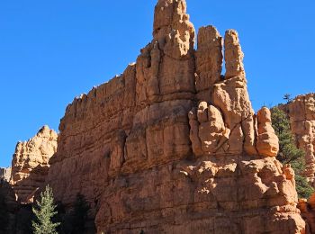
• Super
Wandern

Auto
Auto
Wandern
14 Angezeigte Touren bei 14
Kostenlosegpshiking-Anwendung
 SityTrail
IGN / Geografische Institute
SityTrail World
Die Welt öffnet sich für Sie