![](/images/other/stat-length.png)
Moltrasio, Como: Die besten Touren, Trails, Trecks und Wanderungen
Moltrasio : Entdecken Sie die besten Touren : 2 zu Fuß. Alle diese Touren, Trails, Routen und Outdoor-Aktivitäten sind in unseren SityTrail-Apps für Smartphones und Tablets verfügbar.
Die besten Spuren (2)
![Tour Zu Fuß Moltrasio - IT-26 - Photo](https://media.geolcdn.com/t/350/260/00bfd9e6-6d82-4b71-bfd6-00c35bb0d044.jpeg&format=jpg&maxdim=2)
![Zu Fuß Zu Fuß](https://static1.geolcdn.com/sitytour/trail-icons/100.png)
Km
Zu Fuß
![](/images/other/stat-length.png)
![](https://static1.geolcdn.com/siteimages/upload/files/1508320355ic_sort_den_pos_24dp.png)
![](https://static1.geolcdn.com/siteimages/upload/files/1508320355ic_sort_den_neg_24dp.png)
![](https://static1.geolcdn.com/siteimages/upload/files/16400158638029165_repeat_loop_refresh_sync_direction_icon.png)
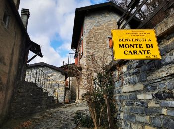
• Trail created by Comunità montana "Lario Intelvese". a Monti di Madrona c'è un guidepost del sentiero 26 in direzion...
![Tour Zu Fuß Moltrasio - Moltrasio - Rifugio Bugone - Photo](https://media.geolcdn.com/t/350/260/ecbf7d97-3d82-4517-8f17-1157963299f2.jpeg&format=jpg&maxdim=2)
![Zu Fuß Zu Fuß](https://static1.geolcdn.com/sitytour/trail-icons/100.png)
Km
Zu Fuß
![](/images/other/stat-length.png)
![](https://static1.geolcdn.com/siteimages/upload/files/1508320355ic_sort_den_pos_24dp.png)
![](https://static1.geolcdn.com/siteimages/upload/files/1508320355ic_sort_den_neg_24dp.png)
![](https://static1.geolcdn.com/siteimages/upload/files/16400158638029165_repeat_loop_refresh_sync_direction_icon.png)
• Trail created by Comunità montana "Lario Intelvese", Club Alpino Italiano. Symbol: arrow shaped metal plate with red...
2 Angezeigte Touren bei 2
Kostenlosegpshiking-Anwendung