![](/images/other/stat-length.png)
Colere, Bergamo: Die besten Touren, Trails, Trecks und Wanderungen
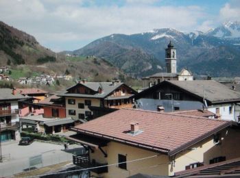
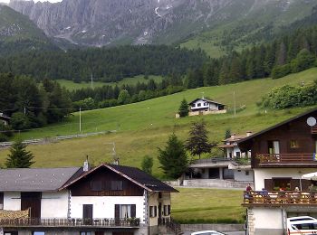
Colere : Entdecken Sie die besten Touren : 9 zu Fuß. Alle diese Touren, Trails, Routen und Outdoor-Aktivitäten sind in unseren SityTrail-Apps für Smartphones und Tablets verfügbar.
Die besten Spuren (9)
![Tour Zu Fuß Colere - IT-401 - Photo](https://media.geolcdn.com/t/350/260/6123d9d7-cca3-4b52-b64f-f80d90363769.jpeg&format=jpg&maxdim=2)
![Zu Fuß Zu Fuß](https://static1.geolcdn.com/sitytour/trail-icons/100.png)
Km
Zu Fuß
![](/images/other/stat-length.png)
![](https://static1.geolcdn.com/siteimages/upload/files/1508320355ic_sort_den_pos_24dp.png)
![](https://static1.geolcdn.com/siteimages/upload/files/1508320355ic_sort_den_neg_24dp.png)
![](https://static1.geolcdn.com/siteimages/upload/files/16400158638029165_repeat_loop_refresh_sync_direction_icon.png)
• SENTIERO DELLE OROBIE Website: http://geoportale.caibergamo.it/it/sentiero/401
![Tour Zu Fuß Colere - Sentiero delle Orobie Orientali - Tappa finale Anello - Photo](https://media.geolcdn.com/t/350/260/08606b6c-30fc-4584-b124-177dd3367da7.jpeg&format=jpg&maxdim=2)
![Zu Fuß Zu Fuß](https://static1.geolcdn.com/sitytour/trail-icons/100.png)
Km
Zu Fuß
![](/images/other/stat-length.png)
![](https://static1.geolcdn.com/siteimages/upload/files/1508320355ic_sort_den_pos_24dp.png)
![](https://static1.geolcdn.com/siteimages/upload/files/1508320355ic_sort_den_neg_24dp.png)
![](https://static1.geolcdn.com/siteimages/upload/files/16400158638029165_repeat_loop_refresh_sync_direction_icon.png)
• Ultima tappa del SENTIERO DELLE OROBIE ORIENTALI - variante ad anello che riporta ad Ardesio. Website: http://geopor...
![Tour Zu Fuß Colere - CAI315: Passo della Presolana - Grotta dei Pagani - Photo](https://media.geolcdn.com/t/350/260/47854369-fdf8-487d-8e03-1306a29c48e5.jpeg&format=jpg&maxdim=2)
![Zu Fuß Zu Fuß](https://static1.geolcdn.com/sitytour/trail-icons/100.png)
Km
Zu Fuß
![](/images/other/stat-length.png)
![](https://static1.geolcdn.com/siteimages/upload/files/1508320355ic_sort_den_pos_24dp.png)
![](https://static1.geolcdn.com/siteimages/upload/files/1508320355ic_sort_den_neg_24dp.png)
![](https://static1.geolcdn.com/siteimages/upload/files/16400158638029165_repeat_loop_refresh_sync_direction_icon.png)
• Il sentiero 315 è forse il percorso più usato per salire al Pizzo della Presolana, partendo dal passo della Presolana...
![Tour Zu Fuß Colere - Sentiero delle Orobie Orientali - Tappa finale Classico - Photo](https://media.geolcdn.com/t/350/260/76765d9a-4898-4654-8692-0eca7d7ca2c7.jpeg&format=jpg&maxdim=2)
![Zu Fuß Zu Fuß](https://static1.geolcdn.com/sitytour/trail-icons/100.png)
Km
Zu Fuß
![](/images/other/stat-length.png)
![](https://static1.geolcdn.com/siteimages/upload/files/1508320355ic_sort_den_pos_24dp.png)
![](https://static1.geolcdn.com/siteimages/upload/files/1508320355ic_sort_den_neg_24dp.png)
![](https://static1.geolcdn.com/siteimages/upload/files/16400158638029165_repeat_loop_refresh_sync_direction_icon.png)
• Il “Sentiero delle Orobie” è un’opera alpina lombarda, in Italia, di grande rilevanza storica, naturalistica e alpini...
![Tour Zu Fuß Colere - IT-403 - Photo](https://media.geolcdn.com/t/350/260/17228836-e5a8-4aa1-96f8-901fa723ac79.jpeg&format=jpg&maxdim=2)
![Zu Fuß Zu Fuß](https://static1.geolcdn.com/sitytour/trail-icons/100.png)
Km
Zu Fuß
![](/images/other/stat-length.png)
![](https://static1.geolcdn.com/siteimages/upload/files/1508320355ic_sort_den_pos_24dp.png)
![](https://static1.geolcdn.com/siteimages/upload/files/1508320355ic_sort_den_neg_24dp.png)
![](https://static1.geolcdn.com/siteimages/upload/files/16400158638029165_repeat_loop_refresh_sync_direction_icon.png)
• Dalla frazione Carbonera di Colere (1043 m - parcheggio impianti di sci) si sale lungo la strada forestale che porta ...
![Tour Zu Fuß Colere - IT-404 - Photo](https://media.geolcdn.com/t/350/260/17228836-e5a8-4aa1-96f8-901fa723ac79.jpeg&format=jpg&maxdim=2)
![Zu Fuß Zu Fuß](https://static1.geolcdn.com/sitytour/trail-icons/100.png)
Km
Zu Fuß
![](/images/other/stat-length.png)
![](https://static1.geolcdn.com/siteimages/upload/files/1508320355ic_sort_den_pos_24dp.png)
![](https://static1.geolcdn.com/siteimages/upload/files/1508320355ic_sort_den_neg_24dp.png)
![](https://static1.geolcdn.com/siteimages/upload/files/16400158638029165_repeat_loop_refresh_sync_direction_icon.png)
• Partendo dalla frazione Carbonera di Colere (1043 m - parcheggio impianti di sci) si sale lungo la strada cementata f...
![Tour Zu Fuß Colere - CAI316: Cantoniera della Presolana - Monte Visolo - Photo](https://media.geolcdn.com/t/350/260/533b78ef-33d7-4806-960f-ee5c9d4d9a4f.jpeg&format=jpg&maxdim=2)
![Zu Fuß Zu Fuß](https://static1.geolcdn.com/sitytour/trail-icons/100.png)
Km
Zu Fuß
![](/images/other/stat-length.png)
![](https://static1.geolcdn.com/siteimages/upload/files/1508320355ic_sort_den_pos_24dp.png)
![](https://static1.geolcdn.com/siteimages/upload/files/1508320355ic_sort_den_neg_24dp.png)
![](https://static1.geolcdn.com/siteimages/upload/files/16400158638029165_repeat_loop_refresh_sync_direction_icon.png)
• SENTIERO DELLE OROBIE (orientali) Website: http://geoportale.caibergamo.it/it/sentiero/316
![Tour Zu Fuß Colere - CAI326: Rifugio Albani - Monte Visolo (ferrata della Porta) - Photo](https://media.geolcdn.com/t/350/260/76765d9a-4898-4654-8692-0eca7d7ca2c7.jpeg&format=jpg&maxdim=2)
![Zu Fuß Zu Fuß](https://static1.geolcdn.com/sitytour/trail-icons/100.png)
Km
Zu Fuß
![](/images/other/stat-length.png)
![](https://static1.geolcdn.com/siteimages/upload/files/1508320355ic_sort_den_pos_24dp.png)
![](https://static1.geolcdn.com/siteimages/upload/files/1508320355ic_sort_den_neg_24dp.png)
![](https://static1.geolcdn.com/siteimages/upload/files/16400158638029165_repeat_loop_refresh_sync_direction_icon.png)
• Trail created by Club Alpino Italiano.
![Tour Zu Fuß Colere - IT-402 - Photo](https://media.geolcdn.com/t/350/260/76765d9a-4898-4654-8692-0eca7d7ca2c7.jpeg&format=jpg&maxdim=2)
![Zu Fuß Zu Fuß](https://static1.geolcdn.com/sitytour/trail-icons/100.png)
Km
Zu Fuß
![](/images/other/stat-length.png)
![](https://static1.geolcdn.com/siteimages/upload/files/1508320355ic_sort_den_pos_24dp.png)
![](https://static1.geolcdn.com/siteimages/upload/files/1508320355ic_sort_den_neg_24dp.png)
![](https://static1.geolcdn.com/siteimages/upload/files/16400158638029165_repeat_loop_refresh_sync_direction_icon.png)
9 Angezeigte Touren bei 9
Kostenlosegpshiking-Anwendung