![](/images/other/stat-length.png)
Vicenza, Venetien: Die besten Touren, Trails, Trecks und Wanderungen
Vicenza : Entdecken Sie die besten Touren : 218 zu Fuß. Alle diese Touren, Trails, Routen und Outdoor-Aktivitäten sind in unseren SityTrail-Apps für Smartphones und Tablets verfügbar.
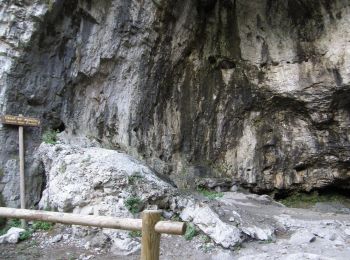
Die besten Spuren (219)
![Tour Zu Fuß Arcugnano - Percorso GIALLO - Lapio - Photo](https://media.geolcdn.com/t/350/260/8596040b-155d-462d-9462-96da3e6bafe1.jpeg&format=jpg&maxdim=2)
![Zu Fuß Zu Fuß](https://static1.geolcdn.com/sitytour/trail-icons/100.png)
Km
Zu Fuß
![](/images/other/stat-length.png)
![](https://static1.geolcdn.com/siteimages/upload/files/1508320355ic_sort_den_pos_24dp.png)
![](https://static1.geolcdn.com/siteimages/upload/files/1508320355ic_sort_den_neg_24dp.png)
![](https://static1.geolcdn.com/siteimages/upload/files/16400158638029165_repeat_loop_refresh_sync_direction_icon.png)
• Get set up with a new domain name right away. Affordable payment plans to fit any budget. Friendly customer support. ...
![Tour Zu Fuß Bassano del Grappa - Alta Via del Tabacco - Photo](https://media.geolcdn.com/t/350/260/b5114b3f-7e87-431e-a5a2-28207aeb60f1.jpeg&format=jpg&maxdim=2)
![Zu Fuß Zu Fuß](https://static1.geolcdn.com/sitytour/trail-icons/100.png)
Km
Zu Fuß
![](/images/other/stat-length.png)
![](https://static1.geolcdn.com/siteimages/upload/files/1508320355ic_sort_den_pos_24dp.png)
![](https://static1.geolcdn.com/siteimages/upload/files/1508320355ic_sort_den_neg_24dp.png)
![](https://static1.geolcdn.com/siteimages/upload/files/16400158638029165_repeat_loop_refresh_sync_direction_icon.png)
• Trail created by Associazione Alta Via del Tabacco. Website: http://www.altaviatabacco.it
![Tour Zu Fuß Mussolente - Le Volpere - Photo](https://media.geolcdn.com/t/350/260/25732017-1623-4ebb-86bd-16bee4428640.jpeg&format=jpg&maxdim=2)
![Zu Fuß Zu Fuß](https://static1.geolcdn.com/sitytour/trail-icons/100.png)
Km
Zu Fuß
![](/images/other/stat-length.png)
![](https://static1.geolcdn.com/siteimages/upload/files/1508320355ic_sort_den_pos_24dp.png)
![](https://static1.geolcdn.com/siteimages/upload/files/1508320355ic_sort_den_neg_24dp.png)
![](https://static1.geolcdn.com/siteimages/upload/files/16400158638029165_repeat_loop_refresh_sync_direction_icon.png)
• Trail created by Comune Mussolente.
![Tour Zu Fuß Recoaro Terme - Sentiero delle Mole - Photo](https://media.geolcdn.com/t/350/260/415f08fe-adfd-4017-b0e4-f8688286a2bc.jpeg&format=jpg&maxdim=2)
![Zu Fuß Zu Fuß](https://static1.geolcdn.com/sitytour/trail-icons/100.png)
Km
Zu Fuß
![](/images/other/stat-length.png)
![](https://static1.geolcdn.com/siteimages/upload/files/1508320355ic_sort_den_pos_24dp.png)
![](https://static1.geolcdn.com/siteimages/upload/files/1508320355ic_sort_den_neg_24dp.png)
![](https://static1.geolcdn.com/siteimages/upload/files/16400158638029165_repeat_loop_refresh_sync_direction_icon.png)
• Trail created by CAI Recoaro.
![Tour Zu Fuß Valli del Pasubio - Sentiero dell'Emmele - Photo](https://media.geolcdn.com/t/350/260/0a95afff-a37f-4a4a-81f4-62a6fb6c0678.jpeg&format=jpg&maxdim=2)
![Zu Fuß Zu Fuß](https://static1.geolcdn.com/sitytour/trail-icons/100.png)
Km
Zu Fuß
![](/images/other/stat-length.png)
![](https://static1.geolcdn.com/siteimages/upload/files/1508320355ic_sort_den_pos_24dp.png)
![](https://static1.geolcdn.com/siteimages/upload/files/1508320355ic_sort_den_neg_24dp.png)
![](https://static1.geolcdn.com/siteimages/upload/files/16400158638029165_repeat_loop_refresh_sync_direction_icon.png)
• Trail created by CAI Montecchio Maggiore.
![Tour Zu Fuß Solagna - IT-940 - Photo](https://media.geolcdn.com/t/350/260/0f4ab9ed-0de7-4cf1-8475-a5e1dbf7d1b5.jpeg&format=jpg&maxdim=2)
![Zu Fuß Zu Fuß](https://static1.geolcdn.com/sitytour/trail-icons/100.png)
Km
Zu Fuß
![](/images/other/stat-length.png)
![](https://static1.geolcdn.com/siteimages/upload/files/1508320355ic_sort_den_pos_24dp.png)
![](https://static1.geolcdn.com/siteimages/upload/files/1508320355ic_sort_den_neg_24dp.png)
![](https://static1.geolcdn.com/siteimages/upload/files/16400158638029165_repeat_loop_refresh_sync_direction_icon.png)
• Trail created by Club Alpino Italiano. Symbol: 940 on red and white flag Website: http://www.caibassanograppa.com/...
![Tour Zu Fuß Crespadoro - 215 - Photo](https://media.geolcdn.com/t/350/260/3f985bbe-a1c9-439d-a48e-8466bd528543.jpeg&format=jpg&maxdim=2)
![Zu Fuß Zu Fuß](https://static1.geolcdn.com/sitytour/trail-icons/100.png)
Km
Zu Fuß
![](/images/other/stat-length.png)
![](https://static1.geolcdn.com/siteimages/upload/files/1508320355ic_sort_den_pos_24dp.png)
![](https://static1.geolcdn.com/siteimages/upload/files/1508320355ic_sort_den_neg_24dp.png)
![](https://static1.geolcdn.com/siteimages/upload/files/16400158638029165_repeat_loop_refresh_sync_direction_icon.png)
• Trail created by C.A.I. Arzignano. Symbol: 215 on white red flag Website: http://www.caiarzignano.info/
![Tour Zu Fuß Posina - Val Sorapache - Photo](https://media.geolcdn.com/t/350/260/26a9e899-d617-4f79-9d2b-6cb6dc3fa16a.jpeg&format=jpg&maxdim=2)
![Zu Fuß Zu Fuß](https://static1.geolcdn.com/sitytour/trail-icons/100.png)
Km
Zu Fuß
![](/images/other/stat-length.png)
![](https://static1.geolcdn.com/siteimages/upload/files/1508320355ic_sort_den_pos_24dp.png)
![](https://static1.geolcdn.com/siteimages/upload/files/1508320355ic_sort_den_neg_24dp.png)
![](https://static1.geolcdn.com/siteimages/upload/files/16400158638029165_repeat_loop_refresh_sync_direction_icon.png)
• Symbol: 377 on white red flag Website: http://www.caischio.it/
![Tour Zu Fuß Recoaro Terme - Anello Ecoturistico Piccole Dolomiti 010 - Photo](https://media.geolcdn.com/t/350/260/5e4bb82e-f2af-452a-8233-405b90aa6462.jpeg&format=jpg&maxdim=2)
![Zu Fuß Zu Fuß](https://static1.geolcdn.com/sitytour/trail-icons/100.png)
Km
Zu Fuß
![](/images/other/stat-length.png)
![](https://static1.geolcdn.com/siteimages/upload/files/1508320355ic_sort_den_pos_24dp.png)
![](https://static1.geolcdn.com/siteimages/upload/files/1508320355ic_sort_den_neg_24dp.png)
![](https://static1.geolcdn.com/siteimages/upload/files/16400158638029165_repeat_loop_refresh_sync_direction_icon.png)
• Trail created by Comunità montana Agno-Chiampo.
![Tour Zu Fuß Valdagno - Anello Ecoturistico Piccole Dolomiti 009 - Photo](https://media.geolcdn.com/t/350/260/c2571389-1c29-4d61-a919-5049ffd6df8d.jpeg&format=jpg&maxdim=2)
![Zu Fuß Zu Fuß](https://static1.geolcdn.com/sitytour/trail-icons/100.png)
Km
Zu Fuß
![](/images/other/stat-length.png)
![](https://static1.geolcdn.com/siteimages/upload/files/1508320355ic_sort_den_pos_24dp.png)
![](https://static1.geolcdn.com/siteimages/upload/files/1508320355ic_sort_den_neg_24dp.png)
![](https://static1.geolcdn.com/siteimages/upload/files/16400158638029165_repeat_loop_refresh_sync_direction_icon.png)
• Trail created by Comunità montana Agno-Chiampo.
![Tour Zu Fuß San Pietro Mussolino - Anello Ecoturistico Piccole Dolomiti 008 - Photo](https://media.geolcdn.com/t/350/260/ee348842-cb8c-446a-9e12-f145561062c4.jpeg&format=jpg&maxdim=2)
![Zu Fuß Zu Fuß](https://static1.geolcdn.com/sitytour/trail-icons/100.png)
Km
Zu Fuß
![](/images/other/stat-length.png)
![](https://static1.geolcdn.com/siteimages/upload/files/1508320355ic_sort_den_pos_24dp.png)
![](https://static1.geolcdn.com/siteimages/upload/files/1508320355ic_sort_den_neg_24dp.png)
![](https://static1.geolcdn.com/siteimages/upload/files/16400158638029165_repeat_loop_refresh_sync_direction_icon.png)
• Trail created by Comunità montana Agno-Chiampo.
![Tour Zu Fuß Crespadoro - Anello Ecoturistico Piccole Dolomiti 009 - Photo](https://media.geolcdn.com/t/350/260/92862afa-bf6e-4e71-abc6-4de07489d8fb.jpeg&format=jpg&maxdim=2)
![Zu Fuß Zu Fuß](https://static1.geolcdn.com/sitytour/trail-icons/100.png)
Km
Zu Fuß
![](/images/other/stat-length.png)
![](https://static1.geolcdn.com/siteimages/upload/files/1508320355ic_sort_den_pos_24dp.png)
![](https://static1.geolcdn.com/siteimages/upload/files/1508320355ic_sort_den_neg_24dp.png)
![](https://static1.geolcdn.com/siteimages/upload/files/16400158638029165_repeat_loop_refresh_sync_direction_icon.png)
• Trail created by Comunità montana Agno-Chiampo.
![Tour Zu Fuß Crespadoro - Anello Ecoturistico Piccole Dolomiti - Photo](https://media.geolcdn.com/t/350/260/53110be4-ca56-4dc7-ab46-c4a553067ed7.jpeg&format=jpg&maxdim=2)
![Zu Fuß Zu Fuß](https://static1.geolcdn.com/sitytour/trail-icons/100.png)
Km
Zu Fuß
![](/images/other/stat-length.png)
![](https://static1.geolcdn.com/siteimages/upload/files/1508320355ic_sort_den_pos_24dp.png)
![](https://static1.geolcdn.com/siteimages/upload/files/1508320355ic_sort_den_neg_24dp.png)
![](https://static1.geolcdn.com/siteimages/upload/files/16400158638029165_repeat_loop_refresh_sync_direction_icon.png)
• Trail created by Comunità montana Agno-Chiampo.
![Tour Zu Fuß Cornedo Vicentino - Anello Ecoturistico Piccole Dolomiti 006 - Photo](https://media.geolcdn.com/t/350/260/cb994697-00c7-4e4b-9687-1e5c83581277.jpeg&format=jpg&maxdim=2)
![Zu Fuß Zu Fuß](https://static1.geolcdn.com/sitytour/trail-icons/100.png)
Km
Zu Fuß
![](/images/other/stat-length.png)
![](https://static1.geolcdn.com/siteimages/upload/files/1508320355ic_sort_den_pos_24dp.png)
![](https://static1.geolcdn.com/siteimages/upload/files/1508320355ic_sort_den_neg_24dp.png)
![](https://static1.geolcdn.com/siteimages/upload/files/16400158638029165_repeat_loop_refresh_sync_direction_icon.png)
• Trail created by Comunità montana Agno-Chiampo.
![Tour Zu Fuß Altissimo - Anello Ecoturistico Piccole Dolomiti 002 - Photo](https://media.geolcdn.com/t/350/260/c9915f85-75a2-4f82-a8d5-507903a06499.jpeg&format=jpg&maxdim=2)
![Zu Fuß Zu Fuß](https://static1.geolcdn.com/sitytour/trail-icons/100.png)
Km
Zu Fuß
![](/images/other/stat-length.png)
![](https://static1.geolcdn.com/siteimages/upload/files/1508320355ic_sort_den_pos_24dp.png)
![](https://static1.geolcdn.com/siteimages/upload/files/1508320355ic_sort_den_neg_24dp.png)
![](https://static1.geolcdn.com/siteimages/upload/files/16400158638029165_repeat_loop_refresh_sync_direction_icon.png)
• Trail created by Comunità montana Agno-Chiampo.
![Tour Zu Fuß Crespadoro - Anello Ecoturistico Piccole Dolomiti 003 - Photo](https://media.geolcdn.com/t/350/260/3d813d6a-80e7-41f0-a457-8e0b75a76092.jpeg&format=jpg&maxdim=2)
![Zu Fuß Zu Fuß](https://static1.geolcdn.com/sitytour/trail-icons/100.png)
Km
Zu Fuß
![](/images/other/stat-length.png)
![](https://static1.geolcdn.com/siteimages/upload/files/1508320355ic_sort_den_pos_24dp.png)
![](https://static1.geolcdn.com/siteimages/upload/files/1508320355ic_sort_den_neg_24dp.png)
![](https://static1.geolcdn.com/siteimages/upload/files/16400158638029165_repeat_loop_refresh_sync_direction_icon.png)
• Trail created by Comunità montana Agno-Chiampo.
![Tour Zu Fuß Recoaro Terme - Anello Ecoturistico Piccole Dolomiti 004 - Photo](https://media.geolcdn.com/t/350/260/415f08fe-adfd-4017-b0e4-f8688286a2bc.jpeg&format=jpg&maxdim=2)
![Zu Fuß Zu Fuß](https://static1.geolcdn.com/sitytour/trail-icons/100.png)
Km
Zu Fuß
![](/images/other/stat-length.png)
![](https://static1.geolcdn.com/siteimages/upload/files/1508320355ic_sort_den_pos_24dp.png)
![](https://static1.geolcdn.com/siteimages/upload/files/1508320355ic_sort_den_neg_24dp.png)
![](https://static1.geolcdn.com/siteimages/upload/files/16400158638029165_repeat_loop_refresh_sync_direction_icon.png)
• Trail created by Comunità montana Agno-Chiampo.
![Tour Zu Fuß Nogarole Vicentino - Anello Ecoturistico Piccole Dolomiti 001 - Photo](https://media.geolcdn.com/t/350/260/cb994697-00c7-4e4b-9687-1e5c83581277.jpeg&format=jpg&maxdim=2)
![Zu Fuß Zu Fuß](https://static1.geolcdn.com/sitytour/trail-icons/100.png)
Km
Zu Fuß
![](/images/other/stat-length.png)
![](https://static1.geolcdn.com/siteimages/upload/files/1508320355ic_sort_den_pos_24dp.png)
![](https://static1.geolcdn.com/siteimages/upload/files/1508320355ic_sort_den_neg_24dp.png)
![](https://static1.geolcdn.com/siteimages/upload/files/16400158638029165_repeat_loop_refresh_sync_direction_icon.png)
• Trail created by Comunità montana Agno-Chiampo.
![Tour Zu Fuß Enego - Stoner - Lisser - Photo](https://media.geolcdn.com/t/350/260/5e71f2f3-fa3a-4bae-b20d-d5ec130b21db.jpeg&format=jpg&maxdim=2)
![Zu Fuß Zu Fuß](https://static1.geolcdn.com/sitytour/trail-icons/100.png)
Km
Zu Fuß
![](/images/other/stat-length.png)
![](https://static1.geolcdn.com/siteimages/upload/files/1508320355ic_sort_den_pos_24dp.png)
![](https://static1.geolcdn.com/siteimages/upload/files/1508320355ic_sort_den_neg_24dp.png)
![](https://static1.geolcdn.com/siteimages/upload/files/16400158638029165_repeat_loop_refresh_sync_direction_icon.png)
• Symbol: 865 on white red flag
![Tour Zu Fuß Valbrenta - Oliero di Sotto - Le Pozzette - Col d'Astiago - Photo](https://media.geolcdn.com/t/350/260/ef293c7f-6588-4629-b16e-9d8bb675a946.jpeg&format=jpg&maxdim=2)
![Zu Fuß Zu Fuß](https://static1.geolcdn.com/sitytour/trail-icons/100.png)
Km
Zu Fuß
![](/images/other/stat-length.png)
![](https://static1.geolcdn.com/siteimages/upload/files/1508320355ic_sort_den_pos_24dp.png)
![](https://static1.geolcdn.com/siteimages/upload/files/1508320355ic_sort_den_neg_24dp.png)
![](https://static1.geolcdn.com/siteimages/upload/files/16400158638029165_repeat_loop_refresh_sync_direction_icon.png)
• Symbol: 771 on white red flag Website: http://www.caimarostica.it
20 Angezeigte Touren bei 219
Kostenlosegpshiking-Anwendung
Aktivitäten
Nahegelegene Regionen
- Altavilla Vicentina
- Altissimo
- Arcugnano
- Arsiero
- Arzignano
- Asiago
- Barbarano Mossano
- Bassano del Grappa
- Brendola
- Caltrano
- Calvene
- Castegnero
- Chiampo
- Chiuppano
- Cogollo del Cengio
- Colceresa
- Cornedo Vicentino
- Crespadoro
- Enego
- Foza
- Gallio
- Laghi
- Lastebasse
- Longare
- Lonigo
- Lugo di Vicenza
- Lusiana Conco
- Malo
- Marostica
- Monte di Malo
- Monteviale
- Mussolente
- Nanto
- Nogarole Vicentino
- Nove
- Pedemonte
- Piovene Rocchette
- Posina
- Pove del Grappa
- Recoaro Terme
- Roana
- Romano d'Ezzelino
- Rotzo
- Salcedo
- San Pietro Mussolino
- San Vito di Leguzzano
- Santorso
- Sarego
- Schio
- Solagna
- Sossano
- Tezze sul Brenta
- Tonezza del Cimone
- Torrebelvicino
- Val Liona
- Valbrenta
- Valdagno
- Valdastico
- Valli del Pasubio
- Velo d'Astico
- Vicenza
- Villaga