![](/images/other/stat-length.png)
L'Aquila, Abruzzen: Die besten Touren, Trails, Trecks und Wanderungen
L'Aquila : Entdecken Sie die besten Touren : 224 zu Fuß. Alle diese Touren, Trails, Routen und Outdoor-Aktivitäten sind in unseren SityTrail-Apps für Smartphones und Tablets verfügbar.
Die besten Spuren (224)
![Tour Zu Fuß Civitella Roveto - Civitella Roveto - Capistrello - Photo](https://media.geolcdn.com/t/350/260/54ec2cad-ece4-4893-ab8a-d949904f2264.jpeg&format=jpg&maxdim=2)
![Zu Fuß Zu Fuß](https://static1.geolcdn.com/sitytour/trail-icons/100.png)
Km
Zu Fuß
![](/images/other/stat-length.png)
![](https://static1.geolcdn.com/siteimages/upload/files/1508320355ic_sort_den_pos_24dp.png)
![](https://static1.geolcdn.com/siteimages/upload/files/1508320355ic_sort_den_neg_24dp.png)
![](https://static1.geolcdn.com/siteimages/upload/files/16400158638029165_repeat_loop_refresh_sync_direction_icon.png)
• Symbol: 401 on white red flags
![Tour Zu Fuß Pacentro - Anello di Passo San Leonardo - Photo](https://media.geolcdn.com/t/350/260/8b533a26-dc4c-47cf-923f-e8deaf7b7596.jpeg&format=jpg&maxdim=2)
![Zu Fuß Zu Fuß](https://static1.geolcdn.com/sitytour/trail-icons/100.png)
Km
Zu Fuß
![](/images/other/stat-length.png)
![](https://static1.geolcdn.com/siteimages/upload/files/1508320355ic_sort_den_pos_24dp.png)
![](https://static1.geolcdn.com/siteimages/upload/files/1508320355ic_sort_den_neg_24dp.png)
![](https://static1.geolcdn.com/siteimages/upload/files/16400158638029165_repeat_loop_refresh_sync_direction_icon.png)
• Trail created by PNM. Symbol: CP on white red flags
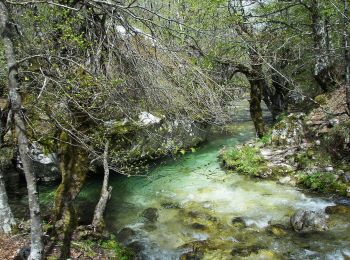
![Tour Zu Fuß Opi - Acqua Sfranatara - Fonte San Cataldo - Photo](https://media.geolcdn.com/t/350/260/bd6b7374-b4fd-4418-8c89-b21e676fbe9d.jpeg&format=jpg&maxdim=2)
![Zu Fuß Zu Fuß](https://static1.geolcdn.com/sitytour/trail-icons/100.png)
Km
Zu Fuß
![](/images/other/stat-length.png)
![](https://static1.geolcdn.com/siteimages/upload/files/1508320355ic_sort_den_pos_24dp.png)
![](https://static1.geolcdn.com/siteimages/upload/files/1508320355ic_sort_den_neg_24dp.png)
![](https://static1.geolcdn.com/siteimages/upload/files/16400158638029165_repeat_loop_refresh_sync_direction_icon.png)
• Trail created by PNALM. Symbol: F5 on white red flags
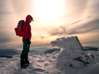
![Tour Zu Fuß Opi - Val Fondillo - Madonna Del Canneto - Photo](https://media.geolcdn.com/t/350/260/86102070-e5f8-4fd2-b9ab-d7d98a69cf57.jpeg&format=jpg&maxdim=2)
![Zu Fuß Zu Fuß](https://static1.geolcdn.com/sitytour/trail-icons/100.png)
Km
Zu Fuß
![](/images/other/stat-length.png)
![](https://static1.geolcdn.com/siteimages/upload/files/1508320355ic_sort_den_pos_24dp.png)
![](https://static1.geolcdn.com/siteimages/upload/files/1508320355ic_sort_den_neg_24dp.png)
![](https://static1.geolcdn.com/siteimages/upload/files/16400158638029165_repeat_loop_refresh_sync_direction_icon.png)
• Trail created by PNALM. Symbol: F2 on white red flags
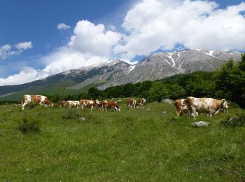
![Tour Zu Fuß Pacentro - Passo San Leonardo - Roccacaramanico - Photo](https://media.geolcdn.com/t/350/260/d89cb9e6-b8de-469e-b469-e8e547301471.jpeg&format=jpg&maxdim=2)
![Zu Fuß Zu Fuß](https://static1.geolcdn.com/sitytour/trail-icons/100.png)
Km
Zu Fuß
![](/images/other/stat-length.png)
![](https://static1.geolcdn.com/siteimages/upload/files/1508320355ic_sort_den_pos_24dp.png)
![](https://static1.geolcdn.com/siteimages/upload/files/1508320355ic_sort_den_neg_24dp.png)
![](https://static1.geolcdn.com/siteimages/upload/files/16400158638029165_repeat_loop_refresh_sync_direction_icon.png)
• Trail created by Paco Nazionale della majella. Symbol: Q8 on white red flags
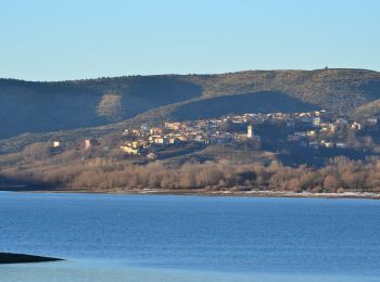
![Tour Zu Fuß Campotosto - (SI P14) Campotosto - Amatrice - Photo](https://media.geolcdn.com/t/350/260/a8557ca1-562a-4cc2-9728-cf5c11b2c754.jpeg&format=jpg&maxdim=2)
![Zu Fuß Zu Fuß](https://static1.geolcdn.com/sitytour/trail-icons/100.png)
Km
Zu Fuß
![](/images/other/stat-length.png)
![](https://static1.geolcdn.com/siteimages/upload/files/1508320355ic_sort_den_pos_24dp.png)
![](https://static1.geolcdn.com/siteimages/upload/files/1508320355ic_sort_den_neg_24dp.png)
![](https://static1.geolcdn.com/siteimages/upload/files/16400158638029165_repeat_loop_refresh_sync_direction_icon.png)
• Sentiero Italia CAI 2019
![Tour Zu Fuß Villetta Barrea - Villetta Barrea - Anatuccio - Photo](https://media.geolcdn.com/t/350/260/3e95bfa5-9098-4bc1-b5c1-52d0729cdafa.jpeg&format=jpg&maxdim=2)
![Zu Fuß Zu Fuß](https://static1.geolcdn.com/sitytour/trail-icons/100.png)
Km
Zu Fuß
![](/images/other/stat-length.png)
![](https://static1.geolcdn.com/siteimages/upload/files/1508320355ic_sort_den_pos_24dp.png)
![](https://static1.geolcdn.com/siteimages/upload/files/1508320355ic_sort_den_neg_24dp.png)
![](https://static1.geolcdn.com/siteimages/upload/files/16400158638029165_repeat_loop_refresh_sync_direction_icon.png)
• Trail created by PNALM. Symbol: H5 on white red flags
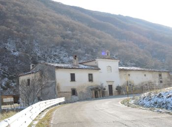
![Tour Zu Fuß Scanno - San Liborio - Stazzo di Preccia - Photo](https://media.geolcdn.com/t/350/260/6dee67dd-3898-4f7f-ab2a-4f73a873482f.jpeg&format=jpg&maxdim=2)
![Zu Fuß Zu Fuß](https://static1.geolcdn.com/sitytour/trail-icons/100.png)
Km
Zu Fuß
![](/images/other/stat-length.png)
![](https://static1.geolcdn.com/siteimages/upload/files/1508320355ic_sort_den_pos_24dp.png)
![](https://static1.geolcdn.com/siteimages/upload/files/1508320355ic_sort_den_neg_24dp.png)
![](https://static1.geolcdn.com/siteimages/upload/files/16400158638029165_repeat_loop_refresh_sync_direction_icon.png)
• Symbol: 44 on white red flags
![Tour Zu Fuß Scanno - Scanno - Collerotondo - Photo](https://media.geolcdn.com/t/350/260/7a3c1a2f-d411-4781-852f-f757f85a60b4.jpeg&format=jpg&maxdim=2)
![Zu Fuß Zu Fuß](https://static1.geolcdn.com/sitytour/trail-icons/100.png)
Km
Zu Fuß
![](/images/other/stat-length.png)
![](https://static1.geolcdn.com/siteimages/upload/files/1508320355ic_sort_den_pos_24dp.png)
![](https://static1.geolcdn.com/siteimages/upload/files/1508320355ic_sort_den_neg_24dp.png)
![](https://static1.geolcdn.com/siteimages/upload/files/16400158638029165_repeat_loop_refresh_sync_direction_icon.png)
• Symbol: 40 on white red flags
![Tour Zu Fuß Scanno - Stazzo Mandrucce - Imposto di Chiarano - Photo](https://media.geolcdn.com/t/350/260/0f3e3617-5233-477b-9dcd-0c1cc810407b.jpeg&format=jpg&maxdim=2)
![Zu Fuß Zu Fuß](https://static1.geolcdn.com/sitytour/trail-icons/100.png)
Km
Zu Fuß
![](/images/other/stat-length.png)
![](https://static1.geolcdn.com/siteimages/upload/files/1508320355ic_sort_den_pos_24dp.png)
![](https://static1.geolcdn.com/siteimages/upload/files/1508320355ic_sort_den_neg_24dp.png)
![](https://static1.geolcdn.com/siteimages/upload/files/16400158638029165_repeat_loop_refresh_sync_direction_icon.png)
• Symbol: 36 on white red flags
![Tour Zu Fuß Scanno - Vallone delle Croci - Fonte Sparvera - Photo](https://media.geolcdn.com/t/350/260/b7b182c0-3373-4145-955c-1d93544f913c.jpeg&format=jpg&maxdim=2)
![Zu Fuß Zu Fuß](https://static1.geolcdn.com/sitytour/trail-icons/100.png)
Km
Zu Fuß
![](/images/other/stat-length.png)
![](https://static1.geolcdn.com/siteimages/upload/files/1508320355ic_sort_den_pos_24dp.png)
![](https://static1.geolcdn.com/siteimages/upload/files/1508320355ic_sort_den_neg_24dp.png)
![](https://static1.geolcdn.com/siteimages/upload/files/16400158638029165_repeat_loop_refresh_sync_direction_icon.png)
• Symbol: 30 on white red flags
![Tour Zu Fuß Scanno - San Liborio - Cantoniera Mimola - Photo](https://media.geolcdn.com/t/350/260/6dee67dd-3898-4f7f-ab2a-4f73a873482f.jpeg&format=jpg&maxdim=2)
![Zu Fuß Zu Fuß](https://static1.geolcdn.com/sitytour/trail-icons/100.png)
Km
Zu Fuß
![](/images/other/stat-length.png)
![](https://static1.geolcdn.com/siteimages/upload/files/1508320355ic_sort_den_pos_24dp.png)
![](https://static1.geolcdn.com/siteimages/upload/files/1508320355ic_sort_den_neg_24dp.png)
![](https://static1.geolcdn.com/siteimages/upload/files/16400158638029165_repeat_loop_refresh_sync_direction_icon.png)
• Symbol: 26 on white red flags
![Tour Zu Fuß Villalago - Lago di Scanno - Monte Terratta - Photo](https://media.geolcdn.com/t/350/260/82ac4eb9-f40d-4797-98d2-9b66a6bf6cb2.jpeg&format=jpg&maxdim=2)
![Zu Fuß Zu Fuß](https://static1.geolcdn.com/sitytour/trail-icons/100.png)
Km
Zu Fuß
![](/images/other/stat-length.png)
![](https://static1.geolcdn.com/siteimages/upload/files/1508320355ic_sort_den_pos_24dp.png)
![](https://static1.geolcdn.com/siteimages/upload/files/1508320355ic_sort_den_neg_24dp.png)
![](https://static1.geolcdn.com/siteimages/upload/files/16400158638029165_repeat_loop_refresh_sync_direction_icon.png)
• Symbol: 13 on white red flags
![Tour Zu Fuß Aielli - Gole di Celano - Photo](https://media.geolcdn.com/t/350/260/4dcd43be-fddc-4be1-a69c-9b1a691d2f41.jpeg&format=jpg&maxdim=2)
![Zu Fuß Zu Fuß](https://static1.geolcdn.com/sitytour/trail-icons/100.png)
Km
Zu Fuß
![](/images/other/stat-length.png)
![](https://static1.geolcdn.com/siteimages/upload/files/1508320355ic_sort_den_pos_24dp.png)
![](https://static1.geolcdn.com/siteimages/upload/files/1508320355ic_sort_den_neg_24dp.png)
![](https://static1.geolcdn.com/siteimages/upload/files/16400158638029165_repeat_loop_refresh_sync_direction_icon.png)
• Trail created by Parco Regionale Sirente Velino. Symbol: 12 on white red flags
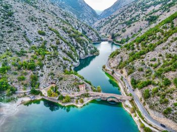
![Tour Zu Fuß Villalago - Villalago - Sorgente Faete - Photo](https://media.geolcdn.com/t/350/260/51778bb1-6334-4d1b-a327-7f075a15491e.jpeg&format=jpg&maxdim=2)
![Zu Fuß Zu Fuß](https://static1.geolcdn.com/sitytour/trail-icons/100.png)
Km
Zu Fuß
![](/images/other/stat-length.png)
![](https://static1.geolcdn.com/siteimages/upload/files/1508320355ic_sort_den_pos_24dp.png)
![](https://static1.geolcdn.com/siteimages/upload/files/1508320355ic_sort_den_neg_24dp.png)
![](https://static1.geolcdn.com/siteimages/upload/files/16400158638029165_repeat_loop_refresh_sync_direction_icon.png)
• Symbol: 1 on white red flags
![Tour Zu Fuß Carsoli - (SI O10) Carsoli - Paganico Sabino - Photo](https://media.geolcdn.com/t/350/260/8ce38778-b0c7-470c-b2e2-04022ac56577.jpeg&format=jpg&maxdim=2)
![Zu Fuß Zu Fuß](https://static1.geolcdn.com/sitytour/trail-icons/100.png)
Km
Zu Fuß
![](/images/other/stat-length.png)
![](https://static1.geolcdn.com/siteimages/upload/files/1508320355ic_sort_den_pos_24dp.png)
![](https://static1.geolcdn.com/siteimages/upload/files/1508320355ic_sort_den_neg_24dp.png)
![](https://static1.geolcdn.com/siteimages/upload/files/16400158638029165_repeat_loop_refresh_sync_direction_icon.png)
• Sentiero Italia CAI 2019
![Tour Zu Fuß Ovindoli - Ovindoli - Serra Di Celano - Photo](https://media.geolcdn.com/t/350/260/5d644340-a30a-4e9a-92c8-565f56a3abd3.jpeg&format=jpg&maxdim=2)
![Zu Fuß Zu Fuß](https://static1.geolcdn.com/sitytour/trail-icons/100.png)
Km
Zu Fuß
![](/images/other/stat-length.png)
![](https://static1.geolcdn.com/siteimages/upload/files/1508320355ic_sort_den_pos_24dp.png)
![](https://static1.geolcdn.com/siteimages/upload/files/1508320355ic_sort_den_neg_24dp.png)
![](https://static1.geolcdn.com/siteimages/upload/files/16400158638029165_repeat_loop_refresh_sync_direction_icon.png)
• Trail created by Parco Regionale Sirente Velino. Symbol: 11 on white red flags
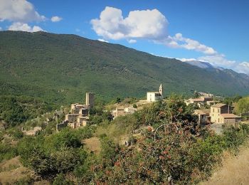
![Tour Zu Fuß Acciano - Stazione di Acciano - Beffi - Photo](https://media.geolcdn.com/t/350/260/22061c03-89e0-4a1c-962e-b754f7b1ff73.jpeg&format=jpg&maxdim=2)
![Zu Fuß Zu Fuß](https://static1.geolcdn.com/sitytour/trail-icons/100.png)
Km
Zu Fuß
![](/images/other/stat-length.png)
![](https://static1.geolcdn.com/siteimages/upload/files/1508320355ic_sort_den_pos_24dp.png)
![](https://static1.geolcdn.com/siteimages/upload/files/1508320355ic_sort_den_neg_24dp.png)
![](https://static1.geolcdn.com/siteimages/upload/files/16400158638029165_repeat_loop_refresh_sync_direction_icon.png)
• Symbol: LA2 on white red flags
![Tour Zu Fuß Fagnano Alto - Campana - Beffi - Photo](https://media.geolcdn.com/t/350/260/ff2ad3d3-cff7-4179-b7ea-fe0790a62b4e.jpeg&format=jpg&maxdim=2)
![Zu Fuß Zu Fuß](https://static1.geolcdn.com/sitytour/trail-icons/100.png)
Km
Zu Fuß
![](/images/other/stat-length.png)
![](https://static1.geolcdn.com/siteimages/upload/files/1508320355ic_sort_den_pos_24dp.png)
![](https://static1.geolcdn.com/siteimages/upload/files/1508320355ic_sort_den_neg_24dp.png)
![](https://static1.geolcdn.com/siteimages/upload/files/16400158638029165_repeat_loop_refresh_sync_direction_icon.png)
• Symbol: LA1 on white red flags
![Tour Zu Fuß Fagnano Alto - Campana - Pagliare di Fagnano - Photo](https://media.geolcdn.com/t/350/260/b8140a38-f49e-427b-83a6-b262a8423df3.jpeg&format=jpg&maxdim=2)
![Zu Fuß Zu Fuß](https://static1.geolcdn.com/sitytour/trail-icons/100.png)
Km
Zu Fuß
![](/images/other/stat-length.png)
![](https://static1.geolcdn.com/siteimages/upload/files/1508320355ic_sort_den_pos_24dp.png)
![](https://static1.geolcdn.com/siteimages/upload/files/1508320355ic_sort_den_neg_24dp.png)
![](https://static1.geolcdn.com/siteimages/upload/files/16400158638029165_repeat_loop_refresh_sync_direction_icon.png)
• Symbol: 20C on white red flags
20 Angezeigte Touren bei 224
Kostenlosegpshiking-Anwendung
Aktivitäten
Nahegelegene Regionen
- Acciano
- Aielli
- Alfedena
- Anversa degli Abruzzi
- Ateleta
- Avezzano
- Barrea
- Bisegna
- Bugnara
- Calascio
- Campo di Giove
- Campotosto
- Cansano
- Carsoli
- Castel del Monte
- Civitella Alfedena
- Civitella Roveto
- Collarmele
- Fagnano Alto
- Fontecchio
- Gagliano Aterno
- Gioia dei Marsi
- Introdacqua
- L'Aquila
- Lecce nei Marsi
- Magliano de' Marsi
- Massa d'Albe
- Montereale
- Ofena
- Opi
- Ortona dei Marsi
- Ovindoli
- Pacentro
- Pescasseroli
- Pescocostanzo
- Pettorano sul Gizio
- Pizzoli
- Prata d'Ansidonia
- Pratola Peligna
- Rivisondoli
- Rocca Pia
- Rocca di Cambio
- Rocca di Mezzo
- Roccacasale
- Roccaraso
- Santo Stefano di Sessanio
- Scanno
- Secinaro
- Sulmona
- Tione degli Abruzzi
- Villalago
- Villavallelonga
- Villetta Barrea