![](/images/other/stat-length.png)
Terni, Umbrien: Die besten Touren, Trails, Trecks und Wanderungen
Terni : Entdecken Sie die besten Touren : 80 zu Fuß. Alle diese Touren, Trails, Routen und Outdoor-Aktivitäten sind in unseren SityTrail-Apps für Smartphones und Tablets verfügbar.
Die besten Spuren (82)
![Tour Zu Fuß Allerona - Anello orvietano - Photo](https://media.geolcdn.com/t/350/260/1174a806-5c21-4731-a235-0ee9bbf6bc9e.jpeg&format=jpg&maxdim=2)
![Zu Fuß Zu Fuß](https://static1.geolcdn.com/sitytour/trail-icons/100.png)
Km
Zu Fuß
![](/images/other/stat-length.png)
![](https://static1.geolcdn.com/siteimages/upload/files/1508320355ic_sort_den_pos_24dp.png)
![](https://static1.geolcdn.com/siteimages/upload/files/1508320355ic_sort_den_neg_24dp.png)
![](https://static1.geolcdn.com/siteimages/upload/files/16400158638029165_repeat_loop_refresh_sync_direction_icon.png)
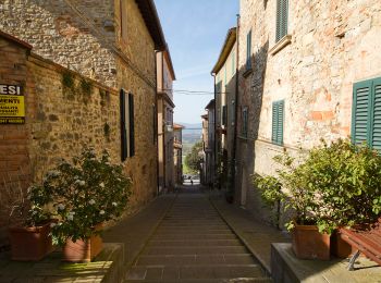
• Trail created by Sistema Territoriale di Interesse Naturalistico Ambientale (S.T.I.N.A.).
![Tour Zu Fuß Allerona - Anello Villa Cahen - Photo](https://media.geolcdn.com/t/350/260/0b79a6f7-bfa0-4866-952a-519d3559d797.jpeg&format=jpg&maxdim=2)
![Zu Fuß Zu Fuß](https://static1.geolcdn.com/sitytour/trail-icons/100.png)
Km
Zu Fuß
![](/images/other/stat-length.png)
![](https://static1.geolcdn.com/siteimages/upload/files/1508320355ic_sort_den_pos_24dp.png)
![](https://static1.geolcdn.com/siteimages/upload/files/1508320355ic_sort_den_neg_24dp.png)
![](https://static1.geolcdn.com/siteimages/upload/files/16400158638029165_repeat_loop_refresh_sync_direction_icon.png)
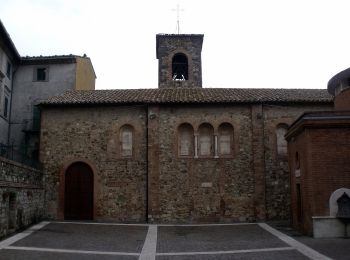
• Trail created by Sistema Territoriale di Interesse Naturalistico Ambientale (S.T.I.N.A.).
![Tour Zu Fuß Narni - Tour dei centri - Photo](https://media.geolcdn.com/t/350/260/3cb0eefc-c8f9-4b63-8fda-b4d9c11beae2.jpeg&format=jpg&maxdim=2)
![Zu Fuß Zu Fuß](https://static1.geolcdn.com/sitytour/trail-icons/100.png)
Km
Zu Fuß
![](/images/other/stat-length.png)
![](https://static1.geolcdn.com/siteimages/upload/files/1508320355ic_sort_den_pos_24dp.png)
![](https://static1.geolcdn.com/siteimages/upload/files/1508320355ic_sort_den_neg_24dp.png)
![](https://static1.geolcdn.com/siteimages/upload/files/16400158638029165_repeat_loop_refresh_sync_direction_icon.png)
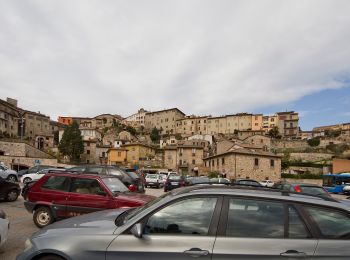
• Trail created by Club Alpino Italiano. Symbol: 654 on white red flags
![Tour Zu Fuß Calvi dell'Umbria - Calvi - Roccarello - Monte San Pancrazio - Photo](https://media.geolcdn.com/t/350/260/338cc07a-4426-4be3-a924-f587a9cf3b06.jpeg&format=jpg&maxdim=2)
![Zu Fuß Zu Fuß](https://static1.geolcdn.com/sitytour/trail-icons/100.png)
Km
Zu Fuß
![](/images/other/stat-length.png)
![](https://static1.geolcdn.com/siteimages/upload/files/1508320355ic_sort_den_pos_24dp.png)
![](https://static1.geolcdn.com/siteimages/upload/files/1508320355ic_sort_den_neg_24dp.png)
![](https://static1.geolcdn.com/siteimages/upload/files/16400158638029165_repeat_loop_refresh_sync_direction_icon.png)
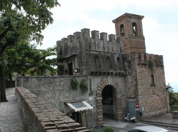
• Trail created by Club Alpino Italiano. Symbol: 643 on white red flags
![Tour Zu Fuß Calvi dell'Umbria - Calvi - Vallombrisa - Valle Saglianese - Photo](https://media.geolcdn.com/t/350/260/338cc07a-4426-4be3-a924-f587a9cf3b06.jpeg&format=jpg&maxdim=2)
![Zu Fuß Zu Fuß](https://static1.geolcdn.com/sitytour/trail-icons/100.png)
Km
Zu Fuß
![](/images/other/stat-length.png)
![](https://static1.geolcdn.com/siteimages/upload/files/1508320355ic_sort_den_pos_24dp.png)
![](https://static1.geolcdn.com/siteimages/upload/files/1508320355ic_sort_den_neg_24dp.png)
![](https://static1.geolcdn.com/siteimages/upload/files/16400158638029165_repeat_loop_refresh_sync_direction_icon.png)
• Trail created by Club Alpino Italiano. Symbol: 642 on white red flags
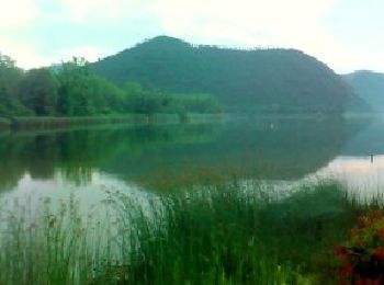
![Tour Zu Fuß Terni - Osteria - Miniera di Buonacquisto - San Venanzio - Photo](https://media.geolcdn.com/t/350/260/14f572e7-87d0-40d0-96e3-c1391a4de532.jpeg&format=jpg&maxdim=2)
![Zu Fuß Zu Fuß](https://static1.geolcdn.com/sitytour/trail-icons/100.png)
Km
Zu Fuß
![](/images/other/stat-length.png)
![](https://static1.geolcdn.com/siteimages/upload/files/1508320355ic_sort_den_pos_24dp.png)
![](https://static1.geolcdn.com/siteimages/upload/files/1508320355ic_sort_den_neg_24dp.png)
![](https://static1.geolcdn.com/siteimages/upload/files/16400158638029165_repeat_loop_refresh_sync_direction_icon.png)
• Trail created by Club Alpino Italiano. Symbol: 634 on white red flags
![Tour Zu Fuß Terni - Le Marmore - Miranda - Cimitelle - Photo](https://media.geolcdn.com/t/350/260/b0a47ce7-d9b5-4ef6-9e35-db5a0c1e3cca.jpeg&format=jpg&maxdim=2)
![Zu Fuß Zu Fuß](https://static1.geolcdn.com/sitytour/trail-icons/100.png)
Km
Zu Fuß
![](/images/other/stat-length.png)
![](https://static1.geolcdn.com/siteimages/upload/files/1508320355ic_sort_den_pos_24dp.png)
![](https://static1.geolcdn.com/siteimages/upload/files/1508320355ic_sort_den_neg_24dp.png)
![](https://static1.geolcdn.com/siteimages/upload/files/16400158638029165_repeat_loop_refresh_sync_direction_icon.png)
• Trail created by CAI. Symbol: 623 on white red flags
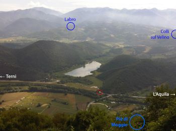
![Tour Zu Fuß Terni - Le Marmore - Moggio - Photo](https://media.geolcdn.com/t/350/260/d233b2b0-4f1f-458a-b071-90f883c7f1b2.jpeg&format=jpg&maxdim=2)
![Zu Fuß Zu Fuß](https://static1.geolcdn.com/sitytour/trail-icons/100.png)
Km
Zu Fuß
![](/images/other/stat-length.png)
![](https://static1.geolcdn.com/siteimages/upload/files/1508320355ic_sort_den_pos_24dp.png)
![](https://static1.geolcdn.com/siteimages/upload/files/1508320355ic_sort_den_neg_24dp.png)
![](https://static1.geolcdn.com/siteimages/upload/files/16400158638029165_repeat_loop_refresh_sync_direction_icon.png)
• Trail created by CAI. Symbol: 624 on white red flags
![Tour Zu Fuß Stroncone - Colle - Le Cimitelle - I Prati - Photo](https://media.geolcdn.com/t/350/260/b0a47ce7-d9b5-4ef6-9e35-db5a0c1e3cca.jpeg&format=jpg&maxdim=2)
![Zu Fuß Zu Fuß](https://static1.geolcdn.com/sitytour/trail-icons/100.png)
Km
Zu Fuß
![](/images/other/stat-length.png)
![](https://static1.geolcdn.com/siteimages/upload/files/1508320355ic_sort_den_pos_24dp.png)
![](https://static1.geolcdn.com/siteimages/upload/files/1508320355ic_sort_den_neg_24dp.png)
![](https://static1.geolcdn.com/siteimages/upload/files/16400158638029165_repeat_loop_refresh_sync_direction_icon.png)
• Trail created by CAI. Symbol: 627 on white red flags
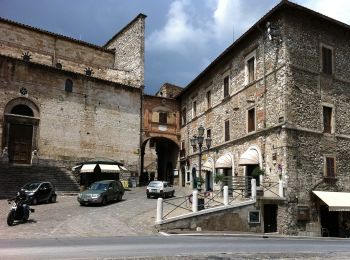
![Tour Zu Fuß Narni - Narni - Madonna del Ponte - Taizzano - Castel Sant'Angelo - Photo](https://media.geolcdn.com/t/350/260/ef5b9130-3746-4d78-b53f-a0ec820e8a6a.jpeg&format=jpg&maxdim=2)
![Zu Fuß Zu Fuß](https://static1.geolcdn.com/sitytour/trail-icons/100.png)
Km
Zu Fuß
![](/images/other/stat-length.png)
![](https://static1.geolcdn.com/siteimages/upload/files/1508320355ic_sort_den_pos_24dp.png)
![](https://static1.geolcdn.com/siteimages/upload/files/1508320355ic_sort_den_neg_24dp.png)
![](https://static1.geolcdn.com/siteimages/upload/files/16400158638029165_repeat_loop_refresh_sync_direction_icon.png)
• Trail created by Club Alpino Italiano. Symbol: 659 on white red flags
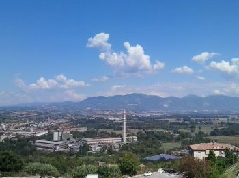
![Tour Zu Fuß Narni - Rocca di Narni - Monte San Pancrazio - Monte Cosce - Vacone - Rocchette - Photo](https://media.geolcdn.com/t/350/260/98bcf361-294b-4416-b7ff-3c562274a5b1.jpeg&format=jpg&maxdim=2)
![Zu Fuß Zu Fuß](https://static1.geolcdn.com/sitytour/trail-icons/100.png)
Km
Zu Fuß
![](/images/other/stat-length.png)
![](https://static1.geolcdn.com/siteimages/upload/files/1508320355ic_sort_den_pos_24dp.png)
![](https://static1.geolcdn.com/siteimages/upload/files/1508320355ic_sort_den_neg_24dp.png)
![](https://static1.geolcdn.com/siteimages/upload/files/16400158638029165_repeat_loop_refresh_sync_direction_icon.png)
• Trail created by Club Alpino Italiano. relation route to be completed Symbol: 640 on white red flags
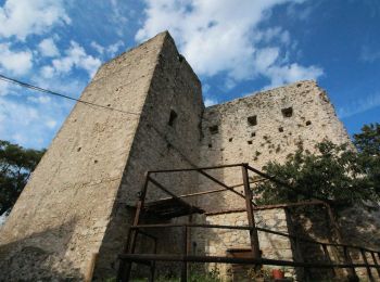
![Tour Zu Fuß Otricoli - Poggio - Croce San Valentino - Photo](https://media.geolcdn.com/t/350/260/b782d084-f428-4f2f-a2d7-73d93f794c70.jpeg&format=jpg&maxdim=2)
![Zu Fuß Zu Fuß](https://static1.geolcdn.com/sitytour/trail-icons/100.png)
Km
Zu Fuß
![](/images/other/stat-length.png)
![](https://static1.geolcdn.com/siteimages/upload/files/1508320355ic_sort_den_pos_24dp.png)
![](https://static1.geolcdn.com/siteimages/upload/files/1508320355ic_sort_den_neg_24dp.png)
![](https://static1.geolcdn.com/siteimages/upload/files/16400158638029165_repeat_loop_refresh_sync_direction_icon.png)
• Trail created by Club Alpino Italiano. Symbol: 646 on white red flags
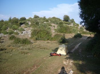
![Tour Zu Fuß Otricoli - Poggio - Aravecchia - Intersezione 646 - Photo](https://media.geolcdn.com/t/350/260/cde57823-f9a9-4328-95f5-42dd1c208d6c.jpeg&format=jpg&maxdim=2)
![Zu Fuß Zu Fuß](https://static1.geolcdn.com/sitytour/trail-icons/100.png)
Km
Zu Fuß
![](/images/other/stat-length.png)
![](https://static1.geolcdn.com/siteimages/upload/files/1508320355ic_sort_den_pos_24dp.png)
![](https://static1.geolcdn.com/siteimages/upload/files/1508320355ic_sort_den_neg_24dp.png)
![](https://static1.geolcdn.com/siteimages/upload/files/16400158638029165_repeat_loop_refresh_sync_direction_icon.png)
• Trail created by Club Alpino Italiano. Symbol: 645 on white red flags
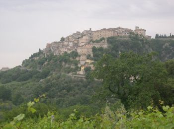
![Tour Zu Fuß Calvi dell'Umbria - Calvi - San Benedetto - Montebuono - Photo](https://media.geolcdn.com/t/350/260/10d684b0-36ab-4023-a6fa-99a6a63bcc47.jpeg&format=jpg&maxdim=2)
![Zu Fuß Zu Fuß](https://static1.geolcdn.com/sitytour/trail-icons/100.png)
Km
Zu Fuß
![](/images/other/stat-length.png)
![](https://static1.geolcdn.com/siteimages/upload/files/1508320355ic_sort_den_pos_24dp.png)
![](https://static1.geolcdn.com/siteimages/upload/files/1508320355ic_sort_den_neg_24dp.png)
![](https://static1.geolcdn.com/siteimages/upload/files/16400158638029165_repeat_loop_refresh_sync_direction_icon.png)
• Trail created by Club Alpino Italiano. Symbol: 641 on white red flags
![Tour Zu Fuß Otricoli - Poggio - Intersezione 656 - Photo](https://media.geolcdn.com/t/350/260/b782d084-f428-4f2f-a2d7-73d93f794c70.jpeg&format=jpg&maxdim=2)
![Zu Fuß Zu Fuß](https://static1.geolcdn.com/sitytour/trail-icons/100.png)
Km
Zu Fuß
![](/images/other/stat-length.png)
![](https://static1.geolcdn.com/siteimages/upload/files/1508320355ic_sort_den_pos_24dp.png)
![](https://static1.geolcdn.com/siteimages/upload/files/1508320355ic_sort_den_neg_24dp.png)
![](https://static1.geolcdn.com/siteimages/upload/files/16400158638029165_repeat_loop_refresh_sync_direction_icon.png)
• Trail created by Club Alpino Italiano. Symbol: 647 on white red flags
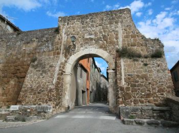
![Tour Zu Fuß Otricoli - Ocriculum - Poggio - Photo](https://media.geolcdn.com/t/350/260/408600a4-14ae-4ae6-b185-3ee208479d82.jpeg&format=jpg&maxdim=2)
![Zu Fuß Zu Fuß](https://static1.geolcdn.com/sitytour/trail-icons/100.png)
Km
Zu Fuß
![](/images/other/stat-length.png)
![](https://static1.geolcdn.com/siteimages/upload/files/1508320355ic_sort_den_pos_24dp.png)
![](https://static1.geolcdn.com/siteimages/upload/files/1508320355ic_sort_den_neg_24dp.png)
![](https://static1.geolcdn.com/siteimages/upload/files/16400158638029165_repeat_loop_refresh_sync_direction_icon.png)
• Trail created by Club Alpino Italiano. Symbol: 648 on white red flags
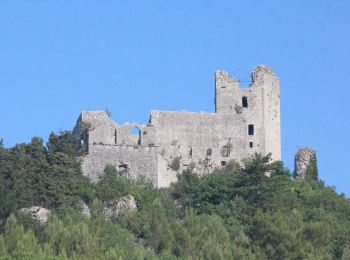
![Tour Zu Fuß Arrone - Via di Francesco - Tappa 17 Arrone-Piediluco - Photo](https://media.geolcdn.com/t/350/260/544ff526-3687-442d-83da-d2379bdb8a11.jpeg&format=jpg&maxdim=2)
![Zu Fuß Zu Fuß](https://static1.geolcdn.com/sitytour/trail-icons/100.png)
Km
Zu Fuß
![](/images/other/stat-length.png)
![](https://static1.geolcdn.com/siteimages/upload/files/1508320355ic_sort_den_pos_24dp.png)
![](https://static1.geolcdn.com/siteimages/upload/files/1508320355ic_sort_den_neg_24dp.png)
![](https://static1.geolcdn.com/siteimages/upload/files/16400158638029165_repeat_loop_refresh_sync_direction_icon.png)
• È un unico cammino per raggiungere Assisi sui passi di San Francesco, partendo da Nord (La Verna) o da Sud (Roma) . È...
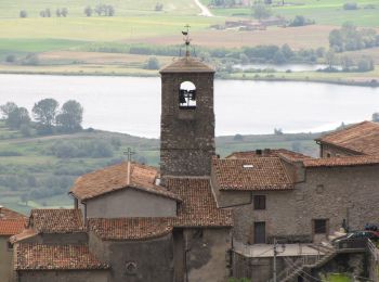
![Tour Zu Fuß Terni - Via di Francesco - Tappa 18 Piediluco-Poggio Bustone - Photo](https://media.geolcdn.com/t/350/260/8d8ef304-1b05-4a66-8b56-6936329c3348.jpeg&format=jpg&maxdim=2)
![Zu Fuß Zu Fuß](https://static1.geolcdn.com/sitytour/trail-icons/100.png)
Km
Zu Fuß
![](/images/other/stat-length.png)
![](https://static1.geolcdn.com/siteimages/upload/files/1508320355ic_sort_den_pos_24dp.png)
![](https://static1.geolcdn.com/siteimages/upload/files/1508320355ic_sort_den_neg_24dp.png)
![](https://static1.geolcdn.com/siteimages/upload/files/16400158638029165_repeat_loop_refresh_sync_direction_icon.png)
• È un unico cammino per raggiungere Assisi sui passi di San Francesco, partendo da Nord (La Verna) o da Sud (Roma) . È...
![Tour Zu Fuß Terni - Via di Francesco - Tappa 8 Piediluco-Arrone - Photo](https://media.geolcdn.com/t/350/260/ce3e23c2-dca4-46ca-b209-9701e2b47123.jpeg&format=jpg&maxdim=2)
![Zu Fuß Zu Fuß](https://static1.geolcdn.com/sitytour/trail-icons/100.png)
Km
Zu Fuß
![](/images/other/stat-length.png)
![](https://static1.geolcdn.com/siteimages/upload/files/1508320355ic_sort_den_pos_24dp.png)
![](https://static1.geolcdn.com/siteimages/upload/files/1508320355ic_sort_den_neg_24dp.png)
![](https://static1.geolcdn.com/siteimages/upload/files/16400158638029165_repeat_loop_refresh_sync_direction_icon.png)
• È un unico cammino per raggiungere Assisi sui passi di San Francesco, partendo da Nord (La Verna) o da Sud (Roma) . È...
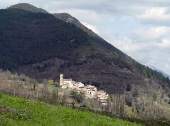
![Tour Zu Fuß Arrone - Via di Francesco - Tappa 9 Arrone-Ceselli - Photo](https://media.geolcdn.com/t/350/260/63fbcd35-f02e-4751-8cea-af878be377d4.jpeg&format=jpg&maxdim=2)
![Zu Fuß Zu Fuß](https://static1.geolcdn.com/sitytour/trail-icons/100.png)
Km
Zu Fuß
![](/images/other/stat-length.png)
![](https://static1.geolcdn.com/siteimages/upload/files/1508320355ic_sort_den_pos_24dp.png)
![](https://static1.geolcdn.com/siteimages/upload/files/1508320355ic_sort_den_neg_24dp.png)
![](https://static1.geolcdn.com/siteimages/upload/files/16400158638029165_repeat_loop_refresh_sync_direction_icon.png)
• È un unico cammino per raggiungere Assisi sui passi di San Francesco, partendo da Nord (La Verna) o da Sud (Roma) . È...
20 Angezeigte Touren bei 82
Kostenlosegpshiking-Anwendung