The Municipal District of Wicklow, County Wicklow: Die besten Touren, Trails, Trecks und Wanderungen

The Municipal District of Wicklow : Entdecken Sie die besten Touren : 10 zu Fuß. Alle diese Touren, Trails, Routen und Outdoor-Aktivitäten sind in unseren SityTrail-Apps für Smartphones und Tablets verfügbar.


Die besten Spuren (13)
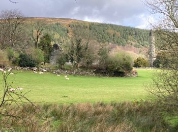
Tour Wandern The Municipal District of Wicklow - Glendalough  - Photo
Wandern 9.409
Km

Wandern

Medium
The Municipal District of Wicklow, Unbekannt, County Wicklow, Ireland
9,4 km | 13,7 km-effort
2h 21min
318 m
320 m
Ja
Lobin

Tour Wandern The Municipal District of Wicklow - Glendalough - Photo
Wandern 9.568
Km

Wandern

Medium
The Municipal District of Wicklow, Unbekannt, County Wicklow, Ireland
9,6 km | 14 km-effort
2h 59min
333 m
333 m
Ja
FabienneD

• Monastic city, Upper lake, Spinc cliffs

Tour Andere Aktivitäten The Municipal District of Wicklow - Willie Whelan - Photo
Andere Aktivitäten 9.405
Km

Andere Aktivitäten

Sehr leicht
The Municipal District of Wicklow, Unbekannt, County Wicklow, Ireland
9,4 km | 15,3 km-effort
Unbekannt
444 m
440 m
Ja
adagio

• MS1 Colaiste Dhulaigh

Tour Wandern The Municipal District of Wicklow - Mountain Hike from Glendalough car park - Photo
Wandern 17.184
Km

Wandern

Sehr leicht
The Municipal District of Wicklow, Unbekannt, County Wicklow, Ireland
17,2 km | 26 km-effort
6h 1min
692 m
692 m
Ja
RVCrazy

Tour Wandern The Municipal District of Wicklow - Knocknacloghoge and Fancy Mtn - Photo
Wandern 13.085
Km

Wandern

Sehr leicht
The Municipal District of Wicklow, Unbekannt, County Wicklow, Ireland
13,1 km | 22 km-effort
Unbekannt
673 m
672 m
Ja
jaf299

Tour Wandern The Municipal District of Wicklow - The Brockaghs and St Kevins Road - Photo
Wandern 16.696
Km

Wandern

Sehr leicht
The Municipal District of Wicklow, Unbekannt, County Wicklow, Ireland
16,7 km | 25 km-effort
Unbekannt
646 m
644 m
Ja
jaf299

Tour Wandern The Municipal District of Wicklow - Mullaghcleevaun and Tonelagee - Photo
Wandern 16.44
Km

Wandern

Sehr leicht
The Municipal District of Wicklow, Unbekannt, County Wicklow, Ireland
16,4 km | 26 km-effort
Unbekannt
730 m
723 m
Ja
jaf299

Tour Wandern The Municipal District of Wicklow - glendalough outer circuit - Photo
Wandern 20.709
Km

Wandern

Sehr leicht
The Municipal District of Wicklow, Unbekannt, County Wicklow, Ireland
21 km | 33 km-effort
Unbekannt
900 m
945 m
Ja
isurgeon

Tour Andere Aktivitäten The Municipal District of Wicklow - Camaderry - Photo
Andere Aktivitäten 8.808
Km

Andere Aktivitäten

Sehr leicht
The Municipal District of Wicklow, Unbekannt, County Wicklow, Ireland
8,8 km | 15,8 km-effort
Unbekannt
526 m
528 m
Ja
bradygerry

Tour Andere Aktivitäten The Municipal District of Wicklow - Camaderry - Photo
Andere Aktivitäten 12.608
Km

Andere Aktivitäten

Sehr leicht
The Municipal District of Wicklow, Unbekannt, County Wicklow, Ireland
12,6 km | 20 km-effort
Unbekannt
581 m
585 m
Ja
andycarr05

Tour Wandern The Municipal District of Wicklow - glendalough - Photo
Wandern 5.624
Km

Wandern

Medium
The Municipal District of Wicklow, Unbekannt, County Wicklow, Ireland
5,6 km | 7,3 km-effort
1h 39min
128 m
128 m
Ja
bena42

Tour Wandern The Municipal District of Wicklow - wiclow  - Photo
Wandern 17.969
Km

Wandern

Sehr schwierig
The Municipal District of Wicklow, Unbekannt, County Wicklow, Ireland
18 km | 27 km-effort
4h 11min
641 m
640 m
Ja
peuch4

Tour Wandern The Municipal District of Wicklow - Wicklow4 - Photo
Wandern 18.909
Km

Wandern

Sehr leicht
The Municipal District of Wicklow, Unbekannt, County Wicklow, Ireland
18,9 km | 28 km-effort
6h 0min
648 m
762 m
Nein
dewaeph

13 Angezeigte Touren bei 13

Kostenlosegpshiking-Anwendung

Logo SityTrail SityTrail

IGN / Geografische Institute

SityTrail aus dem App Store herunterladen SityTrail von Google Play herunterladen

Logo SityTrail SityTrail World

Die Welt öffnet sich für Sie

SityTrail aus dem App Store herunterladen SityTrail von Google Play herunterladen SityTrail auf Huawei AppGallery herunterladen

Aktivitäten

Nahegelegene Regionen

Schließen
Meine Abonnements