![](/images/other/stat-length.png)
- Touren
- Outdoor
- United Kingdom
- England
- Somerset
Somerset, England: Die besten Touren, Trails, Trecks und Wanderungen
Somerset : Entdecken Sie die besten Touren : 6 zu Fuß. Alle diese Touren, Trails, Routen und Outdoor-Aktivitäten sind in unseren SityTrail-Apps für Smartphones und Tablets verfügbar.
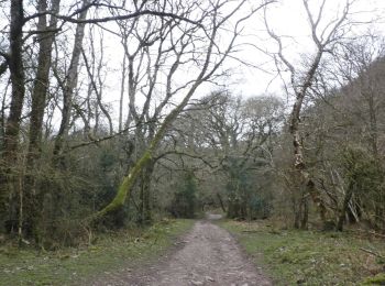
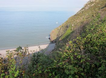
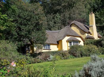
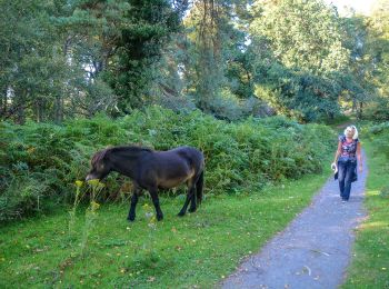
Die besten Spuren (6)
![Tour Wandern Somerset West and Taunton - Blue Anchor - Photo](https://media.geolcdn.com/t/350/260/ext.jpg?maxdim=2&url=https%3A%2F%2Fstatic1.geolcdn.com%2Fsiteimages%2Fupload%2Ffiles%2F1553511878bg_sport_marche.png)
![Wandern Wandern](https://static1.geolcdn.com/sitytour/trail-icons/101.png)
Km
#1 - Blue Anchor
Wandern
Einfach
Somerset West and Taunton,
England,
Somerset,
United Kingdom
![](/images/other/stat-length.png)
4,4 km | 4,7 km-effort
1h 30min
![](https://static1.geolcdn.com/siteimages/upload/files/1508320355ic_sort_den_pos_24dp.png)
19 m
![](https://static1.geolcdn.com/siteimages/upload/files/1508320355ic_sort_den_neg_24dp.png)
20 m
![](https://static1.geolcdn.com/siteimages/upload/files/16400158638029165_repeat_loop_refresh_sync_direction_icon.png)
Ja
sallfrey
![Tour Wandern Sedgemoor - Anthony to 178 - Photo](https://media.geolcdn.com/t/350/260/ext.jpg?maxdim=2&url=https%3A%2F%2Fstatic1.geolcdn.com%2Fsiteimages%2Fupload%2Ffiles%2F1553511878bg_sport_marche.png)
![Wandern Wandern](https://static1.geolcdn.com/sitytour/trail-icons/101.png)
Km
#2 - Anthony to 178
Wandern
Medium
Sedgemoor,
England,
Somerset,
United Kingdom
![](/images/other/stat-length.png)
7,7 km | 8,7 km-effort
1h 43min
![](https://static1.geolcdn.com/siteimages/upload/files/1508320355ic_sort_den_pos_24dp.png)
36 m
![](https://static1.geolcdn.com/siteimages/upload/files/1508320355ic_sort_den_neg_24dp.png)
212 m
![](https://static1.geolcdn.com/siteimages/upload/files/16400158638029165_repeat_loop_refresh_sync_direction_icon.png)
Nein
sallfrey
![Tour Wandern Somerset West and Taunton - 178 to the Quantocks - Photo](https://media.geolcdn.com/t/350/260/ext.jpg?maxdim=2&url=https%3A%2F%2Fstatic1.geolcdn.com%2Fsiteimages%2Fupload%2Ffiles%2F1553511878bg_sport_marche.png)
![Wandern Wandern](https://static1.geolcdn.com/sitytour/trail-icons/101.png)
Km
#3 - 178 to the Quantocks
Wandern
Sehr schwierig
Somerset West and Taunton,
England,
Somerset,
United Kingdom
![](/images/other/stat-length.png)
19,1 km | 24 km-effort
6h 29min
![](https://static1.geolcdn.com/siteimages/upload/files/1508320355ic_sort_den_pos_24dp.png)
348 m
![](https://static1.geolcdn.com/siteimages/upload/files/1508320355ic_sort_den_neg_24dp.png)
348 m
![](https://static1.geolcdn.com/siteimages/upload/files/16400158638029165_repeat_loop_refresh_sync_direction_icon.png)
Ja
sallfrey
![Tour Wandern Mendip - Ewan Cottles Church - Photo](https://media.geolcdn.com/t/350/260/ext.jpg?maxdim=2&url=https%3A%2F%2Fstatic1.geolcdn.com%2Fsiteimages%2Fupload%2Ffiles%2F1553511878bg_sport_marche.png)
![Wandern Wandern](https://static1.geolcdn.com/sitytour/trail-icons/101.png)
Km
#4 - Ewan Cottles Church
Wandern
Einfach
Mendip,
England,
Somerset,
United Kingdom
![](/images/other/stat-length.png)
3,6 km | 4,8 km-effort
1h 12min
![](https://static1.geolcdn.com/siteimages/upload/files/1508320355ic_sort_den_pos_24dp.png)
87 m
![](https://static1.geolcdn.com/siteimages/upload/files/1508320355ic_sort_den_neg_24dp.png)
86 m
![](https://static1.geolcdn.com/siteimages/upload/files/16400158638029165_repeat_loop_refresh_sync_direction_icon.png)
Ja
JohnTompa
![Tour Wandern Mendip - Ewan to Wells - Monarch Way - Photo](https://media.geolcdn.com/t/350/260/ext.jpg?maxdim=2&url=https%3A%2F%2Fstatic1.geolcdn.com%2Fsiteimages%2Fupload%2Ffiles%2F1553511878bg_sport_marche.png)
![Wandern Wandern](https://static1.geolcdn.com/sitytour/trail-icons/101.png)
Km
#5 - Ewan to Wells - Monarch Way
Wandern
Medium
Mendip,
England,
Somerset,
United Kingdom
![](/images/other/stat-length.png)
13,5 km | 17,1 km-effort
Unbekannt
![](https://static1.geolcdn.com/siteimages/upload/files/1508320355ic_sort_den_pos_24dp.png)
270 m
![](https://static1.geolcdn.com/siteimages/upload/files/1508320355ic_sort_den_neg_24dp.png)
263 m
![](https://static1.geolcdn.com/siteimages/upload/files/16400158638029165_repeat_loop_refresh_sync_direction_icon.png)
Nein
JohnTompa
![Tour Wandern Mendip - WPennard-Croscombe 180408 - Photo](https://media.geolcdn.com/t/350/260/ext.jpg?maxdim=2&url=https%3A%2F%2Fstatic1.geolcdn.com%2Fsiteimages%2Fupload%2Ffiles%2F1553511878bg_sport_marche.png)
![Wandern Wandern](https://static1.geolcdn.com/sitytour/trail-icons/101.png)
Km
#6 - WPennard-Croscombe 180408
Wandern
Sehr leicht
Mendip,
England,
Somerset,
United Kingdom
![](/images/other/stat-length.png)
10,3 km | 12 km-effort
2h 36min
![](https://static1.geolcdn.com/siteimages/upload/files/1508320355ic_sort_den_pos_24dp.png)
138 m
![](https://static1.geolcdn.com/siteimages/upload/files/1508320355ic_sort_den_neg_24dp.png)
98 m
![](https://static1.geolcdn.com/siteimages/upload/files/16400158638029165_repeat_loop_refresh_sync_direction_icon.png)
Nein
JohnTompa
6 Angezeigte Touren bei 6
Kostenlosegpshiking-Anwendung