


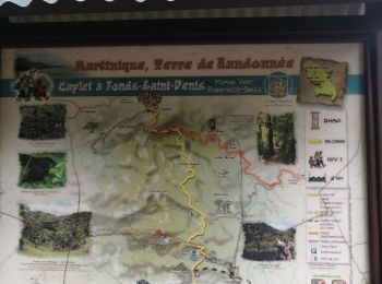
3,3 km | 5,2 km-effort
Le Morne-Vert : Entdecken Sie die besten Touren : 41 zu Fuß. Alle diese Touren, Trails, Routen und Outdoor-Aktivitäten sind in unseren SityTrail-Apps für Smartphones und Tablets verfügbar.
Wandern


 3.238
3.238
sport
Wandern
Wandern
Wandern
Wandern

Wandern
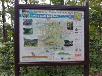
• Martinique
Wandern
Wandern
Pfad
Wandern
Wandern

Wandern

Nordic Walking
Wandern
Wandern
Wandern
Wandern
Wandern
Nordic Walking
20 Angezeigte Touren bei 42
Kostenlosegpshiking-Anwendung
 SityTrail
IGN / Geografische Institute
SityTrail World
Die Welt öffnet sich für Sie