![](/images/other/stat-length.png)
- Touren
- Outdoor
- France
- Neu-Aquitanien
- Vienne
Vienne, Neu-Aquitanien: Die besten Touren, Trails, Trecks und Wanderungen
Vienne : Entdecken Sie die besten Touren : 693 zu Fuß, 365 mit dem Fahrrad oder Mountainbike und 75 auf dem Pferderücken. Alle diese Touren, Trails, Routen und Outdoor-Aktivitäten sind in unseren SityTrail-Apps für Smartphones und Tablets verfügbar.
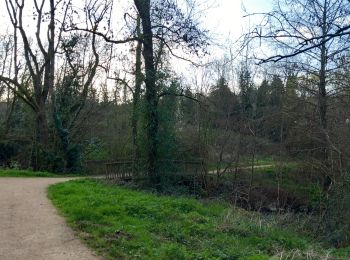
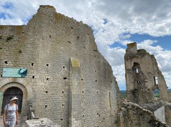
Die besten Spuren (1183)
![Tour Wandern Tercé - La femme du carrier - Tercé - Photo](https://media.geolcdn.com/t/350/260/ext.jpg?maxdim=2&url=https%3A%2F%2Fservices.sitytrail.com%2FGeolivesWS%2FDownloadMedia.ashx%3FTrailID%3D111628%26Media%3D7801_3.jpg)
![Wandern Wandern](https://static1.geolcdn.com/sitytour/trail-icons/101.png)
Km
Wandern
![](/images/other/stat-length.png)
![](https://static1.geolcdn.com/siteimages/upload/files/1508320355ic_sort_den_pos_24dp.png)
![](https://static1.geolcdn.com/siteimages/upload/files/1508320355ic_sort_den_neg_24dp.png)
![](https://static1.geolcdn.com/siteimages/upload/files/16400158638029165_repeat_loop_refresh_sync_direction_icon.png)
![Tour Wandern Bonnes - Le maréchal rêvant - Bonnes - Photo](https://media.geolcdn.com/t/350/260/ext.jpg?maxdim=2&url=https%3A%2F%2Fservices.sitytrail.com%2FGeolivesWS%2FDownloadMedia.ashx%3FTrailID%3D111624%26Media%3D7797_3.jpg)
![Wandern Wandern](https://static1.geolcdn.com/sitytour/trail-icons/101.png)
Km
Wandern
![](/images/other/stat-length.png)
![](https://static1.geolcdn.com/siteimages/upload/files/1508320355ic_sort_den_pos_24dp.png)
![](https://static1.geolcdn.com/siteimages/upload/files/1508320355ic_sort_den_neg_24dp.png)
![](https://static1.geolcdn.com/siteimages/upload/files/16400158638029165_repeat_loop_refresh_sync_direction_icon.png)
![Tour Wandern Bonnes - Le maréchal rêvant - Bonnes en Vienne Moulières - Photo](https://media.geolcdn.com/t/350/260/ext.jpg?maxdim=2&url=https%3A%2F%2Fservices.sitytrail.com%2FGeolivesWS%2FDownloadMedia.ashx%3FTrailID%3D104472%26Media%3D7780_3.jpg)
![Wandern Wandern](https://static1.geolcdn.com/sitytour/trail-icons/101.png)
Km
Wandern
![](/images/other/stat-length.png)
![](https://static1.geolcdn.com/siteimages/upload/files/1508320355ic_sort_den_pos_24dp.png)
![](https://static1.geolcdn.com/siteimages/upload/files/1508320355ic_sort_den_neg_24dp.png)
![](https://static1.geolcdn.com/siteimages/upload/files/16400158638029165_repeat_loop_refresh_sync_direction_icon.png)
![Tour Wandern Tercé - La femme du carrier (circuit court) - Tercé - Photo](https://media.geolcdn.com/t/350/260/ext.jpg?maxdim=2&url=https%3A%2F%2Fservices.sitytrail.com%2FGeolivesWS%2FDownloadMedia.ashx%3FTrailID%3D111629%26Media%3D7803_2.jpg)
![Wandern Wandern](https://static1.geolcdn.com/sitytour/trail-icons/101.png)
Km
Wandern
![](/images/other/stat-length.png)
![](https://static1.geolcdn.com/siteimages/upload/files/1508320355ic_sort_den_pos_24dp.png)
![](https://static1.geolcdn.com/siteimages/upload/files/1508320355ic_sort_den_neg_24dp.png)
![](https://static1.geolcdn.com/siteimages/upload/files/16400158638029165_repeat_loop_refresh_sync_direction_icon.png)
![Tour Wandern Lusignan - Sentier de Mélusine à Lusignan - Photo](https://media.geolcdn.com/t/350/260/ext.jpg?maxdim=2&url=https%3A%2F%2Fservices.sitytrail.com%2FGeolivesWS%2FDownloadMedia.ashx%3FTrailID%3D110172%26Media%3D5372_1.jpg)
![Wandern Wandern](https://static1.geolcdn.com/sitytour/trail-icons/101.png)
Km
Wandern
![](/images/other/stat-length.png)
![](https://static1.geolcdn.com/siteimages/upload/files/1508320355ic_sort_den_pos_24dp.png)
![](https://static1.geolcdn.com/siteimages/upload/files/1508320355ic_sort_den_neg_24dp.png)
![](https://static1.geolcdn.com/siteimages/upload/files/16400158638029165_repeat_loop_refresh_sync_direction_icon.png)
![Tour Wandern Port-de-Piles - Port-de-Piles - la Creuse les Ormes GR655 - 20.7km 300m 4h30 (1h) - 2024 09 13 - Photo](https://media.geolcdn.com/t/350/260/5d3ec580-5341-495b-b7cb-d8cc2eea12e1.jpg&format=jpg&maxdim=2)
![Wandern Wandern](https://static1.geolcdn.com/sitytour/trail-icons/101.png)
Km
Wandern
![](/images/other/stat-length.png)
![](https://static1.geolcdn.com/siteimages/upload/files/1508320355ic_sort_den_pos_24dp.png)
![](https://static1.geolcdn.com/siteimages/upload/files/1508320355ic_sort_den_neg_24dp.png)
![](https://static1.geolcdn.com/siteimages/upload/files/16400158638029165_repeat_loop_refresh_sync_direction_icon.png)
![Tour Wandern Les Ormes - les Ormes - GR48 GR655 Poizay PM - 9.4km 100m 2h05 - 2024 07 18 - Photo](https://media.geolcdn.com/t/350/260/23dcb82f-5e55-4eb3-b38c-2148e14e16b1.jpg&format=jpg&maxdim=2)
![Wandern Wandern](https://static1.geolcdn.com/sitytour/trail-icons/101.png)
Km
Wandern
![](/images/other/stat-length.png)
![](https://static1.geolcdn.com/siteimages/upload/files/1508320355ic_sort_den_pos_24dp.png)
![](https://static1.geolcdn.com/siteimages/upload/files/1508320355ic_sort_den_neg_24dp.png)
![](https://static1.geolcdn.com/siteimages/upload/files/16400158638029165_repeat_loop_refresh_sync_direction_icon.png)
![Tour Wandern Port-de-Piles - Port-de-Piles - GR655 GR48 Descartes GRP Touraine Sud - 25.6km 180m 5h30 (45mn) - 2024 04 20 - Photo](https://media.geolcdn.com/t/350/260/d7a7c171-4f05-4aee-8b9b-948ac935ee9a.jpg&format=jpg&maxdim=2)
![Wandern Wandern](https://static1.geolcdn.com/sitytour/trail-icons/101.png)
Km
Wandern
![](/images/other/stat-length.png)
![](https://static1.geolcdn.com/siteimages/upload/files/1508320355ic_sort_den_pos_24dp.png)
![](https://static1.geolcdn.com/siteimages/upload/files/1508320355ic_sort_den_neg_24dp.png)
![](https://static1.geolcdn.com/siteimages/upload/files/16400158638029165_repeat_loop_refresh_sync_direction_icon.png)
![Tour Wandern Poitiers - Poiters St Benoit - Photo](https://media.geolcdn.com/t/350/260/1c049646-5ee2-4f57-842f-e480ac3a3433.jpg&format=jpg&maxdim=2)
![Wandern Wandern](https://static1.geolcdn.com/sitytour/trail-icons/101.png)
Km
Wandern
![](/images/other/stat-length.png)
![](https://static1.geolcdn.com/siteimages/upload/files/1508320355ic_sort_den_pos_24dp.png)
![](https://static1.geolcdn.com/siteimages/upload/files/1508320355ic_sort_den_neg_24dp.png)
![](https://static1.geolcdn.com/siteimages/upload/files/16400158638029165_repeat_loop_refresh_sync_direction_icon.png)
![Tour Wandern Les Trois-Moutiers - Les Dolmens - Photo](https://media.geolcdn.com/t/350/260/ext.jpg?maxdim=2&url=https%3A%2F%2Fstatic1.geolcdn.com%2Fsiteimages%2Fupload%2Ffiles%2F1553511878bg_sport_marche.png)
![Wandern Wandern](https://static1.geolcdn.com/sitytour/trail-icons/101.png)
Km
Wandern
![](/images/other/stat-length.png)
![](https://static1.geolcdn.com/siteimages/upload/files/1508320355ic_sort_den_pos_24dp.png)
![](https://static1.geolcdn.com/siteimages/upload/files/1508320355ic_sort_den_neg_24dp.png)
![](https://static1.geolcdn.com/siteimages/upload/files/16400158638029165_repeat_loop_refresh_sync_direction_icon.png)
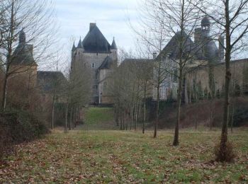
• Départ Les Trois Moutiers (86) Nord est de Loudun
![Tour Wandern Poitiers - Balade Camille - Photo](https://media.geolcdn.com/t/350/260/bd353917-f068-4c5d-b388-88752a7a8dc4.jpg&format=jpg&maxdim=2)
![Wandern Wandern](https://static1.geolcdn.com/sitytour/trail-icons/101.png)
Km
Wandern
![](/images/other/stat-length.png)
![](https://static1.geolcdn.com/siteimages/upload/files/1508320355ic_sort_den_pos_24dp.png)
![](https://static1.geolcdn.com/siteimages/upload/files/1508320355ic_sort_den_neg_24dp.png)
![](https://static1.geolcdn.com/siteimages/upload/files/16400158638029165_repeat_loop_refresh_sync_direction_icon.png)
![Tour Wandern Romagne - Romagne - Photo](https://media.geolcdn.com/t/350/260/57a0a14a-5a54-4b2d-95c1-fea330ff49e9.jpg&format=jpg&maxdim=2)
![Wandern Wandern](https://static1.geolcdn.com/sitytour/trail-icons/101.png)
Km
Wandern
![](/images/other/stat-length.png)
![](https://static1.geolcdn.com/siteimages/upload/files/1508320355ic_sort_den_pos_24dp.png)
![](https://static1.geolcdn.com/siteimages/upload/files/1508320355ic_sort_den_neg_24dp.png)
![](https://static1.geolcdn.com/siteimages/upload/files/16400158638029165_repeat_loop_refresh_sync_direction_icon.png)
![Tour Wandern Lusignan - Voie de Tours - de Lusignan à MELLE - Photo](https://media.geolcdn.com/t/350/260/21d33dd5-2988-43c4-b489-05540c188df1.jpg&format=jpg&maxdim=2)
![Wandern Wandern](https://static1.geolcdn.com/sitytour/trail-icons/101.png)
Km
Wandern
![](/images/other/stat-length.png)
![](https://static1.geolcdn.com/siteimages/upload/files/1508320355ic_sort_den_pos_24dp.png)
![](https://static1.geolcdn.com/siteimages/upload/files/1508320355ic_sort_den_neg_24dp.png)
![](https://static1.geolcdn.com/siteimages/upload/files/16400158638029165_repeat_loop_refresh_sync_direction_icon.png)
![Tour Wandern Ligugé - Voie de Tours Ligugé - Lusignan - Photo](https://media.geolcdn.com/t/350/260/d3559b77-50ce-423d-acff-ed52053e525f.jpg&format=jpg&maxdim=2)
![Wandern Wandern](https://static1.geolcdn.com/sitytour/trail-icons/101.png)
Km
Wandern
![](/images/other/stat-length.png)
![](https://static1.geolcdn.com/siteimages/upload/files/1508320355ic_sort_den_pos_24dp.png)
![](https://static1.geolcdn.com/siteimages/upload/files/1508320355ic_sort_den_neg_24dp.png)
![](https://static1.geolcdn.com/siteimages/upload/files/16400158638029165_repeat_loop_refresh_sync_direction_icon.png)
![Tour Wandern Champagné-Saint-Hilaire - Champagné-Saint-Hilaire - Photo](https://media.geolcdn.com/t/350/260/03d40b79-2749-4f5d-9429-54b32038aadf.jpg&format=jpg&maxdim=2)
![Wandern Wandern](https://static1.geolcdn.com/sitytour/trail-icons/101.png)
Km
Wandern
![](/images/other/stat-length.png)
![](https://static1.geolcdn.com/siteimages/upload/files/1508320355ic_sort_den_pos_24dp.png)
![](https://static1.geolcdn.com/siteimages/upload/files/1508320355ic_sort_den_neg_24dp.png)
![](https://static1.geolcdn.com/siteimages/upload/files/16400158638029165_repeat_loop_refresh_sync_direction_icon.png)
![Tour Wandern Dissay - Voie de Tours - 11 06 2024 - Photo](https://media.geolcdn.com/t/350/260/c1b182c0-f02b-4d72-80db-adc95dcc825a.jpg&format=jpg&maxdim=2)
![Wandern Wandern](https://static1.geolcdn.com/sitytour/trail-icons/101.png)
Km
Wandern
![](/images/other/stat-length.png)
![](https://static1.geolcdn.com/siteimages/upload/files/1508320355ic_sort_den_pos_24dp.png)
![](https://static1.geolcdn.com/siteimages/upload/files/1508320355ic_sort_den_neg_24dp.png)
![](https://static1.geolcdn.com/siteimages/upload/files/16400158638029165_repeat_loop_refresh_sync_direction_icon.png)
![Tour Wandern Chauvigny - SityTrail - Cité Médiévale Chauvigny - Photo](https://media.geolcdn.com/t/350/260/ext.jpg?maxdim=2&url=https%3A%2F%2Fstatic1.geolcdn.com%2Fsiteimages%2Fupload%2Ffiles%2F1553511878bg_sport_marche.png)
![Wandern Wandern](https://static1.geolcdn.com/sitytour/trail-icons/101.png)
Km
Wandern
![](/images/other/stat-length.png)
![](https://static1.geolcdn.com/siteimages/upload/files/1508320355ic_sort_den_pos_24dp.png)
![](https://static1.geolcdn.com/siteimages/upload/files/1508320355ic_sort_den_neg_24dp.png)
![](https://static1.geolcdn.com/siteimages/upload/files/16400158638029165_repeat_loop_refresh_sync_direction_icon.png)
![Tour Wandern Lésigny - LES FROUX - Photo](https://media.geolcdn.com/t/350/260/ext.jpg?maxdim=2&url=https%3A%2F%2Fstatic1.geolcdn.com%2Fsiteimages%2Fupload%2Ffiles%2F1553511878bg_sport_marche.png)
![Wandern Wandern](https://static1.geolcdn.com/sitytour/trail-icons/101.png)
Km
Wandern
![](/images/other/stat-length.png)
![](https://static1.geolcdn.com/siteimages/upload/files/1508320355ic_sort_den_pos_24dp.png)
![](https://static1.geolcdn.com/siteimages/upload/files/1508320355ic_sort_den_neg_24dp.png)
![](https://static1.geolcdn.com/siteimages/upload/files/16400158638029165_repeat_loop_refresh_sync_direction_icon.png)
![Tour Wandern Poitiers - SityTrail - Grottes de la Noree - Photo](https://media.geolcdn.com/t/350/260/bad56a70-0545-4e86-894b-a5e906d8d8a0.jpg&format=jpg&maxdim=2)
![Wandern Wandern](https://static1.geolcdn.com/sitytour/trail-icons/101.png)
Km
Wandern
![](/images/other/stat-length.png)
![](https://static1.geolcdn.com/siteimages/upload/files/1508320355ic_sort_den_pos_24dp.png)
![](https://static1.geolcdn.com/siteimages/upload/files/1508320355ic_sort_den_neg_24dp.png)
![](https://static1.geolcdn.com/siteimages/upload/files/16400158638029165_repeat_loop_refresh_sync_direction_icon.png)
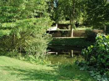
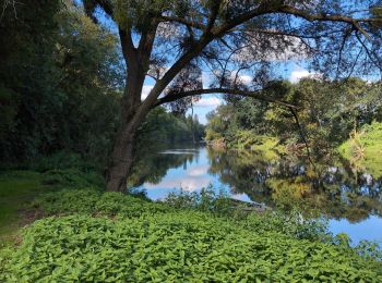
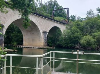
• Ancienne voie de chemin de fer
![Tour Wandern Chauvigny - Le 3 juillet 2024 - Photo](https://media.geolcdn.com/t/350/260/543e1e82-f571-4fb2-be6f-2f75f137224e.jpg&format=jpg&maxdim=2)
![Wandern Wandern](https://static1.geolcdn.com/sitytour/trail-icons/101.png)
Km
Wandern
![](/images/other/stat-length.png)
![](https://static1.geolcdn.com/siteimages/upload/files/1508320355ic_sort_den_pos_24dp.png)
![](https://static1.geolcdn.com/siteimages/upload/files/1508320355ic_sort_den_neg_24dp.png)
![](https://static1.geolcdn.com/siteimages/upload/files/16400158638029165_repeat_loop_refresh_sync_direction_icon.png)
20 Angezeigte Touren bei 1183
Kostenlosegpshiking-Anwendung
Aktivitäten
Nahegelegene Regionen
- Adriers
- Anché
- Angles-sur-l'Anglin
- Angliers
- Antigny
- Antran
- Archigny
- Aslonnes
- Asnières-sur-Blour
- Asnois
- Availles-Limouzine
- Availles-en-Châtellerault
- Avanton
- Ayron
- Basses
- Beaumont Saint-Cyr
- Bellefonds
- Berrie
- Béruges
- Béthines
- Beuxes
- Biard
- Bignoux
- Blanzay
- Boivre-la-Vallée
- Bonnes
- Bonneuil-Matours
- Bourg-Archambault
- Brigueil-le-Chantre
- Brion
- Brux
- Buxerolles
- Buxeuil
- Celle-Lévescault
- Cenon-sur-Vienne
- Chalandray
- Champagné-Saint-Hilaire
- Champigny en Rochereau
- Champniers
- Chapelle-Viviers
- Charroux
- Chasseneuil-du-Poitou
- Chatain
- Château-Garnier
- Château-Larcher
- Châtellerault
- Chaunay
- Chauvigny
- Chenevelles
- Cherves
- Chiré-en-Montreuil
- Cissé
- Civaux
- Civray
- Cloué
- Colombiers
- Coulombiers
- Coulonges
- Croutelle
- Curçay-sur-Dive
- Curzay-sur-Vonne
- Dangé-Saint-Romain
- Dercé
- Dienné
- Dissay
- Fleuré
- Fontaine-le-Comte
- Gençay
- Genouillé
- Gizay
- Glénouze
- Gouex
- Guesnes
- Haims
- Ingrandes
- Iteuil
- Jardres
- Jaunay-Marigny
- Jazeneuil
- Jouhet
- Journet
- Joussé
- L'Isle-Jourdain
- La Bussière
- La Chapelle-Bâton
- La Chapelle-Moulière
- La Chaussée
- La Grimaudière
- La Puye
- La Roche-Posay
- La Trimouille
- La Villedieu-du-Clain
- Lathus-Saint-Rémy
- Latillé
- Lavoux
- Le Vigeant
- Leigné-les-Bois
- Leigné-sur-Usseau
- Leignes-sur-Fontaine
- Lencloître
- Les Ormes
- Les Trois-Moutiers
- Lésigny
- Leugny
- Lhommaizé
- Liglet
- Ligugé
- Linazay
- Liniers
- Lizant
- Loudun
- Luchapt
- Lusignan
- Lussac-les-Châteaux
- Magné
- Mairé
- Marçay
- Marigny-Chemereau
- Marnay
- Massognes
- Mauprévoir
- Mazerolles
- Mazeuil
- Mignaloux-Beauvoir
- Migné-Auxances
- Millac
- Mirebeau
- Moncontour
- Montamisé
- Monthoiron
- Montmorillon
- Monts-sur-Guesnes
- Morton
- Moulismes
- Moussac
- Mouterre-sur-Blourde
- Naintré
- Nalliers
- Nérignac
- Neuville-de-Poitou
- Nieuil-l'Espoir
- Nouaillé-Maupertuis
- Ouzilly
- Oyré
- Paizay-le-Sec
- Payroux
- Persac
- Pindray
- Plaisance
- Pleumartin
- Poitiers
- Port-de-Piles
- Pouançay
- Pouant
- Pouillé
- Pressac
- Queaux
- Quinçay
- Ranton
- Roches-Prémarie-Andillé
- Roiffé
- Romagne
- Rouillé
- Saint-Benoît
- Saint-Clair
- Saint-Gaudent
- Saint-Genest-d'Ambière
- Saint-Georges-lès-Baillargeaux
- Saint-Germain
- Saint-Gervais-les-Trois-Clochers
- Saint-Jean-de-Sauves
- Saint-Julien-l'Ars
- Saint-Laurent-de-Jourdes
- Saint-Léger-de-Montbrillais
- Saint-Léomer
- Saint-Macoux
- Saint-Martin-l'Ars
- Saint-Martin-la-Pallu
- Saint-Maurice-la-Clouère
- Saint-Pierre-d'Exideuil
- Saint-Pierre-de-Maillé
- Saint-Rémy-sur-Creuse
- Saint-Sauvant
- Saint-Savin
- Saint-Saviol
- Saint-Secondin
- Sainte-Radégonde
- Sammarçolles
- Sanxay
- Saulgé
- Savigné
- Savigny-Lévescault
- Scorbé-Clairvaux
- Senillé-Saint-Sauveur
- Sérigny
- Sèvres-Anxaumont
- Sillars
- Smarves
- Sommières-du-Clain
- Sossay
- Surin
- Tercé
- Ternay
- Thollet
- Thuré
- Usseau
- Usson-du-Poitou
- Valdivienne
- Valence-en-Poitou
- Vaux-sur-Vienne
- Vellèches
- Vernon
- Verrières
- Verrue
- Vézières
- Vicq-sur-Gartempe
- Villiers
- Vivonne
- Vouillé
- Voulême
- Voulon
- Vouneuil-sous-Biard
- Vouneuil-sur-Vienne
- Vouzailles
- Yversay