


10,9 km | 18,6 km-effort
Venterol : Entdecken Sie die besten Touren : 13 zu Fuß und 2 mit dem Fahrrad oder Mountainbike. Alle diese Touren, Trails, Routen und Outdoor-Aktivitäten sind in unseren SityTrail-Apps für Smartphones und Tablets verfügbar.
Wandern


Wandern
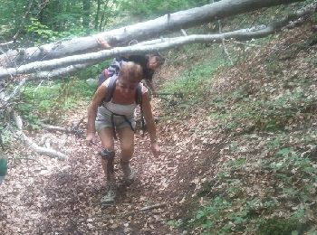
• PETITE RANDO EN SOUS-BOIS;

Wandern
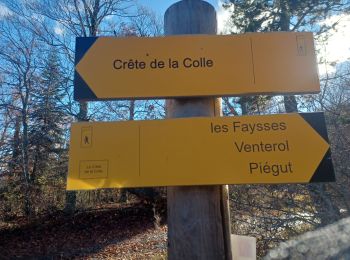
• venterol plutôt sympa avec quelques difficultés

Wandern
• venterol plutôt sympa avec quelques difficultés
Wandern
• venterol plutôt sympa avec quelques difficultés

Wandern
Wandern

Andere Aktivitäten
• 26/04/2016
Wandern
Wandern
Wandern
Wandern
Wandern

Mountainbike
Rennrad
Wandern
16 Angezeigte Touren bei 16
Kostenlosegpshiking-Anwendung
 SityTrail
IGN / Geografische Institute
SityTrail World
Die Welt öffnet sich für Sie