


23 km | 27 km-effort
Vitrolles : Entdecken Sie die besten Touren : 95 zu Fuß, 72 mit dem Fahrrad oder Mountainbike und 1 auf dem Pferderücken. Alle diese Touren, Trails, Routen und Outdoor-Aktivitäten sind in unseren SityTrail-Apps für Smartphones und Tablets verfügbar.
Mountainbike


 9.01
9.01
sport

Mountainbike

Wandern
Wandern

Mountainbike
Mountainbike
Wandern
Wandern
Wandern
Wandern
Mountainbike
Wandern

Wandern
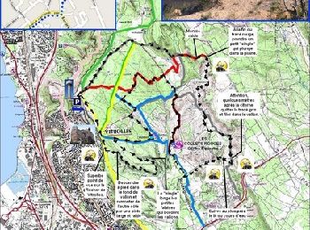
• Pistes
Mountainbike
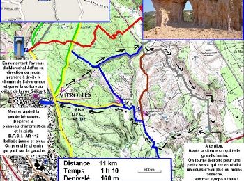
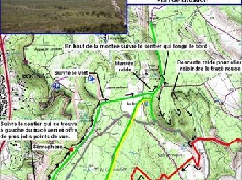
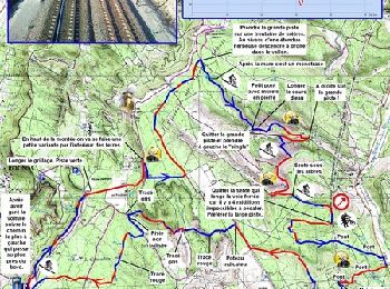
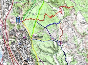
• 24 km avec la raccourci / parcours relativement facile mais 4h30
Mountainbike
Laufen
Laufen
Mountainbike
Pferd
20 Angezeigte Touren bei 172
Kostenlosegpshiking-Anwendung
 SityTrail
IGN / Geografische Institute
SityTrail World
Die Welt öffnet sich für Sie