![](/images/other/stat-length.png)
Main-Kinzig-Kreis, Hessen: Die besten Touren, Trails, Trecks und Wanderungen
Main-Kinzig-Kreis : Entdecken Sie die besten Touren : 266 zu Fuß. Alle diese Touren, Trails, Routen und Outdoor-Aktivitäten sind in unseren SityTrail-Apps für Smartphones und Tablets verfügbar.
Die besten Spuren (266)
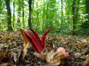
![Tour Zu Fuß Bruchköbel - 5-Sterne-Wanderweg Bruchköbel - Photo](https://media.geolcdn.com/t/350/260/46cd4dbc-faa0-41bf-9855-f30e6c57040a.jpeg&format=jpg&maxdim=2)
![Zu Fuß Zu Fuß](https://static1.geolcdn.com/sitytour/trail-icons/100.png)
Km
Zu Fuß
![](/images/other/stat-length.png)
![](https://static1.geolcdn.com/siteimages/upload/files/1508320355ic_sort_den_pos_24dp.png)
![](https://static1.geolcdn.com/siteimages/upload/files/1508320355ic_sort_den_neg_24dp.png)
![](https://static1.geolcdn.com/siteimages/upload/files/16400158638029165_repeat_loop_refresh_sync_direction_icon.png)
• Trail created by Stadt Bruchköbel.
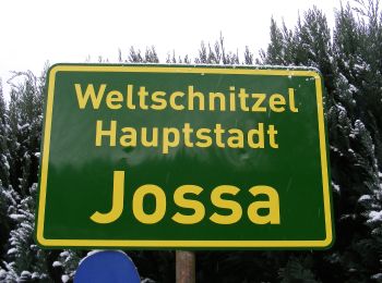
![Tour Zu Fuß Sinntal - Spessartspuren - Jossa-Sinn-Blick - Photo](https://media.geolcdn.com/t/350/260/cd33c038-9e0b-4efb-b676-5a195b30aedb.jpeg&format=jpg&maxdim=2)
![Zu Fuß Zu Fuß](https://static1.geolcdn.com/sitytour/trail-icons/100.png)
Km
Zu Fuß
![](/images/other/stat-length.png)
![](https://static1.geolcdn.com/siteimages/upload/files/1508320355ic_sort_den_pos_24dp.png)
![](https://static1.geolcdn.com/siteimages/upload/files/1508320355ic_sort_den_neg_24dp.png)
![](https://static1.geolcdn.com/siteimages/upload/files/16400158638029165_repeat_loop_refresh_sync_direction_icon.png)
• Trail created by Naturpark Hessischer Spessart. Symbol: Blauer Strich und grüner Bogen über gelbem Rechteck auf hell...
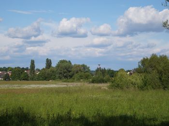
![Tour Zu Fuß Bruchköbel - Bruchköbel Wanderweg 9 - Photo](https://media.geolcdn.com/t/350/260/95045a03-ddfb-484c-adf0-ed04c67f4fde.jpeg&format=jpg&maxdim=2)
![Zu Fuß Zu Fuß](https://static1.geolcdn.com/sitytour/trail-icons/100.png)
Km
Zu Fuß
![](/images/other/stat-length.png)
![](https://static1.geolcdn.com/siteimages/upload/files/1508320355ic_sort_den_pos_24dp.png)
![](https://static1.geolcdn.com/siteimages/upload/files/1508320355ic_sort_den_neg_24dp.png)
![](https://static1.geolcdn.com/siteimages/upload/files/16400158638029165_repeat_loop_refresh_sync_direction_icon.png)
• Trail created by Stadt Bruchköbel.
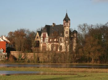
![Tour Zu Fuß Schöneck - Schöneck Landschaftsweg (Halbmarathonroute) - Photo](https://media.geolcdn.com/t/350/260/62b0332a-a4c4-495c-b7a1-cba4d268cc54.jpeg&format=jpg&maxdim=2)
![Zu Fuß Zu Fuß](https://static1.geolcdn.com/sitytour/trail-icons/100.png)
Km
Zu Fuß
![](/images/other/stat-length.png)
![](https://static1.geolcdn.com/siteimages/upload/files/1508320355ic_sort_den_pos_24dp.png)
![](https://static1.geolcdn.com/siteimages/upload/files/1508320355ic_sort_den_neg_24dp.png)
![](https://static1.geolcdn.com/siteimages/upload/files/16400158638029165_repeat_loop_refresh_sync_direction_icon.png)
• Trail created by Gemeinde Schöneck. Symbol: Roter Kreis auf blauem Hintergrund mit eingeschriebener weißer 2. Häufig...
![Tour Zu Fuß Freigericht - Spessartspuren - Neuseser Fernblick - Photo](https://media.geolcdn.com/t/350/260/ca56fb1d-ddad-4098-9ae7-66f7201cd6d2.jpeg&format=jpg&maxdim=2)
![Zu Fuß Zu Fuß](https://static1.geolcdn.com/sitytour/trail-icons/100.png)
Km
Zu Fuß
![](/images/other/stat-length.png)
![](https://static1.geolcdn.com/siteimages/upload/files/1508320355ic_sort_den_pos_24dp.png)
![](https://static1.geolcdn.com/siteimages/upload/files/1508320355ic_sort_den_neg_24dp.png)
![](https://static1.geolcdn.com/siteimages/upload/files/16400158638029165_repeat_loop_refresh_sync_direction_icon.png)
• Trail created by Naturpark Hessischer Spessart. Symbol: Blauer Strich und grüner Bogen über gelbem Rechteck auf hell...
![Tour Zu Fuß Hanau - Spessartspuren - Niederrodenbach - Barbarossaquelle und Klosterruine - Photo](https://media.geolcdn.com/t/350/260/582999f3-e5b8-4ba5-8b9c-1d0ab3958527.jpeg&format=jpg&maxdim=2)
![Zu Fuß Zu Fuß](https://static1.geolcdn.com/sitytour/trail-icons/100.png)
Km
Zu Fuß
![](/images/other/stat-length.png)
![](https://static1.geolcdn.com/siteimages/upload/files/1508320355ic_sort_den_pos_24dp.png)
![](https://static1.geolcdn.com/siteimages/upload/files/1508320355ic_sort_den_neg_24dp.png)
![](https://static1.geolcdn.com/siteimages/upload/files/16400158638029165_repeat_loop_refresh_sync_direction_icon.png)
• Trail created by Naturpark Hessischer Spessart. Symbol: Blauer Strich und grüner Bogen über gelbem Rechteck auf hell...
![Tour Zu Fuß Biebergemünd - Spessartspuren - Bieber - Photo](https://media.geolcdn.com/t/350/260/62cb8d3f-1937-4ed4-9d97-142b12397164.jpeg&format=jpg&maxdim=2)
![Zu Fuß Zu Fuß](https://static1.geolcdn.com/sitytour/trail-icons/100.png)
Km
Zu Fuß
![](/images/other/stat-length.png)
![](https://static1.geolcdn.com/siteimages/upload/files/1508320355ic_sort_den_pos_24dp.png)
![](https://static1.geolcdn.com/siteimages/upload/files/1508320355ic_sort_den_neg_24dp.png)
![](https://static1.geolcdn.com/siteimages/upload/files/16400158638029165_repeat_loop_refresh_sync_direction_icon.png)
• Trail created by Naturpark Hessischer Spessart. Symbol: Blauer Strich und grüner Bogen über gelbem Rechteck auf hell...
![Tour Zu Fuß Flörsbachtal - Spessartspuren - Wiesbüttmoor und Flörsbacher Panorama - Photo](https://media.geolcdn.com/t/350/260/f572fa30-e08a-4645-9d7d-2b6b71accb1f.jpeg&format=jpg&maxdim=2)
![Zu Fuß Zu Fuß](https://static1.geolcdn.com/sitytour/trail-icons/100.png)
Km
Zu Fuß
![](/images/other/stat-length.png)
![](https://static1.geolcdn.com/siteimages/upload/files/1508320355ic_sort_den_pos_24dp.png)
![](https://static1.geolcdn.com/siteimages/upload/files/1508320355ic_sort_den_neg_24dp.png)
![](https://static1.geolcdn.com/siteimages/upload/files/16400158638029165_repeat_loop_refresh_sync_direction_icon.png)
• Trail created by Natirpark Hessischer Spessart. Symbol: Blauer Strich und grüner Bogen über gelbem Rechteck auf hell...
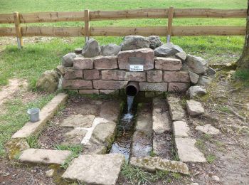
![Tour Zu Fuß Sinntal - Sterbfritz - Rundweg 5 - Photo](https://media.geolcdn.com/t/350/260/b749f20d-5637-434d-8033-94a053a83247.jpeg&format=jpg&maxdim=2)
![Zu Fuß Zu Fuß](https://static1.geolcdn.com/sitytour/trail-icons/100.png)
Km
Zu Fuß
![](/images/other/stat-length.png)
![](https://static1.geolcdn.com/siteimages/upload/files/1508320355ic_sort_den_pos_24dp.png)
![](https://static1.geolcdn.com/siteimages/upload/files/1508320355ic_sort_den_neg_24dp.png)
![](https://static1.geolcdn.com/siteimages/upload/files/16400158638029165_repeat_loop_refresh_sync_direction_icon.png)
• Trail created by Rhönklub Zweigverein Sterbfritz. Symbol: Weiße 5 auf blauem Hintergrund
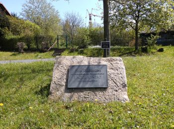
![Tour Zu Fuß Sinntal - Sterbfritz - Rundweg 2 - Photo](https://media.geolcdn.com/t/350/260/0692c028-afe7-427d-a641-8c356599369f.jpeg&format=jpg&maxdim=2)
![Zu Fuß Zu Fuß](https://static1.geolcdn.com/sitytour/trail-icons/100.png)
Km
Zu Fuß
![](/images/other/stat-length.png)
![](https://static1.geolcdn.com/siteimages/upload/files/1508320355ic_sort_den_pos_24dp.png)
![](https://static1.geolcdn.com/siteimages/upload/files/1508320355ic_sort_den_neg_24dp.png)
![](https://static1.geolcdn.com/siteimages/upload/files/16400158638029165_repeat_loop_refresh_sync_direction_icon.png)
• Trail created by Rhönklub Zweigverein Sterbfritz. Symbol: Weiße 2 auf blauem Hintergrund
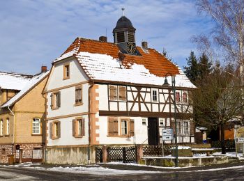
![Tour Zu Fuß Hasselroth - Spessartspuren - Neuenhaßlauer Ysenburg-Runde - Photo](https://media.geolcdn.com/t/350/260/2c041be9-e260-4358-b852-b0670ff23424.jpeg&format=jpg&maxdim=2)
![Zu Fuß Zu Fuß](https://static1.geolcdn.com/sitytour/trail-icons/100.png)
Km
Zu Fuß
![](/images/other/stat-length.png)
![](https://static1.geolcdn.com/siteimages/upload/files/1508320355ic_sort_den_pos_24dp.png)
![](https://static1.geolcdn.com/siteimages/upload/files/1508320355ic_sort_den_neg_24dp.png)
![](https://static1.geolcdn.com/siteimages/upload/files/16400158638029165_repeat_loop_refresh_sync_direction_icon.png)
• Trail created by Naturpark Hessischer Spessart. Hier ist das Symbol mit einem rotem Punkt etwas abgewandelt. Symbol...
![Tour Zu Fuß Schlüchtern - Vollmerz Wanderweg VOL1 - Photo](https://media.geolcdn.com/t/350/260/abe3a7c8-dfc9-4fc7-ac45-ba512d6431de.jpeg&format=jpg&maxdim=2)
![Zu Fuß Zu Fuß](https://static1.geolcdn.com/sitytour/trail-icons/100.png)
Km
Zu Fuß
![](/images/other/stat-length.png)
![](https://static1.geolcdn.com/siteimages/upload/files/1508320355ic_sort_den_pos_24dp.png)
![](https://static1.geolcdn.com/siteimages/upload/files/1508320355ic_sort_den_neg_24dp.png)
![](https://static1.geolcdn.com/siteimages/upload/files/16400158638029165_repeat_loop_refresh_sync_direction_icon.png)
• Symbol: Weißes VOL1 auf blauem Hintergrund
![Tour Zu Fuß Schlüchtern - Vollmerz Wanderweg VOL2 - Photo](https://media.geolcdn.com/t/350/260/abe3a7c8-dfc9-4fc7-ac45-ba512d6431de.jpeg&format=jpg&maxdim=2)
![Zu Fuß Zu Fuß](https://static1.geolcdn.com/sitytour/trail-icons/100.png)
Km
Zu Fuß
![](/images/other/stat-length.png)
![](https://static1.geolcdn.com/siteimages/upload/files/1508320355ic_sort_den_pos_24dp.png)
![](https://static1.geolcdn.com/siteimages/upload/files/1508320355ic_sort_den_neg_24dp.png)
![](https://static1.geolcdn.com/siteimages/upload/files/16400158638029165_repeat_loop_refresh_sync_direction_icon.png)
• Symbol: Weißes VOL2 auf blauem Hintergrund
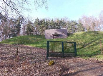
![Tour Zu Fuß Hasselroth - Spessartspuren - Niedermittlauer Berkopp Runde - Photo](https://media.geolcdn.com/t/350/260/3e623794-157c-40b8-a2d8-4cb5e8847430.jpeg&format=jpg&maxdim=2)
![Zu Fuß Zu Fuß](https://static1.geolcdn.com/sitytour/trail-icons/100.png)
Km
Zu Fuß
![](/images/other/stat-length.png)
![](https://static1.geolcdn.com/siteimages/upload/files/1508320355ic_sort_den_pos_24dp.png)
![](https://static1.geolcdn.com/siteimages/upload/files/1508320355ic_sort_den_neg_24dp.png)
![](https://static1.geolcdn.com/siteimages/upload/files/16400158638029165_repeat_loop_refresh_sync_direction_icon.png)
• Trail created by Naturpark Hessischer Spessart. Symbol: Blauer Strich und grüner Bogen über gelbem Rechteck auf hell...
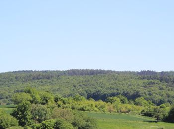
![Tour Zu Fuß Freigericht - Spessartspuren - Somborner Hügelland-Spur - Photo](https://media.geolcdn.com/t/350/260/2fd25fb0-9331-491e-9593-ed0fc43d9430.jpeg&format=jpg&maxdim=2)
![Zu Fuß Zu Fuß](https://static1.geolcdn.com/sitytour/trail-icons/100.png)
Km
Zu Fuß
![](/images/other/stat-length.png)
![](https://static1.geolcdn.com/siteimages/upload/files/1508320355ic_sort_den_pos_24dp.png)
![](https://static1.geolcdn.com/siteimages/upload/files/1508320355ic_sort_den_neg_24dp.png)
![](https://static1.geolcdn.com/siteimages/upload/files/16400158638029165_repeat_loop_refresh_sync_direction_icon.png)
• Trail created by Naturpark Hessischer Spessart. Symbol: Blauer Strich und grüner Bogen über gelbem Rechteck auf hell...
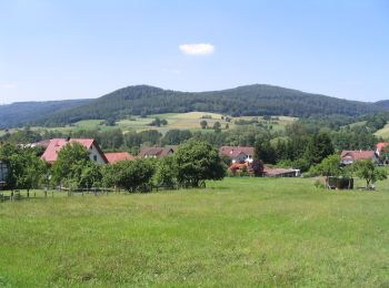
![Tour Zu Fuß Sinntal - Oberzell - Rundwanderweg Hemmersbach - Photo](https://media.geolcdn.com/t/350/260/4e962bfc-8421-43f7-8dea-a30191c785e8.jpeg&format=jpg&maxdim=2)
![Zu Fuß Zu Fuß](https://static1.geolcdn.com/sitytour/trail-icons/100.png)
Km
Zu Fuß
![](/images/other/stat-length.png)
![](https://static1.geolcdn.com/siteimages/upload/files/1508320355ic_sort_den_pos_24dp.png)
![](https://static1.geolcdn.com/siteimages/upload/files/1508320355ic_sort_den_neg_24dp.png)
![](https://static1.geolcdn.com/siteimages/upload/files/16400158638029165_repeat_loop_refresh_sync_direction_icon.png)
• Trail created by Rhönfalken Oberzell. Symbol: Schwarze 5 auf gelbem Hintergrund
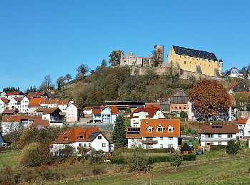
![Tour Zu Fuß Sinntal - Spessartspuren - Schwarzenfelser Sonnenseite - Photo](https://media.geolcdn.com/t/350/260/2a05401e-dc40-44c1-afe1-0448727b6160.jpeg&format=jpg&maxdim=2)
![Zu Fuß Zu Fuß](https://static1.geolcdn.com/sitytour/trail-icons/100.png)
Km
Zu Fuß
![](/images/other/stat-length.png)
![](https://static1.geolcdn.com/siteimages/upload/files/1508320355ic_sort_den_pos_24dp.png)
![](https://static1.geolcdn.com/siteimages/upload/files/1508320355ic_sort_den_neg_24dp.png)
![](https://static1.geolcdn.com/siteimages/upload/files/16400158638029165_repeat_loop_refresh_sync_direction_icon.png)
• Trail created by Naturpark Hessischer Spessart. Symbol: Blauer Strich und grüner Bogen über gelbem Rechteck auf hell...
![Tour Zu Fuß Steinau an der Straße - Ulmbach - Rundwanderweg UW - Photo](https://media.geolcdn.com/t/350/260/33246466-00bd-49e4-9abf-e59a98c78973.jpeg&format=jpg&maxdim=2)
![Zu Fuß Zu Fuß](https://static1.geolcdn.com/sitytour/trail-icons/100.png)
Km
Zu Fuß
![](/images/other/stat-length.png)
![](https://static1.geolcdn.com/siteimages/upload/files/1508320355ic_sort_den_pos_24dp.png)
![](https://static1.geolcdn.com/siteimages/upload/files/1508320355ic_sort_den_neg_24dp.png)
![](https://static1.geolcdn.com/siteimages/upload/files/16400158638029165_repeat_loop_refresh_sync_direction_icon.png)
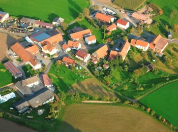
• Auf Nachfrage konnte niemand sagen wer diesen Wanderweg verantwortet. Völliges Rätsel. Symbol: Roter Text UW auf wei...
![Tour Zu Fuß Flörsbachtal - Spessartspuren - Lohrhaupter Widdehuh - Photo](https://media.geolcdn.com/t/350/260/7b2b8aa5-47c0-44c4-97b6-3a2902fb77ab.jpeg&format=jpg&maxdim=2)
![Zu Fuß Zu Fuß](https://static1.geolcdn.com/sitytour/trail-icons/100.png)
Km
Zu Fuß
![](/images/other/stat-length.png)
![](https://static1.geolcdn.com/siteimages/upload/files/1508320355ic_sort_den_pos_24dp.png)
![](https://static1.geolcdn.com/siteimages/upload/files/1508320355ic_sort_den_neg_24dp.png)
![](https://static1.geolcdn.com/siteimages/upload/files/16400158638029165_repeat_loop_refresh_sync_direction_icon.png)
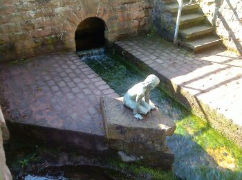
• Trail created by Naturpark Hessischer Spessart. Symbol: Blauer Strich und grüner Bogen über gelbem Rechteck auf hell...
![Tour Zu Fuß Bad Soden-Salmünster - Spessartspuren - Bad Sodener Waldgeflüster - Photo](https://media.geolcdn.com/t/350/260/eab33703-db53-400c-8f5e-a96553cdf665.jpeg&format=jpg&maxdim=2)
![Zu Fuß Zu Fuß](https://static1.geolcdn.com/sitytour/trail-icons/100.png)
Km
Zu Fuß
![](/images/other/stat-length.png)
![](https://static1.geolcdn.com/siteimages/upload/files/1508320355ic_sort_den_pos_24dp.png)
![](https://static1.geolcdn.com/siteimages/upload/files/1508320355ic_sort_den_neg_24dp.png)
![](https://static1.geolcdn.com/siteimages/upload/files/16400158638029165_repeat_loop_refresh_sync_direction_icon.png)
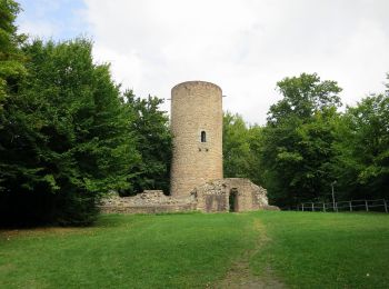
• Trail created by Naturpark Hessischer Spessart. Symbol: Blauer Strich und grüner Bogen über gelbem Rechteck auf hell...
20 Angezeigte Touren bei 266
Kostenlosegpshiking-Anwendung