![](/images/other/stat-length.png)
- Touren
- Outdoor
- Germany
- Hessen
- Kreis Bergstraße
- Grasellenbach
Grasellenbach, Kreis Bergstraße: Die besten Touren, Trails, Trecks und Wanderungen
Grasellenbach : Entdecken Sie die besten Touren : 22 zu Fuß. Alle diese Touren, Trails, Routen und Outdoor-Aktivitäten sind in unseren SityTrail-Apps für Smartphones und Tablets verfügbar.
Die besten Spuren (22)
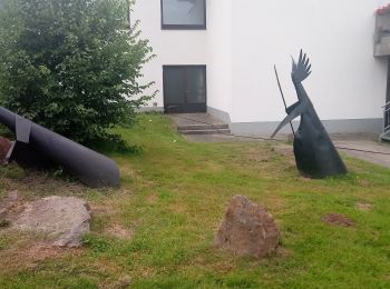
![Tour Zu Fuß Grasellenbach - Rundwanderweg Grasellenbach 6: Kirchberg-Weg - Photo](https://media.geolcdn.com/t/350/260/c88bea1d-f14f-465e-ae6a-d571ed58dd82.jpeg&format=jpg&maxdim=2)
![Zu Fuß Zu Fuß](https://static1.geolcdn.com/sitytour/trail-icons/100.png)
Km
Zu Fuß
![](/images/other/stat-length.png)
![](https://static1.geolcdn.com/siteimages/upload/files/1508320355ic_sort_den_pos_24dp.png)
![](https://static1.geolcdn.com/siteimages/upload/files/1508320355ic_sort_den_neg_24dp.png)
![](https://static1.geolcdn.com/siteimages/upload/files/16400158638029165_repeat_loop_refresh_sync_direction_icon.png)
• Trail created by Geo-Naturpark Bergstraße-Odenwald. Symbol: 6 in einem oben offenen Kreis; in der Kreisöffnung ein G
![Tour Zu Fuß Grasellenbach - Rundwanderweg Grasellenbach 8: Erlebniswanderweg Fürth-Grasellenbach - Photo](https://media.geolcdn.com/t/350/260/c0c408ef-37cd-4633-b234-742b9dad92f4.jpeg&format=jpg&maxdim=2)
![Zu Fuß Zu Fuß](https://static1.geolcdn.com/sitytour/trail-icons/100.png)
Km
Zu Fuß
![](/images/other/stat-length.png)
![](https://static1.geolcdn.com/siteimages/upload/files/1508320355ic_sort_den_pos_24dp.png)
![](https://static1.geolcdn.com/siteimages/upload/files/1508320355ic_sort_den_neg_24dp.png)
![](https://static1.geolcdn.com/siteimages/upload/files/16400158638029165_repeat_loop_refresh_sync_direction_icon.png)
• Trail created by Odenwaldklub. Symbol: Grüne 8 in einem oben offenen grünen Kreis, darüber ein grünes G
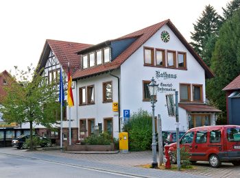
![Tour Zu Fuß Grasellenbach - Rundwanderweg Wahlen 1: Hammelberg Weg - Photo](https://media.geolcdn.com/t/350/260/4996dc75-474b-4112-bfd9-3d43aad246ba.jpeg&format=jpg&maxdim=2)
![Zu Fuß Zu Fuß](https://static1.geolcdn.com/sitytour/trail-icons/100.png)
Km
Zu Fuß
![](/images/other/stat-length.png)
![](https://static1.geolcdn.com/siteimages/upload/files/1508320355ic_sort_den_pos_24dp.png)
![](https://static1.geolcdn.com/siteimages/upload/files/1508320355ic_sort_den_neg_24dp.png)
![](https://static1.geolcdn.com/siteimages/upload/files/16400158638029165_repeat_loop_refresh_sync_direction_icon.png)
• Trail created by Odenwaldklub. Symbol: Weiße "1" im Kreis darüber weißes "Wa"
![Tour Zu Fuß Grasellenbach - Rundwanderweg Grasellenbach 3: Hammelberg-Weg - Photo](https://media.geolcdn.com/t/350/260/c88bea1d-f14f-465e-ae6a-d571ed58dd82.jpeg&format=jpg&maxdim=2)
![Zu Fuß Zu Fuß](https://static1.geolcdn.com/sitytour/trail-icons/100.png)
Km
Zu Fuß
![](/images/other/stat-length.png)
![](https://static1.geolcdn.com/siteimages/upload/files/1508320355ic_sort_den_pos_24dp.png)
![](https://static1.geolcdn.com/siteimages/upload/files/1508320355ic_sort_den_neg_24dp.png)
![](https://static1.geolcdn.com/siteimages/upload/files/16400158638029165_repeat_loop_refresh_sync_direction_icon.png)
• Trail created by Geo-Naturpark Bergstraße-Odenwald. Symbol: 3 in einem oben offenen Kreis; in der Kreisöffnung ein G
![Tour Zu Fuß Grasellenbach - Rundwanderweg Grasellenbach 1: Gemeinde-Rundweg - Photo](https://media.geolcdn.com/t/350/260/4996dc75-474b-4112-bfd9-3d43aad246ba.jpeg&format=jpg&maxdim=2)
![Zu Fuß Zu Fuß](https://static1.geolcdn.com/sitytour/trail-icons/100.png)
Km
Zu Fuß
![](/images/other/stat-length.png)
![](https://static1.geolcdn.com/siteimages/upload/files/1508320355ic_sort_den_pos_24dp.png)
![](https://static1.geolcdn.com/siteimages/upload/files/1508320355ic_sort_den_neg_24dp.png)
![](https://static1.geolcdn.com/siteimages/upload/files/16400158638029165_repeat_loop_refresh_sync_direction_icon.png)
• Trail created by Geo-Naturpark Bergstraße-Odenwald. Symbol: 1 in einem oben offenen Kreis; in der Kreisöffnung ein G
![Tour Zu Fuß Grasellenbach - Rundwanderweg Hammelbach 6: Walburgis-Kapellen-Weg - Photo](https://media.geolcdn.com/t/350/260/4996dc75-474b-4112-bfd9-3d43aad246ba.jpeg&format=jpg&maxdim=2)
![Zu Fuß Zu Fuß](https://static1.geolcdn.com/sitytour/trail-icons/100.png)
Km
Zu Fuß
![](/images/other/stat-length.png)
![](https://static1.geolcdn.com/siteimages/upload/files/1508320355ic_sort_den_pos_24dp.png)
![](https://static1.geolcdn.com/siteimages/upload/files/1508320355ic_sort_den_neg_24dp.png)
![](https://static1.geolcdn.com/siteimages/upload/files/16400158638029165_repeat_loop_refresh_sync_direction_icon.png)
• Trail created by Geo-Naturpark Bergstraße-Odenwald. Symbol: 6 in oben offenem Kreis darüber H
![Tour Zu Fuß Grasellenbach - Rundwanderweg Hammelbach 4: Langklingerhof-Weg - Photo](https://media.geolcdn.com/t/350/260/4996dc75-474b-4112-bfd9-3d43aad246ba.jpeg&format=jpg&maxdim=2)
![Zu Fuß Zu Fuß](https://static1.geolcdn.com/sitytour/trail-icons/100.png)
Km
Zu Fuß
![](/images/other/stat-length.png)
![](https://static1.geolcdn.com/siteimages/upload/files/1508320355ic_sort_den_pos_24dp.png)
![](https://static1.geolcdn.com/siteimages/upload/files/1508320355ic_sort_den_neg_24dp.png)
![](https://static1.geolcdn.com/siteimages/upload/files/16400158638029165_repeat_loop_refresh_sync_direction_icon.png)
• Trail created by Geo-Naturpark Bergstraße-Odenwald. Symbol: 4 in oben offenem Kreis darüber H
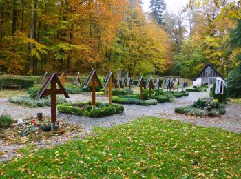
![Tour Zu Fuß Grasellenbach - Rundwanderweg Hammelbach 10: Quellenweg Hammelbach - Photo](https://media.geolcdn.com/t/350/260/eae78859-84f9-46dd-a45a-383d56d8c97c.jpeg&format=jpg&maxdim=2)
![Zu Fuß Zu Fuß](https://static1.geolcdn.com/sitytour/trail-icons/100.png)
Km
Zu Fuß
![](/images/other/stat-length.png)
![](https://static1.geolcdn.com/siteimages/upload/files/1508320355ic_sort_den_pos_24dp.png)
![](https://static1.geolcdn.com/siteimages/upload/files/1508320355ic_sort_den_neg_24dp.png)
![](https://static1.geolcdn.com/siteimages/upload/files/16400158638029165_repeat_loop_refresh_sync_direction_icon.png)
• Trail created by Odenwaldklub. Symbol: Gruene 10 in einem oben offenen gruenen Kreis, darüber ein gruenes H
![Tour Zu Fuß Grasellenbach - Rundwanderweg Hammelbach 1: Lenzenbuckel-Weg - Photo](https://media.geolcdn.com/t/350/260/4996dc75-474b-4112-bfd9-3d43aad246ba.jpeg&format=jpg&maxdim=2)
![Zu Fuß Zu Fuß](https://static1.geolcdn.com/sitytour/trail-icons/100.png)
Km
Zu Fuß
![](/images/other/stat-length.png)
![](https://static1.geolcdn.com/siteimages/upload/files/1508320355ic_sort_den_pos_24dp.png)
![](https://static1.geolcdn.com/siteimages/upload/files/1508320355ic_sort_den_neg_24dp.png)
![](https://static1.geolcdn.com/siteimages/upload/files/16400158638029165_repeat_loop_refresh_sync_direction_icon.png)
• Trail created by Geo-Naturpark Bergstraße-Odenwald. Symbol: 1 in oben offenem Kreis darüber H
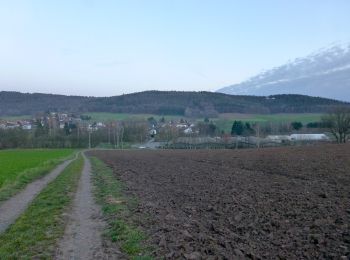
![Tour Zu Fuß Grasellenbach - Rundwanderweg Wahlen 4: Rundwanderweg Wahlen - Photo](https://media.geolcdn.com/t/350/260/4eb41153-df36-4692-ae87-5bc969794979.jpeg&format=jpg&maxdim=2)
![Zu Fuß Zu Fuß](https://static1.geolcdn.com/sitytour/trail-icons/100.png)
Km
Zu Fuß
![](/images/other/stat-length.png)
![](https://static1.geolcdn.com/siteimages/upload/files/1508320355ic_sort_den_pos_24dp.png)
![](https://static1.geolcdn.com/siteimages/upload/files/1508320355ic_sort_den_neg_24dp.png)
![](https://static1.geolcdn.com/siteimages/upload/files/16400158638029165_repeat_loop_refresh_sync_direction_icon.png)
• Trail created by Odenwaldklub. Symbol: Grüne 4 im einemoben offenen grünen Kreis, darüber grünes "Wa"
![Tour Zu Fuß Grasellenbach - Rundwanderweg Hammelbach 7: Gaßbachtal-Weg - Photo](https://media.geolcdn.com/t/350/260/4996dc75-474b-4112-bfd9-3d43aad246ba.jpeg&format=jpg&maxdim=2)
![Zu Fuß Zu Fuß](https://static1.geolcdn.com/sitytour/trail-icons/100.png)
Km
Zu Fuß
![](/images/other/stat-length.png)
![](https://static1.geolcdn.com/siteimages/upload/files/1508320355ic_sort_den_pos_24dp.png)
![](https://static1.geolcdn.com/siteimages/upload/files/1508320355ic_sort_den_neg_24dp.png)
![](https://static1.geolcdn.com/siteimages/upload/files/16400158638029165_repeat_loop_refresh_sync_direction_icon.png)
• Trail created by Geo-Naturpark Bergstraße-Odenwald. Symbol: 7 in oben offenem Kreis darüber H
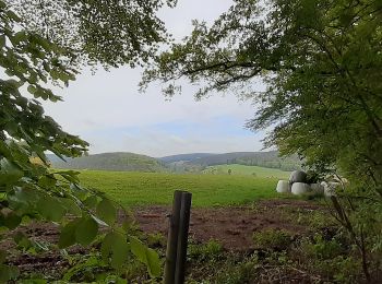
![Tour Zu Fuß Grasellenbach - Mossautaler Drachenweg 1: Triumphalis - Photo](https://media.geolcdn.com/t/350/260/700f2d33-0b31-468a-a203-409d0e25462b.jpeg&format=jpg&maxdim=2)
![Zu Fuß Zu Fuß](https://static1.geolcdn.com/sitytour/trail-icons/100.png)
Km
Zu Fuß
![](/images/other/stat-length.png)
![](https://static1.geolcdn.com/siteimages/upload/files/1508320355ic_sort_den_pos_24dp.png)
![](https://static1.geolcdn.com/siteimages/upload/files/1508320355ic_sort_den_neg_24dp.png)
![](https://static1.geolcdn.com/siteimages/upload/files/16400158638029165_repeat_loop_refresh_sync_direction_icon.png)
• Trail created by Odenwaldklub. Symbol: Grüne 1 im oben offenen Kreis, in der Öffnung ein MD
![Tour Zu Fuß Grasellenbach - Rundwanderweg Grasellenbach 5: Hardt-Weg - Photo](https://media.geolcdn.com/t/350/260/c88bea1d-f14f-465e-ae6a-d571ed58dd82.jpeg&format=jpg&maxdim=2)
![Zu Fuß Zu Fuß](https://static1.geolcdn.com/sitytour/trail-icons/100.png)
Km
Zu Fuß
![](/images/other/stat-length.png)
![](https://static1.geolcdn.com/siteimages/upload/files/1508320355ic_sort_den_pos_24dp.png)
![](https://static1.geolcdn.com/siteimages/upload/files/1508320355ic_sort_den_neg_24dp.png)
![](https://static1.geolcdn.com/siteimages/upload/files/16400158638029165_repeat_loop_refresh_sync_direction_icon.png)
• Trail created by Geo-Naturpark Bergstraße-Odenwald. Symbol: 5 in einem oben offenen Kreis; in der Kreisöffnung ein G
![Tour Zu Fuß Grasellenbach - Rundwanderweg Grasellenbach 7: Striet-Weg - Photo](https://media.geolcdn.com/t/350/260/c88bea1d-f14f-465e-ae6a-d571ed58dd82.jpeg&format=jpg&maxdim=2)
![Zu Fuß Zu Fuß](https://static1.geolcdn.com/sitytour/trail-icons/100.png)
Km
Zu Fuß
![](/images/other/stat-length.png)
![](https://static1.geolcdn.com/siteimages/upload/files/1508320355ic_sort_den_pos_24dp.png)
![](https://static1.geolcdn.com/siteimages/upload/files/1508320355ic_sort_den_neg_24dp.png)
![](https://static1.geolcdn.com/siteimages/upload/files/16400158638029165_repeat_loop_refresh_sync_direction_icon.png)
• Trail created by Geo-Naturpark Bergstraße-Odenwald. Symbol: Weiße 7 im oben offenen Kreis, in Öffnung "G"
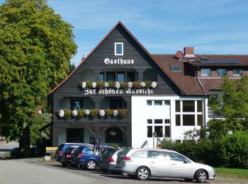
![Tour Zu Fuß Grasellenbach - Rundwanderweg Grasellenbach Tromm 3: Fahrenbacherkopf-Weg - Photo](https://media.geolcdn.com/t/350/260/bde0987b-0a93-4ab7-86ac-a1542aa9015e.jpeg&format=jpg&maxdim=2)
![Zu Fuß Zu Fuß](https://static1.geolcdn.com/sitytour/trail-icons/100.png)
Km
Zu Fuß
![](/images/other/stat-length.png)
![](https://static1.geolcdn.com/siteimages/upload/files/1508320355ic_sort_den_pos_24dp.png)
![](https://static1.geolcdn.com/siteimages/upload/files/1508320355ic_sort_den_neg_24dp.png)
![](https://static1.geolcdn.com/siteimages/upload/files/16400158638029165_repeat_loop_refresh_sync_direction_icon.png)
• Trail created by Geo-Naturpark Bergstraße-Odenwald. Symbol: Gelbe 3 im gelben Kreis
![Tour Zu Fuß Grasellenbach - Rundwanderweg Wahlen 2: Tromm-Weg - Photo](https://media.geolcdn.com/t/350/260/bde0987b-0a93-4ab7-86ac-a1542aa9015e.jpeg&format=jpg&maxdim=2)
![Zu Fuß Zu Fuß](https://static1.geolcdn.com/sitytour/trail-icons/100.png)
Km
Zu Fuß
![](/images/other/stat-length.png)
![](https://static1.geolcdn.com/siteimages/upload/files/1508320355ic_sort_den_pos_24dp.png)
![](https://static1.geolcdn.com/siteimages/upload/files/1508320355ic_sort_den_neg_24dp.png)
![](https://static1.geolcdn.com/siteimages/upload/files/16400158638029165_repeat_loop_refresh_sync_direction_icon.png)
• Trail created by Geo-Naturpark Bergstraße-Odenwald. Symbol: Weiße 2 im oben offenen weißen Kreis, in der Öffnung die...
![Tour Zu Fuß Grasellenbach - Rundwanderweg Grasellenbach 2: Geopark-Wanderweg - Photo](https://media.geolcdn.com/t/350/260/c0c408ef-37cd-4633-b234-742b9dad92f4.jpeg&format=jpg&maxdim=2)
![Zu Fuß Zu Fuß](https://static1.geolcdn.com/sitytour/trail-icons/100.png)
Km
Zu Fuß
![](/images/other/stat-length.png)
![](https://static1.geolcdn.com/siteimages/upload/files/1508320355ic_sort_den_pos_24dp.png)
![](https://static1.geolcdn.com/siteimages/upload/files/1508320355ic_sort_den_neg_24dp.png)
![](https://static1.geolcdn.com/siteimages/upload/files/16400158638029165_repeat_loop_refresh_sync_direction_icon.png)
• Trail created by Geo-Naturpark Bergstraße-Odenwald. Symbol: Weiße 2 im oben offenen weißen Kreis, in der Öffnung die...
![Tour Zu Fuß Grasellenbach - Rundwanderweg Wahlen 3: Kochert-Weg - Photo](https://media.geolcdn.com/t/350/260/4eb41153-df36-4692-ae87-5bc969794979.jpeg&format=jpg&maxdim=2)
![Zu Fuß Zu Fuß](https://static1.geolcdn.com/sitytour/trail-icons/100.png)
Km
Zu Fuß
![](/images/other/stat-length.png)
![](https://static1.geolcdn.com/siteimages/upload/files/1508320355ic_sort_den_pos_24dp.png)
![](https://static1.geolcdn.com/siteimages/upload/files/1508320355ic_sort_den_neg_24dp.png)
![](https://static1.geolcdn.com/siteimages/upload/files/16400158638029165_repeat_loop_refresh_sync_direction_icon.png)
• Trail created by Geo-Naturpark Bergstraße-Odenwald. Symbol: Weiße "3" im Kreis darüber weißes "Wa"
![Tour Zu Fuß Grasellenbach - Rundwanderweg Scharbach 1: Tromm-Weg - Photo](https://media.geolcdn.com/t/350/260/bde0987b-0a93-4ab7-86ac-a1542aa9015e.jpeg&format=jpg&maxdim=2)
![Zu Fuß Zu Fuß](https://static1.geolcdn.com/sitytour/trail-icons/100.png)
Km
Zu Fuß
![](/images/other/stat-length.png)
![](https://static1.geolcdn.com/siteimages/upload/files/1508320355ic_sort_den_pos_24dp.png)
![](https://static1.geolcdn.com/siteimages/upload/files/1508320355ic_sort_den_neg_24dp.png)
![](https://static1.geolcdn.com/siteimages/upload/files/16400158638029165_repeat_loop_refresh_sync_direction_icon.png)
• Trail created by Geo-Naturpark Bergstraße-Odenwald. Symbol: Weiße 1 im oben offenen Kreis, in Öffnung "S"
![Tour Zu Fuß Grasellenbach - von Tromm zum Kohlhof - Photo](https://media.geolcdn.com/t/350/260/ext.jpg?maxdim=2&url=https%3A%2F%2Fstatic1.geolcdn.com%2Fsiteimages%2Fupload%2Ffiles%2F1545311037marcheuse_200dpi.jpg)
![Zu Fuß Zu Fuß](https://static1.geolcdn.com/sitytour/trail-icons/100.png)
Km
Zu Fuß
![](/images/other/stat-length.png)
![](https://static1.geolcdn.com/siteimages/upload/files/1508320355ic_sort_den_pos_24dp.png)
![](https://static1.geolcdn.com/siteimages/upload/files/1508320355ic_sort_den_neg_24dp.png)
![](https://static1.geolcdn.com/siteimages/upload/files/16400158638029165_repeat_loop_refresh_sync_direction_icon.png)
• Trail created by NaturFreunde Deutschland.
20 Angezeigte Touren bei 22
Kostenlosegpshiking-Anwendung