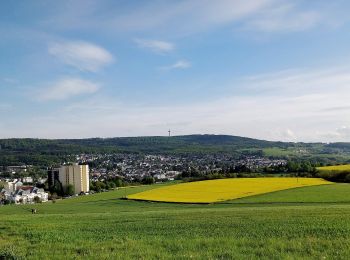
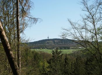
![](/images/other/stat-length.png)
- Touren
- Outdoor
- Germany
- Hessen
- Rheingau-Taunus-Kreis
- Taunusstein
Taunusstein, Rheingau-Taunus-Kreis: Die besten Touren, Trails, Trecks und Wanderungen
Taunusstein : Entdecken Sie die besten Touren : 10 zu Fuß. Alle diese Touren, Trails, Routen und Outdoor-Aktivitäten sind in unseren SityTrail-Apps für Smartphones und Tablets verfügbar.
Die besten Spuren (10)
![Tour Zu Fuß Taunusstein - Wingsbacher Rundwanderweg - Photo](https://media.geolcdn.com/t/350/260/e0fcb213-9a15-4ce2-bab3-9e7578b4c8c9.jpeg&format=jpg&maxdim=2)
![Zu Fuß Zu Fuß](https://static1.geolcdn.com/sitytour/trail-icons/100.png)
Km
Zu Fuß
![](/images/other/stat-length.png)
![](https://static1.geolcdn.com/siteimages/upload/files/1508320355ic_sort_den_pos_24dp.png)
![](https://static1.geolcdn.com/siteimages/upload/files/1508320355ic_sort_den_neg_24dp.png)
![](https://static1.geolcdn.com/siteimages/upload/files/16400158638029165_repeat_loop_refresh_sync_direction_icon.png)
• Trail created by Turn- und Gesangsverein Wingsbach 1913. Symbol: oranger Kreis auf weißem Schild, darin blauer Text ...
![Tour Zu Fuß Taunusstein - Rundwanderweg Keiler - Photo](https://media.geolcdn.com/t/350/260/d6de9aeb-45c5-4269-af11-16fff3b6e800.jpeg&format=jpg&maxdim=2)
![Zu Fuß Zu Fuß](https://static1.geolcdn.com/sitytour/trail-icons/100.png)
Km
Zu Fuß
![](/images/other/stat-length.png)
![](https://static1.geolcdn.com/siteimages/upload/files/1508320355ic_sort_den_pos_24dp.png)
![](https://static1.geolcdn.com/siteimages/upload/files/1508320355ic_sort_den_neg_24dp.png)
![](https://static1.geolcdn.com/siteimages/upload/files/16400158638029165_repeat_loop_refresh_sync_direction_icon.png)
• Trail created by Kommunaler Zweckverband Naturpark Rhein-Taunus. Symbol: schwarzer Keiler (Wildschwein) auf weißem G...
![Tour Zu Fuß Taunusstein - Rundwanderweg rote Flagge - Photo](https://media.geolcdn.com/t/350/260/fa7b56ed-e4cf-4290-b555-85cce3a47808.jpeg&format=jpg&maxdim=2)
![Zu Fuß Zu Fuß](https://static1.geolcdn.com/sitytour/trail-icons/100.png)
Km
Zu Fuß
![](/images/other/stat-length.png)
![](https://static1.geolcdn.com/siteimages/upload/files/1508320355ic_sort_den_pos_24dp.png)
![](https://static1.geolcdn.com/siteimages/upload/files/1508320355ic_sort_den_neg_24dp.png)
![](https://static1.geolcdn.com/siteimages/upload/files/16400158638029165_repeat_loop_refresh_sync_direction_icon.png)
• Trail created by Stadt Taunusstein. Symbol: rote Flagge auf weißem Grund
![Tour Zu Fuß Taunusstein - Rundwanderweg Geweih - Photo](https://media.geolcdn.com/t/350/260/95729a3c-d906-4c38-8925-a2081945e3f9.jpeg&format=jpg&maxdim=2)
![Zu Fuß Zu Fuß](https://static1.geolcdn.com/sitytour/trail-icons/100.png)
Km
Zu Fuß
![](/images/other/stat-length.png)
![](https://static1.geolcdn.com/siteimages/upload/files/1508320355ic_sort_den_pos_24dp.png)
![](https://static1.geolcdn.com/siteimages/upload/files/1508320355ic_sort_den_neg_24dp.png)
![](https://static1.geolcdn.com/siteimages/upload/files/16400158638029165_repeat_loop_refresh_sync_direction_icon.png)
• Trail created by Kommunaler Zweckverband Naturpark Rhein-Taunus. Symbol: braunes Geweih auf weißem Grund Website: ...
![Tour Zu Fuß Taunusstein - Schwarzer Hahn - Photo](https://media.geolcdn.com/t/350/260/50084536-66c3-44b6-af78-313ab7ad23f0.jpeg&format=jpg&maxdim=2)
![Zu Fuß Zu Fuß](https://static1.geolcdn.com/sitytour/trail-icons/100.png)
Km
Zu Fuß
![](/images/other/stat-length.png)
![](https://static1.geolcdn.com/siteimages/upload/files/1508320355ic_sort_den_pos_24dp.png)
![](https://static1.geolcdn.com/siteimages/upload/files/1508320355ic_sort_den_neg_24dp.png)
![](https://static1.geolcdn.com/siteimages/upload/files/16400158638029165_repeat_loop_refresh_sync_direction_icon.png)
• Symbol: Schwarzer Hahn auf weißem Grund
![Tour Zu Fuß Taunusstein - Rundwanderweg rotes Quadrat - Photo](https://media.geolcdn.com/t/350/260/50084536-66c3-44b6-af78-313ab7ad23f0.jpeg&format=jpg&maxdim=2)
![Zu Fuß Zu Fuß](https://static1.geolcdn.com/sitytour/trail-icons/100.png)
Km
Zu Fuß
![](/images/other/stat-length.png)
![](https://static1.geolcdn.com/siteimages/upload/files/1508320355ic_sort_den_pos_24dp.png)
![](https://static1.geolcdn.com/siteimages/upload/files/1508320355ic_sort_den_neg_24dp.png)
![](https://static1.geolcdn.com/siteimages/upload/files/16400158638029165_repeat_loop_refresh_sync_direction_icon.png)
• Trail created by Stadt Taunusstein. Symbol: rotesQuadrat auf weißem Grund
![Tour Zu Fuß Taunusstein - Rundwanderweg gelbe Flagge - Photo](https://media.geolcdn.com/t/350/260/fa7b56ed-e4cf-4290-b555-85cce3a47808.jpeg&format=jpg&maxdim=2)
![Zu Fuß Zu Fuß](https://static1.geolcdn.com/sitytour/trail-icons/100.png)
Km
Zu Fuß
![](/images/other/stat-length.png)
![](https://static1.geolcdn.com/siteimages/upload/files/1508320355ic_sort_den_pos_24dp.png)
![](https://static1.geolcdn.com/siteimages/upload/files/1508320355ic_sort_den_neg_24dp.png)
![](https://static1.geolcdn.com/siteimages/upload/files/16400158638029165_repeat_loop_refresh_sync_direction_icon.png)
• Trail created by Stadt Taunusstein. Symbol: gelbe Flagge auf weißem Grund
![Tour Zu Fuß Taunusstein - Rundwanderweg gelbes Quadrat - Photo](https://media.geolcdn.com/t/350/260/50084536-66c3-44b6-af78-313ab7ad23f0.jpeg&format=jpg&maxdim=2)
![Zu Fuß Zu Fuß](https://static1.geolcdn.com/sitytour/trail-icons/100.png)
Km
Zu Fuß
![](/images/other/stat-length.png)
![](https://static1.geolcdn.com/siteimages/upload/files/1508320355ic_sort_den_pos_24dp.png)
![](https://static1.geolcdn.com/siteimages/upload/files/1508320355ic_sort_den_neg_24dp.png)
![](https://static1.geolcdn.com/siteimages/upload/files/16400158638029165_repeat_loop_refresh_sync_direction_icon.png)
• Trail created by Stadt Taunusstein. Symbol: gelbes Quadrat auf weißem Grund
![Tour Zu Fuß Taunusstein - Rundwanderweg schwarzes Quadrat - Photo](https://media.geolcdn.com/t/350/260/50084536-66c3-44b6-af78-313ab7ad23f0.jpeg&format=jpg&maxdim=2)
![Zu Fuß Zu Fuß](https://static1.geolcdn.com/sitytour/trail-icons/100.png)
Km
Zu Fuß
![](/images/other/stat-length.png)
![](https://static1.geolcdn.com/siteimages/upload/files/1508320355ic_sort_den_pos_24dp.png)
![](https://static1.geolcdn.com/siteimages/upload/files/1508320355ic_sort_den_neg_24dp.png)
![](https://static1.geolcdn.com/siteimages/upload/files/16400158638029165_repeat_loop_refresh_sync_direction_icon.png)
• Trail created by Stadt Taunusstein. Symbol: schwarzes Quadrat auf weißem Grund
![Tour Zu Fuß Taunusstein - Rundwanderweg Forelle - Photo](https://media.geolcdn.com/t/350/260/42c5a6c4-5617-4568-b714-87cb837e455b.jpeg&format=jpg&maxdim=2)
![Zu Fuß Zu Fuß](https://static1.geolcdn.com/sitytour/trail-icons/100.png)
Km
Zu Fuß
![](/images/other/stat-length.png)
![](https://static1.geolcdn.com/siteimages/upload/files/1508320355ic_sort_den_pos_24dp.png)
![](https://static1.geolcdn.com/siteimages/upload/files/1508320355ic_sort_den_neg_24dp.png)
![](https://static1.geolcdn.com/siteimages/upload/files/16400158638029165_repeat_loop_refresh_sync_direction_icon.png)
• Symbol: blaue Forelle auf weißem Grund
10 Angezeigte Touren bei 10
Kostenlosegpshiking-Anwendung