![](/images/other/stat-length.png)
- Touren
- Outdoor
- Germany
- Rheinland-Pfalz
- Landkreis Bad Kreuznach
Landkreis Bad Kreuznach, Rheinland-Pfalz: Die besten Touren, Trails, Trecks und Wanderungen
Landkreis Bad Kreuznach : Entdecken Sie die besten Touren : 72 zu Fuß. Alle diese Touren, Trails, Routen und Outdoor-Aktivitäten sind in unseren SityTrail-Apps für Smartphones und Tablets verfügbar.
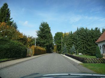
Die besten Spuren (73)
![Tour Zu Fuß Bretzenheim - Vitaltour Eremitenpfad - Photo](https://media.geolcdn.com/t/350/260/1d50e95c-f083-4176-872d-58483e9ebd04.jpeg&format=jpg&maxdim=2)
![Zu Fuß Zu Fuß](https://static1.geolcdn.com/sitytour/trail-icons/100.png)
Km
Zu Fuß
![](/images/other/stat-length.png)
![](https://static1.geolcdn.com/siteimages/upload/files/1508320355ic_sort_den_pos_24dp.png)
![](https://static1.geolcdn.com/siteimages/upload/files/1508320355ic_sort_den_neg_24dp.png)
![](https://static1.geolcdn.com/siteimages/upload/files/16400158638029165_repeat_loop_refresh_sync_direction_icon.png)
• Trail created by Gemeinde Bretzenheim.
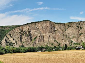
![Tour Zu Fuß Bad Kreuznach - Tour Natur - Photo](https://media.geolcdn.com/t/350/260/0bd70bf5-e581-42bb-811f-f899da135d18.jpeg&format=jpg&maxdim=2)
![Zu Fuß Zu Fuß](https://static1.geolcdn.com/sitytour/trail-icons/100.png)
Km
Zu Fuß
![](/images/other/stat-length.png)
![](https://static1.geolcdn.com/siteimages/upload/files/1508320355ic_sort_den_pos_24dp.png)
![](https://static1.geolcdn.com/siteimages/upload/files/1508320355ic_sort_den_neg_24dp.png)
![](https://static1.geolcdn.com/siteimages/upload/files/16400158638029165_repeat_loop_refresh_sync_direction_icon.png)
• Symbol: Grünes Ahornblatt auf weißem Grund
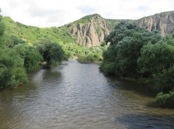
![Tour Zu Fuß Guldental - Guldentaler Weinwanderweg - Photo](https://media.geolcdn.com/t/350/260/b0212427-aeb5-45a0-9962-1a61044dbb06.jpeg&format=jpg&maxdim=2)
![Zu Fuß Zu Fuß](https://static1.geolcdn.com/sitytour/trail-icons/100.png)
Km
Zu Fuß
![](/images/other/stat-length.png)
![](https://static1.geolcdn.com/siteimages/upload/files/1508320355ic_sort_den_pos_24dp.png)
![](https://static1.geolcdn.com/siteimages/upload/files/1508320355ic_sort_den_neg_24dp.png)
![](https://static1.geolcdn.com/siteimages/upload/files/16400158638029165_repeat_loop_refresh_sync_direction_icon.png)
• Symbol: doppeltes weißes W auf rotem Hintergrund Website: https://www.guldental.de/project/wanderwege-rund-um-gulde...
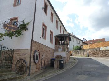
![Tour Zu Fuß Guldental - Guldentaler Krönchen - Photo](https://media.geolcdn.com/t/350/260/ef06a4f4-b98b-48ce-b3a2-a35eac2a946a.jpeg&format=jpg&maxdim=2)
![Zu Fuß Zu Fuß](https://static1.geolcdn.com/sitytour/trail-icons/100.png)
Km
Zu Fuß
![](/images/other/stat-length.png)
![](https://static1.geolcdn.com/siteimages/upload/files/1508320355ic_sort_den_pos_24dp.png)
![](https://static1.geolcdn.com/siteimages/upload/files/1508320355ic_sort_den_neg_24dp.png)
![](https://static1.geolcdn.com/siteimages/upload/files/16400158638029165_repeat_loop_refresh_sync_direction_icon.png)
• Symbol: gelbe Krone auf blauem Hintergrund Website: https://www.guldental.de/project/wanderwege-rund-um-guldental/
![Tour Zu Fuß Auen - Auen 3 - Photo](https://media.geolcdn.com/t/350/260/69d50de2-4efd-4935-8881-47a5ff2036c2.jpeg&format=jpg&maxdim=2)
![Zu Fuß Zu Fuß](https://static1.geolcdn.com/sitytour/trail-icons/100.png)
Km
Zu Fuß
![](/images/other/stat-length.png)
![](https://static1.geolcdn.com/siteimages/upload/files/1508320355ic_sort_den_pos_24dp.png)
![](https://static1.geolcdn.com/siteimages/upload/files/1508320355ic_sort_den_neg_24dp.png)
![](https://static1.geolcdn.com/siteimages/upload/files/16400158638029165_repeat_loop_refresh_sync_direction_icon.png)
• Trail created by Ortsgemeinde Auen. Symbol: Schwarze Schrift auf Holz
![Tour Zu Fuß Bad Sobernheim - Entenpfuhl 2 - Photo](https://media.geolcdn.com/t/350/260/ee05e713-9c76-4f6e-8850-6a4c313cd94a.jpeg&format=jpg&maxdim=2)
![Zu Fuß Zu Fuß](https://static1.geolcdn.com/sitytour/trail-icons/100.png)
Km
Zu Fuß
![](/images/other/stat-length.png)
![](https://static1.geolcdn.com/siteimages/upload/files/1508320355ic_sort_den_pos_24dp.png)
![](https://static1.geolcdn.com/siteimages/upload/files/1508320355ic_sort_den_neg_24dp.png)
![](https://static1.geolcdn.com/siteimages/upload/files/16400158638029165_repeat_loop_refresh_sync_direction_icon.png)
• Symbol: schwarze Schrift auf Holz
![Tour Zu Fuß Bad Sobernheim - Jäger-aus-Kurpfalz-Weg (Entenpfuhl 3) - Photo](https://media.geolcdn.com/t/350/260/da96cadf-4d54-49da-a249-f2e1c0732feb.jpeg&format=jpg&maxdim=2)
![Zu Fuß Zu Fuß](https://static1.geolcdn.com/sitytour/trail-icons/100.png)
Km
Zu Fuß
![](/images/other/stat-length.png)
![](https://static1.geolcdn.com/siteimages/upload/files/1508320355ic_sort_den_pos_24dp.png)
![](https://static1.geolcdn.com/siteimages/upload/files/1508320355ic_sort_den_neg_24dp.png)
![](https://static1.geolcdn.com/siteimages/upload/files/16400158638029165_repeat_loop_refresh_sync_direction_icon.png)
• Symbol: schwarze Schrift in Naturholz graviert
![Tour Zu Fuß Oberhausen bei Kirn - Drei-Burgen-Weg - Photo](https://media.geolcdn.com/t/350/260/6c888f2a-5efb-42e2-b238-e5a63375d933.jpeg&format=jpg&maxdim=2)
![Zu Fuß Zu Fuß](https://static1.geolcdn.com/sitytour/trail-icons/100.png)
Km
Zu Fuß
![](/images/other/stat-length.png)
![](https://static1.geolcdn.com/siteimages/upload/files/1508320355ic_sort_den_pos_24dp.png)
![](https://static1.geolcdn.com/siteimages/upload/files/1508320355ic_sort_den_neg_24dp.png)
![](https://static1.geolcdn.com/siteimages/upload/files/16400158638029165_repeat_loop_refresh_sync_direction_icon.png)
• Trail created by Stadtverwaltung Kirn.
![Tour Zu Fuß Münchwald - Münchwald-Trifthütte - Photo](https://media.geolcdn.com/t/350/260/fda4e4bc-2aae-451c-89dd-5c0ad8c3f794.jpeg&format=jpg&maxdim=2)
![Zu Fuß Zu Fuß](https://static1.geolcdn.com/sitytour/trail-icons/100.png)
Km
Zu Fuß
![](/images/other/stat-length.png)
![](https://static1.geolcdn.com/siteimages/upload/files/1508320355ic_sort_den_pos_24dp.png)
![](https://static1.geolcdn.com/siteimages/upload/files/1508320355ic_sort_den_neg_24dp.png)
![](https://static1.geolcdn.com/siteimages/upload/files/16400158638029165_repeat_loop_refresh_sync_direction_icon.png)
• Symbol: Rotes Dreieck, gefüllt, geschlossen, Pfeilspitze nach oben.
![Tour Zu Fuß Bad Kreuznach - VITALtour Ebernburg - Photo](https://media.geolcdn.com/t/350/260/11454e8e-f7ad-45a5-b1fd-c3959b4ed60d.jpeg&format=jpg&maxdim=2)
![Zu Fuß Zu Fuß](https://static1.geolcdn.com/sitytour/trail-icons/100.png)
Km
Zu Fuß
![](/images/other/stat-length.png)
![](https://static1.geolcdn.com/siteimages/upload/files/1508320355ic_sort_den_pos_24dp.png)
![](https://static1.geolcdn.com/siteimages/upload/files/1508320355ic_sort_den_neg_24dp.png)
![](https://static1.geolcdn.com/siteimages/upload/files/16400158638029165_repeat_loop_refresh_sync_direction_icon.png)
• Trail created by Stadt Bad Kreuznach.
![Tour Zu Fuß Bad Kreuznach - CLASSICtour Ebernburg - Photo](https://media.geolcdn.com/t/350/260/367c4f69-37b0-4930-a976-e0fba27c0ac4.jpeg&format=jpg&maxdim=2)
![Zu Fuß Zu Fuß](https://static1.geolcdn.com/sitytour/trail-icons/100.png)
Km
Zu Fuß
![](/images/other/stat-length.png)
![](https://static1.geolcdn.com/siteimages/upload/files/1508320355ic_sort_den_pos_24dp.png)
![](https://static1.geolcdn.com/siteimages/upload/files/1508320355ic_sort_den_neg_24dp.png)
![](https://static1.geolcdn.com/siteimages/upload/files/16400158638029165_repeat_loop_refresh_sync_direction_icon.png)
• Trail created by Stadt Bad Kreuznach.
![Tour Zu Fuß Bad Kreuznach - INTROtour Ebernburg - Photo](https://media.geolcdn.com/t/350/260/9cdfcaed-0f29-406a-a8d3-be07df56a775.jpeg&format=jpg&maxdim=2)
![Zu Fuß Zu Fuß](https://static1.geolcdn.com/sitytour/trail-icons/100.png)
Km
Zu Fuß
![](/images/other/stat-length.png)
![](https://static1.geolcdn.com/siteimages/upload/files/1508320355ic_sort_den_pos_24dp.png)
![](https://static1.geolcdn.com/siteimages/upload/files/1508320355ic_sort_den_neg_24dp.png)
![](https://static1.geolcdn.com/siteimages/upload/files/16400158638029165_repeat_loop_refresh_sync_direction_icon.png)
• Trail created by Stadt Bad Kreuznach.
![Tour Zu Fuß Bad Kreuznach - Bäderhöhenweg 5km - Photo](https://media.geolcdn.com/t/350/260/9ee6532b-8b87-4b5a-bf29-6ac4fa517dd6.jpeg&format=jpg&maxdim=2)
![Zu Fuß Zu Fuß](https://static1.geolcdn.com/sitytour/trail-icons/100.png)
Km
Zu Fuß
![](/images/other/stat-length.png)
![](https://static1.geolcdn.com/siteimages/upload/files/1508320355ic_sort_den_pos_24dp.png)
![](https://static1.geolcdn.com/siteimages/upload/files/1508320355ic_sort_den_neg_24dp.png)
![](https://static1.geolcdn.com/siteimages/upload/files/16400158638029165_repeat_loop_refresh_sync_direction_icon.png)
• Trail created by Wanderfreunde Naheland. Symbol: quadratisches weißes Schild mit rotem Rand;2 rote gleichgerichtete ...
![Tour Zu Fuß Bad Kreuznach - VITALtour Rotenfels - Photo](https://media.geolcdn.com/t/350/260/a3e43b83-cfd7-4092-b126-d0afe63d2a12.jpeg&format=jpg&maxdim=2)
![Zu Fuß Zu Fuß](https://static1.geolcdn.com/sitytour/trail-icons/100.png)
Km
Zu Fuß
![](/images/other/stat-length.png)
![](https://static1.geolcdn.com/siteimages/upload/files/1508320355ic_sort_den_pos_24dp.png)
![](https://static1.geolcdn.com/siteimages/upload/files/1508320355ic_sort_den_neg_24dp.png)
![](https://static1.geolcdn.com/siteimages/upload/files/16400158638029165_repeat_loop_refresh_sync_direction_icon.png)
• Trail created by Stadt Bad Kreuznach.
![Tour Zu Fuß Bad Kreuznach - CLASSICtour Rotenfels - Photo](https://media.geolcdn.com/t/350/260/cee8d753-620d-47e8-90c1-d8e178f1cc59.jpeg&format=jpg&maxdim=2)
![Zu Fuß Zu Fuß](https://static1.geolcdn.com/sitytour/trail-icons/100.png)
Km
Zu Fuß
![](/images/other/stat-length.png)
![](https://static1.geolcdn.com/siteimages/upload/files/1508320355ic_sort_den_pos_24dp.png)
![](https://static1.geolcdn.com/siteimages/upload/files/1508320355ic_sort_den_neg_24dp.png)
![](https://static1.geolcdn.com/siteimages/upload/files/16400158638029165_repeat_loop_refresh_sync_direction_icon.png)
• Trail created by Stadt Bad Kreuznach.
![Tour Zu Fuß Bad Kreuznach - INTROtour Rotenfels - Photo](https://media.geolcdn.com/t/350/260/d397efa7-486d-47ff-aab7-88c64a0ac604.jpeg&format=jpg&maxdim=2)
![Zu Fuß Zu Fuß](https://static1.geolcdn.com/sitytour/trail-icons/100.png)
Km
Zu Fuß
![](/images/other/stat-length.png)
![](https://static1.geolcdn.com/siteimages/upload/files/1508320355ic_sort_den_pos_24dp.png)
![](https://static1.geolcdn.com/siteimages/upload/files/1508320355ic_sort_den_neg_24dp.png)
![](https://static1.geolcdn.com/siteimages/upload/files/16400158638029165_repeat_loop_refresh_sync_direction_icon.png)
• Trail created by Stadt Bad Kreuznach.
![Tour Zu Fuß Altenbamberg - VITALtour Rheingrafenstein - Photo](https://media.geolcdn.com/t/350/260/690c3691-3353-4205-bd12-5609d191005f.jpeg&format=jpg&maxdim=2)
![Zu Fuß Zu Fuß](https://static1.geolcdn.com/sitytour/trail-icons/100.png)
Km
Zu Fuß
![](/images/other/stat-length.png)
![](https://static1.geolcdn.com/siteimages/upload/files/1508320355ic_sort_den_pos_24dp.png)
![](https://static1.geolcdn.com/siteimages/upload/files/1508320355ic_sort_den_neg_24dp.png)
![](https://static1.geolcdn.com/siteimages/upload/files/16400158638029165_repeat_loop_refresh_sync_direction_icon.png)
• Trail created by Stadt Bad Kreuznach.
![Tour Zu Fuß Bad Kreuznach - CLASSICtour Rheingrafenstein - Photo](https://media.geolcdn.com/t/350/260/690c3691-3353-4205-bd12-5609d191005f.jpeg&format=jpg&maxdim=2)
![Zu Fuß Zu Fuß](https://static1.geolcdn.com/sitytour/trail-icons/100.png)
Km
Zu Fuß
![](/images/other/stat-length.png)
![](https://static1.geolcdn.com/siteimages/upload/files/1508320355ic_sort_den_pos_24dp.png)
![](https://static1.geolcdn.com/siteimages/upload/files/1508320355ic_sort_den_neg_24dp.png)
![](https://static1.geolcdn.com/siteimages/upload/files/16400158638029165_repeat_loop_refresh_sync_direction_icon.png)
• Trail created by Stadt Bad Kreuznach.
![Tour Zu Fuß Bad Kreuznach - INTROtour Rheingrafenstein - Photo](https://media.geolcdn.com/t/350/260/690c3691-3353-4205-bd12-5609d191005f.jpeg&format=jpg&maxdim=2)
![Zu Fuß Zu Fuß](https://static1.geolcdn.com/sitytour/trail-icons/100.png)
Km
Zu Fuß
![](/images/other/stat-length.png)
![](https://static1.geolcdn.com/siteimages/upload/files/1508320355ic_sort_den_pos_24dp.png)
![](https://static1.geolcdn.com/siteimages/upload/files/1508320355ic_sort_den_neg_24dp.png)
![](https://static1.geolcdn.com/siteimages/upload/files/16400158638029165_repeat_loop_refresh_sync_direction_icon.png)
• Trail created by Stadt Bad Kreuznach.
![Tour Zu Fuß Feilbingert - VITALtour Geheimnisvoller Lemberg - Photo](https://media.geolcdn.com/t/350/260/46e1e849-3c9f-48a4-a463-d1b10e5aa9c3.jpeg&format=jpg&maxdim=2)
![Zu Fuß Zu Fuß](https://static1.geolcdn.com/sitytour/trail-icons/100.png)
Km
Zu Fuß
![](/images/other/stat-length.png)
![](https://static1.geolcdn.com/siteimages/upload/files/1508320355ic_sort_den_pos_24dp.png)
![](https://static1.geolcdn.com/siteimages/upload/files/1508320355ic_sort_den_neg_24dp.png)
![](https://static1.geolcdn.com/siteimages/upload/files/16400158638029165_repeat_loop_refresh_sync_direction_icon.png)
• Trail created by Gemeinden Feilbingert-Niederhausen-Oberhausen.
20 Angezeigte Touren bei 73
Kostenlosegpshiking-Anwendung
Aktivitäten
Nahegelegene Regionen
- Allenfeld
- Altenbamberg
- Argenschwang
- Auen
- Bad Kreuznach
- Bad Sobernheim
- Bärenbach
- Bärweiler
- Bockenau
- Braunweiler
- Bretzenheim
- Feilbingert
- Frei-Laubersheim
- Gebroth
- Guldental
- Gutenberg
- Hergenfeld
- Hochstetten-Dhaun
- Kirn
- Kirschroth
- Meddersheim
- Merxheim
- Münchwald
- Neu-Bamberg
- Oberhausen bei Kirn
- Odernheim am Glan
- Sankt Katharinen
- Schöneberg
- Seesbach
- Simmertal
- Sommerloch
- Staudernheim
- Stromberg
- Tiefenthal
- Traisen
- Waldböckelheim
- Wallhausen
- Weiler bei Monzingen
- Windesheim