![](/images/other/stat-length.png)
- Touren
- Outdoor
- Germany
- Nordrhein-Westfalen
- Rhein-Sieg-Kreis
- Wachtberg
Wachtberg, Rhein-Sieg-Kreis: Die besten Touren, Trails, Trecks und Wanderungen
Wachtberg : Entdecken Sie die besten Touren : 15 zu Fuß. Alle diese Touren, Trails, Routen und Outdoor-Aktivitäten sind in unseren SityTrail-Apps für Smartphones und Tablets verfügbar.
Die besten Spuren (15)
![Tour Zu Fuß Wachtberg - Verbindungsweg - Photo](https://media.geolcdn.com/t/350/260/8a894d8e-564e-4043-b18c-669126bb6c29.jpeg&format=jpg&maxdim=2)
![Zu Fuß Zu Fuß](https://static1.geolcdn.com/sitytour/trail-icons/100.png)
Km
Zu Fuß
![](/images/other/stat-length.png)
![](https://static1.geolcdn.com/siteimages/upload/files/1508320355ic_sort_den_pos_24dp.png)
![](https://static1.geolcdn.com/siteimages/upload/files/1508320355ic_sort_den_neg_24dp.png)
![](https://static1.geolcdn.com/siteimages/upload/files/16400158638029165_repeat_loop_refresh_sync_direction_icon.png)
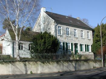
• Trail created by Naturpark Rheinland. ersetzt durch Verbindungswege 10 und 11 Symbol: Schwarzes V in schwarzem Quad...
![Tour Zu Fuß Wachtberg - Dächelsberg-Runde - Photo](https://media.geolcdn.com/t/350/260/c7273de2-5b65-4b43-93d9-f0b5ff3f0a2d.jpeg&format=jpg&maxdim=2)
![Zu Fuß Zu Fuß](https://static1.geolcdn.com/sitytour/trail-icons/100.png)
Km
Zu Fuß
![](/images/other/stat-length.png)
![](https://static1.geolcdn.com/siteimages/upload/files/1508320355ic_sort_den_pos_24dp.png)
![](https://static1.geolcdn.com/siteimages/upload/files/1508320355ic_sort_den_neg_24dp.png)
![](https://static1.geolcdn.com/siteimages/upload/files/16400158638029165_repeat_loop_refresh_sync_direction_icon.png)
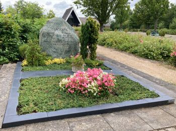
• Trail created by Naturpark Rheinland. Symbol: Schwarzes D auf weißem Grund, Text Dächelsberg-Runde
![Tour Zu Fuß Wachtberg - Hümerich-Runde - Photo](https://media.geolcdn.com/t/350/260/b8080069-04dc-4f64-9b7d-918abc393f6f.jpeg&format=jpg&maxdim=2)
![Zu Fuß Zu Fuß](https://static1.geolcdn.com/sitytour/trail-icons/100.png)
Km
Zu Fuß
![](/images/other/stat-length.png)
![](https://static1.geolcdn.com/siteimages/upload/files/1508320355ic_sort_den_pos_24dp.png)
![](https://static1.geolcdn.com/siteimages/upload/files/1508320355ic_sort_den_neg_24dp.png)
![](https://static1.geolcdn.com/siteimages/upload/files/16400158638029165_repeat_loop_refresh_sync_direction_icon.png)
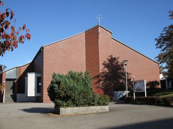
• Trail created by Naturpark Rheinland. Symbol: Schwarzes H auf weißem Grund, Text Hümerich-Runde
![Tour Zu Fuß Wachtberg - Rund um Wachtberg - Photo](https://media.geolcdn.com/t/350/260/c7173096-449e-4784-ae30-11dec60516dc.jpeg&format=jpg&maxdim=2)
![Zu Fuß Zu Fuß](https://static1.geolcdn.com/sitytour/trail-icons/100.png)
Km
Zu Fuß
![](/images/other/stat-length.png)
![](https://static1.geolcdn.com/siteimages/upload/files/1508320355ic_sort_den_pos_24dp.png)
![](https://static1.geolcdn.com/siteimages/upload/files/1508320355ic_sort_den_neg_24dp.png)
![](https://static1.geolcdn.com/siteimages/upload/files/16400158638029165_repeat_loop_refresh_sync_direction_icon.png)
• Trail created by Naturpark Rheinland. Symbol: Schwarzes W in schwarzem Kreis auf weißem Grund, Text Rund um Wachtberg
![Tour Zu Fuß Wachtberg - Kottenforstweg - Photo](https://media.geolcdn.com/t/350/260/80d33be5-9d15-48d1-91cd-c45ac729dd69.jpeg&format=jpg&maxdim=2)
![Zu Fuß Zu Fuß](https://static1.geolcdn.com/sitytour/trail-icons/100.png)
Km
Zu Fuß
![](/images/other/stat-length.png)
![](https://static1.geolcdn.com/siteimages/upload/files/1508320355ic_sort_den_pos_24dp.png)
![](https://static1.geolcdn.com/siteimages/upload/files/1508320355ic_sort_den_neg_24dp.png)
![](https://static1.geolcdn.com/siteimages/upload/files/16400158638029165_repeat_loop_refresh_sync_direction_icon.png)
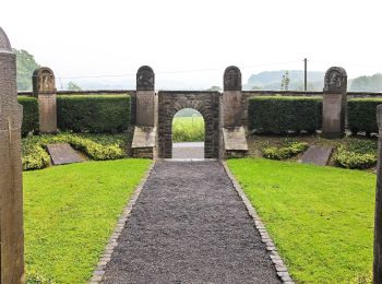
• Trail created by Naturpark Rheinland. Symbol: Schwarze 8 in schwarzem Quadrat auf weißem Grund, Text Wachtberg Kotte...
![Tour Zu Fuß Wachtberg - Gerichtsweg - Photo](https://media.geolcdn.com/t/350/260/80d33be5-9d15-48d1-91cd-c45ac729dd69.jpeg&format=jpg&maxdim=2)
![Zu Fuß Zu Fuß](https://static1.geolcdn.com/sitytour/trail-icons/100.png)
Km
Zu Fuß
![](/images/other/stat-length.png)
![](https://static1.geolcdn.com/siteimages/upload/files/1508320355ic_sort_den_pos_24dp.png)
![](https://static1.geolcdn.com/siteimages/upload/files/1508320355ic_sort_den_neg_24dp.png)
![](https://static1.geolcdn.com/siteimages/upload/files/16400158638029165_repeat_loop_refresh_sync_direction_icon.png)
• Trail created by Naturpark Rheinland. Symbol: Schwarze 7 in schwarzem Quadrat auf weißem Grund, Text Wachtberg Geric...
![Tour Zu Fuß Wachtberg - Töpferweg - Photo](https://media.geolcdn.com/t/350/260/fd2b99fd-7fbe-4b93-a612-5b16f4dae7c9.jpeg&format=jpg&maxdim=2)
![Zu Fuß Zu Fuß](https://static1.geolcdn.com/sitytour/trail-icons/100.png)
Km
Zu Fuß
![](/images/other/stat-length.png)
![](https://static1.geolcdn.com/siteimages/upload/files/1508320355ic_sort_den_pos_24dp.png)
![](https://static1.geolcdn.com/siteimages/upload/files/1508320355ic_sort_den_neg_24dp.png)
![](https://static1.geolcdn.com/siteimages/upload/files/16400158638029165_repeat_loop_refresh_sync_direction_icon.png)
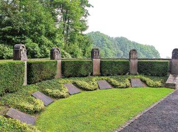
• Trail created by Naturpark Rheinland. Symbol: Schwarze 6 in schwarzem Quadrat auf weißem Grund, Text Wachtberg Töpfe...
![Tour Zu Fuß Wachtberg - Treppenbauerweg - Photo](https://media.geolcdn.com/t/350/260/80d33be5-9d15-48d1-91cd-c45ac729dd69.jpeg&format=jpg&maxdim=2)
![Zu Fuß Zu Fuß](https://static1.geolcdn.com/sitytour/trail-icons/100.png)
Km
Zu Fuß
![](/images/other/stat-length.png)
![](https://static1.geolcdn.com/siteimages/upload/files/1508320355ic_sort_den_pos_24dp.png)
![](https://static1.geolcdn.com/siteimages/upload/files/1508320355ic_sort_den_neg_24dp.png)
![](https://static1.geolcdn.com/siteimages/upload/files/16400158638029165_repeat_loop_refresh_sync_direction_icon.png)
• Trail created by Naturpark Rheinland. Symbol: Schwarze 5 in schwarzem Quadrat auf weißem Grund, Text Wachtberg Trepp...
![Tour Zu Fuß Wachtberg - Kapellenweg - Photo](https://media.geolcdn.com/t/350/260/80d33be5-9d15-48d1-91cd-c45ac729dd69.jpeg&format=jpg&maxdim=2)
![Zu Fuß Zu Fuß](https://static1.geolcdn.com/sitytour/trail-icons/100.png)
Km
Zu Fuß
![](/images/other/stat-length.png)
![](https://static1.geolcdn.com/siteimages/upload/files/1508320355ic_sort_den_pos_24dp.png)
![](https://static1.geolcdn.com/siteimages/upload/files/1508320355ic_sort_den_neg_24dp.png)
![](https://static1.geolcdn.com/siteimages/upload/files/16400158638029165_repeat_loop_refresh_sync_direction_icon.png)
• Trail created by Naturpark Rheinland. Symbol: Schwarze 4 in schwarzem Quadrat auf weißem Grund, Text Wachtberg Kapel...
![Tour Zu Fuß Wachtberg - Kaolinweg - Photo](https://media.geolcdn.com/t/350/260/80d33be5-9d15-48d1-91cd-c45ac729dd69.jpeg&format=jpg&maxdim=2)
![Zu Fuß Zu Fuß](https://static1.geolcdn.com/sitytour/trail-icons/100.png)
Km
Zu Fuß
![](/images/other/stat-length.png)
![](https://static1.geolcdn.com/siteimages/upload/files/1508320355ic_sort_den_pos_24dp.png)
![](https://static1.geolcdn.com/siteimages/upload/files/1508320355ic_sort_den_neg_24dp.png)
![](https://static1.geolcdn.com/siteimages/upload/files/16400158638029165_repeat_loop_refresh_sync_direction_icon.png)
• Trail created by Naturpark Rheinland. Symbol: Schwarze 3 in schwarzem Quadrat auf weißem Grund, Text Wachtberg Kalin...
![Tour Zu Fuß Wachtberg - Römerweg - Photo](https://media.geolcdn.com/t/350/260/c7273de2-5b65-4b43-93d9-f0b5ff3f0a2d.jpeg&format=jpg&maxdim=2)
![Zu Fuß Zu Fuß](https://static1.geolcdn.com/sitytour/trail-icons/100.png)
Km
Zu Fuß
![](/images/other/stat-length.png)
![](https://static1.geolcdn.com/siteimages/upload/files/1508320355ic_sort_den_pos_24dp.png)
![](https://static1.geolcdn.com/siteimages/upload/files/1508320355ic_sort_den_neg_24dp.png)
![](https://static1.geolcdn.com/siteimages/upload/files/16400158638029165_repeat_loop_refresh_sync_direction_icon.png)
• Trail created by Naturpark Rheinland. Symbol: Schwarze 2 in schwarzem Quadrat auf weißem Grund, Text Wachtberg Römer...
![Tour Zu Fuß Wachtberg - Siebengebirgsweg - Photo](https://media.geolcdn.com/t/350/260/8bf6a8cb-0152-49ae-b3b8-fca22ec5382a.jpeg&format=jpg&maxdim=2)
![Zu Fuß Zu Fuß](https://static1.geolcdn.com/sitytour/trail-icons/100.png)
Km
Zu Fuß
![](/images/other/stat-length.png)
![](https://static1.geolcdn.com/siteimages/upload/files/1508320355ic_sort_den_pos_24dp.png)
![](https://static1.geolcdn.com/siteimages/upload/files/1508320355ic_sort_den_neg_24dp.png)
![](https://static1.geolcdn.com/siteimages/upload/files/16400158638029165_repeat_loop_refresh_sync_direction_icon.png)
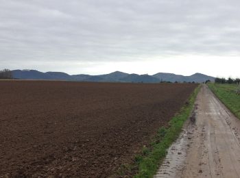
• Trail created by Naturpark Rheinland. Symbol: Schwarze 1 in schwarzem Quadrat auf weißem Grund, Text Wachtberg Siebe...
![Tour Zu Fuß Wachtberg - Feuerroute - Photo](https://media.geolcdn.com/t/350/260/f5d36974-2dd7-4709-98b7-1c99706d0ead.jpeg&format=jpg&maxdim=2)
![Zu Fuß Zu Fuß](https://static1.geolcdn.com/sitytour/trail-icons/100.png)
Km
Zu Fuß
![](/images/other/stat-length.png)
![](https://static1.geolcdn.com/siteimages/upload/files/1508320355ic_sort_den_pos_24dp.png)
![](https://static1.geolcdn.com/siteimages/upload/files/1508320355ic_sort_den_neg_24dp.png)
![](https://static1.geolcdn.com/siteimages/upload/files/16400158638029165_repeat_loop_refresh_sync_direction_icon.png)
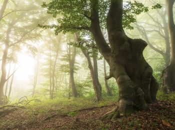
• Trail created by Naturpark Rheinland. Symbol: weiße Flamme in rotem Vollkreis auf weißem Grund Website: https://ww...
![Tour Zu Fuß Wachtberg - Verbindungsweg - Photo](https://media.geolcdn.com/t/350/260/e2bfab6f-df3b-434f-977c-6b5019030202.jpeg&format=jpg&maxdim=2)
![Zu Fuß Zu Fuß](https://static1.geolcdn.com/sitytour/trail-icons/100.png)
Km
Zu Fuß
![](/images/other/stat-length.png)
![](https://static1.geolcdn.com/siteimages/upload/files/1508320355ic_sort_den_pos_24dp.png)
![](https://static1.geolcdn.com/siteimages/upload/files/1508320355ic_sort_den_neg_24dp.png)
![](https://static1.geolcdn.com/siteimages/upload/files/16400158638029165_repeat_loop_refresh_sync_direction_icon.png)
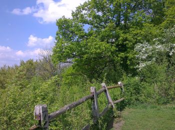
• Trail created by Naturpark Rheinland. Symbol: Schwarzes V in schwarzem Quadrat auf weißem Grund, Text Wachtberg Verb...
![Tour Zu Fuß Wachtberg - Verbindungsweg - Photo](https://media.geolcdn.com/t/350/260/7979d71a-abdc-453c-95cd-fd3636a5417d.jpeg&format=jpg&maxdim=2)
![Zu Fuß Zu Fuß](https://static1.geolcdn.com/sitytour/trail-icons/100.png)
Km
Zu Fuß
![](/images/other/stat-length.png)
![](https://static1.geolcdn.com/siteimages/upload/files/1508320355ic_sort_den_pos_24dp.png)
![](https://static1.geolcdn.com/siteimages/upload/files/1508320355ic_sort_den_neg_24dp.png)
![](https://static1.geolcdn.com/siteimages/upload/files/16400158638029165_repeat_loop_refresh_sync_direction_icon.png)
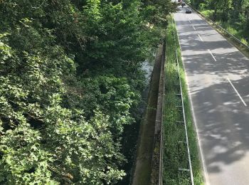
• Trail created by Naturpark Rheinland. Symbol: Schwarzes V in schwarzem Quadrat auf weißem Grund, Text Wachtberg Verb...
15 Angezeigte Touren bei 15
Kostenlosegpshiking-Anwendung