![](/images/other/stat-length.png)
- Touren
- Outdoor
- Germany
- Schleswig-Holstein
- Dithmarschen
Dithmarschen, Schleswig-Holstein: Die besten Touren, Trails, Trecks und Wanderungen
Dithmarschen : Entdecken Sie die besten Touren : 32 zu Fuß. Alle diese Touren, Trails, Routen und Outdoor-Aktivitäten sind in unseren SityTrail-Apps für Smartphones und Tablets verfügbar.
Die besten Spuren (32)
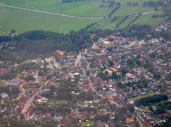
![Tour Zu Fuß Burg (Dithmarschen) - Burg/Ditm. Rundwanderweg Nr.6 - Photo](https://media.geolcdn.com/t/350/260/10bdbd03-a58d-439d-b29d-c83763c6013c.jpeg&format=jpg&maxdim=2)
![Zu Fuß Zu Fuß](https://static1.geolcdn.com/sitytour/trail-icons/100.png)
Km
Zu Fuß
![](/images/other/stat-length.png)
![](https://static1.geolcdn.com/siteimages/upload/files/1508320355ic_sort_den_pos_24dp.png)
![](https://static1.geolcdn.com/siteimages/upload/files/1508320355ic_sort_den_neg_24dp.png)
![](https://static1.geolcdn.com/siteimages/upload/files/16400158638029165_repeat_loop_refresh_sync_direction_icon.png)
• Trail created by Burg/Dithmarschen. Symbol: Rote „6“ auf weißer, rot umrandeter Raute
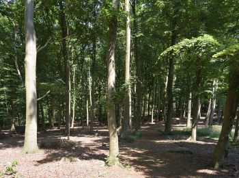
![Tour Zu Fuß Burg (Dithmarschen) - Burg/Ditm. Rundwanderweg Nr.4 - Photo](https://media.geolcdn.com/t/350/260/833b7e05-b349-44b6-9c0c-8506591ed9fc.jpeg&format=jpg&maxdim=2)
![Zu Fuß Zu Fuß](https://static1.geolcdn.com/sitytour/trail-icons/100.png)
Km
Zu Fuß
![](/images/other/stat-length.png)
![](https://static1.geolcdn.com/siteimages/upload/files/1508320355ic_sort_den_pos_24dp.png)
![](https://static1.geolcdn.com/siteimages/upload/files/1508320355ic_sort_den_neg_24dp.png)
![](https://static1.geolcdn.com/siteimages/upload/files/16400158638029165_repeat_loop_refresh_sync_direction_icon.png)
• Trail created by Burg/Dithmarschen. Symbol: Rote „4“ auf weißer, rot umrandeter Raute
![Tour Zu Fuß Burg (Dithmarschen) - Burg/Ditm. Rundwanderweg Nr.3 - Photo](https://media.geolcdn.com/t/350/260/10bdbd03-a58d-439d-b29d-c83763c6013c.jpeg&format=jpg&maxdim=2)
![Zu Fuß Zu Fuß](https://static1.geolcdn.com/sitytour/trail-icons/100.png)
Km
Zu Fuß
![](/images/other/stat-length.png)
![](https://static1.geolcdn.com/siteimages/upload/files/1508320355ic_sort_den_pos_24dp.png)
![](https://static1.geolcdn.com/siteimages/upload/files/1508320355ic_sort_den_neg_24dp.png)
![](https://static1.geolcdn.com/siteimages/upload/files/16400158638029165_repeat_loop_refresh_sync_direction_icon.png)
• Trail created by Burg/Dithmarschen. Symbol: Rote „3“ auf weißer, rot umrandeter Raute
![Tour Zu Fuß Burg (Dithmarschen) - Burg/Ditm. Rundwanderweg Nr.2 - Photo](https://media.geolcdn.com/t/350/260/10bdbd03-a58d-439d-b29d-c83763c6013c.jpeg&format=jpg&maxdim=2)
![Zu Fuß Zu Fuß](https://static1.geolcdn.com/sitytour/trail-icons/100.png)
Km
Zu Fuß
![](/images/other/stat-length.png)
![](https://static1.geolcdn.com/siteimages/upload/files/1508320355ic_sort_den_pos_24dp.png)
![](https://static1.geolcdn.com/siteimages/upload/files/1508320355ic_sort_den_neg_24dp.png)
![](https://static1.geolcdn.com/siteimages/upload/files/16400158638029165_repeat_loop_refresh_sync_direction_icon.png)
• Trail created by Burg/Dithmarschen. Symbol: Rote „2“ auf weißer, rot umrandeter Raute
![Tour Zu Fuß Burg (Dithmarschen) - Burg/Ditm. Rundwanderweg Nr.1 - Photo](https://media.geolcdn.com/t/350/260/10bdbd03-a58d-439d-b29d-c83763c6013c.jpeg&format=jpg&maxdim=2)
![Zu Fuß Zu Fuß](https://static1.geolcdn.com/sitytour/trail-icons/100.png)
Km
Zu Fuß
![](/images/other/stat-length.png)
![](https://static1.geolcdn.com/siteimages/upload/files/1508320355ic_sort_den_pos_24dp.png)
![](https://static1.geolcdn.com/siteimages/upload/files/1508320355ic_sort_den_neg_24dp.png)
![](https://static1.geolcdn.com/siteimages/upload/files/16400158638029165_repeat_loop_refresh_sync_direction_icon.png)
• Trail created by Burg/Dithmarschen. Symbol: Rote „1“ auf weißer, rot umrandeter Raute
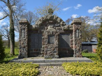
![Tour Zu Fuß Schafstedt - Wanderweg 4 - Photo](https://media.geolcdn.com/t/350/260/5e0ed4d5-71b2-416a-b947-ddab8a0d82df.jpeg&format=jpg&maxdim=2)
![Zu Fuß Zu Fuß](https://static1.geolcdn.com/sitytour/trail-icons/100.png)
Km
Zu Fuß
![](/images/other/stat-length.png)
![](https://static1.geolcdn.com/siteimages/upload/files/1508320355ic_sort_den_pos_24dp.png)
![](https://static1.geolcdn.com/siteimages/upload/files/1508320355ic_sort_den_neg_24dp.png)
![](https://static1.geolcdn.com/siteimages/upload/files/16400158638029165_repeat_loop_refresh_sync_direction_icon.png)
• Trail created by Fremdenverkehrsverein Schafstedt.
![Tour Zu Fuß Schafstedt - Wanderweg 2 - Photo](https://media.geolcdn.com/t/350/260/5e0ed4d5-71b2-416a-b947-ddab8a0d82df.jpeg&format=jpg&maxdim=2)
![Zu Fuß Zu Fuß](https://static1.geolcdn.com/sitytour/trail-icons/100.png)
Km
Zu Fuß
![](/images/other/stat-length.png)
![](https://static1.geolcdn.com/siteimages/upload/files/1508320355ic_sort_den_pos_24dp.png)
![](https://static1.geolcdn.com/siteimages/upload/files/1508320355ic_sort_den_neg_24dp.png)
![](https://static1.geolcdn.com/siteimages/upload/files/16400158638029165_repeat_loop_refresh_sync_direction_icon.png)
• Trail created by Fremdenverkehrsverein Schafstedt.
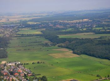
![Tour Zu Fuß Eddelak - St. Michaelisdonn Rundwanderweg Nr. 4 - Photo](https://media.geolcdn.com/t/350/260/34ef2f43-a9b9-440d-adde-19550d07988e.jpeg&format=jpg&maxdim=2)
![Zu Fuß Zu Fuß](https://static1.geolcdn.com/sitytour/trail-icons/100.png)
Km
Zu Fuß
![](/images/other/stat-length.png)
![](https://static1.geolcdn.com/siteimages/upload/files/1508320355ic_sort_den_pos_24dp.png)
![](https://static1.geolcdn.com/siteimages/upload/files/1508320355ic_sort_den_neg_24dp.png)
![](https://static1.geolcdn.com/siteimages/upload/files/16400158638029165_repeat_loop_refresh_sync_direction_icon.png)
• Trail created by Fremdenverkehrsverein Eddelak-Michaelisdonn und Umgebung. Symbol: Rote „4“ auf weißer, rot umrandet...
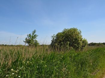
![Tour Zu Fuß Kuden - St.Michaelisdonn Rundwanderweg Nr. 2 Rund um den Kudensee - Photo](https://media.geolcdn.com/t/350/260/05e5e608-fa73-46ec-a66a-09f314aceb67.jpeg&format=jpg&maxdim=2)
![Zu Fuß Zu Fuß](https://static1.geolcdn.com/sitytour/trail-icons/100.png)
Km
Zu Fuß
![](/images/other/stat-length.png)
![](https://static1.geolcdn.com/siteimages/upload/files/1508320355ic_sort_den_pos_24dp.png)
![](https://static1.geolcdn.com/siteimages/upload/files/1508320355ic_sort_den_neg_24dp.png)
![](https://static1.geolcdn.com/siteimages/upload/files/16400158638029165_repeat_loop_refresh_sync_direction_icon.png)
• Trail created by Fremdenverkehrsverein Eddelak-Michaelisdonn und Umgebung. Symbol: Rote „2“ auf weißer, rot umrandet...
![Tour Zu Fuß Burg (Dithmarschen) - Burg/Ditm. Rundwanderweg Nr. 5 - Photo](https://media.geolcdn.com/t/350/260/833b7e05-b349-44b6-9c0c-8506591ed9fc.jpeg&format=jpg&maxdim=2)
![Zu Fuß Zu Fuß](https://static1.geolcdn.com/sitytour/trail-icons/100.png)
Km
Zu Fuß
![](/images/other/stat-length.png)
![](https://static1.geolcdn.com/siteimages/upload/files/1508320355ic_sort_den_pos_24dp.png)
![](https://static1.geolcdn.com/siteimages/upload/files/1508320355ic_sort_den_neg_24dp.png)
![](https://static1.geolcdn.com/siteimages/upload/files/16400158638029165_repeat_loop_refresh_sync_direction_icon.png)
• Trail created by Burg/Dithmarschen. Symbol: Rote „5“ auf weißer, rot umrandeter Raute
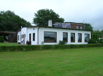
![Tour Zu Fuß Eddelak - St. Michaelisdonn Rundwanderweg Nr. 1 - Photo](https://media.geolcdn.com/t/350/260/15e5d4bd-2bb3-4f24-bb70-48817e28385c.jpeg&format=jpg&maxdim=2)
![Zu Fuß Zu Fuß](https://static1.geolcdn.com/sitytour/trail-icons/100.png)
Km
Zu Fuß
![](/images/other/stat-length.png)
![](https://static1.geolcdn.com/siteimages/upload/files/1508320355ic_sort_den_pos_24dp.png)
![](https://static1.geolcdn.com/siteimages/upload/files/1508320355ic_sort_den_neg_24dp.png)
![](https://static1.geolcdn.com/siteimages/upload/files/16400158638029165_repeat_loop_refresh_sync_direction_icon.png)
• Trail created by Fremdenverkehrsverein Eddelak-Michaelisdonn und Umgebung. Symbol: Rote „1“ auf weißer, rot umrandet...
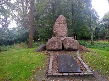
![Tour Zu Fuß Sankt Michaelisdonn - St. Michaelisdonn Rundwanderweg Nr. 3 - Photo](https://media.geolcdn.com/t/350/260/923a9b7c-5f90-49ad-846d-bde45c5e6732.jpeg&format=jpg&maxdim=2)
![Zu Fuß Zu Fuß](https://static1.geolcdn.com/sitytour/trail-icons/100.png)
Km
Zu Fuß
![](/images/other/stat-length.png)
![](https://static1.geolcdn.com/siteimages/upload/files/1508320355ic_sort_den_pos_24dp.png)
![](https://static1.geolcdn.com/siteimages/upload/files/1508320355ic_sort_den_neg_24dp.png)
![](https://static1.geolcdn.com/siteimages/upload/files/16400158638029165_repeat_loop_refresh_sync_direction_icon.png)
• Trail created by Fremdenverkehrsverein Eddelak-Michaelisdonn und Umgebung. Symbol: Rote „3“ auf weißer, rot umrandet...
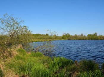
![Tour Zu Fuß Tellingstedt - Klaus-Groth-Wanderweg - Photo](https://media.geolcdn.com/t/350/260/07bda2af-fdea-41e3-ab21-4b73af792f20.jpeg&format=jpg&maxdim=2)
![Zu Fuß Zu Fuß](https://static1.geolcdn.com/sitytour/trail-icons/100.png)
Km
Zu Fuß
![](/images/other/stat-length.png)
![](https://static1.geolcdn.com/siteimages/upload/files/1508320355ic_sort_den_pos_24dp.png)
![](https://static1.geolcdn.com/siteimages/upload/files/1508320355ic_sort_den_neg_24dp.png)
![](https://static1.geolcdn.com/siteimages/upload/files/16400158638029165_repeat_loop_refresh_sync_direction_icon.png)
• Symbol: Klaus-Groth-Wanderweg auf Holzschild
![Tour Zu Fuß Heide - Rundwanderweg - Tour 2 - Photo](https://media.geolcdn.com/t/350/260/96c6d559-9603-4909-9f98-0f3567fdd283.jpeg&format=jpg&maxdim=2)
![Zu Fuß Zu Fuß](https://static1.geolcdn.com/sitytour/trail-icons/100.png)
Km
Zu Fuß
![](/images/other/stat-length.png)
![](https://static1.geolcdn.com/siteimages/upload/files/1508320355ic_sort_den_pos_24dp.png)
![](https://static1.geolcdn.com/siteimages/upload/files/1508320355ic_sort_den_neg_24dp.png)
![](https://static1.geolcdn.com/siteimages/upload/files/16400158638029165_repeat_loop_refresh_sync_direction_icon.png)
![Tour Zu Fuß Wesselburen - Dichterpfad 3 - Photo](https://media.geolcdn.com/t/350/260/f92334a6-5e44-4c4a-b5e0-8402d6d2c5d4.jpeg&format=jpg&maxdim=2)
![Zu Fuß Zu Fuß](https://static1.geolcdn.com/sitytour/trail-icons/100.png)
Km
Zu Fuß
![](/images/other/stat-length.png)
![](https://static1.geolcdn.com/siteimages/upload/files/1508320355ic_sort_den_pos_24dp.png)
![](https://static1.geolcdn.com/siteimages/upload/files/1508320355ic_sort_den_neg_24dp.png)
![](https://static1.geolcdn.com/siteimages/upload/files/16400158638029165_repeat_loop_refresh_sync_direction_icon.png)
![Tour Zu Fuß Wesselburen - Dichterfad 1 - Photo](https://media.geolcdn.com/t/350/260/6951b014-7f57-4f98-888f-e571d121d4fd.jpeg&format=jpg&maxdim=2)
![Zu Fuß Zu Fuß](https://static1.geolcdn.com/sitytour/trail-icons/100.png)
Km
Zu Fuß
![](/images/other/stat-length.png)
![](https://static1.geolcdn.com/siteimages/upload/files/1508320355ic_sort_den_pos_24dp.png)
![](https://static1.geolcdn.com/siteimages/upload/files/1508320355ic_sort_den_neg_24dp.png)
![](https://static1.geolcdn.com/siteimages/upload/files/16400158638029165_repeat_loop_refresh_sync_direction_icon.png)
![Tour Zu Fuß Heide - Rundwanderweg - Tour 3 - Photo](https://media.geolcdn.com/t/350/260/96c6d559-9603-4909-9f98-0f3567fdd283.jpeg&format=jpg&maxdim=2)
![Zu Fuß Zu Fuß](https://static1.geolcdn.com/sitytour/trail-icons/100.png)
Km
Zu Fuß
![](/images/other/stat-length.png)
![](https://static1.geolcdn.com/siteimages/upload/files/1508320355ic_sort_den_pos_24dp.png)
![](https://static1.geolcdn.com/siteimages/upload/files/1508320355ic_sort_den_neg_24dp.png)
![](https://static1.geolcdn.com/siteimages/upload/files/16400158638029165_repeat_loop_refresh_sync_direction_icon.png)
![Tour Zu Fuß Heide - Rundwanderweg - Tour 1 - Photo](https://media.geolcdn.com/t/350/260/ab30c513-9a2e-4616-abbc-23233c3441f8.jpeg&format=jpg&maxdim=2)
![Zu Fuß Zu Fuß](https://static1.geolcdn.com/sitytour/trail-icons/100.png)
Km
Zu Fuß
![](/images/other/stat-length.png)
![](https://static1.geolcdn.com/siteimages/upload/files/1508320355ic_sort_den_pos_24dp.png)
![](https://static1.geolcdn.com/siteimages/upload/files/1508320355ic_sort_den_neg_24dp.png)
![](https://static1.geolcdn.com/siteimages/upload/files/16400158638029165_repeat_loop_refresh_sync_direction_icon.png)
![Tour Zu Fuß Meldorf - Wanderwege in und um Meldorf Tour 3 - Photo](https://media.geolcdn.com/t/350/260/d14f9cbc-a726-4231-9606-9bf8e0e03660.jpeg&format=jpg&maxdim=2)
![Zu Fuß Zu Fuß](https://static1.geolcdn.com/sitytour/trail-icons/100.png)
Km
Zu Fuß
![](/images/other/stat-length.png)
![](https://static1.geolcdn.com/siteimages/upload/files/1508320355ic_sort_den_pos_24dp.png)
![](https://static1.geolcdn.com/siteimages/upload/files/1508320355ic_sort_den_neg_24dp.png)
![](https://static1.geolcdn.com/siteimages/upload/files/16400158638029165_repeat_loop_refresh_sync_direction_icon.png)
![Tour Zu Fuß Meldorf - Wanderwege in und um Meldorf Tour 5 - Photo](https://media.geolcdn.com/t/350/260/d14f9cbc-a726-4231-9606-9bf8e0e03660.jpeg&format=jpg&maxdim=2)
![Zu Fuß Zu Fuß](https://static1.geolcdn.com/sitytour/trail-icons/100.png)
Km
Zu Fuß
![](/images/other/stat-length.png)
![](https://static1.geolcdn.com/siteimages/upload/files/1508320355ic_sort_den_pos_24dp.png)
![](https://static1.geolcdn.com/siteimages/upload/files/1508320355ic_sort_den_neg_24dp.png)
![](https://static1.geolcdn.com/siteimages/upload/files/16400158638029165_repeat_loop_refresh_sync_direction_icon.png)
20 Angezeigte Touren bei 32
Kostenlosegpshiking-Anwendung