![](/images/other/stat-length.png)
- Touren
- Outdoor
- Germany
- Baden-Württemberg
- Landkreis Göppingen
Landkreis Göppingen, Baden-Württemberg: Die besten Touren, Trails, Trecks und Wanderungen
Landkreis Göppingen : Entdecken Sie die besten Touren : 42 zu Fuß. Alle diese Touren, Trails, Routen und Outdoor-Aktivitäten sind in unseren SityTrail-Apps für Smartphones und Tablets verfügbar.
Die besten Spuren (42)
![Tour Zu Fuß Süßen - Süßen - Grünenberg - Photo](https://media.geolcdn.com/t/350/260/f8ef7267-7322-4df7-a44d-f2005202aa54.jpeg&format=jpg&maxdim=2)
![Zu Fuß Zu Fuß](https://static1.geolcdn.com/sitytour/trail-icons/100.png)
Km
Zu Fuß
![](/images/other/stat-length.png)
![](https://static1.geolcdn.com/siteimages/upload/files/1508320355ic_sort_den_pos_24dp.png)
![](https://static1.geolcdn.com/siteimages/upload/files/1508320355ic_sort_den_neg_24dp.png)
![](https://static1.geolcdn.com/siteimages/upload/files/16400158638029165_repeat_loop_refresh_sync_direction_icon.png)
• Trail created by Schwäbischer Albverein.
![Tour Zu Fuß Bad Boll - Löwenpfade: Berta-Hörnle-Tour - Photo](https://media.geolcdn.com/t/350/260/f9919d7d-6b82-4c57-85ec-c19288102447.jpeg&format=jpg&maxdim=2)
![Zu Fuß Zu Fuß](https://static1.geolcdn.com/sitytour/trail-icons/100.png)
Km
Zu Fuß
![](/images/other/stat-length.png)
![](https://static1.geolcdn.com/siteimages/upload/files/1508320355ic_sort_den_pos_24dp.png)
![](https://static1.geolcdn.com/siteimages/upload/files/1508320355ic_sort_den_neg_24dp.png)
![](https://static1.geolcdn.com/siteimages/upload/files/16400158638029165_repeat_loop_refresh_sync_direction_icon.png)
• Trail created by Landkreis Göppingen. Symbol: Stilisiertes weißes Löwengesicht mit grüner Mähne
![Tour Zu Fuß Donzdorf - Donzdorf - Messelberg - Photo](https://media.geolcdn.com/t/350/260/db6895b8-89de-4ba2-afd2-c8ced98936aa.jpeg&format=jpg&maxdim=2)
![Zu Fuß Zu Fuß](https://static1.geolcdn.com/sitytour/trail-icons/100.png)
Km
Zu Fuß
![](/images/other/stat-length.png)
![](https://static1.geolcdn.com/siteimages/upload/files/1508320355ic_sort_den_pos_24dp.png)
![](https://static1.geolcdn.com/siteimages/upload/files/1508320355ic_sort_den_neg_24dp.png)
![](https://static1.geolcdn.com/siteimages/upload/files/16400158638029165_repeat_loop_refresh_sync_direction_icon.png)
• Trail created by Schwäbischer Albverein. blaues Dreieck
![Tour Zu Fuß Eislingen/Fils - Eislingen - Ottenbach - Photo](https://media.geolcdn.com/t/350/260/cf4c4546-e1d6-4f09-aca0-0b00429f617a.jpeg&format=jpg&maxdim=2)
![Zu Fuß Zu Fuß](https://static1.geolcdn.com/sitytour/trail-icons/100.png)
Km
Zu Fuß
![](/images/other/stat-length.png)
![](https://static1.geolcdn.com/siteimages/upload/files/1508320355ic_sort_den_pos_24dp.png)
![](https://static1.geolcdn.com/siteimages/upload/files/1508320355ic_sort_den_neg_24dp.png)
![](https://static1.geolcdn.com/siteimages/upload/files/16400158638029165_repeat_loop_refresh_sync_direction_icon.png)
• Trail created by Schwäbischer Albverein. blauer Balken
![Tour Zu Fuß Göppingen - Göppingen-Wangen blauer Balken - Photo](https://media.geolcdn.com/t/350/260/89a60757-67dc-4454-956a-79bbcb01f9d7.jpeg&format=jpg&maxdim=2)
![Zu Fuß Zu Fuß](https://static1.geolcdn.com/sitytour/trail-icons/100.png)
Km
Zu Fuß
![](/images/other/stat-length.png)
![](https://static1.geolcdn.com/siteimages/upload/files/1508320355ic_sort_den_pos_24dp.png)
![](https://static1.geolcdn.com/siteimages/upload/files/1508320355ic_sort_den_neg_24dp.png)
![](https://static1.geolcdn.com/siteimages/upload/files/16400158638029165_repeat_loop_refresh_sync_direction_icon.png)
• Trail created by Schwäbischer Albverein. Symbol: Blauer Balken auf weißem Grund
![Tour Zu Fuß Göppingen - Göppingen-Hörnle - Photo](https://media.geolcdn.com/t/350/260/e2d320e7-1ee5-4a7b-b439-1d30125e989a.jpeg&format=jpg&maxdim=2)
![Zu Fuß Zu Fuß](https://static1.geolcdn.com/sitytour/trail-icons/100.png)
Km
Zu Fuß
![](/images/other/stat-length.png)
![](https://static1.geolcdn.com/siteimages/upload/files/1508320355ic_sort_den_pos_24dp.png)
![](https://static1.geolcdn.com/siteimages/upload/files/1508320355ic_sort_den_neg_24dp.png)
![](https://static1.geolcdn.com/siteimages/upload/files/16400158638029165_repeat_loop_refresh_sync_direction_icon.png)
• Trail created by Schwäbischer Albverein. Symbol: Blaues Kreuz auf weißem Grund
![Tour Zu Fuß Göppingen - Faurndau - Schloss Filseck - Charlottenseeblaue Raute - Photo](https://media.geolcdn.com/t/350/260/27f87b1b-135c-4c39-8550-348ea019b653.jpeg&format=jpg&maxdim=2)
![Zu Fuß Zu Fuß](https://static1.geolcdn.com/sitytour/trail-icons/100.png)
Km
Zu Fuß
![](/images/other/stat-length.png)
![](https://static1.geolcdn.com/siteimages/upload/files/1508320355ic_sort_den_pos_24dp.png)
![](https://static1.geolcdn.com/siteimages/upload/files/1508320355ic_sort_den_neg_24dp.png)
![](https://static1.geolcdn.com/siteimages/upload/files/16400158638029165_repeat_loop_refresh_sync_direction_icon.png)
• Trail created by Schwäbischer Albverein. Symbol: Blaue Raute auf weißem Grund
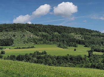
![Tour Zu Fuß Donzdorf - Glaubensweg 15 Heldenbergweg - Photo](https://media.geolcdn.com/t/350/260/2e13880c-9ffa-400d-97f5-6de663c3823c.jpeg&format=jpg&maxdim=2)
![Zu Fuß Zu Fuß](https://static1.geolcdn.com/sitytour/trail-icons/100.png)
Km
Zu Fuß
![](/images/other/stat-length.png)
![](https://static1.geolcdn.com/siteimages/upload/files/1508320355ic_sort_den_pos_24dp.png)
![](https://static1.geolcdn.com/siteimages/upload/files/1508320355ic_sort_den_neg_24dp.png)
![](https://static1.geolcdn.com/siteimages/upload/files/16400158638029165_repeat_loop_refresh_sync_direction_icon.png)
• umbenannt von 13a in 15
![Tour Zu Fuß Geislingen an der Steige - Eybach - Geislingen - Photo](https://media.geolcdn.com/t/350/260/d2997729-99b9-47f9-b8eb-035f08fc110f.jpeg&format=jpg&maxdim=2)
![Zu Fuß Zu Fuß](https://static1.geolcdn.com/sitytour/trail-icons/100.png)
Km
Zu Fuß
![](/images/other/stat-length.png)
![](https://static1.geolcdn.com/siteimages/upload/files/1508320355ic_sort_den_pos_24dp.png)
![](https://static1.geolcdn.com/siteimages/upload/files/1508320355ic_sort_den_neg_24dp.png)
![](https://static1.geolcdn.com/siteimages/upload/files/16400158638029165_repeat_loop_refresh_sync_direction_icon.png)
• Trail created by Schwäbischer Albverein. Symbol: Rote Raute auf weißem Grund
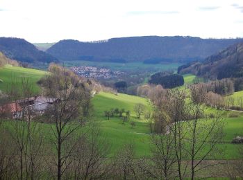
![Tour Zu Fuß Donzdorf - Donzdorf - Winzingen - Reiterleskapelle - Photo](https://media.geolcdn.com/t/350/260/021d6fe9-291a-4426-9722-9d466d572dcf.jpeg&format=jpg&maxdim=2)
![Zu Fuß Zu Fuß](https://static1.geolcdn.com/sitytour/trail-icons/100.png)
Km
Zu Fuß
![](/images/other/stat-length.png)
![](https://static1.geolcdn.com/siteimages/upload/files/1508320355ic_sort_den_pos_24dp.png)
![](https://static1.geolcdn.com/siteimages/upload/files/1508320355ic_sort_den_neg_24dp.png)
![](https://static1.geolcdn.com/siteimages/upload/files/16400158638029165_repeat_loop_refresh_sync_direction_icon.png)
• Trail created by Schwäbischer Albverein.
![Tour Zu Fuß Eislingen/Fils - Eislinger Rundwanderweg Süd E3 - Photo](https://media.geolcdn.com/t/350/260/ff4d470f-ae6e-4beb-9e26-46ca15be779a.jpeg&format=jpg&maxdim=2)
![Zu Fuß Zu Fuß](https://static1.geolcdn.com/sitytour/trail-icons/100.png)
Km
Zu Fuß
![](/images/other/stat-length.png)
![](https://static1.geolcdn.com/siteimages/upload/files/1508320355ic_sort_den_pos_24dp.png)
![](https://static1.geolcdn.com/siteimages/upload/files/1508320355ic_sort_den_neg_24dp.png)
![](https://static1.geolcdn.com/siteimages/upload/files/16400158638029165_repeat_loop_refresh_sync_direction_icon.png)
• Trail created by Stadt Eislingen. Symbol: Weißer Text E3 auf blauem Untergrund
![Tour Zu Fuß Eislingen/Fils - Eislinger Rundwanderweg Süd E2 - Photo](https://media.geolcdn.com/t/350/260/ff4d470f-ae6e-4beb-9e26-46ca15be779a.jpeg&format=jpg&maxdim=2)
![Zu Fuß Zu Fuß](https://static1.geolcdn.com/sitytour/trail-icons/100.png)
Km
Zu Fuß
![](/images/other/stat-length.png)
![](https://static1.geolcdn.com/siteimages/upload/files/1508320355ic_sort_den_pos_24dp.png)
![](https://static1.geolcdn.com/siteimages/upload/files/1508320355ic_sort_den_neg_24dp.png)
![](https://static1.geolcdn.com/siteimages/upload/files/16400158638029165_repeat_loop_refresh_sync_direction_icon.png)
• Trail created by Stadt Eislingen. Symbol: Weißer Text E2 auf violettem Untergrund
![Tour Zu Fuß Eislingen/Fils - Eislinger Rundwanderweg Süd E1 - Photo](https://media.geolcdn.com/t/350/260/cf4c4546-e1d6-4f09-aca0-0b00429f617a.jpeg&format=jpg&maxdim=2)
![Zu Fuß Zu Fuß](https://static1.geolcdn.com/sitytour/trail-icons/100.png)
Km
Zu Fuß
![](/images/other/stat-length.png)
![](https://static1.geolcdn.com/siteimages/upload/files/1508320355ic_sort_den_pos_24dp.png)
![](https://static1.geolcdn.com/siteimages/upload/files/1508320355ic_sort_den_neg_24dp.png)
![](https://static1.geolcdn.com/siteimages/upload/files/16400158638029165_repeat_loop_refresh_sync_direction_icon.png)
• Trail created by Stadt Eislingen. Symbol: weißer Text E1 auf grünem Untergrund
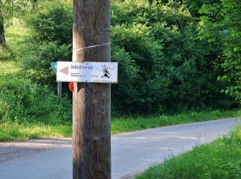
![Tour Zu Fuß Göppingen - Eislinger Rundwanderweg Nord E2 - Photo](https://media.geolcdn.com/t/350/260/e97f6806-da1b-4db8-bb2c-fc2fad8e3003.jpeg&format=jpg&maxdim=2)
![Zu Fuß Zu Fuß](https://static1.geolcdn.com/sitytour/trail-icons/100.png)
Km
Zu Fuß
![](/images/other/stat-length.png)
![](https://static1.geolcdn.com/siteimages/upload/files/1508320355ic_sort_den_pos_24dp.png)
![](https://static1.geolcdn.com/siteimages/upload/files/1508320355ic_sort_den_neg_24dp.png)
![](https://static1.geolcdn.com/siteimages/upload/files/16400158638029165_repeat_loop_refresh_sync_direction_icon.png)
• Trail created by Stadt Eislingen. Symbol: weißer Text E2 auf violettem Untergrund
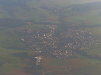
![Tour Zu Fuß Göppingen - Eislinger Rundwanderweg Nord E5 - Photo](https://media.geolcdn.com/t/350/260/8a4a3fbc-79d2-43f1-a575-0cc1547fa516.jpeg&format=jpg&maxdim=2)
![Zu Fuß Zu Fuß](https://static1.geolcdn.com/sitytour/trail-icons/100.png)
Km
Zu Fuß
![](/images/other/stat-length.png)
![](https://static1.geolcdn.com/siteimages/upload/files/1508320355ic_sort_den_pos_24dp.png)
![](https://static1.geolcdn.com/siteimages/upload/files/1508320355ic_sort_den_neg_24dp.png)
![](https://static1.geolcdn.com/siteimages/upload/files/16400158638029165_repeat_loop_refresh_sync_direction_icon.png)
• Trail created by Stadt Eislingen. Symbol: Weißer Text E5 auf blauem Untergrund
![Tour Zu Fuß Göppingen - Eislinger Rundwanderweg Nord E4 - Photo](https://media.geolcdn.com/t/350/260/e97f6806-da1b-4db8-bb2c-fc2fad8e3003.jpeg&format=jpg&maxdim=2)
![Zu Fuß Zu Fuß](https://static1.geolcdn.com/sitytour/trail-icons/100.png)
Km
Zu Fuß
![](/images/other/stat-length.png)
![](https://static1.geolcdn.com/siteimages/upload/files/1508320355ic_sort_den_pos_24dp.png)
![](https://static1.geolcdn.com/siteimages/upload/files/1508320355ic_sort_den_neg_24dp.png)
![](https://static1.geolcdn.com/siteimages/upload/files/16400158638029165_repeat_loop_refresh_sync_direction_icon.png)
• Trail created by Stadt Eislingen. Symbol: Weißer Text E4 auf gelbem Untergrund
![Tour Zu Fuß Eislingen/Fils - Eislinger Rundwanderweg Nord E3 - Photo](https://media.geolcdn.com/t/350/260/cf4c4546-e1d6-4f09-aca0-0b00429f617a.jpeg&format=jpg&maxdim=2)
![Zu Fuß Zu Fuß](https://static1.geolcdn.com/sitytour/trail-icons/100.png)
Km
Zu Fuß
![](/images/other/stat-length.png)
![](https://static1.geolcdn.com/siteimages/upload/files/1508320355ic_sort_den_pos_24dp.png)
![](https://static1.geolcdn.com/siteimages/upload/files/1508320355ic_sort_den_neg_24dp.png)
![](https://static1.geolcdn.com/siteimages/upload/files/16400158638029165_repeat_loop_refresh_sync_direction_icon.png)
• Trail created by Stadt Eislingen. Symbol: weißer Text E3 auf hellblauem Untergrund
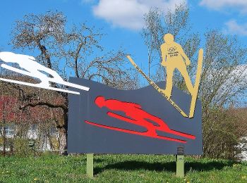
![Tour Zu Fuß Lauterstein - Glaubensweg 12 - Photo](https://media.geolcdn.com/t/350/260/f9d955c4-1d2c-435b-908a-bcbf360a307c.jpeg&format=jpg&maxdim=2)
![Zu Fuß Zu Fuß](https://static1.geolcdn.com/sitytour/trail-icons/100.png)
Km
Zu Fuß
![](/images/other/stat-length.png)
![](https://static1.geolcdn.com/siteimages/upload/files/1508320355ic_sort_den_pos_24dp.png)
![](https://static1.geolcdn.com/siteimages/upload/files/1508320355ic_sort_den_neg_24dp.png)
![](https://static1.geolcdn.com/siteimages/upload/files/16400158638029165_repeat_loop_refresh_sync_direction_icon.png)
• Website: https://www.glaubenswege.de/
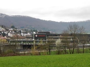
![Tour Zu Fuß Geislingen an der Steige - Kahlenstein Bad Überkingen Oberböhringen Geislingen-West - Photo](https://media.geolcdn.com/t/350/260/455731ce-19db-4df5-9ef5-acff236f0294.jpeg&format=jpg&maxdim=2)
![Zu Fuß Zu Fuß](https://static1.geolcdn.com/sitytour/trail-icons/100.png)
Km
Zu Fuß
![](/images/other/stat-length.png)
![](https://static1.geolcdn.com/siteimages/upload/files/1508320355ic_sort_den_pos_24dp.png)
![](https://static1.geolcdn.com/siteimages/upload/files/1508320355ic_sort_den_neg_24dp.png)
![](https://static1.geolcdn.com/siteimages/upload/files/16400158638029165_repeat_loop_refresh_sync_direction_icon.png)
• Trail created by Schwäbischer Albverein.
![Tour Zu Fuß Deggingen - Deggingen - Nordalb - Hochalb - Photo](https://media.geolcdn.com/t/350/260/b65f353e-5c83-452b-81ff-696237067deb.jpeg&format=jpg&maxdim=2)
![Zu Fuß Zu Fuß](https://static1.geolcdn.com/sitytour/trail-icons/100.png)
Km
Zu Fuß
![](/images/other/stat-length.png)
![](https://static1.geolcdn.com/siteimages/upload/files/1508320355ic_sort_den_pos_24dp.png)
![](https://static1.geolcdn.com/siteimages/upload/files/1508320355ic_sort_den_neg_24dp.png)
![](https://static1.geolcdn.com/siteimages/upload/files/16400158638029165_repeat_loop_refresh_sync_direction_icon.png)
• Trail created by Schwäbischer Albverein.
20 Angezeigte Touren bei 42
Kostenlosegpshiking-Anwendung