![](/images/other/stat-length.png)
- Touren
- Outdoor
- Germany
- Baden-Württemberg
- Main-Tauber-Kreis
- Bad Mergentheim
Bad Mergentheim, Main-Tauber-Kreis: Die besten Touren, Trails, Trecks und Wanderungen
Bad Mergentheim : Entdecken Sie die besten Touren : 7 zu Fuß. Alle diese Touren, Trails, Routen und Outdoor-Aktivitäten sind in unseren SityTrail-Apps für Smartphones und Tablets verfügbar.
Die besten Spuren (7)
![Tour Zu Fuß Bad Mergentheim - Wanderweg 14 - Photo](https://media.geolcdn.com/t/350/260/189d946a-134c-4286-80bb-1ab9fdf9a976.jpeg&format=jpg&maxdim=2)
![Zu Fuß Zu Fuß](https://static1.geolcdn.com/sitytour/trail-icons/100.png)
Km
Zu Fuß
![](/images/other/stat-length.png)
![](https://static1.geolcdn.com/siteimages/upload/files/1508320355ic_sort_den_pos_24dp.png)
![](https://static1.geolcdn.com/siteimages/upload/files/1508320355ic_sort_den_neg_24dp.png)
![](https://static1.geolcdn.com/siteimages/upload/files/16400158638029165_repeat_loop_refresh_sync_direction_icon.png)
• Symbol: schwarze 14 auf weißem Grund
![Tour Zu Fuß Bad Mergentheim - Wanderweg 27 - Photo](https://media.geolcdn.com/t/350/260/c5f9c2b6-27f8-4ab1-b862-9d0027afbd91.jpeg&format=jpg&maxdim=2)
![Zu Fuß Zu Fuß](https://static1.geolcdn.com/sitytour/trail-icons/100.png)
Km
Zu Fuß
![](/images/other/stat-length.png)
![](https://static1.geolcdn.com/siteimages/upload/files/1508320355ic_sort_den_pos_24dp.png)
![](https://static1.geolcdn.com/siteimages/upload/files/1508320355ic_sort_den_neg_24dp.png)
![](https://static1.geolcdn.com/siteimages/upload/files/16400158638029165_repeat_loop_refresh_sync_direction_icon.png)
• Symbol: schwarze 27 auf weißem Grund
![Tour Zu Fuß Bad Mergentheim - Liebliches Taubertal 15 - Photo](https://media.geolcdn.com/t/350/260/489bae20-f786-4b9c-89f6-a8cea704cf53.jpeg&format=jpg&maxdim=2)
![Zu Fuß Zu Fuß](https://static1.geolcdn.com/sitytour/trail-icons/100.png)
Km
Zu Fuß
![](/images/other/stat-length.png)
![](https://static1.geolcdn.com/siteimages/upload/files/1508320355ic_sort_den_pos_24dp.png)
![](https://static1.geolcdn.com/siteimages/upload/files/1508320355ic_sort_den_neg_24dp.png)
![](https://static1.geolcdn.com/siteimages/upload/files/16400158638029165_repeat_loop_refresh_sync_direction_icon.png)
• Symbol: blaues Schild mit weißer Schrift, in der Mitte durch eine weiße Linie getrennt. Obehalb "LT", darunter "15"
![Tour Zu Fuß Bad Mergentheim - Schönbühler Weg - Photo](https://media.geolcdn.com/t/350/260/da5b207a-d0e2-49f4-b0c6-3d058584c401.jpeg&format=jpg&maxdim=2)
![Zu Fuß Zu Fuß](https://static1.geolcdn.com/sitytour/trail-icons/100.png)
Km
Zu Fuß
![](/images/other/stat-length.png)
![](https://static1.geolcdn.com/siteimages/upload/files/1508320355ic_sort_den_pos_24dp.png)
![](https://static1.geolcdn.com/siteimages/upload/files/1508320355ic_sort_den_neg_24dp.png)
![](https://static1.geolcdn.com/siteimages/upload/files/16400158638029165_repeat_loop_refresh_sync_direction_icon.png)
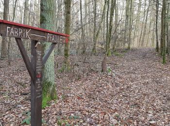
• Trail created by Gemeinde Markelsheim. Symbol: schwarze 41 auf grünem Grund
![Tour Zu Fuß Bad Mergentheim - Weikersheimer Weg - Photo](https://media.geolcdn.com/t/350/260/882dc426-5f95-4c71-976a-4b59a79eb649.jpeg&format=jpg&maxdim=2)
![Zu Fuß Zu Fuß](https://static1.geolcdn.com/sitytour/trail-icons/100.png)
Km
Zu Fuß
![](/images/other/stat-length.png)
![](https://static1.geolcdn.com/siteimages/upload/files/1508320355ic_sort_den_pos_24dp.png)
![](https://static1.geolcdn.com/siteimages/upload/files/1508320355ic_sort_den_neg_24dp.png)
![](https://static1.geolcdn.com/siteimages/upload/files/16400158638029165_repeat_loop_refresh_sync_direction_icon.png)
• Trail created by Gemeinde Markelsheim. Symbol: schwarze 35 auf grünem Grund
![Tour Zu Fuß Bad Mergentheim - Sailbergweg - Photo](https://media.geolcdn.com/t/350/260/ce9a6ca9-6618-4ea0-ae55-4602c7541285.jpeg&format=jpg&maxdim=2)
![Zu Fuß Zu Fuß](https://static1.geolcdn.com/sitytour/trail-icons/100.png)
Km
Zu Fuß
![](/images/other/stat-length.png)
![](https://static1.geolcdn.com/siteimages/upload/files/1508320355ic_sort_den_pos_24dp.png)
![](https://static1.geolcdn.com/siteimages/upload/files/1508320355ic_sort_den_neg_24dp.png)
![](https://static1.geolcdn.com/siteimages/upload/files/16400158638029165_repeat_loop_refresh_sync_direction_icon.png)
• Trail created by Gemeinde Markelsheim. Symbol: schwarze 37 auf grünem Grund
![Tour Zu Fuß Bad Mergentheim - Waldlehrpfad - Photo](https://media.geolcdn.com/t/350/260/ext.jpg?maxdim=2&url=https%3A%2F%2Fstatic1.geolcdn.com%2Fsiteimages%2Fupload%2Ffiles%2F1545311037marcheuse_200dpi.jpg)
![Zu Fuß Zu Fuß](https://static1.geolcdn.com/sitytour/trail-icons/100.png)
Km
Zu Fuß
![](/images/other/stat-length.png)
![](https://static1.geolcdn.com/siteimages/upload/files/1508320355ic_sort_den_pos_24dp.png)
![](https://static1.geolcdn.com/siteimages/upload/files/1508320355ic_sort_den_neg_24dp.png)
![](https://static1.geolcdn.com/siteimages/upload/files/16400158638029165_repeat_loop_refresh_sync_direction_icon.png)
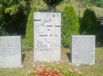
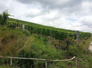
• diverse Informationstafeln zu Flora und Fauna
7 Angezeigte Touren bei 7
Kostenlosegpshiking-Anwendung