![](/images/other/stat-length.png)
- Touren
- Outdoor
- Germany
- Baden-Württemberg
- Heidelberg
Heidelberg, Baden-Württemberg: Die besten Touren, Trails, Trecks und Wanderungen
Heidelberg : Entdecken Sie die besten Touren : 37 zu Fuß. Alle diese Touren, Trails, Routen und Outdoor-Aktivitäten sind in unseren SityTrail-Apps für Smartphones und Tablets verfügbar.
Die besten Spuren (37)
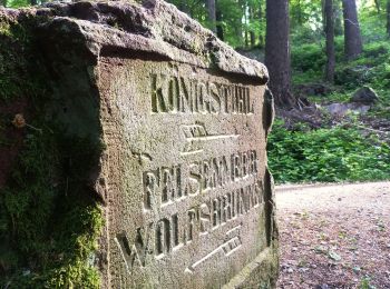
![Tour Zu Fuß Unbekannt - Via naturae - Photo](https://media.geolcdn.com/t/350/260/2835f373-5052-4f86-8992-9128d859e00a.jpeg&format=jpg&maxdim=2)
![Zu Fuß Zu Fuß](https://static1.geolcdn.com/sitytour/trail-icons/100.png)
Km
Zu Fuß
![](/images/other/stat-length.png)
![](https://static1.geolcdn.com/siteimages/upload/files/1508320355ic_sort_den_pos_24dp.png)
![](https://static1.geolcdn.com/siteimages/upload/files/1508320355ic_sort_den_neg_24dp.png)
![](https://static1.geolcdn.com/siteimages/upload/files/16400158638029165_repeat_loop_refresh_sync_direction_icon.png)
• Trail created by Stadt Heidelberg. Symbol: Gelbes N in gelbem Kreis
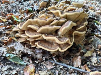
![Tour Zu Fuß Unbekannt - Rundwanderweg Heidelberg Heiligenberg 2: Zollstock-Weg - Photo](https://media.geolcdn.com/t/350/260/72f9f861-8fa0-43c5-ad44-0753d22bb2b6.jpeg&format=jpg&maxdim=2)
![Zu Fuß Zu Fuß](https://static1.geolcdn.com/sitytour/trail-icons/100.png)
Km
Zu Fuß
![](/images/other/stat-length.png)
![](https://static1.geolcdn.com/siteimages/upload/files/1508320355ic_sort_den_pos_24dp.png)
![](https://static1.geolcdn.com/siteimages/upload/files/1508320355ic_sort_den_neg_24dp.png)
![](https://static1.geolcdn.com/siteimages/upload/files/16400158638029165_repeat_loop_refresh_sync_direction_icon.png)
• Trail created by Naturpark Neckartal-Odenwald. Symbol: Gelbe 2 im gelben Kreis
![Tour Zu Fuß Unbekannt - Rundwanderweg Heidelberg Turnerbrunnen 5: Hoher-Nistler-Weg - Photo](https://media.geolcdn.com/t/350/260/02a3e436-5fd4-4e9e-8d78-af1b4ee05e5a.jpeg&format=jpg&maxdim=2)
![Zu Fuß Zu Fuß](https://static1.geolcdn.com/sitytour/trail-icons/100.png)
Km
Zu Fuß
![](/images/other/stat-length.png)
![](https://static1.geolcdn.com/siteimages/upload/files/1508320355ic_sort_den_pos_24dp.png)
![](https://static1.geolcdn.com/siteimages/upload/files/1508320355ic_sort_den_neg_24dp.png)
![](https://static1.geolcdn.com/siteimages/upload/files/16400158638029165_repeat_loop_refresh_sync_direction_icon.png)
• Trail created by Naturpark Neckartal-Odenwald. Symbol: Gelbe 5 im gelben Kreis
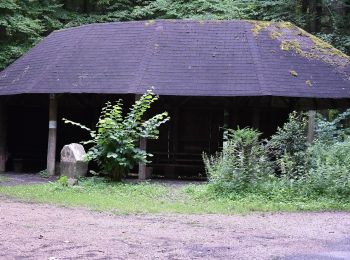
![Tour Zu Fuß Unbekannt - Rundwanderweg Blockhaus 2: Rindenhäusle-Weg - Photo](https://media.geolcdn.com/t/350/260/06bc4456-1f32-4e0a-b4de-4db241026ddb.jpeg&format=jpg&maxdim=2)
![Zu Fuß Zu Fuß](https://static1.geolcdn.com/sitytour/trail-icons/100.png)
Km
Zu Fuß
![](/images/other/stat-length.png)
![](https://static1.geolcdn.com/siteimages/upload/files/1508320355ic_sort_den_pos_24dp.png)
![](https://static1.geolcdn.com/siteimages/upload/files/1508320355ic_sort_den_neg_24dp.png)
![](https://static1.geolcdn.com/siteimages/upload/files/16400158638029165_repeat_loop_refresh_sync_direction_icon.png)
• Trail created by Naturpark Neckartal-Odenwald. Symbol: Gelbe 2 in gelbem Kreis
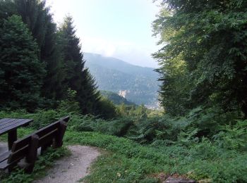
![Tour Zu Fuß Unbekannt - Rundwanderweg Heidelberg Turnerbrunnen 4: Holdermannseiche-Weg - Photo](https://media.geolcdn.com/t/350/260/90745cac-5831-4a35-9e8b-c48d866cf3cf.jpeg&format=jpg&maxdim=2)
![Zu Fuß Zu Fuß](https://static1.geolcdn.com/sitytour/trail-icons/100.png)
Km
Zu Fuß
![](/images/other/stat-length.png)
![](https://static1.geolcdn.com/siteimages/upload/files/1508320355ic_sort_den_pos_24dp.png)
![](https://static1.geolcdn.com/siteimages/upload/files/1508320355ic_sort_den_neg_24dp.png)
![](https://static1.geolcdn.com/siteimages/upload/files/16400158638029165_repeat_loop_refresh_sync_direction_icon.png)
• Trail created by Naturpark Neckartal-Odenwald. Symbol: Gelbe 4 im gelben Kreis
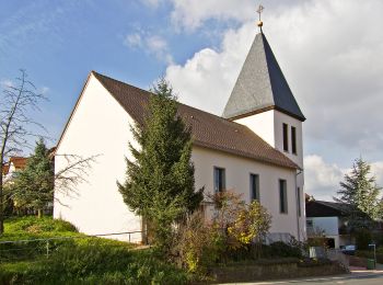
![Tour Zu Fuß Unbekannt - Ochsenpferch-Weg - Photo](https://media.geolcdn.com/t/350/260/c630a0b9-deec-4b66-9392-cc4d18c07230.jpeg&format=jpg&maxdim=2)
![Zu Fuß Zu Fuß](https://static1.geolcdn.com/sitytour/trail-icons/100.png)
Km
Zu Fuß
![](/images/other/stat-length.png)
![](https://static1.geolcdn.com/siteimages/upload/files/1508320355ic_sort_den_pos_24dp.png)
![](https://static1.geolcdn.com/siteimages/upload/files/1508320355ic_sort_den_neg_24dp.png)
![](https://static1.geolcdn.com/siteimages/upload/files/16400158638029165_repeat_loop_refresh_sync_direction_icon.png)
• Trail created by Naturpark Neckartal-Odenwald. Symbol: Weiße 4 in einem oben offenen Kreis, darüber weißes G
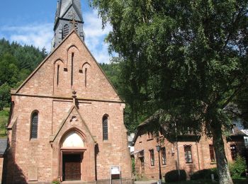
![Tour Zu Fuß Unbekannt - Rundwanderweg Ziegelhausen 3: Rund um Peterstal - Photo](https://media.geolcdn.com/t/350/260/d115d575-c43e-4f58-8e54-d1667eccc4ec.jpeg&format=jpg&maxdim=2)
![Zu Fuß Zu Fuß](https://static1.geolcdn.com/sitytour/trail-icons/100.png)
Km
Zu Fuß
![](/images/other/stat-length.png)
![](https://static1.geolcdn.com/siteimages/upload/files/1508320355ic_sort_den_pos_24dp.png)
![](https://static1.geolcdn.com/siteimages/upload/files/1508320355ic_sort_den_neg_24dp.png)
![](https://static1.geolcdn.com/siteimages/upload/files/16400158638029165_repeat_loop_refresh_sync_direction_icon.png)
• Trail created by Odenwaldklub. Symbol: 3 in oben offenen Kreis, in Öffnung ein Z
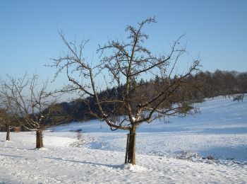
![Tour Zu Fuß Unbekannt - Rundwanderweg Drei Eichen 7: Stephanshütten-Weg - Photo](https://media.geolcdn.com/t/350/260/64358739-b386-455a-aa8e-90332cf4b671.jpeg&format=jpg&maxdim=2)
![Zu Fuß Zu Fuß](https://static1.geolcdn.com/sitytour/trail-icons/100.png)
Km
Zu Fuß
![](/images/other/stat-length.png)
![](https://static1.geolcdn.com/siteimages/upload/files/1508320355ic_sort_den_pos_24dp.png)
![](https://static1.geolcdn.com/siteimages/upload/files/1508320355ic_sort_den_neg_24dp.png)
![](https://static1.geolcdn.com/siteimages/upload/files/16400158638029165_repeat_loop_refresh_sync_direction_icon.png)
• Trail created by Naturpark Neckartal-Odenwald. Symbol: Gelbe 7 im gelben Kreis
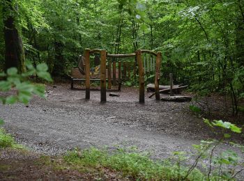
![Tour Zu Fuß Unbekannt - Rundwanderweg Königstuhl 4: Königstuhl-Rundweg - Photo](https://media.geolcdn.com/t/350/260/e58a2f3a-e57b-42fd-b304-86031150355e.jpeg&format=jpg&maxdim=2)
![Zu Fuß Zu Fuß](https://static1.geolcdn.com/sitytour/trail-icons/100.png)
Km
Zu Fuß
![](/images/other/stat-length.png)
![](https://static1.geolcdn.com/siteimages/upload/files/1508320355ic_sort_den_pos_24dp.png)
![](https://static1.geolcdn.com/siteimages/upload/files/1508320355ic_sort_den_neg_24dp.png)
![](https://static1.geolcdn.com/siteimages/upload/files/16400158638029165_repeat_loop_refresh_sync_direction_icon.png)
• Trail created by Naturpark Neckartal-Odenwald. Symbol: Gelbe 4 in gelbem Kreis
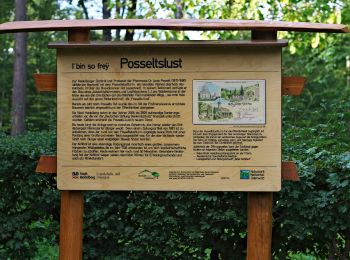
![Tour Zu Fuß Unbekannt - Rundwanderweg Drei Eichen 8: Leopoldstein-Weg - Photo](https://media.geolcdn.com/t/350/260/2b3c3120-1136-4481-8d30-cda861a1a7e0.jpeg&format=jpg&maxdim=2)
![Zu Fuß Zu Fuß](https://static1.geolcdn.com/sitytour/trail-icons/100.png)
Km
Zu Fuß
![](/images/other/stat-length.png)
![](https://static1.geolcdn.com/siteimages/upload/files/1508320355ic_sort_den_pos_24dp.png)
![](https://static1.geolcdn.com/siteimages/upload/files/1508320355ic_sort_den_neg_24dp.png)
![](https://static1.geolcdn.com/siteimages/upload/files/16400158638029165_repeat_loop_refresh_sync_direction_icon.png)
• Trail created by Naturpark Neckartal-Odenwald. Symbol: Gelbe 8 im gelben Kreis
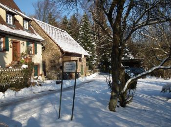
![Tour Zu Fuß Unbekannt - Rundwanderweg Königstuhl 5: Kohlhof-Weg - Photo](https://media.geolcdn.com/t/350/260/39f3563a-3355-46d5-b280-8718d4211e4f.jpeg&format=jpg&maxdim=2)
![Zu Fuß Zu Fuß](https://static1.geolcdn.com/sitytour/trail-icons/100.png)
Km
Zu Fuß
![](/images/other/stat-length.png)
![](https://static1.geolcdn.com/siteimages/upload/files/1508320355ic_sort_den_pos_24dp.png)
![](https://static1.geolcdn.com/siteimages/upload/files/1508320355ic_sort_den_neg_24dp.png)
![](https://static1.geolcdn.com/siteimages/upload/files/16400158638029165_repeat_loop_refresh_sync_direction_icon.png)
• Trail created by Naturpark Neckartal-Odenwald. Symbol: Gelbe 5 im gelben Kreis
![Tour Zu Fuß Unbekannt - Rundwanderweg Dossenheim Weißer Stein 10: Centwald-Weg - Photo](https://media.geolcdn.com/t/350/260/02a3e436-5fd4-4e9e-8d78-af1b4ee05e5a.jpeg&format=jpg&maxdim=2)
![Zu Fuß Zu Fuß](https://static1.geolcdn.com/sitytour/trail-icons/100.png)
Km
Zu Fuß
![](/images/other/stat-length.png)
![](https://static1.geolcdn.com/siteimages/upload/files/1508320355ic_sort_den_pos_24dp.png)
![](https://static1.geolcdn.com/siteimages/upload/files/1508320355ic_sort_den_neg_24dp.png)
![](https://static1.geolcdn.com/siteimages/upload/files/16400158638029165_repeat_loop_refresh_sync_direction_icon.png)
• Trail created by Naturpark Neckartal-Odenwald. Symbol: Gelbe 10 im gelben Kreis
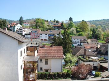
![Tour Zu Fuß Unbekannt - Rundwanderweg Ziegelhausen 2: Rund um Ziegelhausen - Photo](https://media.geolcdn.com/t/350/260/9b393914-1b6b-4893-8dbe-fc3056f01cd9.jpeg&format=jpg&maxdim=2)
![Zu Fuß Zu Fuß](https://static1.geolcdn.com/sitytour/trail-icons/100.png)
Km
Zu Fuß
![](/images/other/stat-length.png)
![](https://static1.geolcdn.com/siteimages/upload/files/1508320355ic_sort_den_pos_24dp.png)
![](https://static1.geolcdn.com/siteimages/upload/files/1508320355ic_sort_den_neg_24dp.png)
![](https://static1.geolcdn.com/siteimages/upload/files/16400158638029165_repeat_loop_refresh_sync_direction_icon.png)
• Trail created by Odenwaldklub. Symbol: 2 in oben offenen Kreis, in Öffnung ein Z
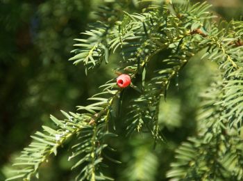
![Tour Zu Fuß Unbekannt - Rundwanderweg Heidelberg Turnerbrunnen 3: Weinberg-Weg - Photo](https://media.geolcdn.com/t/350/260/fa806d48-4b76-4cf5-93ac-5a73168d3637.jpeg&format=jpg&maxdim=2)
![Zu Fuß Zu Fuß](https://static1.geolcdn.com/sitytour/trail-icons/100.png)
Km
Zu Fuß
![](/images/other/stat-length.png)
![](https://static1.geolcdn.com/siteimages/upload/files/1508320355ic_sort_den_pos_24dp.png)
![](https://static1.geolcdn.com/siteimages/upload/files/1508320355ic_sort_den_neg_24dp.png)
![](https://static1.geolcdn.com/siteimages/upload/files/16400158638029165_repeat_loop_refresh_sync_direction_icon.png)
• Trail created by Naturpark Neckartal-Odenwald. Symbol: Gelbe 3 im gelben Kreis
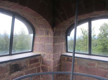
![Tour Zu Fuß Unbekannt - Rundwanderweg Wilhelmsfeld 10 : Weißer-Stein-Weg - Photo](https://media.geolcdn.com/t/350/260/79375ba0-0b03-45c4-8a21-253e8f44d90f.jpeg&format=jpg&maxdim=2)
![Zu Fuß Zu Fuß](https://static1.geolcdn.com/sitytour/trail-icons/100.png)
Km
Zu Fuß
![](/images/other/stat-length.png)
![](https://static1.geolcdn.com/siteimages/upload/files/1508320355ic_sort_den_pos_24dp.png)
![](https://static1.geolcdn.com/siteimages/upload/files/1508320355ic_sort_den_neg_24dp.png)
![](https://static1.geolcdn.com/siteimages/upload/files/16400158638029165_repeat_loop_refresh_sync_direction_icon.png)
• Trail created by Naturpark Neckartal-Odenwald. Symbol: 10 in einem oben offenen Kreis; in der Kreisöffnung ein W
![Tour Zu Fuß Unbekannt - Rundwanderweg Wilhelmsfeld 9: Allmendwaldweg - Photo](https://media.geolcdn.com/t/350/260/79375ba0-0b03-45c4-8a21-253e8f44d90f.jpeg&format=jpg&maxdim=2)
![Zu Fuß Zu Fuß](https://static1.geolcdn.com/sitytour/trail-icons/100.png)
Km
Zu Fuß
![](/images/other/stat-length.png)
![](https://static1.geolcdn.com/siteimages/upload/files/1508320355ic_sort_den_pos_24dp.png)
![](https://static1.geolcdn.com/siteimages/upload/files/1508320355ic_sort_den_neg_24dp.png)
![](https://static1.geolcdn.com/siteimages/upload/files/16400158638029165_repeat_loop_refresh_sync_direction_icon.png)
• Trail created by Naturpark Neckartal-Odenwald. Symbol: 9 in einem oben offenen Kreis; in der Kreisöffnung ein W
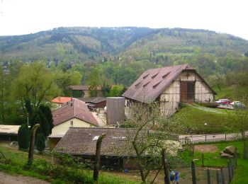
![Tour Zu Fuß Unbekannt - Rundwanderweg Ziegelhausen 4: Mausbachwiesen-Weg - Photo](https://media.geolcdn.com/t/350/260/63b982da-0a44-4e7e-9ec0-ffd777547d3b.jpeg&format=jpg&maxdim=2)
![Zu Fuß Zu Fuß](https://static1.geolcdn.com/sitytour/trail-icons/100.png)
Km
Zu Fuß
![](/images/other/stat-length.png)
![](https://static1.geolcdn.com/siteimages/upload/files/1508320355ic_sort_den_pos_24dp.png)
![](https://static1.geolcdn.com/siteimages/upload/files/1508320355ic_sort_den_neg_24dp.png)
![](https://static1.geolcdn.com/siteimages/upload/files/16400158638029165_repeat_loop_refresh_sync_direction_icon.png)
• Trail created by Naturpark Neckartal-Odenwald. Symbol: 4 in oben offenen Kreis, in Öffnung ein Z
![Tour Zu Fuß Unbekannt - Rundwanderweg Ziegelhausen 5: Karlshütten-Weg - Photo](https://media.geolcdn.com/t/350/260/63b982da-0a44-4e7e-9ec0-ffd777547d3b.jpeg&format=jpg&maxdim=2)
![Zu Fuß Zu Fuß](https://static1.geolcdn.com/sitytour/trail-icons/100.png)
Km
Zu Fuß
![](/images/other/stat-length.png)
![](https://static1.geolcdn.com/siteimages/upload/files/1508320355ic_sort_den_pos_24dp.png)
![](https://static1.geolcdn.com/siteimages/upload/files/1508320355ic_sort_den_neg_24dp.png)
![](https://static1.geolcdn.com/siteimages/upload/files/16400158638029165_repeat_loop_refresh_sync_direction_icon.png)
• Trail created by Naturpark Neckartal-Odenwald. Symbol: 5 in oben offenen Kreis, in Öffnung ein Z
![Tour Zu Fuß Unbekannt - Wanderweg Königstuhl 12 - Photo](https://media.geolcdn.com/t/350/260/f3ad6c75-0180-4cb1-b752-843dba115b3b.jpeg&format=jpg&maxdim=2)
![Zu Fuß Zu Fuß](https://static1.geolcdn.com/sitytour/trail-icons/100.png)
Km
Zu Fuß
![](/images/other/stat-length.png)
![](https://static1.geolcdn.com/siteimages/upload/files/1508320355ic_sort_den_pos_24dp.png)
![](https://static1.geolcdn.com/siteimages/upload/files/1508320355ic_sort_den_neg_24dp.png)
![](https://static1.geolcdn.com/siteimages/upload/files/16400158638029165_repeat_loop_refresh_sync_direction_icon.png)
• Trail created by Schwarzwaldverein Ortsgruppe Heidelberg.
![Tour Zu Fuß Unbekannt - Wanderweg Königstuhl 11 - Photo](https://media.geolcdn.com/t/350/260/f3ad6c75-0180-4cb1-b752-843dba115b3b.jpeg&format=jpg&maxdim=2)
![Zu Fuß Zu Fuß](https://static1.geolcdn.com/sitytour/trail-icons/100.png)
Km
Zu Fuß
![](/images/other/stat-length.png)
![](https://static1.geolcdn.com/siteimages/upload/files/1508320355ic_sort_den_pos_24dp.png)
![](https://static1.geolcdn.com/siteimages/upload/files/1508320355ic_sort_den_neg_24dp.png)
![](https://static1.geolcdn.com/siteimages/upload/files/16400158638029165_repeat_loop_refresh_sync_direction_icon.png)
• Trail created by Schwarzwaldverein Ortsgruppe Heidelberg.
20 Angezeigte Touren bei 37
Kostenlosegpshiking-Anwendung