![](/images/other/stat-length.png)
Landkreis Neustadt an der Aisch-Bad Windsheim, Bayern: Die besten Touren, Trails, Trecks und Wanderungen
Landkreis Neustadt an der Aisch-Bad Windsheim : Entdecken Sie die besten Touren : 35 zu Fuß. Alle diese Touren, Trails, Routen und Outdoor-Aktivitäten sind in unseren SityTrail-Apps für Smartphones und Tablets verfügbar.
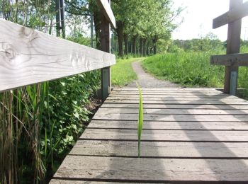
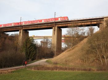
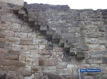
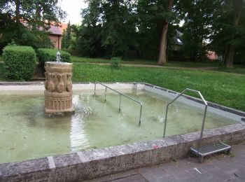
Die besten Spuren (35)
![Tour Zu Fuß Burghaslach - Sagen-Weg Burghaslach - Photo](https://media.geolcdn.com/t/350/260/f0abbf3f-a91c-4f61-ad91-68ed72a0c1a4.jpeg&format=jpg&maxdim=2)
![Zu Fuß Zu Fuß](https://static1.geolcdn.com/sitytour/trail-icons/100.png)
Km
Zu Fuß
![](/images/other/stat-length.png)
![](https://static1.geolcdn.com/siteimages/upload/files/1508320355ic_sort_den_pos_24dp.png)
![](https://static1.geolcdn.com/siteimages/upload/files/1508320355ic_sort_den_neg_24dp.png)
![](https://static1.geolcdn.com/siteimages/upload/files/16400158638029165_repeat_loop_refresh_sync_direction_icon.png)
• Symbol: Schwarzes B1 auf gelbem Hintergrund
![Tour Zu Fuß Uehlfeld - YoungGO Fitness-Parcours - Photo](https://media.geolcdn.com/t/350/260/fcad0d6d-04c1-42fd-a93c-c95a873b2853.jpeg&format=jpg&maxdim=2)
![Zu Fuß Zu Fuß](https://static1.geolcdn.com/sitytour/trail-icons/100.png)
Km
Zu Fuß
![](/images/other/stat-length.png)
![](https://static1.geolcdn.com/siteimages/upload/files/1508320355ic_sort_den_pos_24dp.png)
![](https://static1.geolcdn.com/siteimages/upload/files/1508320355ic_sort_den_neg_24dp.png)
![](https://static1.geolcdn.com/siteimages/upload/files/16400158638029165_repeat_loop_refresh_sync_direction_icon.png)
• Trail created by Gemeinde Uehlfeld.
![Tour Zu Fuß Uehlfeld - Kräuter-Rundweg Uehlfeld - Photo](https://media.geolcdn.com/t/350/260/48250117-8b40-484c-8b89-1f6ec968c33d.jpeg&format=jpg&maxdim=2)
![Zu Fuß Zu Fuß](https://static1.geolcdn.com/sitytour/trail-icons/100.png)
Km
Zu Fuß
![](/images/other/stat-length.png)
![](https://static1.geolcdn.com/siteimages/upload/files/1508320355ic_sort_den_pos_24dp.png)
![](https://static1.geolcdn.com/siteimages/upload/files/1508320355ic_sort_den_neg_24dp.png)
![](https://static1.geolcdn.com/siteimages/upload/files/16400158638029165_repeat_loop_refresh_sync_direction_icon.png)
• Trail created by Gemeinde Uehlfeld. teilweise unzureichende Markierung Symbol: Rote Blüte auf weißem Hintergrund
![Tour Zu Fuß Uehlfeld - Karpfen-Rundweg Uehlfeld - Photo](https://media.geolcdn.com/t/350/260/6e73a48e-e790-4f50-8c65-571f1003efc9.jpeg&format=jpg&maxdim=2)
![Zu Fuß Zu Fuß](https://static1.geolcdn.com/sitytour/trail-icons/100.png)
Km
Zu Fuß
![](/images/other/stat-length.png)
![](https://static1.geolcdn.com/siteimages/upload/files/1508320355ic_sort_den_pos_24dp.png)
![](https://static1.geolcdn.com/siteimages/upload/files/1508320355ic_sort_den_neg_24dp.png)
![](https://static1.geolcdn.com/siteimages/upload/files/16400158638029165_repeat_loop_refresh_sync_direction_icon.png)
• Trail created by Gemeinde Uehlfeld. teilweise unzureichende Markierung Symbol: Grüner Karpfen auf weißem Hintergrund
![Tour Zu Fuß Bad Windsheim - Rundwanderweg Bad Windsheim 1 - Photo](https://media.geolcdn.com/t/350/260/41e55e28-2395-48b7-906a-86ee72ae0529.jpeg&format=jpg&maxdim=2)
![Zu Fuß Zu Fuß](https://static1.geolcdn.com/sitytour/trail-icons/100.png)
Km
Zu Fuß
![](/images/other/stat-length.png)
![](https://static1.geolcdn.com/siteimages/upload/files/1508320355ic_sort_den_pos_24dp.png)
![](https://static1.geolcdn.com/siteimages/upload/files/1508320355ic_sort_den_neg_24dp.png)
![](https://static1.geolcdn.com/siteimages/upload/files/16400158638029165_repeat_loop_refresh_sync_direction_icon.png)
• Trail created by Stadt Bad Windsheim. Symbol: Schwarze BW 1 auf gelbem Hintergrund
![Tour Zu Fuß Burgbernheim - Nordic-Walking-Strecke Birkensumpf - Photo](https://media.geolcdn.com/t/350/260/82399683-7c89-4c22-ba52-774eeba51623.jpeg&format=jpg&maxdim=2)
![Zu Fuß Zu Fuß](https://static1.geolcdn.com/sitytour/trail-icons/100.png)
Km
Zu Fuß
![](/images/other/stat-length.png)
![](https://static1.geolcdn.com/siteimages/upload/files/1508320355ic_sort_den_pos_24dp.png)
![](https://static1.geolcdn.com/siteimages/upload/files/1508320355ic_sort_den_neg_24dp.png)
![](https://static1.geolcdn.com/siteimages/upload/files/16400158638029165_repeat_loop_refresh_sync_direction_icon.png)
• Trail created by Gemeinde Burgbernheim. Symbol: Weiße 8 auf schwarzem Punkt
![Tour Zu Fuß Burgbernheim - Rundweg Elster Burgbernheim - Photo](https://media.geolcdn.com/t/350/260/82399683-7c89-4c22-ba52-774eeba51623.jpeg&format=jpg&maxdim=2)
![Zu Fuß Zu Fuß](https://static1.geolcdn.com/sitytour/trail-icons/100.png)
Km
Zu Fuß
![](/images/other/stat-length.png)
![](https://static1.geolcdn.com/siteimages/upload/files/1508320355ic_sort_den_pos_24dp.png)
![](https://static1.geolcdn.com/siteimages/upload/files/1508320355ic_sort_den_neg_24dp.png)
![](https://static1.geolcdn.com/siteimages/upload/files/16400158638029165_repeat_loop_refresh_sync_direction_icon.png)
• Trail created by Gemeinde Burgbernheim. Symbol: Elster auf gelbem Hintergrund
![Tour Zu Fuß Burgbernheim - Markgrafenweg Burgbernheim - Photo](https://media.geolcdn.com/t/350/260/82399683-7c89-4c22-ba52-774eeba51623.jpeg&format=jpg&maxdim=2)
![Zu Fuß Zu Fuß](https://static1.geolcdn.com/sitytour/trail-icons/100.png)
Km
Zu Fuß
![](/images/other/stat-length.png)
![](https://static1.geolcdn.com/siteimages/upload/files/1508320355ic_sort_den_pos_24dp.png)
![](https://static1.geolcdn.com/siteimages/upload/files/1508320355ic_sort_den_neg_24dp.png)
![](https://static1.geolcdn.com/siteimages/upload/files/16400158638029165_repeat_loop_refresh_sync_direction_icon.png)
• Trail created by Gemeinde Burgbernheim. Symbol: Markgrafenwappen
![Tour Zu Fuß Markt Nordheim - Wanderweg Blauer Tropfen / Markt Nordheim - Bullenheim - Photo](https://media.geolcdn.com/t/350/260/96dd2e9c-c70e-49f6-9afd-b90b1c81236f.jpeg&format=jpg&maxdim=2)
![Zu Fuß Zu Fuß](https://static1.geolcdn.com/sitytour/trail-icons/100.png)
Km
Zu Fuß
![](/images/other/stat-length.png)
![](https://static1.geolcdn.com/siteimages/upload/files/1508320355ic_sort_den_pos_24dp.png)
![](https://static1.geolcdn.com/siteimages/upload/files/1508320355ic_sort_den_neg_24dp.png)
![](https://static1.geolcdn.com/siteimages/upload/files/16400158638029165_repeat_loop_refresh_sync_direction_icon.png)
• Trail created by Steigerwaldclub. Da es für das osmc:symbol keinen blauen Tropfen gibt, einen blauen "dot" entschied...
![Tour Zu Fuß Neustadt an der Aisch - Pfalzbachschluch - Photo](https://media.geolcdn.com/t/350/260/9c552982-e5fa-4a5e-86e8-c07140d5b115.jpeg&format=jpg&maxdim=2)
![Zu Fuß Zu Fuß](https://static1.geolcdn.com/sitytour/trail-icons/100.png)
Km
Zu Fuß
![](/images/other/stat-length.png)
![](https://static1.geolcdn.com/siteimages/upload/files/1508320355ic_sort_den_pos_24dp.png)
![](https://static1.geolcdn.com/siteimages/upload/files/1508320355ic_sort_den_neg_24dp.png)
![](https://static1.geolcdn.com/siteimages/upload/files/16400158638029165_repeat_loop_refresh_sync_direction_icon.png)
• Trail created by Stadt Neustadt/Aisch. Symbol: Schwarze N3 auf gelbem Hintergrund
![Tour Zu Fuß Neustadt an der Aisch - Schweinbach-Wanderweg - Photo](https://media.geolcdn.com/t/350/260/65c29ec1-a20e-4f8c-819a-211ca9229230.jpeg&format=jpg&maxdim=2)
![Zu Fuß Zu Fuß](https://static1.geolcdn.com/sitytour/trail-icons/100.png)
Km
Zu Fuß
![](/images/other/stat-length.png)
![](https://static1.geolcdn.com/siteimages/upload/files/1508320355ic_sort_den_pos_24dp.png)
![](https://static1.geolcdn.com/siteimages/upload/files/1508320355ic_sort_den_neg_24dp.png)
![](https://static1.geolcdn.com/siteimages/upload/files/16400158638029165_repeat_loop_refresh_sync_direction_icon.png)
• Trail created by Stadt Neustadt/Aisch. Symbol: Schwarze N8 auf gelbem Hintergrund
![Tour Zu Fuß Emskirchen - Museumsrundwanderweg Emskirchen - Photo](https://media.geolcdn.com/t/350/260/97c339bb-b46e-4b35-a94e-adb28908922d.jpeg&format=jpg&maxdim=2)
![Zu Fuß Zu Fuß](https://static1.geolcdn.com/sitytour/trail-icons/100.png)
Km
Zu Fuß
![](/images/other/stat-length.png)
![](https://static1.geolcdn.com/siteimages/upload/files/1508320355ic_sort_den_pos_24dp.png)
![](https://static1.geolcdn.com/siteimages/upload/files/1508320355ic_sort_den_neg_24dp.png)
![](https://static1.geolcdn.com/siteimages/upload/files/16400158638029165_repeat_loop_refresh_sync_direction_icon.png)
• Trail created by Gemeinde Emskirchen. Symbol: Schwarze E 3 auf gelbem Hintergrund
![Tour Zu Fuß Neustadt an der Aisch - Strahlbach-Tour - Photo](https://media.geolcdn.com/t/350/260/df2dac10-721d-4d61-bb99-9bf9c6b7bfff.jpeg&format=jpg&maxdim=2)
![Zu Fuß Zu Fuß](https://static1.geolcdn.com/sitytour/trail-icons/100.png)
Km
Zu Fuß
![](/images/other/stat-length.png)
![](https://static1.geolcdn.com/siteimages/upload/files/1508320355ic_sort_den_pos_24dp.png)
![](https://static1.geolcdn.com/siteimages/upload/files/1508320355ic_sort_den_neg_24dp.png)
![](https://static1.geolcdn.com/siteimages/upload/files/16400158638029165_repeat_loop_refresh_sync_direction_icon.png)
• Trail created by Stadt Neustadt/Aisch. Symbol: Schwarze N10 auf gelbem Hintergrund
![Tour Zu Fuß Neustadt an der Aisch - Naturlehrpfad Hasengründlein - Multernschlucht - Photo](https://media.geolcdn.com/t/350/260/7fda4683-b364-44eb-8559-72de6f91fa94.jpeg&format=jpg&maxdim=2)
![Zu Fuß Zu Fuß](https://static1.geolcdn.com/sitytour/trail-icons/100.png)
Km
Zu Fuß
![](/images/other/stat-length.png)
![](https://static1.geolcdn.com/siteimages/upload/files/1508320355ic_sort_den_pos_24dp.png)
![](https://static1.geolcdn.com/siteimages/upload/files/1508320355ic_sort_den_neg_24dp.png)
![](https://static1.geolcdn.com/siteimages/upload/files/16400158638029165_repeat_loop_refresh_sync_direction_icon.png)
• Trail created by Stadt Neustadt/Aisch. Symbol: Schwarze N4 auf gelbem Hintergrund
![Tour Zu Fuß Neustadt an der Aisch - Neustädter Panoramaweg - Photo](https://media.geolcdn.com/t/350/260/9c552982-e5fa-4a5e-86e8-c07140d5b115.jpeg&format=jpg&maxdim=2)
![Zu Fuß Zu Fuß](https://static1.geolcdn.com/sitytour/trail-icons/100.png)
Km
Zu Fuß
![](/images/other/stat-length.png)
![](https://static1.geolcdn.com/siteimages/upload/files/1508320355ic_sort_den_pos_24dp.png)
![](https://static1.geolcdn.com/siteimages/upload/files/1508320355ic_sort_den_neg_24dp.png)
![](https://static1.geolcdn.com/siteimages/upload/files/16400158638029165_repeat_loop_refresh_sync_direction_icon.png)
• Trail created by Stadt Neustadt/Aisch. Symbol: Schwarze N2 auf gelbem Hintergrund
![Tour Zu Fuß Neustadt an der Aisch - Rundwanderweg Neustadt/Aisch N 5 - Photo](https://media.geolcdn.com/t/350/260/673b6fe8-7584-4f68-8a9e-3703126a6aaa.jpeg&format=jpg&maxdim=2)
![Zu Fuß Zu Fuß](https://static1.geolcdn.com/sitytour/trail-icons/100.png)
Km
Zu Fuß
![](/images/other/stat-length.png)
![](https://static1.geolcdn.com/siteimages/upload/files/1508320355ic_sort_den_pos_24dp.png)
![](https://static1.geolcdn.com/siteimages/upload/files/1508320355ic_sort_den_neg_24dp.png)
![](https://static1.geolcdn.com/siteimages/upload/files/16400158638029165_repeat_loop_refresh_sync_direction_icon.png)
• Trail created by Stadt Neustadt/Aisch. Symbol: Schwarze N5 auf gelbem Hintergrund
![Tour Zu Fuß Bad Windsheim - Rundwanderweg Bad Windsheim 4 - Photo](https://media.geolcdn.com/t/350/260/6c676c30-ec2d-40eb-ac5b-2a574534949c.jpeg&format=jpg&maxdim=2)
![Zu Fuß Zu Fuß](https://static1.geolcdn.com/sitytour/trail-icons/100.png)
Km
Zu Fuß
![](/images/other/stat-length.png)
![](https://static1.geolcdn.com/siteimages/upload/files/1508320355ic_sort_den_pos_24dp.png)
![](https://static1.geolcdn.com/siteimages/upload/files/1508320355ic_sort_den_neg_24dp.png)
![](https://static1.geolcdn.com/siteimages/upload/files/16400158638029165_repeat_loop_refresh_sync_direction_icon.png)
• Trail created by Stadt Bad Windsheim. Symbol: Schwarze BW 4 auf gelbem Hintergrund
![Tour Zu Fuß Münchsteinach - Baudenbach Rundweg B2 - Photo](https://media.geolcdn.com/t/350/260/f8cd48a7-90f8-4b52-bb42-e52922cbbf5f.jpeg&format=jpg&maxdim=2)
![Zu Fuß Zu Fuß](https://static1.geolcdn.com/sitytour/trail-icons/100.png)
Km
Zu Fuß
![](/images/other/stat-length.png)
![](https://static1.geolcdn.com/siteimages/upload/files/1508320355ic_sort_den_pos_24dp.png)
![](https://static1.geolcdn.com/siteimages/upload/files/1508320355ic_sort_den_neg_24dp.png)
![](https://static1.geolcdn.com/siteimages/upload/files/16400158638029165_repeat_loop_refresh_sync_direction_icon.png)
• Trail created by Lokale Aktionsgruppe Südlicher Steigerwald. Symbol: Roter Text B2 auf gelbem Grund
![Tour Zu Fuß Scheinfeld - Scheinfeld Rundweg S1 - Photo](https://media.geolcdn.com/t/350/260/b55a2d42-834e-4dd1-9b9f-b8ae6289b1d4.jpeg&format=jpg&maxdim=2)
![Zu Fuß Zu Fuß](https://static1.geolcdn.com/sitytour/trail-icons/100.png)
Km
Zu Fuß
![](/images/other/stat-length.png)
![](https://static1.geolcdn.com/siteimages/upload/files/1508320355ic_sort_den_pos_24dp.png)
![](https://static1.geolcdn.com/siteimages/upload/files/1508320355ic_sort_den_neg_24dp.png)
![](https://static1.geolcdn.com/siteimages/upload/files/16400158638029165_repeat_loop_refresh_sync_direction_icon.png)
• Trail created by Heimat- und Kulturverein Scheinfeld. Symbol: Roter Text S1 auf gelbem Grund
![Tour Zu Fuß Emskirchen - Rundwanderweg Emskirchen E 6 - Photo](https://media.geolcdn.com/t/350/260/97c339bb-b46e-4b35-a94e-adb28908922d.jpeg&format=jpg&maxdim=2)
![Zu Fuß Zu Fuß](https://static1.geolcdn.com/sitytour/trail-icons/100.png)
Km
Zu Fuß
![](/images/other/stat-length.png)
![](https://static1.geolcdn.com/siteimages/upload/files/1508320355ic_sort_den_pos_24dp.png)
![](https://static1.geolcdn.com/siteimages/upload/files/1508320355ic_sort_den_neg_24dp.png)
![](https://static1.geolcdn.com/siteimages/upload/files/16400158638029165_repeat_loop_refresh_sync_direction_icon.png)
• Trail created by Gemeinde Emskirchen. Symbol: Schwarze E 6 auf gelbem Hintergrund
20 Angezeigte Touren bei 35
Kostenlosegpshiking-Anwendung