![](/images/other/stat-length.png)
- Touren
- Outdoor
- Germany
- Bayern
- Landkreis Lichtenfels
- Bad Staffelstein
Bad Staffelstein, Landkreis Lichtenfels: Die besten Touren, Trails, Trecks und Wanderungen
Bad Staffelstein : Entdecken Sie die besten Touren : 48 zu Fuß. Alle diese Touren, Trails, Routen und Outdoor-Aktivitäten sind in unseren SityTrail-Apps für Smartphones und Tablets verfügbar.
Die besten Spuren (48)
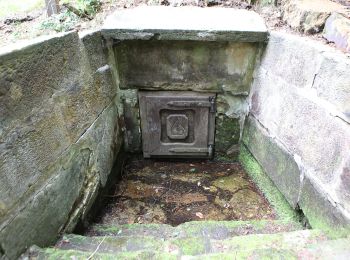
![Tour Zu Fuß Bad Staffelstein - Wanderweg Blaues Kreuz - Photo](https://media.geolcdn.com/t/350/260/ffb4c2e6-9461-4d78-be7a-d9d22ebcbff3.jpeg&format=jpg&maxdim=2)
![Zu Fuß Zu Fuß](https://static1.geolcdn.com/sitytour/trail-icons/100.png)
Km
Zu Fuß
![](/images/other/stat-length.png)
![](https://static1.geolcdn.com/siteimages/upload/files/1508320355ic_sort_den_pos_24dp.png)
![](https://static1.geolcdn.com/siteimages/upload/files/1508320355ic_sort_den_neg_24dp.png)
![](https://static1.geolcdn.com/siteimages/upload/files/16400158638029165_repeat_loop_refresh_sync_direction_icon.png)
• Trail created by Thüringerwald-Verein Coburg. Symbol: Blaues Kreuz wuf weißem Hintergrund
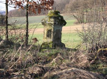
![Tour Zu Fuß Bad Staffelstein - Püchitzer Transversale - Photo](https://media.geolcdn.com/t/350/260/2c18bfb8-7274-45bb-9f1a-5a5b1071191d.jpeg&format=jpg&maxdim=2)
![Zu Fuß Zu Fuß](https://static1.geolcdn.com/sitytour/trail-icons/100.png)
Km
Zu Fuß
![](/images/other/stat-length.png)
![](https://static1.geolcdn.com/siteimages/upload/files/1508320355ic_sort_den_pos_24dp.png)
![](https://static1.geolcdn.com/siteimages/upload/files/1508320355ic_sort_den_neg_24dp.png)
![](https://static1.geolcdn.com/siteimages/upload/files/16400158638029165_repeat_loop_refresh_sync_direction_icon.png)
• Trail created by Landkreis Lichtenfels. Zwische Wanderwegweiser 34 (Storchenweg) und T 0271 unmarkiert Symbol: Gelb...

![Tour Zu Fuß Bad Staffelstein - Rundweg Wiesen - Photo](https://media.geolcdn.com/t/350/260/0d7d237d-ceea-4549-aed2-c6173d59919f.jpeg&format=jpg&maxdim=2)
![Zu Fuß Zu Fuß](https://static1.geolcdn.com/sitytour/trail-icons/100.png)
Km
Zu Fuß
![](/images/other/stat-length.png)
![](https://static1.geolcdn.com/siteimages/upload/files/1508320355ic_sort_den_pos_24dp.png)
![](https://static1.geolcdn.com/siteimages/upload/files/1508320355ic_sort_den_neg_24dp.png)
![](https://static1.geolcdn.com/siteimages/upload/files/16400158638029165_repeat_loop_refresh_sync_direction_icon.png)
• Symbol: Buchstabe A im Ring
![Tour Zu Fuß Bad Staffelstein - Höhenweg Eierberge - Photo](https://media.geolcdn.com/t/350/260/5c0eabad-c4e1-4989-be72-9ac603aecd6a.jpeg&format=jpg&maxdim=2)
![Zu Fuß Zu Fuß](https://static1.geolcdn.com/sitytour/trail-icons/100.png)
Km
Zu Fuß
![](/images/other/stat-length.png)
![](https://static1.geolcdn.com/siteimages/upload/files/1508320355ic_sort_den_pos_24dp.png)
![](https://static1.geolcdn.com/siteimages/upload/files/1508320355ic_sort_den_neg_24dp.png)
![](https://static1.geolcdn.com/siteimages/upload/files/16400158638029165_repeat_loop_refresh_sync_direction_icon.png)
• Symbol: Buchstabe B im Ring
![Tour Zu Fuß Bad Staffelstein - Rundweg Eierberge - Photo](https://media.geolcdn.com/t/350/260/5c0eabad-c4e1-4989-be72-9ac603aecd6a.jpeg&format=jpg&maxdim=2)
![Zu Fuß Zu Fuß](https://static1.geolcdn.com/sitytour/trail-icons/100.png)
Km
Zu Fuß
![](/images/other/stat-length.png)
![](https://static1.geolcdn.com/siteimages/upload/files/1508320355ic_sort_den_pos_24dp.png)
![](https://static1.geolcdn.com/siteimages/upload/files/1508320355ic_sort_den_neg_24dp.png)
![](https://static1.geolcdn.com/siteimages/upload/files/16400158638029165_repeat_loop_refresh_sync_direction_icon.png)
• Symbol: Buchstabe C im Ring
![Tour Zu Fuß Bad Staffelstein - Rundweg Nedensdorf - Photo](https://media.geolcdn.com/t/350/260/0d7d237d-ceea-4549-aed2-c6173d59919f.jpeg&format=jpg&maxdim=2)
![Zu Fuß Zu Fuß](https://static1.geolcdn.com/sitytour/trail-icons/100.png)
Km
Zu Fuß
![](/images/other/stat-length.png)
![](https://static1.geolcdn.com/siteimages/upload/files/1508320355ic_sort_den_pos_24dp.png)
![](https://static1.geolcdn.com/siteimages/upload/files/1508320355ic_sort_den_neg_24dp.png)
![](https://static1.geolcdn.com/siteimages/upload/files/16400158638029165_repeat_loop_refresh_sync_direction_icon.png)
• Symbol: Buchstabe D im Ring
![Tour Zu Fuß Bad Staffelstein - Rundweg Draisdorf - Photo](https://media.geolcdn.com/t/350/260/fe7ca50c-73e6-4322-9c79-2d13983beab7.jpeg&format=jpg&maxdim=2)
![Zu Fuß Zu Fuß](https://static1.geolcdn.com/sitytour/trail-icons/100.png)
Km
Zu Fuß
![](/images/other/stat-length.png)
![](https://static1.geolcdn.com/siteimages/upload/files/1508320355ic_sort_den_pos_24dp.png)
![](https://static1.geolcdn.com/siteimages/upload/files/1508320355ic_sort_den_neg_24dp.png)
![](https://static1.geolcdn.com/siteimages/upload/files/16400158638029165_repeat_loop_refresh_sync_direction_icon.png)
• Symbol: Buchstabe E im Ring
![Tour Zu Fuß Bad Staffelstein - Terrainkurweg 4 Bad Staffelstein - Photo](https://media.geolcdn.com/t/350/260/41b7c812-cbed-42e3-930f-677147ac3646.jpeg&format=jpg&maxdim=2)
![Zu Fuß Zu Fuß](https://static1.geolcdn.com/sitytour/trail-icons/100.png)
Km
Zu Fuß
![](/images/other/stat-length.png)
![](https://static1.geolcdn.com/siteimages/upload/files/1508320355ic_sort_den_pos_24dp.png)
![](https://static1.geolcdn.com/siteimages/upload/files/1508320355ic_sort_den_neg_24dp.png)
![](https://static1.geolcdn.com/siteimages/upload/files/16400158638029165_repeat_loop_refresh_sync_direction_icon.png)
• Trail created by Reha Lautergrund. Symbol: Rotes Herz, rote 4 und rotes Kreuz auf weißem Grund
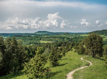
![Tour Zu Fuß Bad Staffelstein - Terrainkurweg 6 Bad Staffelstein - Photo](https://media.geolcdn.com/t/350/260/af69bf02-141a-40c4-aad6-cbdcaba6d4d5.jpeg&format=jpg&maxdim=2)
![Zu Fuß Zu Fuß](https://static1.geolcdn.com/sitytour/trail-icons/100.png)
Km
Zu Fuß
![](/images/other/stat-length.png)
![](https://static1.geolcdn.com/siteimages/upload/files/1508320355ic_sort_den_pos_24dp.png)
![](https://static1.geolcdn.com/siteimages/upload/files/1508320355ic_sort_den_neg_24dp.png)
![](https://static1.geolcdn.com/siteimages/upload/files/16400158638029165_repeat_loop_refresh_sync_direction_icon.png)
• Trail created by Reha Lautergrund. Symbol: Rotes Herz, rote 6 und rotes Kreuz auf weißem Grund
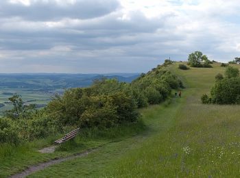
![Tour Zu Fuß Bad Staffelstein - Terrainkurweg 3 Bad Staffelstein - Photo](https://media.geolcdn.com/t/350/260/81ecf210-9ff3-4fd2-a3d9-7c06adc76cfd.jpeg&format=jpg&maxdim=2)
![Zu Fuß Zu Fuß](https://static1.geolcdn.com/sitytour/trail-icons/100.png)
Km
Zu Fuß
![](/images/other/stat-length.png)
![](https://static1.geolcdn.com/siteimages/upload/files/1508320355ic_sort_den_pos_24dp.png)
![](https://static1.geolcdn.com/siteimages/upload/files/1508320355ic_sort_den_neg_24dp.png)
![](https://static1.geolcdn.com/siteimages/upload/files/16400158638029165_repeat_loop_refresh_sync_direction_icon.png)
• Trail created by Reha Lautergrund. Symbol: Rotes Herz, rote 3 und rotes Kreuz auf weißem Grund
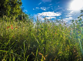
![Tour Zu Fuß Bad Staffelstein - Terrainkurweg 2 Bad Staffelstein - Photo](https://media.geolcdn.com/t/350/260/b70a278f-a97e-4d18-9357-aa47a9a9e191.jpeg&format=jpg&maxdim=2)
![Zu Fuß Zu Fuß](https://static1.geolcdn.com/sitytour/trail-icons/100.png)
Km
Zu Fuß
![](/images/other/stat-length.png)
![](https://static1.geolcdn.com/siteimages/upload/files/1508320355ic_sort_den_pos_24dp.png)
![](https://static1.geolcdn.com/siteimages/upload/files/1508320355ic_sort_den_neg_24dp.png)
![](https://static1.geolcdn.com/siteimages/upload/files/16400158638029165_repeat_loop_refresh_sync_direction_icon.png)
• Trail created by Reha Lautergrund. Symbol: Rotes Herz, rote 2 und rotes Kreuz auf weißem Grund
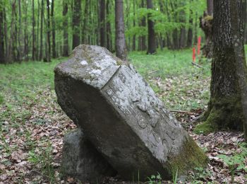
![Tour Zu Fuß Bad Staffelstein - Terrainkurweg 5 Bad Staffelstein - Photo](https://media.geolcdn.com/t/350/260/e0ad133a-15d8-4f55-9f99-74e767b6de26.jpeg&format=jpg&maxdim=2)
![Zu Fuß Zu Fuß](https://static1.geolcdn.com/sitytour/trail-icons/100.png)
Km
Zu Fuß
![](/images/other/stat-length.png)
![](https://static1.geolcdn.com/siteimages/upload/files/1508320355ic_sort_den_pos_24dp.png)
![](https://static1.geolcdn.com/siteimages/upload/files/1508320355ic_sort_den_neg_24dp.png)
![](https://static1.geolcdn.com/siteimages/upload/files/16400158638029165_repeat_loop_refresh_sync_direction_icon.png)
• Trail created by Reha Lautergrund. Symbol: Rotes Herz, rote 5 und rotes Kreuz auf weißem Grund
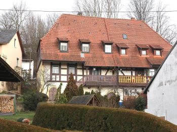
![Tour Zu Fuß Bad Staffelstein - Nedensdorf Eierbergweg - Photo](https://media.geolcdn.com/t/350/260/1b8be22a-c228-44b4-ae14-19a8d72d452f.jpeg&format=jpg&maxdim=2)
![Zu Fuß Zu Fuß](https://static1.geolcdn.com/sitytour/trail-icons/100.png)
Km
Zu Fuß
![](/images/other/stat-length.png)
![](https://static1.geolcdn.com/siteimages/upload/files/1508320355ic_sort_den_pos_24dp.png)
![](https://static1.geolcdn.com/siteimages/upload/files/1508320355ic_sort_den_neg_24dp.png)
![](https://static1.geolcdn.com/siteimages/upload/files/16400158638029165_repeat_loop_refresh_sync_direction_icon.png)
• Trail created by Landkreis Lichtenfels. Symbol: Roter Ring auf weißem Hintergrund
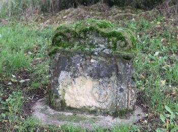
![Tour Zu Fuß Bad Staffelstein - Schönsreuther Weg - Photo](https://media.geolcdn.com/t/350/260/4fdd9397-2475-4bc3-b003-3bae4d53686f.jpeg&format=jpg&maxdim=2)
![Zu Fuß Zu Fuß](https://static1.geolcdn.com/sitytour/trail-icons/100.png)
Km
Zu Fuß
![](/images/other/stat-length.png)
![](https://static1.geolcdn.com/siteimages/upload/files/1508320355ic_sort_den_pos_24dp.png)
![](https://static1.geolcdn.com/siteimages/upload/files/1508320355ic_sort_den_neg_24dp.png)
![](https://static1.geolcdn.com/siteimages/upload/files/16400158638029165_repeat_loop_refresh_sync_direction_icon.png)
• Trail created by Landkreis Lichtenfels. Zwischen T 0252 und T 2097 unmarkiert Symbol: Gelber Strich auf weißem Hint...
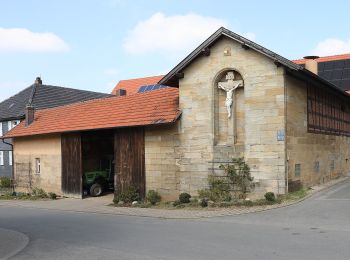
![Tour Zu Fuß Bad Staffelstein - Unterzettlitzer Maintalweg - Photo](https://media.geolcdn.com/t/350/260/dd4cd081-a9c1-4730-92c0-565c682410a2.jpeg&format=jpg&maxdim=2)
![Zu Fuß Zu Fuß](https://static1.geolcdn.com/sitytour/trail-icons/100.png)
Km
Zu Fuß
![](/images/other/stat-length.png)
![](https://static1.geolcdn.com/siteimages/upload/files/1508320355ic_sort_den_pos_24dp.png)
![](https://static1.geolcdn.com/siteimages/upload/files/1508320355ic_sort_den_neg_24dp.png)
![](https://static1.geolcdn.com/siteimages/upload/files/16400158638029165_repeat_loop_refresh_sync_direction_icon.png)
• Symbol: Senkrechter blauer Strich auf weißem Hintergrund
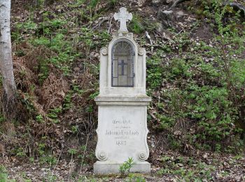
![Tour Zu Fuß Bad Staffelstein - Wiesener Eierbergweg - Photo](https://media.geolcdn.com/t/350/260/5c0eabad-c4e1-4989-be72-9ac603aecd6a.jpeg&format=jpg&maxdim=2)
![Zu Fuß Zu Fuß](https://static1.geolcdn.com/sitytour/trail-icons/100.png)
Km
Zu Fuß
![](/images/other/stat-length.png)
![](https://static1.geolcdn.com/siteimages/upload/files/1508320355ic_sort_den_pos_24dp.png)
![](https://static1.geolcdn.com/siteimages/upload/files/1508320355ic_sort_den_neg_24dp.png)
![](https://static1.geolcdn.com/siteimages/upload/files/16400158638029165_repeat_loop_refresh_sync_direction_icon.png)
• Trail created by Landkreis Lichtenfels. Symbol: Gelber Ring auf weißem Hintergrund
![Tour Zu Fuß Bad Staffelstein - Eierbergrundweg - Photo](https://media.geolcdn.com/t/350/260/5c0eabad-c4e1-4989-be72-9ac603aecd6a.jpeg&format=jpg&maxdim=2)
![Zu Fuß Zu Fuß](https://static1.geolcdn.com/sitytour/trail-icons/100.png)
Km
Zu Fuß
![](/images/other/stat-length.png)
![](https://static1.geolcdn.com/siteimages/upload/files/1508320355ic_sort_den_pos_24dp.png)
![](https://static1.geolcdn.com/siteimages/upload/files/1508320355ic_sort_den_neg_24dp.png)
![](https://static1.geolcdn.com/siteimages/upload/files/16400158638029165_repeat_loop_refresh_sync_direction_icon.png)
• Trail created by Landkreis Lichtenfels. Symbol: Blauer Ring auf weißem Hintergrund
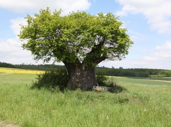
![Tour Zu Fuß Bad Staffelstein - Nedensdorfer Runde - Photo](https://media.geolcdn.com/t/350/260/a517d6b6-4861-4e33-82f1-cdc5679c97fd.jpeg&format=jpg&maxdim=2)
![Zu Fuß Zu Fuß](https://static1.geolcdn.com/sitytour/trail-icons/100.png)
Km
Zu Fuß
![](/images/other/stat-length.png)
![](https://static1.geolcdn.com/siteimages/upload/files/1508320355ic_sort_den_pos_24dp.png)
![](https://static1.geolcdn.com/siteimages/upload/files/1508320355ic_sort_den_neg_24dp.png)
![](https://static1.geolcdn.com/siteimages/upload/files/16400158638029165_repeat_loop_refresh_sync_direction_icon.png)
• Trail created by Landkreis Lichtenfels. Symbol: Grüner Ring auf weißem Hintergrund
![Tour Zu Fuß Bad Staffelstein - Keltenweg A - Photo](https://media.geolcdn.com/t/350/260/ffb4c2e6-9461-4d78-be7a-d9d22ebcbff3.jpeg&format=jpg&maxdim=2)
![Zu Fuß Zu Fuß](https://static1.geolcdn.com/sitytour/trail-icons/100.png)
Km
Zu Fuß
![](/images/other/stat-length.png)
![](https://static1.geolcdn.com/siteimages/upload/files/1508320355ic_sort_den_pos_24dp.png)
![](https://static1.geolcdn.com/siteimages/upload/files/1508320355ic_sort_den_neg_24dp.png)
![](https://static1.geolcdn.com/siteimages/upload/files/16400158638029165_repeat_loop_refresh_sync_direction_icon.png)
• Trail created by Landkreis Lichtenfels. Symbol: Keltisches Gefäß und Ammonit auf gelbem Hintergrund
![Tour Zu Fuß Bad Staffelstein - Banzrundweg - Photo](https://media.geolcdn.com/t/350/260/ffb4c2e6-9461-4d78-be7a-d9d22ebcbff3.jpeg&format=jpg&maxdim=2)
![Zu Fuß Zu Fuß](https://static1.geolcdn.com/sitytour/trail-icons/100.png)
Km
Zu Fuß
![](/images/other/stat-length.png)
![](https://static1.geolcdn.com/siteimages/upload/files/1508320355ic_sort_den_pos_24dp.png)
![](https://static1.geolcdn.com/siteimages/upload/files/1508320355ic_sort_den_neg_24dp.png)
![](https://static1.geolcdn.com/siteimages/upload/files/16400158638029165_repeat_loop_refresh_sync_direction_icon.png)
• Trail created by Landkreis Lichtenfels. Symbol: Blauer Balken auf weißem Hintergrund
20 Angezeigte Touren bei 48
Kostenlosegpshiking-Anwendung