![](/images/other/stat-length.png)
- Touren
- Outdoor
- Germany
- Bayern
- Landkreis Lichtenfels
- Weismain
Weismain, Landkreis Lichtenfels: Die besten Touren, Trails, Trecks und Wanderungen
Weismain : Entdecken Sie die besten Touren : 20 zu Fuß. Alle diese Touren, Trails, Routen und Outdoor-Aktivitäten sind in unseren SityTrail-Apps für Smartphones und Tablets verfügbar.
Die besten Spuren (20)
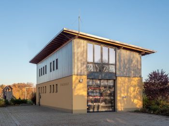
![Tour Zu Fuß Weismain - Kasendorf Rundweg Schwarzer Ring - Photo](https://media.geolcdn.com/t/350/260/e41fe585-4567-4410-8104-1fc901a53465.jpeg&format=jpg&maxdim=2)
![Zu Fuß Zu Fuß](https://static1.geolcdn.com/sitytour/trail-icons/100.png)
Km
Zu Fuß
![](/images/other/stat-length.png)
![](https://static1.geolcdn.com/siteimages/upload/files/1508320355ic_sort_den_pos_24dp.png)
![](https://static1.geolcdn.com/siteimages/upload/files/1508320355ic_sort_den_neg_24dp.png)
![](https://static1.geolcdn.com/siteimages/upload/files/16400158638029165_repeat_loop_refresh_sync_direction_icon.png)
• Trail created by Gemeinde Kasendorf. Symbol: Schwarzer Ring auf weißem Hintergrund
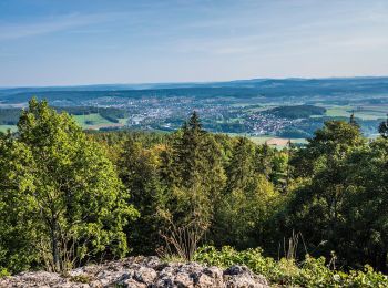
![Tour Zu Fuß Weismain - Kordigast Berglauf - Photo](https://media.geolcdn.com/t/350/260/10e893e5-cfed-43ab-93f5-81b7d4660065.jpeg&format=jpg&maxdim=2)
![Zu Fuß Zu Fuß](https://static1.geolcdn.com/sitytour/trail-icons/100.png)
Km
Zu Fuß
![](/images/other/stat-length.png)
![](https://static1.geolcdn.com/siteimages/upload/files/1508320355ic_sort_den_pos_24dp.png)
![](https://static1.geolcdn.com/siteimages/upload/files/1508320355ic_sort_den_neg_24dp.png)
![](https://static1.geolcdn.com/siteimages/upload/files/16400158638029165_repeat_loop_refresh_sync_direction_icon.png)
• Trail created by SC Weismain Berglauf-Team. Ausschilderung nur in Richtung Kordigast Symbol: Blauer Läufer auf weiß...
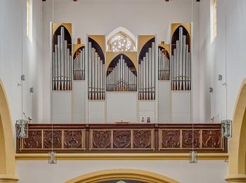
![Tour Zu Fuß Weismain - Adolf-Kolping-Gedächtnisweg - Photo](https://media.geolcdn.com/t/350/260/15c09da7-69f4-4b42-be9a-9900731faa43.jpeg&format=jpg&maxdim=2)
![Zu Fuß Zu Fuß](https://static1.geolcdn.com/sitytour/trail-icons/100.png)
Km
Zu Fuß
![](/images/other/stat-length.png)
![](https://static1.geolcdn.com/siteimages/upload/files/1508320355ic_sort_den_pos_24dp.png)
![](https://static1.geolcdn.com/siteimages/upload/files/1508320355ic_sort_den_neg_24dp.png)
![](https://static1.geolcdn.com/siteimages/upload/files/16400158638029165_repeat_loop_refresh_sync_direction_icon.png)
• Symbol: "Kolping-K" auf weißem Hintergrund mit Beschriftung
![Tour Zu Fuß Weismain - Kordigast-Rundweg (Altenkunstadt) - Photo](https://media.geolcdn.com/t/350/260/10e893e5-cfed-43ab-93f5-81b7d4660065.jpeg&format=jpg&maxdim=2)
![Zu Fuß Zu Fuß](https://static1.geolcdn.com/sitytour/trail-icons/100.png)
Km
Zu Fuß
![](/images/other/stat-length.png)
![](https://static1.geolcdn.com/siteimages/upload/files/1508320355ic_sort_den_pos_24dp.png)
![](https://static1.geolcdn.com/siteimages/upload/files/1508320355ic_sort_den_neg_24dp.png)
![](https://static1.geolcdn.com/siteimages/upload/files/16400158638029165_repeat_loop_refresh_sync_direction_icon.png)
• Trail created by Landkreis Lichtenfels. Symbol: Rotes K auf weißem Hintergrund
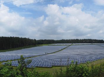
![Tour Zu Fuß Weismain - Zubringerweg Erhardsmühle - Buckendorf, auch Buckendorfer Weg - Photo](https://media.geolcdn.com/t/350/260/4a744e6e-ad3c-455c-a223-6c382462362d.jpeg&format=jpg&maxdim=2)
![Zu Fuß Zu Fuß](https://static1.geolcdn.com/sitytour/trail-icons/100.png)
Km
Zu Fuß
![](/images/other/stat-length.png)
![](https://static1.geolcdn.com/siteimages/upload/files/1508320355ic_sort_den_pos_24dp.png)
![](https://static1.geolcdn.com/siteimages/upload/files/1508320355ic_sort_den_neg_24dp.png)
![](https://static1.geolcdn.com/siteimages/upload/files/16400158638029165_repeat_loop_refresh_sync_direction_icon.png)
• Trail created by Landkreis Lichtenfels. Symbol: Gelbes Kreuz auf weißem Hintergrund
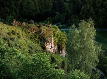
![Tour Zu Fuß Weismain - Rundweg Köttler Grund - Kaspauer - Photo](https://media.geolcdn.com/t/350/260/4888f4ca-981b-479a-b79f-905e39050d6a.jpeg&format=jpg&maxdim=2)
![Zu Fuß Zu Fuß](https://static1.geolcdn.com/sitytour/trail-icons/100.png)
Km
Zu Fuß
![](/images/other/stat-length.png)
![](https://static1.geolcdn.com/siteimages/upload/files/1508320355ic_sort_den_pos_24dp.png)
![](https://static1.geolcdn.com/siteimages/upload/files/1508320355ic_sort_den_neg_24dp.png)
![](https://static1.geolcdn.com/siteimages/upload/files/16400158638029165_repeat_loop_refresh_sync_direction_icon.png)
• Trail created by Landkreis Lichtenfels. Symbol: Grüner Ring auf weissem Hintergrund
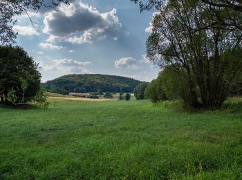
![Tour Zu Fuß Weismain - Kaspauer Rundweg - Photo](https://media.geolcdn.com/t/350/260/aeea06e2-8d1f-44ec-9b97-a5a83051285d.jpeg&format=jpg&maxdim=2)
![Zu Fuß Zu Fuß](https://static1.geolcdn.com/sitytour/trail-icons/100.png)
Km
Zu Fuß
![](/images/other/stat-length.png)
![](https://static1.geolcdn.com/siteimages/upload/files/1508320355ic_sort_den_pos_24dp.png)
![](https://static1.geolcdn.com/siteimages/upload/files/1508320355ic_sort_den_neg_24dp.png)
![](https://static1.geolcdn.com/siteimages/upload/files/16400158638029165_repeat_loop_refresh_sync_direction_icon.png)
• Trail created by Landkreis Lichtenfels. Symbol: Roter Ring auf weissem Hintergrund
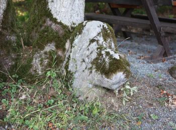
![Tour Zu Fuß Weismain - Fuchstrail - Photo](https://media.geolcdn.com/t/350/260/807ed965-4c0c-49fd-ae20-6b39427586c4.jpeg&format=jpg&maxdim=2)
![Zu Fuß Zu Fuß](https://static1.geolcdn.com/sitytour/trail-icons/100.png)
Km
Zu Fuß
![](/images/other/stat-length.png)
![](https://static1.geolcdn.com/siteimages/upload/files/1508320355ic_sort_den_pos_24dp.png)
![](https://static1.geolcdn.com/siteimages/upload/files/1508320355ic_sort_den_neg_24dp.png)
![](https://static1.geolcdn.com/siteimages/upload/files/16400158638029165_repeat_loop_refresh_sync_direction_icon.png)
• Trail created by Landkreis Lichtenfels. Symbol: Nordic Walker auf blauem Hintergrund
![Tour Zu Fuß Weismain - Kleiner Hüttenweg - Photo](https://media.geolcdn.com/t/350/260/807ed965-4c0c-49fd-ae20-6b39427586c4.jpeg&format=jpg&maxdim=2)
![Zu Fuß Zu Fuß](https://static1.geolcdn.com/sitytour/trail-icons/100.png)
Km
Zu Fuß
![](/images/other/stat-length.png)
![](https://static1.geolcdn.com/siteimages/upload/files/1508320355ic_sort_den_pos_24dp.png)
![](https://static1.geolcdn.com/siteimages/upload/files/1508320355ic_sort_den_neg_24dp.png)
![](https://static1.geolcdn.com/siteimages/upload/files/16400158638029165_repeat_loop_refresh_sync_direction_icon.png)
• Trail created by Landkreis Lichtenfels. Symbol: Nordic Walker auf gelbem Hintergrund
![Tour Zu Fuß Weismain - Korches-Trail - Photo](https://media.geolcdn.com/t/350/260/10e893e5-cfed-43ab-93f5-81b7d4660065.jpeg&format=jpg&maxdim=2)
![Zu Fuß Zu Fuß](https://static1.geolcdn.com/sitytour/trail-icons/100.png)
Km
Zu Fuß
![](/images/other/stat-length.png)
![](https://static1.geolcdn.com/siteimages/upload/files/1508320355ic_sort_den_pos_24dp.png)
![](https://static1.geolcdn.com/siteimages/upload/files/1508320355ic_sort_den_neg_24dp.png)
![](https://static1.geolcdn.com/siteimages/upload/files/16400158638029165_repeat_loop_refresh_sync_direction_icon.png)
• Trail created by Landkreis Lichtenfels. Symbol: Nordic Walker auf rosa Hintergrund
![Tour Zu Fuß Weismain - Pfauengrund Rundweg - Photo](https://media.geolcdn.com/t/350/260/2ba96625-3a7f-4ad4-96e8-8f16f5b0e2d1.jpeg&format=jpg&maxdim=2)
![Zu Fuß Zu Fuß](https://static1.geolcdn.com/sitytour/trail-icons/100.png)
Km
Zu Fuß
![](/images/other/stat-length.png)
![](https://static1.geolcdn.com/siteimages/upload/files/1508320355ic_sort_den_pos_24dp.png)
![](https://static1.geolcdn.com/siteimages/upload/files/1508320355ic_sort_den_neg_24dp.png)
![](https://static1.geolcdn.com/siteimages/upload/files/16400158638029165_repeat_loop_refresh_sync_direction_icon.png)
• Trail created by Landkreis Lichtenfels. Symbol: Weiße 7 zwischen zwei Punkten auf blauem Hintergrund
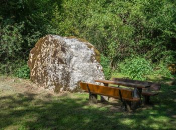
![Tour Zu Fuß Weismain - Frankenberg Rundweg - Photo](https://media.geolcdn.com/t/350/260/b21e7d74-a9ea-48b2-8b36-18cd3b6c67d0.jpeg&format=jpg&maxdim=2)
![Zu Fuß Zu Fuß](https://static1.geolcdn.com/sitytour/trail-icons/100.png)
Km
Zu Fuß
![](/images/other/stat-length.png)
![](https://static1.geolcdn.com/siteimages/upload/files/1508320355ic_sort_den_pos_24dp.png)
![](https://static1.geolcdn.com/siteimages/upload/files/1508320355ic_sort_den_neg_24dp.png)
![](https://static1.geolcdn.com/siteimages/upload/files/16400158638029165_repeat_loop_refresh_sync_direction_icon.png)
• Trail created by Landkreis Lichtenfels. Symbol: Weiße 6 zwischen zwei Punkten auf blauem Hintergrund
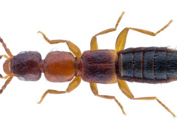
![Tour Zu Fuß Weismain - Görauer Weg - Photo](https://media.geolcdn.com/t/350/260/9c31327f-1c4f-4e19-87f6-64f16ed2c5ae.jpeg&format=jpg&maxdim=2)
![Zu Fuß Zu Fuß](https://static1.geolcdn.com/sitytour/trail-icons/100.png)
Km
Zu Fuß
![](/images/other/stat-length.png)
![](https://static1.geolcdn.com/siteimages/upload/files/1508320355ic_sort_den_pos_24dp.png)
![](https://static1.geolcdn.com/siteimages/upload/files/1508320355ic_sort_den_neg_24dp.png)
![](https://static1.geolcdn.com/siteimages/upload/files/16400158638029165_repeat_loop_refresh_sync_direction_icon.png)
• Trail created by Landkreis Lichtenfels. Symbol: Grüner Strich auf weißem Hintergrund
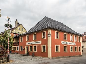
![Tour Zu Fuß Weismain - Lehrpfad Kalkberg (Weismain) - Photo](https://media.geolcdn.com/t/350/260/e198eac7-4622-4e79-adde-f1cd91d4967c.jpeg&format=jpg&maxdim=2)
![Zu Fuß Zu Fuß](https://static1.geolcdn.com/sitytour/trail-icons/100.png)
Km
Zu Fuß
![](/images/other/stat-length.png)
![](https://static1.geolcdn.com/siteimages/upload/files/1508320355ic_sort_den_pos_24dp.png)
![](https://static1.geolcdn.com/siteimages/upload/files/1508320355ic_sort_den_neg_24dp.png)
![](https://static1.geolcdn.com/siteimages/upload/files/16400158638029165_repeat_loop_refresh_sync_direction_icon.png)
• Trail created by Landkreis Lichtenfels. Symbol: Blauer Ring auf weißem Hintergrund
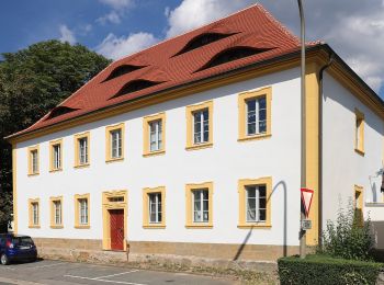
![Tour Zu Fuß Weismain - Großer Hüttenweg - Photo](https://media.geolcdn.com/t/350/260/ba6f3d50-d128-4d01-9811-d82c0dc1f592.jpeg&format=jpg&maxdim=2)
![Zu Fuß Zu Fuß](https://static1.geolcdn.com/sitytour/trail-icons/100.png)
Km
Zu Fuß
![](/images/other/stat-length.png)
![](https://static1.geolcdn.com/siteimages/upload/files/1508320355ic_sort_den_pos_24dp.png)
![](https://static1.geolcdn.com/siteimages/upload/files/1508320355ic_sort_den_neg_24dp.png)
![](https://static1.geolcdn.com/siteimages/upload/files/16400158638029165_repeat_loop_refresh_sync_direction_icon.png)
• Trail created by Landkreis Lichtenfels. Symbol: Nordic Walker auf rotem Hintergrund
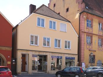
![Tour Zu Fuß Weismain - Naturlehrpfad (am Kalkberg, Weismain) - Photo](https://media.geolcdn.com/t/350/260/abe88478-95c7-46a9-b755-ad45dcfd9548.jpeg&format=jpg&maxdim=2)
![Zu Fuß Zu Fuß](https://static1.geolcdn.com/sitytour/trail-icons/100.png)
Km
Zu Fuß
![](/images/other/stat-length.png)
![](https://static1.geolcdn.com/siteimages/upload/files/1508320355ic_sort_den_pos_24dp.png)
![](https://static1.geolcdn.com/siteimages/upload/files/1508320355ic_sort_den_neg_24dp.png)
![](https://static1.geolcdn.com/siteimages/upload/files/16400158638029165_repeat_loop_refresh_sync_direction_icon.png)
• Trail created by Landkreis Lichtenfels. Symbol: Grüner Ring auf weißem Hintergrund
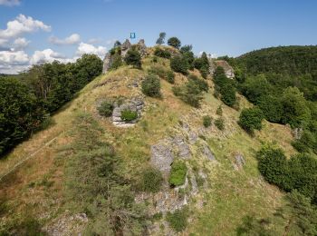
![Tour Zu Fuß Weismain - Bärentrail - Photo](https://media.geolcdn.com/t/350/260/9560ac03-52ca-4b2d-9ea7-713373dd3db0.jpeg&format=jpg&maxdim=2)
![Zu Fuß Zu Fuß](https://static1.geolcdn.com/sitytour/trail-icons/100.png)
Km
Zu Fuß
![](/images/other/stat-length.png)
![](https://static1.geolcdn.com/siteimages/upload/files/1508320355ic_sort_den_pos_24dp.png)
![](https://static1.geolcdn.com/siteimages/upload/files/1508320355ic_sort_den_neg_24dp.png)
![](https://static1.geolcdn.com/siteimages/upload/files/16400158638029165_repeat_loop_refresh_sync_direction_icon.png)
• Trail created by Landkreis Lichtenfels. Symbol: Nordic Walker auf grünem Hintergrund
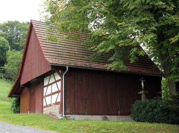
![Tour Zu Fuß Weismain - Bärental-Rundweg - Photo](https://media.geolcdn.com/t/350/260/fcfc30a1-325c-46f2-9702-968bbfd31f1d.jpeg&format=jpg&maxdim=2)
![Zu Fuß Zu Fuß](https://static1.geolcdn.com/sitytour/trail-icons/100.png)
Km
Zu Fuß
![](/images/other/stat-length.png)
![](https://static1.geolcdn.com/siteimages/upload/files/1508320355ic_sort_den_pos_24dp.png)
![](https://static1.geolcdn.com/siteimages/upload/files/1508320355ic_sort_den_neg_24dp.png)
![](https://static1.geolcdn.com/siteimages/upload/files/16400158638029165_repeat_loop_refresh_sync_direction_icon.png)
• Trail created by Landkreis Lichtenfels. Symbol: Weiße 3 zwischen zwei Punkten auf rotem Grund
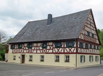
![Tour Zu Fuß Weismain - Arnsteiner Rundweg (Weismain) - Photo](https://media.geolcdn.com/t/350/260/9c5f164c-2217-4384-9bc7-ac82fe8b95d5.jpeg&format=jpg&maxdim=2)
![Zu Fuß Zu Fuß](https://static1.geolcdn.com/sitytour/trail-icons/100.png)
Km
Zu Fuß
![](/images/other/stat-length.png)
![](https://static1.geolcdn.com/siteimages/upload/files/1508320355ic_sort_den_pos_24dp.png)
![](https://static1.geolcdn.com/siteimages/upload/files/1508320355ic_sort_den_neg_24dp.png)
![](https://static1.geolcdn.com/siteimages/upload/files/16400158638029165_repeat_loop_refresh_sync_direction_icon.png)
• Trail created by Landkreis Lichtenfels. Symbol: Weiße 5 zwischen zwei Punkten auf rotem Hintergrund
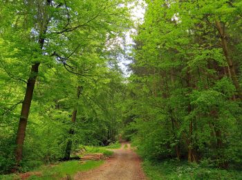
![Tour Zu Fuß Weismain - Lions-Weg (Weismain) - Photo](https://media.geolcdn.com/t/350/260/9706a272-6a9a-4669-aacd-d3bfd6cf93fd.jpeg&format=jpg&maxdim=2)
![Zu Fuß Zu Fuß](https://static1.geolcdn.com/sitytour/trail-icons/100.png)
Km
Zu Fuß
![](/images/other/stat-length.png)
![](https://static1.geolcdn.com/siteimages/upload/files/1508320355ic_sort_den_pos_24dp.png)
![](https://static1.geolcdn.com/siteimages/upload/files/1508320355ic_sort_den_neg_24dp.png)
![](https://static1.geolcdn.com/siteimages/upload/files/16400158638029165_repeat_loop_refresh_sync_direction_icon.png)
• Trail created by Landkreis Lichtenfels. Symbol: Weiße 4 zwischen zwei Punkten auf rotem Hintergrund
20 Angezeigte Touren bei 20
Kostenlosegpshiking-Anwendung