![](/images/other/stat-length.png)
Happurg, Landkreis Nürnberger Land: Die besten Touren, Trails, Trecks und Wanderungen
Happurg : Entdecken Sie die besten Touren : 15 zu Fuß. Alle diese Touren, Trails, Routen und Outdoor-Aktivitäten sind in unseren SityTrail-Apps für Smartphones und Tablets verfügbar.
Die besten Spuren (15)
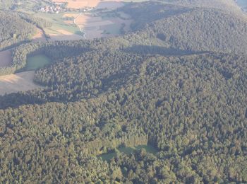
![Tour Zu Fuß Happurg - Happurg E.ON Bayern-Trail 2 - Photo](https://media.geolcdn.com/t/350/260/465de4e6-cf81-4e26-8466-93f70ba11869.jpeg&format=jpg&maxdim=2)
![Zu Fuß Zu Fuß](https://static1.geolcdn.com/sitytour/trail-icons/100.png)
Km
Zu Fuß
![](/images/other/stat-length.png)
![](https://static1.geolcdn.com/siteimages/upload/files/1508320355ic_sort_den_pos_24dp.png)
![](https://static1.geolcdn.com/siteimages/upload/files/1508320355ic_sort_den_neg_24dp.png)
![](https://static1.geolcdn.com/siteimages/upload/files/16400158638029165_repeat_loop_refresh_sync_direction_icon.png)
• Trail created by DSV nordic aktiv Zentrum Happurg. Symbol: t.b.d.
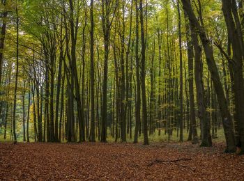
![Tour Zu Fuß Happurg - Happurg E.ON Bayern-Trail 1 - Photo](https://media.geolcdn.com/t/350/260/9a5da231-2d90-4d01-9b1a-17ff9cd9b7d6.jpeg&format=jpg&maxdim=2)
![Zu Fuß Zu Fuß](https://static1.geolcdn.com/sitytour/trail-icons/100.png)
Km
Zu Fuß
![](/images/other/stat-length.png)
![](https://static1.geolcdn.com/siteimages/upload/files/1508320355ic_sort_den_pos_24dp.png)
![](https://static1.geolcdn.com/siteimages/upload/files/1508320355ic_sort_den_neg_24dp.png)
![](https://static1.geolcdn.com/siteimages/upload/files/16400158638029165_repeat_loop_refresh_sync_direction_icon.png)
• Trail created by DSV nordic aktiv Zentrum Happurg. Symbol: t.b.d.
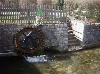
![Tour Zu Fuß Happurg - Happurg Bad Brückenauer Mineralwasser-Trail - Photo](https://media.geolcdn.com/t/350/260/8dde1503-8f93-441d-b8d1-0f2592b63883.jpeg&format=jpg&maxdim=2)
![Zu Fuß Zu Fuß](https://static1.geolcdn.com/sitytour/trail-icons/100.png)
Km
Zu Fuß
![](/images/other/stat-length.png)
![](https://static1.geolcdn.com/siteimages/upload/files/1508320355ic_sort_den_pos_24dp.png)
![](https://static1.geolcdn.com/siteimages/upload/files/1508320355ic_sort_den_neg_24dp.png)
![](https://static1.geolcdn.com/siteimages/upload/files/16400158638029165_repeat_loop_refresh_sync_direction_icon.png)
• Trail created by DSV nordic aktiv Zentrum Happurg. Symbol: t.b.d.
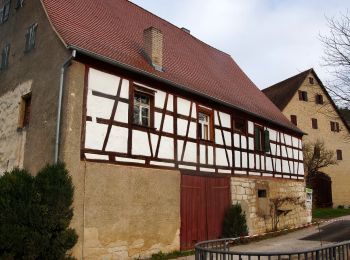
![Tour Zu Fuß Happurg - Happurg Haas Fertigbau-Trail - Photo](https://media.geolcdn.com/t/350/260/4feb4ff8-e3b8-4ad7-9095-07526436368f.jpeg&format=jpg&maxdim=2)
![Zu Fuß Zu Fuß](https://static1.geolcdn.com/sitytour/trail-icons/100.png)
Km
Zu Fuß
![](/images/other/stat-length.png)
![](https://static1.geolcdn.com/siteimages/upload/files/1508320355ic_sort_den_pos_24dp.png)
![](https://static1.geolcdn.com/siteimages/upload/files/1508320355ic_sort_den_neg_24dp.png)
![](https://static1.geolcdn.com/siteimages/upload/files/16400158638029165_repeat_loop_refresh_sync_direction_icon.png)
• Trail created by DSV nordic aktiv Zentrum Happurg. Symbol: t.b.d.
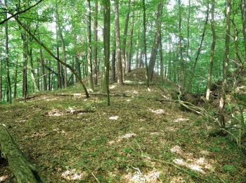
![Tour Zu Fuß Happurg - Rundwanderweg GEO - Photo](https://media.geolcdn.com/t/350/260/81c131f9-b30b-44f8-be5a-f2aa7e346c1a.jpeg&format=jpg&maxdim=2)
![Zu Fuß Zu Fuß](https://static1.geolcdn.com/sitytour/trail-icons/100.png)
Km
Zu Fuß
![](/images/other/stat-length.png)
![](https://static1.geolcdn.com/siteimages/upload/files/1508320355ic_sort_den_pos_24dp.png)
![](https://static1.geolcdn.com/siteimages/upload/files/1508320355ic_sort_den_neg_24dp.png)
![](https://static1.geolcdn.com/siteimages/upload/files/16400158638029165_repeat_loop_refresh_sync_direction_icon.png)
• Trail created by Gemeinde Happurg. geprüft (Dez. 2014, by cycling_zno) Symbol: Schwarzes Geo auf gelbem Grund
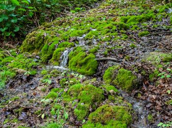
![Tour Zu Fuß Happurg - Happurg 10 - Photo](https://media.geolcdn.com/t/350/260/9c0b1fb4-89e4-4f66-80c5-2d9d09d91e73.jpeg&format=jpg&maxdim=2)
![Zu Fuß Zu Fuß](https://static1.geolcdn.com/sitytour/trail-icons/100.png)
Km
Zu Fuß
![](/images/other/stat-length.png)
![](https://static1.geolcdn.com/siteimages/upload/files/1508320355ic_sort_den_pos_24dp.png)
![](https://static1.geolcdn.com/siteimages/upload/files/1508320355ic_sort_den_neg_24dp.png)
![](https://static1.geolcdn.com/siteimages/upload/files/16400158638029165_repeat_loop_refresh_sync_direction_icon.png)
• Trail created by Gemeinde Happurg. geprüft (Dez. 2014, by cycling_zno) Symbol: Weiße 10 auf grünem Rechteck
![Tour Zu Fuß Happurg - Happurg 1 - Photo](https://media.geolcdn.com/t/350/260/81c131f9-b30b-44f8-be5a-f2aa7e346c1a.jpeg&format=jpg&maxdim=2)
![Zu Fuß Zu Fuß](https://static1.geolcdn.com/sitytour/trail-icons/100.png)
Km
Zu Fuß
![](/images/other/stat-length.png)
![](https://static1.geolcdn.com/siteimages/upload/files/1508320355ic_sort_den_pos_24dp.png)
![](https://static1.geolcdn.com/siteimages/upload/files/1508320355ic_sort_den_neg_24dp.png)
![](https://static1.geolcdn.com/siteimages/upload/files/16400158638029165_repeat_loop_refresh_sync_direction_icon.png)
• Trail created by Gemeinde Happurg. geprüft (Dez. 2014, by cycling_zno) Symbol: Weiße 1 auf grünem Rechteck
![Tour Zu Fuß Happurg - Happurg 4 - Photo](https://media.geolcdn.com/t/350/260/81c131f9-b30b-44f8-be5a-f2aa7e346c1a.jpeg&format=jpg&maxdim=2)
![Zu Fuß Zu Fuß](https://static1.geolcdn.com/sitytour/trail-icons/100.png)
Km
Zu Fuß
![](/images/other/stat-length.png)
![](https://static1.geolcdn.com/siteimages/upload/files/1508320355ic_sort_den_pos_24dp.png)
![](https://static1.geolcdn.com/siteimages/upload/files/1508320355ic_sort_den_neg_24dp.png)
![](https://static1.geolcdn.com/siteimages/upload/files/16400158638029165_repeat_loop_refresh_sync_direction_icon.png)
• Trail created by Gemeinde Happurg. geprüft (Dez. 2014, by cycling_zno) Symbol: Weiße 4 auf grünem Rechteck
![Tour Zu Fuß Happurg - Happurg 2 - Photo](https://media.geolcdn.com/t/350/260/81c131f9-b30b-44f8-be5a-f2aa7e346c1a.jpeg&format=jpg&maxdim=2)
![Zu Fuß Zu Fuß](https://static1.geolcdn.com/sitytour/trail-icons/100.png)
Km
Zu Fuß
![](/images/other/stat-length.png)
![](https://static1.geolcdn.com/siteimages/upload/files/1508320355ic_sort_den_pos_24dp.png)
![](https://static1.geolcdn.com/siteimages/upload/files/1508320355ic_sort_den_neg_24dp.png)
![](https://static1.geolcdn.com/siteimages/upload/files/16400158638029165_repeat_loop_refresh_sync_direction_icon.png)
• Trail created by Gemeinde Happurg. geprüft (Dez. 2014, by cycling_zno) Symbol: Weiße 2 auf grünem Rechteck
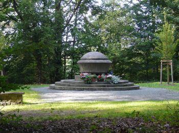
![Tour Zu Fuß Happurg - Happurg 8 - Photo](https://media.geolcdn.com/t/350/260/0ab9b67a-c28d-48a2-9156-40194df128a1.jpeg&format=jpg&maxdim=2)
![Zu Fuß Zu Fuß](https://static1.geolcdn.com/sitytour/trail-icons/100.png)
Km
Zu Fuß
![](/images/other/stat-length.png)
![](https://static1.geolcdn.com/siteimages/upload/files/1508320355ic_sort_den_pos_24dp.png)
![](https://static1.geolcdn.com/siteimages/upload/files/1508320355ic_sort_den_neg_24dp.png)
![](https://static1.geolcdn.com/siteimages/upload/files/16400158638029165_repeat_loop_refresh_sync_direction_icon.png)
• Trail created by Gemeinde Happurg. geprüft (Dez. 2014, by cycling_zno) Symbol: Weiße 8 auf grünem Rechteck
![Tour Zu Fuß Happurg - Happurg 7 - Photo](https://media.geolcdn.com/t/350/260/4feb4ff8-e3b8-4ad7-9095-07526436368f.jpeg&format=jpg&maxdim=2)
![Zu Fuß Zu Fuß](https://static1.geolcdn.com/sitytour/trail-icons/100.png)
Km
Zu Fuß
![](/images/other/stat-length.png)
![](https://static1.geolcdn.com/siteimages/upload/files/1508320355ic_sort_den_pos_24dp.png)
![](https://static1.geolcdn.com/siteimages/upload/files/1508320355ic_sort_den_neg_24dp.png)
![](https://static1.geolcdn.com/siteimages/upload/files/16400158638029165_repeat_loop_refresh_sync_direction_icon.png)
• Trail created by Gemeinde Happurg. geprüft (Dez. 2014, by cycling_zno) Symbol: Weiße 7 auf grünem Rechteck
![Tour Zu Fuß Happurg - Rundweg Happurg - Photo](https://media.geolcdn.com/t/350/260/8dde1503-8f93-441d-b8d1-0f2592b63883.jpeg&format=jpg&maxdim=2)
![Zu Fuß Zu Fuß](https://static1.geolcdn.com/sitytour/trail-icons/100.png)
Km
Zu Fuß
![](/images/other/stat-length.png)
![](https://static1.geolcdn.com/siteimages/upload/files/1508320355ic_sort_den_pos_24dp.png)
![](https://static1.geolcdn.com/siteimages/upload/files/1508320355ic_sort_den_neg_24dp.png)
![](https://static1.geolcdn.com/siteimages/upload/files/16400158638029165_repeat_loop_refresh_sync_direction_icon.png)
• Trail created by Fränkischer Albverein. complete small changes by cycling_zno Symbol: Grüner Punkt auf weißem Grund
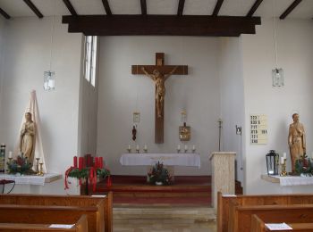
![Tour Zu Fuß Happurg - Engelthal -6- - Photo](https://media.geolcdn.com/t/350/260/efff14fc-fad6-456a-a55b-62fd245a578c.jpeg&format=jpg&maxdim=2)
![Zu Fuß Zu Fuß](https://static1.geolcdn.com/sitytour/trail-icons/100.png)
Km
Zu Fuß
![](/images/other/stat-length.png)
![](https://static1.geolcdn.com/siteimages/upload/files/1508320355ic_sort_den_pos_24dp.png)
![](https://static1.geolcdn.com/siteimages/upload/files/1508320355ic_sort_den_neg_24dp.png)
![](https://static1.geolcdn.com/siteimages/upload/files/16400158638029165_repeat_loop_refresh_sync_direction_icon.png)
• Trail created by Gemeinde Engelthal. geprüft (Dez. 2014 by cycling_zno) Symbol: Weiße 6 auf grünem Rechteck
![Tour Zu Fuß Happurg - Landkreislauf Nürnberger Land 2011 Etappe 1 - Photo](https://media.geolcdn.com/t/350/260/ext.jpg?maxdim=2&url=https%3A%2F%2Fstatic1.geolcdn.com%2Fsiteimages%2Fupload%2Ffiles%2F1545311037marcheuse_200dpi.jpg)
![Zu Fuß Zu Fuß](https://static1.geolcdn.com/sitytour/trail-icons/100.png)
Km
Zu Fuß
![](/images/other/stat-length.png)
![](https://static1.geolcdn.com/siteimages/upload/files/1508320355ic_sort_den_pos_24dp.png)
![](https://static1.geolcdn.com/siteimages/upload/files/1508320355ic_sort_den_neg_24dp.png)
![](https://static1.geolcdn.com/siteimages/upload/files/16400158638029165_repeat_loop_refresh_sync_direction_icon.png)
• Trail created by Landratsamt Nürnberg Land. tag by Wankmann Website: http://landkreislauf.de/
![Tour Zu Fuß Happurg - Rundweg Waller–Gaißberg - Photo](https://media.geolcdn.com/t/350/260/ext.jpg?maxdim=2&url=https%3A%2F%2Fstatic1.geolcdn.com%2Fsiteimages%2Fupload%2Ffiles%2F1545311037marcheuse_200dpi.jpg)
![Zu Fuß Zu Fuß](https://static1.geolcdn.com/sitytour/trail-icons/100.png)
Km
Zu Fuß
![](/images/other/stat-length.png)
![](https://static1.geolcdn.com/siteimages/upload/files/1508320355ic_sort_den_pos_24dp.png)
![](https://static1.geolcdn.com/siteimages/upload/files/1508320355ic_sort_den_neg_24dp.png)
![](https://static1.geolcdn.com/siteimages/upload/files/16400158638029165_repeat_loop_refresh_sync_direction_icon.png)
• Trail created by Alfeld. geprüft (Feb. 2015 by cycling_zno) Symbol: Weiße 7 auf rotem Grund
15 Angezeigte Touren bei 15
Kostenlosegpshiking-Anwendung