![](/images/other/stat-length.png)
- Touren
- Outdoor
- Germany
- Bayern
- Landkreis Nürnberger Land
- Pommelsbrunn
Pommelsbrunn, Landkreis Nürnberger Land: Die besten Touren, Trails, Trecks und Wanderungen
Pommelsbrunn : Entdecken Sie die besten Touren : 21 zu Fuß. Alle diese Touren, Trails, Routen und Outdoor-Aktivitäten sind in unseren SityTrail-Apps für Smartphones und Tablets verfügbar.
Die besten Spuren (21)
![Tour Zu Fuß Pommelsbrunn - 1000hmr - Photo](https://media.geolcdn.com/t/350/260/fecafec4-f503-48df-ae84-f1de1fe8dfa4.jpeg&format=jpg&maxdim=2)
![Zu Fuß Zu Fuß](https://static1.geolcdn.com/sitytour/trail-icons/100.png)
Km
Zu Fuß
![](/images/other/stat-length.png)
![](https://static1.geolcdn.com/siteimages/upload/files/1508320355ic_sort_den_pos_24dp.png)
![](https://static1.geolcdn.com/siteimages/upload/files/1508320355ic_sort_den_neg_24dp.png)
![](https://static1.geolcdn.com/siteimages/upload/files/16400158638029165_repeat_loop_refresh_sync_direction_icon.png)
• Symbol: 1000hmr in weißer Schrift auf rotem Grund
![Tour Zu Fuß Pommelsbrunn - 1000hmr Nordkette - Photo](https://media.geolcdn.com/t/350/260/fecafec4-f503-48df-ae84-f1de1fe8dfa4.jpeg&format=jpg&maxdim=2)
![Zu Fuß Zu Fuß](https://static1.geolcdn.com/sitytour/trail-icons/100.png)
Km
Zu Fuß
![](/images/other/stat-length.png)
![](https://static1.geolcdn.com/siteimages/upload/files/1508320355ic_sort_den_pos_24dp.png)
![](https://static1.geolcdn.com/siteimages/upload/files/1508320355ic_sort_den_neg_24dp.png)
![](https://static1.geolcdn.com/siteimages/upload/files/16400158638029165_repeat_loop_refresh_sync_direction_icon.png)
• Trail created by Naturfreunde Pommelsbrunn. geprüft (Feb. 2015 cy cycling_zno) Symbol: 1000hmr in weißer Schrift au...
![Tour Zu Fuß Pommelsbrunn - Mühlkoppe-Rundweg - Photo](https://media.geolcdn.com/t/350/260/fecafec4-f503-48df-ae84-f1de1fe8dfa4.jpeg&format=jpg&maxdim=2)
![Zu Fuß Zu Fuß](https://static1.geolcdn.com/sitytour/trail-icons/100.png)
Km
Zu Fuß
![](/images/other/stat-length.png)
![](https://static1.geolcdn.com/siteimages/upload/files/1508320355ic_sort_den_pos_24dp.png)
![](https://static1.geolcdn.com/siteimages/upload/files/1508320355ic_sort_den_neg_24dp.png)
![](https://static1.geolcdn.com/siteimages/upload/files/16400158638029165_repeat_loop_refresh_sync_direction_icon.png)
• Trail created by Naturfreunde Pommelsbrunn. geprüft (Jan. 2015 by cycling_zno) Symbol: Blaues M auf weißem Grund
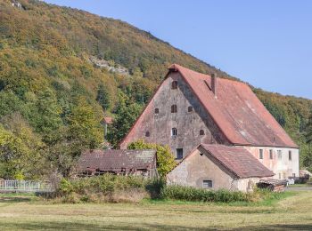
![Tour Zu Fuß Pommelsbrunn - 1000hmr Südkette - Photo](https://media.geolcdn.com/t/350/260/a867937d-2f3e-43c8-96b9-6035f3fbc10f.jpeg&format=jpg&maxdim=2)
![Zu Fuß Zu Fuß](https://static1.geolcdn.com/sitytour/trail-icons/100.png)
Km
Zu Fuß
![](/images/other/stat-length.png)
![](https://static1.geolcdn.com/siteimages/upload/files/1508320355ic_sort_den_pos_24dp.png)
![](https://static1.geolcdn.com/siteimages/upload/files/1508320355ic_sort_den_neg_24dp.png)
![](https://static1.geolcdn.com/siteimages/upload/files/16400158638029165_repeat_loop_refresh_sync_direction_icon.png)
• Trail created by Naturfreunde Pommelsbrunn. geprüft (Feb. 2015 by cycling_zno) Symbol: 1000hmr in weißer Schrift au...
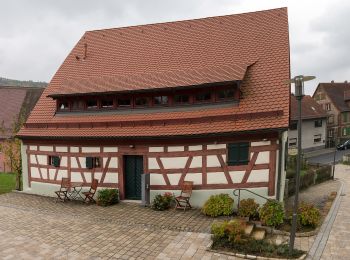
![Tour Zu Fuß Pommelsbrunn - Hunas-Rundweg um Pommelsbrunn - Photo](https://media.geolcdn.com/t/350/260/0365e444-b008-4c26-9fdf-e1d93055dd3c.jpeg&format=jpg&maxdim=2)
![Zu Fuß Zu Fuß](https://static1.geolcdn.com/sitytour/trail-icons/100.png)
Km
Zu Fuß
![](/images/other/stat-length.png)
![](https://static1.geolcdn.com/siteimages/upload/files/1508320355ic_sort_den_pos_24dp.png)
![](https://static1.geolcdn.com/siteimages/upload/files/1508320355ic_sort_den_neg_24dp.png)
![](https://static1.geolcdn.com/siteimages/upload/files/16400158638029165_repeat_loop_refresh_sync_direction_icon.png)
• Trail created by Naturfreunde Pommelsbrunn. geprüft (Jan. 2015 by cycling_zno) Symbol: Rote 1 auf weißem Grund
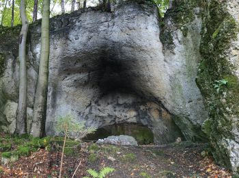
![Tour Zu Fuß Pommelsbrunn - Rundweg Claramühle-Ameisenberg - Photo](https://media.geolcdn.com/t/350/260/d360eb28-b8c1-4086-867d-2505c02ec43d.jpeg&format=jpg&maxdim=2)
![Zu Fuß Zu Fuß](https://static1.geolcdn.com/sitytour/trail-icons/100.png)
Km
Zu Fuß
![](/images/other/stat-length.png)
![](https://static1.geolcdn.com/siteimages/upload/files/1508320355ic_sort_den_pos_24dp.png)
![](https://static1.geolcdn.com/siteimages/upload/files/1508320355ic_sort_den_neg_24dp.png)
![](https://static1.geolcdn.com/siteimages/upload/files/16400158638029165_repeat_loop_refresh_sync_direction_icon.png)
• Trail created by Fränkischer Albverein. completed by cycling_zno Symbol: Roter Ring auf weißem Grund
![Tour Zu Fuß Pommelsbrunn - Hohenstadt Rundweg 5 - Eichhörnchen-Markierung - Photo](https://media.geolcdn.com/t/350/260/fecafec4-f503-48df-ae84-f1de1fe8dfa4.jpeg&format=jpg&maxdim=2)
![Zu Fuß Zu Fuß](https://static1.geolcdn.com/sitytour/trail-icons/100.png)
Km
Zu Fuß
![](/images/other/stat-length.png)
![](https://static1.geolcdn.com/siteimages/upload/files/1508320355ic_sort_den_pos_24dp.png)
![](https://static1.geolcdn.com/siteimages/upload/files/1508320355ic_sort_den_neg_24dp.png)
![](https://static1.geolcdn.com/siteimages/upload/files/16400158638029165_repeat_loop_refresh_sync_direction_icon.png)
• Trail created by Gemeinde Pommelsbrunn. geprüft (Jan. 2015 by cycling_zno) Symbol: schwarzes Eichhörnchen auf weiße...
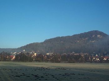
![Tour Zu Fuß Pommelsbrunn - Hohenstadt Rundweg 2 - Reh-Markierung - Photo](https://media.geolcdn.com/t/350/260/af9028fb-90a4-4121-bae2-28d9588b7dce.jpeg&format=jpg&maxdim=2)
![Zu Fuß Zu Fuß](https://static1.geolcdn.com/sitytour/trail-icons/100.png)
Km
Zu Fuß
![](/images/other/stat-length.png)
![](https://static1.geolcdn.com/siteimages/upload/files/1508320355ic_sort_den_pos_24dp.png)
![](https://static1.geolcdn.com/siteimages/upload/files/1508320355ic_sort_den_neg_24dp.png)
![](https://static1.geolcdn.com/siteimages/upload/files/16400158638029165_repeat_loop_refresh_sync_direction_icon.png)
• Trail created by Gemeinde Pommelsbrunn. geprüft (Jan. 2015 by cycling_zno) Symbol: schwarzes Reh auf weißen Grund
![Tour Zu Fuß Pommelsbrunn - Hohenstadt Rundweg 1 - Hasen-Markierung - Photo](https://media.geolcdn.com/t/350/260/af9028fb-90a4-4121-bae2-28d9588b7dce.jpeg&format=jpg&maxdim=2)
![Zu Fuß Zu Fuß](https://static1.geolcdn.com/sitytour/trail-icons/100.png)
Km
Zu Fuß
![](/images/other/stat-length.png)
![](https://static1.geolcdn.com/siteimages/upload/files/1508320355ic_sort_den_pos_24dp.png)
![](https://static1.geolcdn.com/siteimages/upload/files/1508320355ic_sort_den_neg_24dp.png)
![](https://static1.geolcdn.com/siteimages/upload/files/16400158638029165_repeat_loop_refresh_sync_direction_icon.png)
• Trail created by Gemeinde Pommelsbrunn. geprüft (Feb. 2015 by cycling_zno) Symbol: schwarzer Hase auf weißen Grund
![Tour Zu Fuß Pommelsbrunn - Högenbachtal-Rundweg - Photo](https://media.geolcdn.com/t/350/260/fecafec4-f503-48df-ae84-f1de1fe8dfa4.jpeg&format=jpg&maxdim=2)
![Zu Fuß Zu Fuß](https://static1.geolcdn.com/sitytour/trail-icons/100.png)
Km
Zu Fuß
![](/images/other/stat-length.png)
![](https://static1.geolcdn.com/siteimages/upload/files/1508320355ic_sort_den_pos_24dp.png)
![](https://static1.geolcdn.com/siteimages/upload/files/1508320355ic_sort_den_neg_24dp.png)
![](https://static1.geolcdn.com/siteimages/upload/files/16400158638029165_repeat_loop_refresh_sync_direction_icon.png)
• Trail created by Naturfreunde Pommelsbrunn. geprüft (Jan. 2015 by cycling_zno) Symbol: Grüner Kreis auf weißem Grund
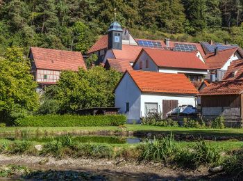
![Tour Zu Fuß Pommelsbrunn - Norissteig - Photo](https://media.geolcdn.com/t/350/260/0c817e5f-d725-4378-9a3e-9365f7f7b2d8.jpeg&format=jpg&maxdim=2)
![Zu Fuß Zu Fuß](https://static1.geolcdn.com/sitytour/trail-icons/100.png)
Km
Zu Fuß
![](/images/other/stat-length.png)
![](https://static1.geolcdn.com/siteimages/upload/files/1508320355ic_sort_den_pos_24dp.png)
![](https://static1.geolcdn.com/siteimages/upload/files/1508320355ic_sort_den_neg_24dp.png)
![](https://static1.geolcdn.com/siteimages/upload/files/16400158638029165_repeat_loop_refresh_sync_direction_icon.png)
• Trail created by DAV Sektion Noris. geprüft (Jan. 2015 by cycling_zno) Symbol: Roter Punkt auf weissem Grund
![Tour Zu Fuß Pommelsbrunn - Hochberg-Rundweg - Photo](https://media.geolcdn.com/t/350/260/fecafec4-f503-48df-ae84-f1de1fe8dfa4.jpeg&format=jpg&maxdim=2)
![Zu Fuß Zu Fuß](https://static1.geolcdn.com/sitytour/trail-icons/100.png)
Km
Zu Fuß
![](/images/other/stat-length.png)
![](https://static1.geolcdn.com/siteimages/upload/files/1508320355ic_sort_den_pos_24dp.png)
![](https://static1.geolcdn.com/siteimages/upload/files/1508320355ic_sort_den_neg_24dp.png)
![](https://static1.geolcdn.com/siteimages/upload/files/16400158638029165_repeat_loop_refresh_sync_direction_icon.png)
• Trail created by Naturfreunde Pommelsbrunn. geprüft (Jan. 2015 by cycling_zno) Symbol: Rotes H auf weißem Grund
![Tour Zu Fuß Pommelsbrunn - Pommelsbrunn–Arzlohe - Photo](https://media.geolcdn.com/t/350/260/fecafec4-f503-48df-ae84-f1de1fe8dfa4.jpeg&format=jpg&maxdim=2)
![Zu Fuß Zu Fuß](https://static1.geolcdn.com/sitytour/trail-icons/100.png)
Km
Zu Fuß
![](/images/other/stat-length.png)
![](https://static1.geolcdn.com/siteimages/upload/files/1508320355ic_sort_den_pos_24dp.png)
![](https://static1.geolcdn.com/siteimages/upload/files/1508320355ic_sort_den_neg_24dp.png)
![](https://static1.geolcdn.com/siteimages/upload/files/16400158638029165_repeat_loop_refresh_sync_direction_icon.png)
• Trail created by Naturfreunde Pommelsbrunn. geprüft (Jan. 2015 by cycling_zno) Symbol: Gelber Punkt auf weißem Grund
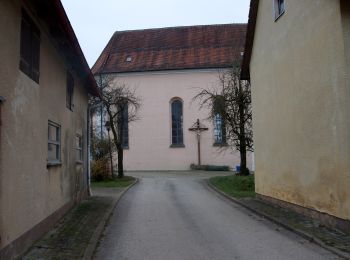
![Tour Zu Fuß Pommelsbrunn - Rundweg um Waizenfeld - Photo](https://media.geolcdn.com/t/350/260/9103e85b-082b-48de-82ce-a2683329981e.jpeg&format=jpg&maxdim=2)
![Zu Fuß Zu Fuß](https://static1.geolcdn.com/sitytour/trail-icons/100.png)
Km
Zu Fuß
![](/images/other/stat-length.png)
![](https://static1.geolcdn.com/siteimages/upload/files/1508320355ic_sort_den_pos_24dp.png)
![](https://static1.geolcdn.com/siteimages/upload/files/1508320355ic_sort_den_neg_24dp.png)
![](https://static1.geolcdn.com/siteimages/upload/files/16400158638029165_repeat_loop_refresh_sync_direction_icon.png)
• Trail created by Fränkischer Albverein. Symbol: Roter Ring auf weißem Grund
![Tour Zu Fuß Pommelsbrunn - Zankelstein-Rundweg II - Photo](https://media.geolcdn.com/t/350/260/fecafec4-f503-48df-ae84-f1de1fe8dfa4.jpeg&format=jpg&maxdim=2)
![Zu Fuß Zu Fuß](https://static1.geolcdn.com/sitytour/trail-icons/100.png)
Km
Zu Fuß
![](/images/other/stat-length.png)
![](https://static1.geolcdn.com/siteimages/upload/files/1508320355ic_sort_den_pos_24dp.png)
![](https://static1.geolcdn.com/siteimages/upload/files/1508320355ic_sort_den_neg_24dp.png)
![](https://static1.geolcdn.com/siteimages/upload/files/16400158638029165_repeat_loop_refresh_sync_direction_icon.png)
• Trail created by Naturfreunde Pommelsbrunn. geprüft (Jan. 2015 by cycling_zno) Symbol: blaues Z auf weißem Grund
![Tour Zu Fuß Pommelsbrunn - Zankelstein-Rundweg I - Photo](https://media.geolcdn.com/t/350/260/fecafec4-f503-48df-ae84-f1de1fe8dfa4.jpeg&format=jpg&maxdim=2)
![Zu Fuß Zu Fuß](https://static1.geolcdn.com/sitytour/trail-icons/100.png)
Km
Zu Fuß
![](/images/other/stat-length.png)
![](https://static1.geolcdn.com/siteimages/upload/files/1508320355ic_sort_den_pos_24dp.png)
![](https://static1.geolcdn.com/siteimages/upload/files/1508320355ic_sort_den_neg_24dp.png)
![](https://static1.geolcdn.com/siteimages/upload/files/16400158638029165_repeat_loop_refresh_sync_direction_icon.png)
• Trail created by Naturfreunde Pommelsbrunn. geprüft (Jan. 2015 by cycling_zno) Symbol: rotes Z auf weißem Grund
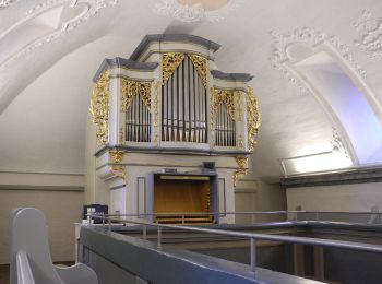
![Tour Zu Fuß Pommelsbrunn - Eschenbacher Rundweg - Photo](https://media.geolcdn.com/t/350/260/103b3de0-71bc-4e64-90fb-cd1c7ff0576c.jpeg&format=jpg&maxdim=2)
![Zu Fuß Zu Fuß](https://static1.geolcdn.com/sitytour/trail-icons/100.png)
Km
Zu Fuß
![](/images/other/stat-length.png)
![](https://static1.geolcdn.com/siteimages/upload/files/1508320355ic_sort_den_pos_24dp.png)
![](https://static1.geolcdn.com/siteimages/upload/files/1508320355ic_sort_den_neg_24dp.png)
![](https://static1.geolcdn.com/siteimages/upload/files/16400158638029165_repeat_loop_refresh_sync_direction_icon.png)
• Trail created by Naturfreunde Pommelsbrunn. geprüft (Jan. 2015 by cycling_zno) Symbol: Roter Ring auf weißem Grund
![Tour Zu Fuß Pommelsbrunn - Pommelsbrunn–Burgruine Lichtenstein–Pommelsbrunn - Photo](https://media.geolcdn.com/t/350/260/fecafec4-f503-48df-ae84-f1de1fe8dfa4.jpeg&format=jpg&maxdim=2)
![Zu Fuß Zu Fuß](https://static1.geolcdn.com/sitytour/trail-icons/100.png)
Km
Zu Fuß
![](/images/other/stat-length.png)
![](https://static1.geolcdn.com/siteimages/upload/files/1508320355ic_sort_den_pos_24dp.png)
![](https://static1.geolcdn.com/siteimages/upload/files/1508320355ic_sort_den_neg_24dp.png)
![](https://static1.geolcdn.com/siteimages/upload/files/16400158638029165_repeat_loop_refresh_sync_direction_icon.png)
• Trail created by Naturfreunde Pommelsbrunn. geprüft (Jan. 2015 by cycling_zno) Symbol: Grüner Punkt auf weißem Grund
![Tour Zu Fuß Pommelsbrunn - Kreuzbergrundweg - Photo](https://media.geolcdn.com/t/350/260/fecafec4-f503-48df-ae84-f1de1fe8dfa4.jpeg&format=jpg&maxdim=2)
![Zu Fuß Zu Fuß](https://static1.geolcdn.com/sitytour/trail-icons/100.png)
Km
Zu Fuß
![](/images/other/stat-length.png)
![](https://static1.geolcdn.com/siteimages/upload/files/1508320355ic_sort_den_pos_24dp.png)
![](https://static1.geolcdn.com/siteimages/upload/files/1508320355ic_sort_den_neg_24dp.png)
![](https://static1.geolcdn.com/siteimages/upload/files/16400158638029165_repeat_loop_refresh_sync_direction_icon.png)
• Trail created by Naturfreunde Pommelsbrunn. geprüft (Jan. 2015 by cycling_zno) Symbol: Rotes K auf weissem Grund
![Tour Zu Fuß Pommelsbrunn - Höhenrundweg - Photo](https://media.geolcdn.com/t/350/260/fecafec4-f503-48df-ae84-f1de1fe8dfa4.jpeg&format=jpg&maxdim=2)
![Zu Fuß Zu Fuß](https://static1.geolcdn.com/sitytour/trail-icons/100.png)
Km
Zu Fuß
![](/images/other/stat-length.png)
![](https://static1.geolcdn.com/siteimages/upload/files/1508320355ic_sort_den_pos_24dp.png)
![](https://static1.geolcdn.com/siteimages/upload/files/1508320355ic_sort_den_neg_24dp.png)
![](https://static1.geolcdn.com/siteimages/upload/files/16400158638029165_repeat_loop_refresh_sync_direction_icon.png)
• Trail created by Naturfreunde Pommelsbrunn. geprüft (Jan. 2015 by cycling_zno) Symbol: Weisser Kreis auf rotem Grund
20 Angezeigte Touren bei 21
Kostenlosegpshiking-Anwendung