


3,4 km | 4,3 km-effort
Albula : Entdecken Sie die besten Touren : 36 zu Fuß und 6 mit dem Fahrrad oder Mountainbike. Alle diese Touren, Trails, Routen und Outdoor-Aktivitäten sind in unseren SityTrail-Apps für Smartphones und Tablets verfügbar.
Zu Fuß


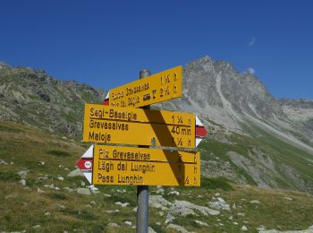
• Symbol: weiss-rot-weiss
Zu Fuß
• Symbol: weiss-rot-weiss
Zu Fuß
• Symbol: weiss-rot-weiss
Zu Fuß
• Club Alpino Italiano Sezione di SEREGNO
Zu Fuß
• Monstein - Jenisberg Symbol: weiss-rot-weiss

Zu Fuß
• Muldain-Siedlung Albula Symbol: weiss-rot-weiss
Zu Fuß
• Alvaschein-Muldain Symbol: weiss-rot-weiss
Zu Fuß
• Tiefencastel-Alvaschein Symbol: gelbe Raute

Zu Fuß
• Trail created by BAW Bündner Wanderwege. Symbol: weiss-rot-weiss
Zu Fuß
• Station Stuls-Bellaluna Symbol: weiss-rot-weiss
Zu Fuß
• Bergün-Stuls Station Symbol: weiss-rot-weiss
Zu Fuß
• Symbol: weiss-rot-weiss
Zu Fuß
• Der Bahnerlebnisweg Albula führt entlang dem UNESCO Welterbe RhB von Preda nach Bergün und weiter nach Filisur – vorb...
Zu Fuß
Zu Fuß
• Pass da Sett-Maroz Dora Symbol: weiss-rot-weiss

Zu Fuß
• Trail created by BAW Bündner Wanderwege. Symbol: weiss-rot-weiss
Zu Fuß
• Symbol: weiss-rot-weiss

Wandern
•

Mountainbike
•
Mountainbike
•
20 Angezeigte Touren bei 50
Kostenlosegpshiking-Anwendung
 SityTrail
IGN / Geografische Institute
SityTrail World
Die Welt öffnet sich für Sie