![](/images/other/stat-length.png)
- Touren
- Outdoor
- Switzerland
- Zürich
- Bezirk Meilen
Bezirk Meilen, Zürich: Die besten Touren, Trails, Trecks und Wanderungen
Bezirk Meilen : Entdecken Sie die besten Touren : 32 zu Fuß und 1 mit dem Fahrrad oder Mountainbike. Alle diese Touren, Trails, Routen und Outdoor-Aktivitäten sind in unseren SityTrail-Apps für Smartphones und Tablets verfügbar.
Die besten Spuren (36)
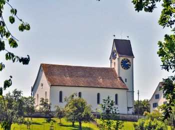
![Tour Zu Fuß Meilen - Meilen Schiff - Oetwil - Photo](https://media.geolcdn.com/t/350/260/4293bfca-bb27-491c-a61c-7dc32b369462.jpeg&format=jpg&maxdim=2)
![Zu Fuß Zu Fuß](https://static1.geolcdn.com/sitytour/trail-icons/100.png)
Km
Zu Fuß
![](/images/other/stat-length.png)
![](https://static1.geolcdn.com/siteimages/upload/files/1508320355ic_sort_den_pos_24dp.png)
![](https://static1.geolcdn.com/siteimages/upload/files/1508320355ic_sort_den_neg_24dp.png)
![](https://static1.geolcdn.com/siteimages/upload/files/16400158638029165_repeat_loop_refresh_sync_direction_icon.png)
• Trail created by Zürcher Wanderwege ZAW. Symbol: gelbe Raute
![Tour Zu Fuß Küsnacht - Forch - Rehalp - Photo](https://media.geolcdn.com/t/350/260/a27889fe-d744-4d2a-aff3-0d5b812d5ed1.jpeg&format=jpg&maxdim=2)
![Zu Fuß Zu Fuß](https://static1.geolcdn.com/sitytour/trail-icons/100.png)
Km
Zu Fuß
![](/images/other/stat-length.png)
![](https://static1.geolcdn.com/siteimages/upload/files/1508320355ic_sort_den_pos_24dp.png)
![](https://static1.geolcdn.com/siteimages/upload/files/1508320355ic_sort_den_neg_24dp.png)
![](https://static1.geolcdn.com/siteimages/upload/files/16400158638029165_repeat_loop_refresh_sync_direction_icon.png)
• Trail created by Zürcher Wanderwege ZAW. Symbol: gelbe Raute
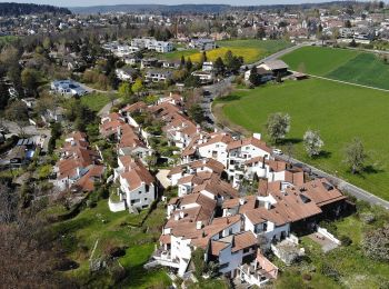
![Tour Zu Fuß Erlenbach (ZH) - Erlenbach Schiff - Maur Schifflände - Photo](https://media.geolcdn.com/t/350/260/d54a1003-c760-4651-b1cf-e1d93f22f776.jpeg&format=jpg&maxdim=2)
![Zu Fuß Zu Fuß](https://static1.geolcdn.com/sitytour/trail-icons/100.png)
Km
Zu Fuß
![](/images/other/stat-length.png)
![](https://static1.geolcdn.com/siteimages/upload/files/1508320355ic_sort_den_pos_24dp.png)
![](https://static1.geolcdn.com/siteimages/upload/files/1508320355ic_sort_den_neg_24dp.png)
![](https://static1.geolcdn.com/siteimages/upload/files/16400158638029165_repeat_loop_refresh_sync_direction_icon.png)
• Trail created by Zürcher Wanderwege ZAW. Symbol: gelbe Raute
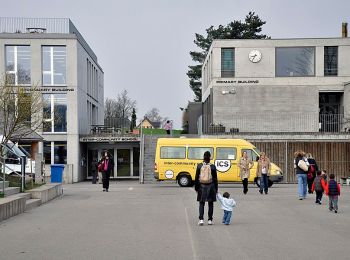
![Tour Zu Fuß Küsnacht - Forch - Burgwis - Photo](https://media.geolcdn.com/t/350/260/b225d131-3ae4-4c0e-821b-e44bc3ac6514.jpeg&format=jpg&maxdim=2)
![Zu Fuß Zu Fuß](https://static1.geolcdn.com/sitytour/trail-icons/100.png)
Km
Zu Fuß
![](/images/other/stat-length.png)
![](https://static1.geolcdn.com/siteimages/upload/files/1508320355ic_sort_den_pos_24dp.png)
![](https://static1.geolcdn.com/siteimages/upload/files/1508320355ic_sort_den_neg_24dp.png)
![](https://static1.geolcdn.com/siteimages/upload/files/16400158638029165_repeat_loop_refresh_sync_direction_icon.png)
• Trail created by Zürcher Wanderwege ZAW. Symbol: gelbe Raute
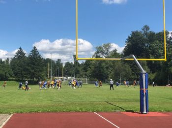
![Tour Zu Fuß Küsnacht - Forch - Witikon - Photo](https://media.geolcdn.com/t/350/260/3959a9c0-37a5-4486-8fb4-30169713683f.jpeg&format=jpg&maxdim=2)
![Zu Fuß Zu Fuß](https://static1.geolcdn.com/sitytour/trail-icons/100.png)
Km
Zu Fuß
![](/images/other/stat-length.png)
![](https://static1.geolcdn.com/siteimages/upload/files/1508320355ic_sort_den_pos_24dp.png)
![](https://static1.geolcdn.com/siteimages/upload/files/1508320355ic_sort_den_neg_24dp.png)
![](https://static1.geolcdn.com/siteimages/upload/files/16400158638029165_repeat_loop_refresh_sync_direction_icon.png)
• Trail created by Zürcher Wanderwege ZAW. Symbol: gelbe Raute
![Tour Zu Fuß Küsnacht - Forch - Fällanden - Photo](https://media.geolcdn.com/t/350/260/8d1ca4ea-f7d1-4712-8ac8-810aaf7a1e9f.jpeg&format=jpg&maxdim=2)
![Zu Fuß Zu Fuß](https://static1.geolcdn.com/sitytour/trail-icons/100.png)
Km
Zu Fuß
![](/images/other/stat-length.png)
![](https://static1.geolcdn.com/siteimages/upload/files/1508320355ic_sort_den_pos_24dp.png)
![](https://static1.geolcdn.com/siteimages/upload/files/1508320355ic_sort_den_neg_24dp.png)
![](https://static1.geolcdn.com/siteimages/upload/files/16400158638029165_repeat_loop_refresh_sync_direction_icon.png)
• Trail created by Zürcher Wanderwege ZAW. Symbol: gelbe Raute
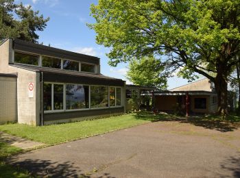
![Tour Zu Fuß Küsnacht - Forch - Fluntern - Photo](https://media.geolcdn.com/t/350/260/0f32c7a2-030a-4c98-a1ae-af1bbafc2274.jpeg&format=jpg&maxdim=2)
![Zu Fuß Zu Fuß](https://static1.geolcdn.com/sitytour/trail-icons/100.png)
Km
Zu Fuß
![](/images/other/stat-length.png)
![](https://static1.geolcdn.com/siteimages/upload/files/1508320355ic_sort_den_pos_24dp.png)
![](https://static1.geolcdn.com/siteimages/upload/files/1508320355ic_sort_den_neg_24dp.png)
![](https://static1.geolcdn.com/siteimages/upload/files/16400158638029165_repeat_loop_refresh_sync_direction_icon.png)
• Trail created by Zürcher Wanderwege ZAW. Symbol: gelbe Raute
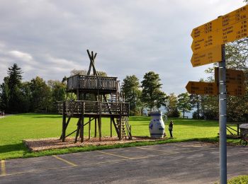
![Tour Zu Fuß Herrliberg - Wetzwil - Pfannenstiel Hochwacht - Photo](https://media.geolcdn.com/t/350/260/f7a0985e-b202-4377-9125-981b2420fa8c.jpeg&format=jpg&maxdim=2)
![Zu Fuß Zu Fuß](https://static1.geolcdn.com/sitytour/trail-icons/100.png)
Km
Zu Fuß
![](/images/other/stat-length.png)
![](https://static1.geolcdn.com/siteimages/upload/files/1508320355ic_sort_den_pos_24dp.png)
![](https://static1.geolcdn.com/siteimages/upload/files/1508320355ic_sort_den_neg_24dp.png)
![](https://static1.geolcdn.com/siteimages/upload/files/16400158638029165_repeat_loop_refresh_sync_direction_icon.png)
• Trail created by Zürcher Wanderwege. Symbol: gelbe Raute
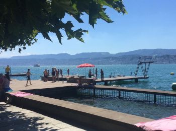
![Tour Zu Fuß Zollikon - Zollikon - Zollikerberg - Photo](https://media.geolcdn.com/t/350/260/fd61f6e3-a451-4a00-a435-548c7b7c55d7.jpeg&format=jpg&maxdim=2)
![Zu Fuß Zu Fuß](https://static1.geolcdn.com/sitytour/trail-icons/100.png)
Km
Zu Fuß
![](/images/other/stat-length.png)
![](https://static1.geolcdn.com/siteimages/upload/files/1508320355ic_sort_den_pos_24dp.png)
![](https://static1.geolcdn.com/siteimages/upload/files/1508320355ic_sort_den_neg_24dp.png)
![](https://static1.geolcdn.com/siteimages/upload/files/16400158638029165_repeat_loop_refresh_sync_direction_icon.png)
• Trail created by Zürcher Wanderwege. Symbol: gelbe Raute
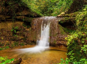
![Tour Zu Fuß Meilen - Herrliberg Feldmeilen (Bahnhof) - Toggwil - Photo](https://media.geolcdn.com/t/350/260/20181e3d-d312-48de-a5ba-65244c75053c.jpeg&format=jpg&maxdim=2)
![Zu Fuß Zu Fuß](https://static1.geolcdn.com/sitytour/trail-icons/100.png)
Km
Zu Fuß
![](/images/other/stat-length.png)
![](https://static1.geolcdn.com/siteimages/upload/files/1508320355ic_sort_den_pos_24dp.png)
![](https://static1.geolcdn.com/siteimages/upload/files/1508320355ic_sort_den_neg_24dp.png)
![](https://static1.geolcdn.com/siteimages/upload/files/16400158638029165_repeat_loop_refresh_sync_direction_icon.png)
• Trail created by Zürcher Wanderwege. Symbol: gelbe Raute
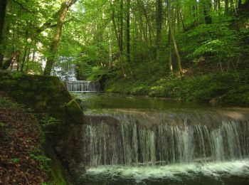
![Tour Zu Fuß Küsnacht - Küsnachter Tobel - Blüemlisalp - Photo](https://media.geolcdn.com/t/350/260/68a683c6-d3b7-4e88-9db9-b66aa2c3770b.jpeg&format=jpg&maxdim=2)
![Zu Fuß Zu Fuß](https://static1.geolcdn.com/sitytour/trail-icons/100.png)
Km
Zu Fuß
![](/images/other/stat-length.png)
![](https://static1.geolcdn.com/siteimages/upload/files/1508320355ic_sort_den_pos_24dp.png)
![](https://static1.geolcdn.com/siteimages/upload/files/1508320355ic_sort_den_neg_24dp.png)
![](https://static1.geolcdn.com/siteimages/upload/files/16400158638029165_repeat_loop_refresh_sync_direction_icon.png)
• Trail created by Zürcher Wanderwege. Symbol: gelbe Raute
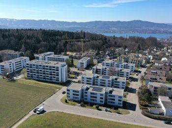
![Tour Zu Fuß Zollikon - Waldburg Station - Waltikon - Photo](https://media.geolcdn.com/t/350/260/d54221ca-d243-4468-b3d7-72e301ea97f4.jpeg&format=jpg&maxdim=2)
![Zu Fuß Zu Fuß](https://static1.geolcdn.com/sitytour/trail-icons/100.png)
Km
Zu Fuß
![](/images/other/stat-length.png)
![](https://static1.geolcdn.com/siteimages/upload/files/1508320355ic_sort_den_pos_24dp.png)
![](https://static1.geolcdn.com/siteimages/upload/files/1508320355ic_sort_den_neg_24dp.png)
![](https://static1.geolcdn.com/siteimages/upload/files/16400158638029165_repeat_loop_refresh_sync_direction_icon.png)
• Trail created by Züricher Wanderwege. Symbol: gelbe Raute
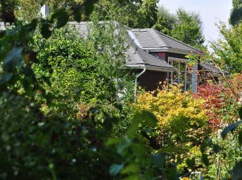
![Tour Zu Fuß Küsnacht - Schübelweiher - Zumikon - Photo](https://media.geolcdn.com/t/350/260/4a3319c4-e621-4ece-89ea-2c8f30dd1361.jpeg&format=jpg&maxdim=2)
![Zu Fuß Zu Fuß](https://static1.geolcdn.com/sitytour/trail-icons/100.png)
Km
Zu Fuß
![](/images/other/stat-length.png)
![](https://static1.geolcdn.com/siteimages/upload/files/1508320355ic_sort_den_pos_24dp.png)
![](https://static1.geolcdn.com/siteimages/upload/files/1508320355ic_sort_den_neg_24dp.png)
![](https://static1.geolcdn.com/siteimages/upload/files/16400158638029165_repeat_loop_refresh_sync_direction_icon.png)
• Trail created by Zürcher Wanderwege. Symbol: gelbe Raute
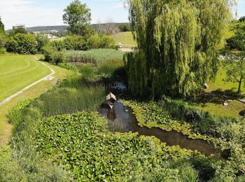
![Tour Zu Fuß Zumikon - Waltikon - Wehrmännerdenkmal - Photo](https://media.geolcdn.com/t/350/260/d8262e23-35ba-4984-b1f2-8b081a7cf638.jpeg&format=jpg&maxdim=2)
![Zu Fuß Zu Fuß](https://static1.geolcdn.com/sitytour/trail-icons/100.png)
Km
Zu Fuß
![](/images/other/stat-length.png)
![](https://static1.geolcdn.com/siteimages/upload/files/1508320355ic_sort_den_pos_24dp.png)
![](https://static1.geolcdn.com/siteimages/upload/files/1508320355ic_sort_den_neg_24dp.png)
![](https://static1.geolcdn.com/siteimages/upload/files/16400158638029165_repeat_loop_refresh_sync_direction_icon.png)
• Trail created by Zürcher Wanderwege. Symbol: gelbe Raute
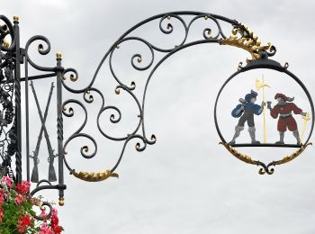
![Tour Zu Fuß Stäfa - Stäfa. Ein Dorf bewegt: Mutzmalen - Lattenberg - Photo](https://media.geolcdn.com/t/350/260/1029bbd8-d2a8-45f5-9b2d-3c662c8683de.jpeg&format=jpg&maxdim=2)
![Zu Fuß Zu Fuß](https://static1.geolcdn.com/sitytour/trail-icons/100.png)
Km
Zu Fuß
![](/images/other/stat-length.png)
![](https://static1.geolcdn.com/siteimages/upload/files/1508320355ic_sort_den_pos_24dp.png)
![](https://static1.geolcdn.com/siteimages/upload/files/1508320355ic_sort_den_neg_24dp.png)
![](https://static1.geolcdn.com/siteimages/upload/files/16400158638029165_repeat_loop_refresh_sync_direction_icon.png)
• Trail created by Stäfa-ein Dorf bewegt. http://www.staefa.ch/documents/Gemeindekarte_def.pdf. Stäfa-ein Dorf bewegt:...
![Tour Zu Fuß Stäfa - Stäfa-ein Dorf bewegt: Risitobel - Püntacher - Photo](https://media.geolcdn.com/t/350/260/1029bbd8-d2a8-45f5-9b2d-3c662c8683de.jpeg&format=jpg&maxdim=2)
![Zu Fuß Zu Fuß](https://static1.geolcdn.com/sitytour/trail-icons/100.png)
Km
Zu Fuß
![](/images/other/stat-length.png)
![](https://static1.geolcdn.com/siteimages/upload/files/1508320355ic_sort_den_pos_24dp.png)
![](https://static1.geolcdn.com/siteimages/upload/files/1508320355ic_sort_den_neg_24dp.png)
![](https://static1.geolcdn.com/siteimages/upload/files/16400158638029165_repeat_loop_refresh_sync_direction_icon.png)
• Trail created by Stäfa-ein Dorf bewegt. http://www.staefa.ch/documents/Gemeindekarte_def.pdf. Stäfa-ein Dorf bewegt:...
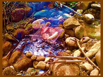
![Tour Zu Fuß Hombrechtikon - Hombrechtikon - Pfannenstiel Hochwacht - Photo](https://media.geolcdn.com/t/350/260/b57e7999-27d9-411c-8c14-26ed912c5325.jpeg&format=jpg&maxdim=2)
![Zu Fuß Zu Fuß](https://static1.geolcdn.com/sitytour/trail-icons/100.png)
Km
Zu Fuß
![](/images/other/stat-length.png)
![](https://static1.geolcdn.com/siteimages/upload/files/1508320355ic_sort_den_pos_24dp.png)
![](https://static1.geolcdn.com/siteimages/upload/files/1508320355ic_sort_den_neg_24dp.png)
![](https://static1.geolcdn.com/siteimages/upload/files/16400158638029165_repeat_loop_refresh_sync_direction_icon.png)
• Trail created by Zürcher Wanderwege ZAW. Symbol: gelbe Raute
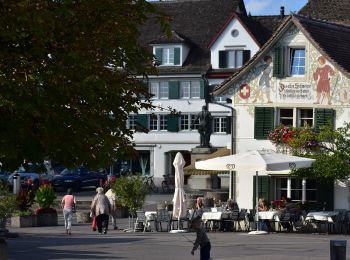
![Tour Zu Fuß Stäfa - Stäfa Schiff - Oetwil - Photo](https://media.geolcdn.com/t/350/260/bb2d22e2-3f3d-448f-8f20-84a0edbd4662.jpeg&format=jpg&maxdim=2)
![Zu Fuß Zu Fuß](https://static1.geolcdn.com/sitytour/trail-icons/100.png)
Km
Zu Fuß
![](/images/other/stat-length.png)
![](https://static1.geolcdn.com/siteimages/upload/files/1508320355ic_sort_den_pos_24dp.png)
![](https://static1.geolcdn.com/siteimages/upload/files/1508320355ic_sort_den_neg_24dp.png)
![](https://static1.geolcdn.com/siteimages/upload/files/16400158638029165_repeat_loop_refresh_sync_direction_icon.png)
• Trail created by Zürcher Wanderwege ZAW.
![Tour Zu Fuß Stäfa - Stäfa-ein Dorf bewegt: Top of Stäfa - Photo](https://media.geolcdn.com/t/350/260/1b4ad704-896b-46b1-b224-c31437822c2d.jpeg&format=jpg&maxdim=2)
![Zu Fuß Zu Fuß](https://static1.geolcdn.com/sitytour/trail-icons/100.png)
Km
Zu Fuß
![](/images/other/stat-length.png)
![](https://static1.geolcdn.com/siteimages/upload/files/1508320355ic_sort_den_pos_24dp.png)
![](https://static1.geolcdn.com/siteimages/upload/files/1508320355ic_sort_den_neg_24dp.png)
![](https://static1.geolcdn.com/siteimages/upload/files/16400158638029165_repeat_loop_refresh_sync_direction_icon.png)
• Trail created by Stäfa. Ein Dorf bewegt. http://www.staefa.ch/documents/Gemeindekarte_def.pdf.
![Tour Zu Fuß Stäfa - Grüningen Haufland - Stäfa Schiff - Photo](https://media.geolcdn.com/t/350/260/bb2d22e2-3f3d-448f-8f20-84a0edbd4662.jpeg&format=jpg&maxdim=2)
![Zu Fuß Zu Fuß](https://static1.geolcdn.com/sitytour/trail-icons/100.png)
Km
Zu Fuß
![](/images/other/stat-length.png)
![](https://static1.geolcdn.com/siteimages/upload/files/1508320355ic_sort_den_pos_24dp.png)
![](https://static1.geolcdn.com/siteimages/upload/files/1508320355ic_sort_den_neg_24dp.png)
![](https://static1.geolcdn.com/siteimages/upload/files/16400158638029165_repeat_loop_refresh_sync_direction_icon.png)
• Trail created by Zürcher Wanderwege ZAW. Symbol: gelbe Raute
20 Angezeigte Touren bei 36
Kostenlosegpshiking-Anwendung