


4,1 km | 6 km-effort
Unbekannt : Entdecken Sie die besten Touren : 44 zu Fuß und 1 mit dem Fahrrad oder Mountainbike. Alle diese Touren, Trails, Routen und Outdoor-Aktivitäten sind in unseren SityTrail-Apps für Smartphones und Tablets verfügbar.
Zu Fuß


• Trail created by Naturfreunde.
Zu Fuß
• Trail created by Österreichischer Astronomischer Verein.
Zu Fuß
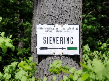
• Trail created by ÖTK-Klosterneuburg. Symbol: weiss-blau-weiss
Zu Fuß
• Trail created by ÖTK-Klosterneuburg; Freunde des Kahlenbergerdorfes. another website: http://www.kahlenbergerdorf.at...
Zu Fuß
• Trail created by ÖTK-Klosterneuburg. Symbol: weiss-blau-weiss Website: https://www.oetk-klosterneuburg.at/index.ph...
Zu Fuß
• Trail created by ÖTK-Klosterneuburg. Symbol: weiss-gruen-weiss Website: https://www.oetk-klosterneuburg.at/index.p...
Zu Fuß
• Trail created by ÖTK-Klosterneuburg. Symbol: weiss-rot-weiss Website: https://www.oetk-klosterneuburg.at/index.php...
Zu Fuß
• Trail created by ÖTK-Klosterneuburg. Symbol: weiss-blau-weiss Website: https://www.oetk-klosterneuburg.at/index.ph...
Zu Fuß
• Trail created by ÖTK-Klosterneuburg. Symbol: weiss-gruen-weiss Website: https://www.oetk-klosterneuburg.at/index.p...
Zu Fuß
• Trail created by ÖTK-Klosterneuburg. Symbol: weiss-blau-weiss Website: https://www.oetk-klosterneuburg.at/index.ph...
Zu Fuß
• Trail created by ÖTK-Klosterneuburg. Symbol: weiss-blau-weiss Website: https://www.oetk-klosterneuburg.at/index.ph...
Zu Fuß
• Symbol: ohne Markierung
Zu Fuß
• Trail created by Österreichischer Touristenklub. Symbol: grüner, waagrechter Balken

Zu Fuß
• Trail created by Stadt Wien (Forstamt). http://wiki.openstreetmap.org/index.php?title=WikiProject_Austria/Wanderwege
Zu Fuß
• Trail created by Stadt Wien (Forstamt). http://wiki.openstreetmap.org/index.php?title=WikiProject_Austria/Wanderwege
Zu Fuß
• Trail created by Stadt Wien (Forstamt). http://wiki.openstreetmap.org/index.php?title=WikiProject_Austria/Wanderwege
Zu Fuß
• Trail created by Stadt Wien (Forstamt). http://wiki.openstreetmap.org/index.php?title=WikiProject_Austria/Wanderwege
Zu Fuß
• osmc:symbol geändert damit auf Karte sichbar, vorher pink:white:pink_bar Symbol: weiß pink
Zu Fuß
• osmc:symbol geändert damit auf Karte sichbar, vorher pink:white:pink_bar Symbol: weiß pink
Zu Fuß
• Trail created by Stadt Wien (Forstamt). http://wiki.openstreetmap.org/index.php?title=WikiProject_Austria/Wanderwege...
20 Angezeigte Touren bei 45
Kostenlosegpshiking-Anwendung
 SityTrail
IGN / Geografische Institute
SityTrail World
Die Welt öffnet sich für Sie