![](/images/other/stat-length.png)
- Touren
- Outdoor
- Austria
- Niederösterreich
- Bezirk Mödling
- Gemeinde Mödling
Gemeinde Mödling, Bezirk Mödling: Die besten Touren, Trails, Trecks und Wanderungen
Gemeinde Mödling : Entdecken Sie die besten Touren : 12 zu Fuß. Alle diese Touren, Trails, Routen und Outdoor-Aktivitäten sind in unseren SityTrail-Apps für Smartphones und Tablets verfügbar.
Die besten Spuren (12)
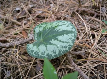
![Tour Zu Fuß Gemeinde Mödling - Laufstrecke 2: Meiereiwiese - Matterhörndl - Hinterbrühl - Vorderbrühl Rundkurs - Photo](https://media.geolcdn.com/t/350/260/5e62481f-2e9e-427d-b129-1e548a512d41.jpeg&format=jpg&maxdim=2)
![Zu Fuß Zu Fuß](https://static1.geolcdn.com/sitytour/trail-icons/100.png)
Km
Zu Fuß
![](/images/other/stat-length.png)
![](https://static1.geolcdn.com/siteimages/upload/files/1508320355ic_sort_den_pos_24dp.png)
![](https://static1.geolcdn.com/siteimages/upload/files/1508320355ic_sort_den_neg_24dp.png)
![](https://static1.geolcdn.com/siteimages/upload/files/16400158638029165_repeat_loop_refresh_sync_direction_icon.png)
• Trail created by Tourismusverband Mödling. Symbol: roter Streifen/Laufstrecke 2
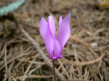
![Tour Zu Fuß Gemeinde Mödling - Rehberger / Lang Runde (Mödling) - Photo](https://media.geolcdn.com/t/350/260/2f849f68-d94d-423d-ab6f-d9805c33b0fe.jpeg&format=jpg&maxdim=2)
![Zu Fuß Zu Fuß](https://static1.geolcdn.com/sitytour/trail-icons/100.png)
Km
Zu Fuß
![](/images/other/stat-length.png)
![](https://static1.geolcdn.com/siteimages/upload/files/1508320355ic_sort_den_pos_24dp.png)
![](https://static1.geolcdn.com/siteimages/upload/files/1508320355ic_sort_den_neg_24dp.png)
![](https://static1.geolcdn.com/siteimages/upload/files/16400158638029165_repeat_loop_refresh_sync_direction_icon.png)
• Trail created by Runnersfun. Symbol: grüner Pfeil, M3
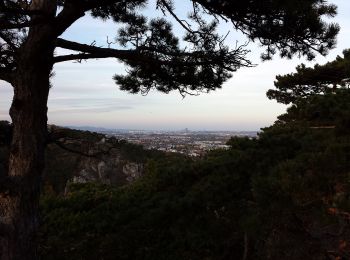
![Tour Zu Fuß Gemeinde Mödling - Knorr Bremse Runde (Mödling) - Photo](https://media.geolcdn.com/t/350/260/ff4a287b-3f84-4ef2-ab9d-621dcd652748.jpeg&format=jpg&maxdim=2)
![Zu Fuß Zu Fuß](https://static1.geolcdn.com/sitytour/trail-icons/100.png)
Km
Zu Fuß
![](/images/other/stat-length.png)
![](https://static1.geolcdn.com/siteimages/upload/files/1508320355ic_sort_den_pos_24dp.png)
![](https://static1.geolcdn.com/siteimages/upload/files/1508320355ic_sort_den_neg_24dp.png)
![](https://static1.geolcdn.com/siteimages/upload/files/16400158638029165_repeat_loop_refresh_sync_direction_icon.png)
• Trail created by Runnersfun. Symbol: blauer Pfeil, M5
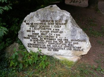
![Tour Zu Fuß Gemeinde Mödling - Beethoven Hotel Runde (Mödling) - Photo](https://media.geolcdn.com/t/350/260/423b457f-e365-4017-993c-ee571b5ac5e3.jpeg&format=jpg&maxdim=2)
![Zu Fuß Zu Fuß](https://static1.geolcdn.com/sitytour/trail-icons/100.png)
Km
Zu Fuß
![](/images/other/stat-length.png)
![](https://static1.geolcdn.com/siteimages/upload/files/1508320355ic_sort_den_pos_24dp.png)
![](https://static1.geolcdn.com/siteimages/upload/files/1508320355ic_sort_den_neg_24dp.png)
![](https://static1.geolcdn.com/siteimages/upload/files/16400158638029165_repeat_loop_refresh_sync_direction_icon.png)
• Trail created by Runnersfun. Symbol: roter Pfeil, M4
![Tour Zu Fuß Gemeinde Mödling - Vorderbrühl (Anningerweg o. Meierei-Wiese) - Husarentempel - Hexensitz, Kientalstraße (Forststraße) - Photo](https://media.geolcdn.com/t/350/260/ff4a287b-3f84-4ef2-ab9d-621dcd652748.jpeg&format=jpg&maxdim=2)
![Zu Fuß Zu Fuß](https://static1.geolcdn.com/sitytour/trail-icons/100.png)
Km
Zu Fuß
![](/images/other/stat-length.png)
![](https://static1.geolcdn.com/siteimages/upload/files/1508320355ic_sort_den_pos_24dp.png)
![](https://static1.geolcdn.com/siteimages/upload/files/1508320355ic_sort_den_neg_24dp.png)
![](https://static1.geolcdn.com/siteimages/upload/files/16400158638029165_repeat_loop_refresh_sync_direction_icon.png)
• Trail created by Verein der Naturfreunde in Mödling. Symbol: blauer, waagrechter Balken
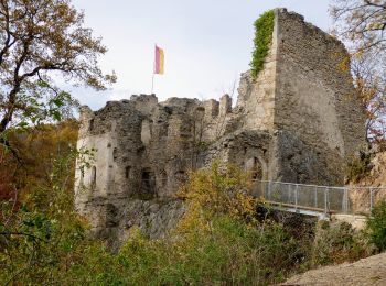
![Tour Zu Fuß Gemeinde Mödling - Wienerwald-Sternwanderweg 43 - Photo](https://media.geolcdn.com/t/350/260/83372499-1710-49eb-8643-f68286ea56b9.jpeg&format=jpg&maxdim=2)
![Zu Fuß Zu Fuß](https://static1.geolcdn.com/sitytour/trail-icons/100.png)
Km
Zu Fuß
![](/images/other/stat-length.png)
![](https://static1.geolcdn.com/siteimages/upload/files/1508320355ic_sort_den_pos_24dp.png)
![](https://static1.geolcdn.com/siteimages/upload/files/1508320355ic_sort_den_neg_24dp.png)
![](https://static1.geolcdn.com/siteimages/upload/files/16400158638029165_repeat_loop_refresh_sync_direction_icon.png)
• Trail created by Organisation der Internationalen Wienerwald-Wanderung. Symbol: weißer, waagerechter Balken auf rote...
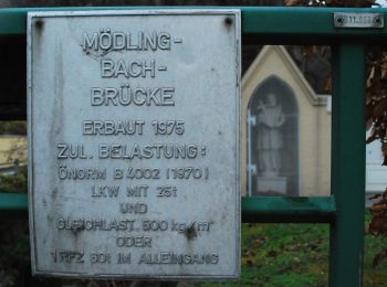
![Tour Zu Fuß Gemeinde Mödling - Wienerwald-IML Wanderweg 3 Mödling - Gaden - Photo](https://media.geolcdn.com/t/350/260/ff3dcf5f-30b5-4cf1-8b31-e750a4cf6df6.jpeg&format=jpg&maxdim=2)
![Zu Fuß Zu Fuß](https://static1.geolcdn.com/sitytour/trail-icons/100.png)
Km
Zu Fuß
![](/images/other/stat-length.png)
![](https://static1.geolcdn.com/siteimages/upload/files/1508320355ic_sort_den_pos_24dp.png)
![](https://static1.geolcdn.com/siteimages/upload/files/1508320355ic_sort_den_neg_24dp.png)
![](https://static1.geolcdn.com/siteimages/upload/files/16400158638029165_repeat_loop_refresh_sync_direction_icon.png)
• Trail created by Organisation der Internationalen Wienerwald-Wanderung. Symbol: blau und weiß waagerecht mit Zahl 3
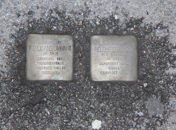
![Tour Zu Fuß Gemeinde Mödling - Wienerwald-IML Wanderweg 1 - Photo](https://media.geolcdn.com/t/350/260/cb7c9c92-f2b1-414a-9f5b-f7eb24aeff69.jpeg&format=jpg&maxdim=2)
![Zu Fuß Zu Fuß](https://static1.geolcdn.com/sitytour/trail-icons/100.png)
Km
Zu Fuß
![](/images/other/stat-length.png)
![](https://static1.geolcdn.com/siteimages/upload/files/1508320355ic_sort_den_pos_24dp.png)
![](https://static1.geolcdn.com/siteimages/upload/files/1508320355ic_sort_den_neg_24dp.png)
![](https://static1.geolcdn.com/siteimages/upload/files/16400158638029165_repeat_loop_refresh_sync_direction_icon.png)
• Trail created by Organisation der Internationalen Wienerwald-Wanderung. Symbol: blau und weiß waagerecht mit Zahl 1
![Tour Zu Fuß Gemeinde Mödling - Prießnitztal - Husarentempel - Photo](https://media.geolcdn.com/t/350/260/542ef443-6344-4380-84c7-1b7c086a8d32.jpeg&format=jpg&maxdim=2)
![Zu Fuß Zu Fuß](https://static1.geolcdn.com/sitytour/trail-icons/100.png)
Km
Zu Fuß
![](/images/other/stat-length.png)
![](https://static1.geolcdn.com/siteimages/upload/files/1508320355ic_sort_den_pos_24dp.png)
![](https://static1.geolcdn.com/siteimages/upload/files/1508320355ic_sort_den_neg_24dp.png)
![](https://static1.geolcdn.com/siteimages/upload/files/16400158638029165_repeat_loop_refresh_sync_direction_icon.png)
• Trail created by Verein der Naturfreunde in Mödling. Symbol: grüner, waagrechter Balken
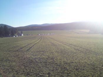
![Tour Zu Fuß Gemeinde Mödling - Wienerwald-Sternwanderweg 42 - Photo](https://media.geolcdn.com/t/350/260/280a29d9-3911-43f4-80f9-5d397d38f094.jpeg&format=jpg&maxdim=2)
![Zu Fuß Zu Fuß](https://static1.geolcdn.com/sitytour/trail-icons/100.png)
Km
Zu Fuß
![](/images/other/stat-length.png)
![](https://static1.geolcdn.com/siteimages/upload/files/1508320355ic_sort_den_pos_24dp.png)
![](https://static1.geolcdn.com/siteimages/upload/files/1508320355ic_sort_den_neg_24dp.png)
![](https://static1.geolcdn.com/siteimages/upload/files/16400158638029165_repeat_loop_refresh_sync_direction_icon.png)
• Trail created by Organisation der Internationalen Wienerwald-Wanderung. Eröffnet 1979. Der Betreiber OdIWW existiert...
![Tour Zu Fuß Gemeinde Mödling - Ostarrichi Wanderweg 48 - Photo](https://media.geolcdn.com/t/350/260/ext.jpg?maxdim=2&url=https%3A%2F%2Fstatic1.geolcdn.com%2Fsiteimages%2Fupload%2Ffiles%2F1545311037marcheuse_200dpi.jpg)
![Zu Fuß Zu Fuß](https://static1.geolcdn.com/sitytour/trail-icons/100.png)
Km
Zu Fuß
![](/images/other/stat-length.png)
![](https://static1.geolcdn.com/siteimages/upload/files/1508320355ic_sort_den_pos_24dp.png)
![](https://static1.geolcdn.com/siteimages/upload/files/1508320355ic_sort_den_neg_24dp.png)
![](https://static1.geolcdn.com/siteimages/upload/files/16400158638029165_repeat_loop_refresh_sync_direction_icon.png)
• Symbol: weißer, waagerechter Balken auf rotem Grund mit 48
![Tour Zu Fuß Gemeinde Mödling - Josef Schöffel Wanderweg 46: Mödling - Meiereiwiese - Matterhörndl - Photo](https://media.geolcdn.com/t/350/260/ext.jpg?maxdim=2&url=https%3A%2F%2Fstatic1.geolcdn.com%2Fsiteimages%2Fupload%2Ffiles%2F1545311037marcheuse_200dpi.jpg)
![Zu Fuß Zu Fuß](https://static1.geolcdn.com/sitytour/trail-icons/100.png)
Km
Zu Fuß
![](/images/other/stat-length.png)
![](https://static1.geolcdn.com/siteimages/upload/files/1508320355ic_sort_den_pos_24dp.png)
![](https://static1.geolcdn.com/siteimages/upload/files/1508320355ic_sort_den_neg_24dp.png)
![](https://static1.geolcdn.com/siteimages/upload/files/16400158638029165_repeat_loop_refresh_sync_direction_icon.png)
• Trail created by Fremdenverkehrsverein Mödling. Symbol: weißer, waagerechter Balken auf rotem Grund mit 46
12 Angezeigte Touren bei 12
Kostenlosegpshiking-Anwendung