![](/images/other/stat-length.png)
- Touren
- Zu Fuß
- Slovakia
- Trentschiner Landschaftsverband
- Unbekannt
- Bezirk Priwitz
Bezirk Priwitz, Unbekannt, Zu Fuß: Die besten Touren, Trails, Trecks und Wanderungen
Bezirk Priwitz : Entdecken Sie die besten Touren : 6 zu fuß. Alle diese Touren, Trails, Routen und Outdoor-Aktivitäten sind in unseren SityTrail-Apps für Smartphones und Tablets verfügbar.
Die besten Spuren (6)
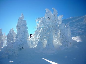
![Tour Zu Fuß Bezirk Priwitz - Náučný chodník Vtáčnik - Photo](https://media.geolcdn.com/t/350/260/4bb5f6a8-6527-4654-8d90-ffaefb8672e0.jpeg&format=jpg&maxdim=2)
![Zu Fuß Zu Fuß](https://static1.geolcdn.com/sitytour/trail-icons/100.png)
Km
Zu Fuß
![](/images/other/stat-length.png)
![](https://static1.geolcdn.com/siteimages/upload/files/1508320355ic_sort_den_pos_24dp.png)
![](https://static1.geolcdn.com/siteimages/upload/files/1508320355ic_sort_den_neg_24dp.png)
![](https://static1.geolcdn.com/siteimages/upload/files/16400158638029165_repeat_loop_refresh_sync_direction_icon.png)
• Tour erstellt von KST. Symbol: education
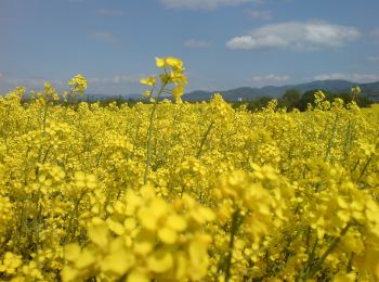
![Tour Zu Fuß Bezirk Priwitz - Náučný banský turistický chodník - Photo](https://media.geolcdn.com/t/350/260/6abb9939-2999-48a3-9789-5e531d2e5eaa.jpeg&format=jpg&maxdim=2)
![Zu Fuß Zu Fuß](https://static1.geolcdn.com/sitytour/trail-icons/100.png)
Km
Zu Fuß
![](/images/other/stat-length.png)
![](https://static1.geolcdn.com/siteimages/upload/files/1508320355ic_sort_den_pos_24dp.png)
![](https://static1.geolcdn.com/siteimages/upload/files/1508320355ic_sort_den_neg_24dp.png)
![](https://static1.geolcdn.com/siteimages/upload/files/16400158638029165_repeat_loop_refresh_sync_direction_icon.png)
• Tour erstellt von Spolok priateľov bane Nováky. Symbol: education Website: http://naucnechodniky.eu/naucny-bansky-...
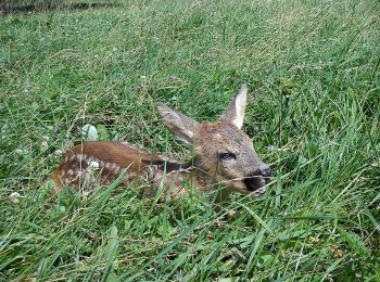
![Tour Zu Fuß Bezirk Priwitz - Náučný chodník Fraňa Madvu - Photo](https://media.geolcdn.com/t/350/260/7884e1e0-278c-4f49-90b4-0af18afa4c46.jpeg&format=jpg&maxdim=2)
![Zu Fuß Zu Fuß](https://static1.geolcdn.com/sitytour/trail-icons/100.png)
Km
Zu Fuß
![](/images/other/stat-length.png)
![](https://static1.geolcdn.com/siteimages/upload/files/1508320355ic_sort_den_pos_24dp.png)
![](https://static1.geolcdn.com/siteimages/upload/files/1508320355ic_sort_den_neg_24dp.png)
![](https://static1.geolcdn.com/siteimages/upload/files/16400158638029165_repeat_loop_refresh_sync_direction_icon.png)
• Symbol: education
![Tour Zu Fuß Bezirk Priwitz - Náučný chodník Bojnice/Dubnica - Hradište - Photo](https://media.geolcdn.com/t/350/260/cdec83f8-fba4-4994-8b0a-b3a565e30db2.jpeg&format=jpg&maxdim=2)
![Zu Fuß Zu Fuß](https://static1.geolcdn.com/sitytour/trail-icons/100.png)
Km
Zu Fuß
![](/images/other/stat-length.png)
![](https://static1.geolcdn.com/siteimages/upload/files/1508320355ic_sort_den_pos_24dp.png)
![](https://static1.geolcdn.com/siteimages/upload/files/1508320355ic_sort_den_neg_24dp.png)
![](https://static1.geolcdn.com/siteimages/upload/files/16400158638029165_repeat_loop_refresh_sync_direction_icon.png)
• Tour erstellt von OZ Klub Melenčiarov Bojnice-Dubnice. Symbol: education
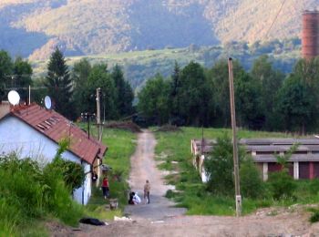
![Tour Zu Fuß Bezirk Priwitz - turisticko-náučný banský chodník - Photo](https://media.geolcdn.com/t/350/260/8d49fc59-ca8d-4bb7-88b3-6e6a9094890f.jpeg&format=jpg&maxdim=2)
![Zu Fuß Zu Fuß](https://static1.geolcdn.com/sitytour/trail-icons/100.png)
Km
Zu Fuß
![](/images/other/stat-length.png)
![](https://static1.geolcdn.com/siteimages/upload/files/1508320355ic_sort_den_pos_24dp.png)
![](https://static1.geolcdn.com/siteimages/upload/files/1508320355ic_sort_den_neg_24dp.png)
![](https://static1.geolcdn.com/siteimages/upload/files/16400158638029165_repeat_loop_refresh_sync_direction_icon.png)
• Symbol: education
![Tour Zu Fuß Bezirk Priwitz - Náučný chodník obce Kocurany - Photo](https://media.geolcdn.com/t/350/260/c89c9741-e296-467e-8cad-b08279c400b3.jpeg&format=jpg&maxdim=2)
![Zu Fuß Zu Fuß](https://static1.geolcdn.com/sitytour/trail-icons/100.png)
Km
Zu Fuß
![](/images/other/stat-length.png)
![](https://static1.geolcdn.com/siteimages/upload/files/1508320355ic_sort_den_pos_24dp.png)
![](https://static1.geolcdn.com/siteimages/upload/files/1508320355ic_sort_den_neg_24dp.png)
![](https://static1.geolcdn.com/siteimages/upload/files/16400158638029165_repeat_loop_refresh_sync_direction_icon.png)
• Symbol: education
6 Angezeigte Touren bei 6
Kostenlosegpshiking-Anwendung