![](/images/other/stat-length.png)
- Touren
- Zu Fuß
- Slovakia
- Kaschauer Landschaftsverband
- Unbekannt
- Bezirk Kaschau - Umgebung
Bezirk Kaschau - Umgebung, Unbekannt, Zu Fuß: Die besten Touren, Trails, Trecks und Wanderungen
Bezirk Kaschau - Umgebung : Entdecken Sie die besten Touren : 7 zu fuß. Alle diese Touren, Trails, Routen und Outdoor-Aktivitäten sind in unseren SityTrail-Apps für Smartphones und Tablets verfügbar.
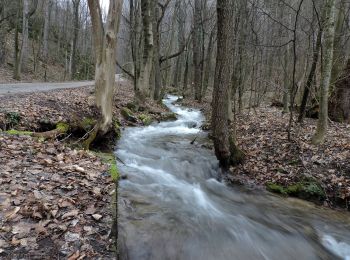
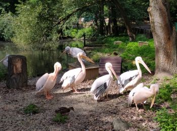
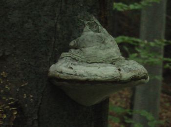
Die besten Spuren (7)
![Tour Zu Fuß Bezirk Kaschau - Umgebung - Náučný chodník Zádielska tiesňava - Photo](https://media.geolcdn.com/t/350/260/cd7d41a2-2ae2-468e-a628-205ef24f5bb8.jpeg&format=jpg&maxdim=2)
![Zu Fuß Zu Fuß](https://static1.geolcdn.com/sitytour/trail-icons/100.png)
Km
Zu Fuß
![](/images/other/stat-length.png)
![](https://static1.geolcdn.com/siteimages/upload/files/1508320355ic_sort_den_pos_24dp.png)
![](https://static1.geolcdn.com/siteimages/upload/files/1508320355ic_sort_den_neg_24dp.png)
![](https://static1.geolcdn.com/siteimages/upload/files/16400158638029165_repeat_loop_refresh_sync_direction_icon.png)
• Tour erstellt von KST. Symbol: education
![Tour Zu Fuß Bezirk Kaschau - Umgebung - Náučný chodník Ku Kráľovej studni - Photo](https://media.geolcdn.com/t/350/260/39cd4757-054e-4536-a83f-63b8afbf0a31.jpeg&format=jpg&maxdim=2)
![Zu Fuß Zu Fuß](https://static1.geolcdn.com/sitytour/trail-icons/100.png)
Km
Zu Fuß
![](/images/other/stat-length.png)
![](https://static1.geolcdn.com/siteimages/upload/files/1508320355ic_sort_den_pos_24dp.png)
![](https://static1.geolcdn.com/siteimages/upload/files/1508320355ic_sort_den_neg_24dp.png)
![](https://static1.geolcdn.com/siteimages/upload/files/16400158638029165_repeat_loop_refresh_sync_direction_icon.png)
• Tour erstellt von OZ Dedinka, Kostoľany nad Hornádom. Symbol: education
![Tour Zu Fuß Bezirk Kaschau - Umgebung - Náučný lesný chodník Košická Belá - Photo](https://media.geolcdn.com/t/350/260/4aa9d587-1e6a-49c8-9ecf-b8dee0d5b384.jpeg&format=jpg&maxdim=2)
![Zu Fuß Zu Fuß](https://static1.geolcdn.com/sitytour/trail-icons/100.png)
Km
Zu Fuß
![](/images/other/stat-length.png)
![](https://static1.geolcdn.com/siteimages/upload/files/1508320355ic_sort_den_pos_24dp.png)
![](https://static1.geolcdn.com/siteimages/upload/files/1508320355ic_sort_den_neg_24dp.png)
![](https://static1.geolcdn.com/siteimages/upload/files/16400158638029165_repeat_loop_refresh_sync_direction_icon.png)
• Tour erstellt von Mestské lesy Košice. Symbol: education
![Tour Zu Fuß Bezirk Kaschau - Umgebung - Orechový les - Photo](https://media.geolcdn.com/t/350/260/c3d2fbe2-47b9-4dec-91ad-1b47a6738d0e.jpeg&format=jpg&maxdim=2)
![Zu Fuß Zu Fuß](https://static1.geolcdn.com/sitytour/trail-icons/100.png)
Km
Zu Fuß
![](/images/other/stat-length.png)
![](https://static1.geolcdn.com/siteimages/upload/files/1508320355ic_sort_den_pos_24dp.png)
![](https://static1.geolcdn.com/siteimages/upload/files/1508320355ic_sort_den_neg_24dp.png)
![](https://static1.geolcdn.com/siteimages/upload/files/16400158638029165_repeat_loop_refresh_sync_direction_icon.png)
• weak marking, may not be 100% accurate
![Tour Zu Fuß Bezirk Kaschau - Umgebung - Torysko-Olšavský okruh zdravia - Photo](https://media.geolcdn.com/t/350/260/c3d2fbe2-47b9-4dec-91ad-1b47a6738d0e.jpeg&format=jpg&maxdim=2)
![Zu Fuß Zu Fuß](https://static1.geolcdn.com/sitytour/trail-icons/100.png)
Km
Zu Fuß
![](/images/other/stat-length.png)
![](https://static1.geolcdn.com/siteimages/upload/files/1508320355ic_sort_den_pos_24dp.png)
![](https://static1.geolcdn.com/siteimages/upload/files/1508320355ic_sort_den_neg_24dp.png)
![](https://static1.geolcdn.com/siteimages/upload/files/16400158638029165_repeat_loop_refresh_sync_direction_icon.png)
• Website: http://www.regionhornad.sk/kam-ist/kam-cyklotrasou-h-t-h/krajom-polianok-na-rozmedzi-abova-a-zemplina/
![Tour Zu Fuß Bezirk Kaschau - Umgebung - Radar - Photo](https://media.geolcdn.com/t/350/260/c3d2fbe2-47b9-4dec-91ad-1b47a6738d0e.jpeg&format=jpg&maxdim=2)
![Zu Fuß Zu Fuß](https://static1.geolcdn.com/sitytour/trail-icons/100.png)
Km
Zu Fuß
![](/images/other/stat-length.png)
![](https://static1.geolcdn.com/siteimages/upload/files/1508320355ic_sort_den_pos_24dp.png)
![](https://static1.geolcdn.com/siteimages/upload/files/1508320355ic_sort_den_neg_24dp.png)
![](https://static1.geolcdn.com/siteimages/upload/files/16400158638029165_repeat_loop_refresh_sync_direction_icon.png)
• marking is mostly missing
![Tour Zu Fuß Bezirk Kaschau - Umgebung - SK-8829 - Photo](https://media.geolcdn.com/t/350/260/ext.jpg?maxdim=2&url=https%3A%2F%2Fstatic1.geolcdn.com%2Fsiteimages%2Fupload%2Ffiles%2F1545311037marcheuse_200dpi.jpg)
![Zu Fuß Zu Fuß](https://static1.geolcdn.com/sitytour/trail-icons/100.png)
Km
Zu Fuß
![](/images/other/stat-length.png)
![](https://static1.geolcdn.com/siteimages/upload/files/1508320355ic_sort_den_pos_24dp.png)
![](https://static1.geolcdn.com/siteimages/upload/files/1508320355ic_sort_den_neg_24dp.png)
![](https://static1.geolcdn.com/siteimages/upload/files/16400158638029165_repeat_loop_refresh_sync_direction_icon.png)
• Tour erstellt von KST. Symbol: major
7 Angezeigte Touren bei 7
Kostenlosegpshiking-Anwendung