![](/images/other/stat-length.png)
- Touren
- Zu Fuß
- Italy
- Piemont
- Alessandria
- Cantalupo Ligure
Cantalupo Ligure, Alessandria, Zu Fuß: Die besten Touren, Trails, Trecks und Wanderungen
Cantalupo Ligure : Entdecken Sie die besten Touren : 3 zu fuß. Alle diese Touren, Trails, Routen und Outdoor-Aktivitäten sind in unseren SityTrail-Apps für Smartphones und Tablets verfügbar.
Die besten Spuren (3)
![Tour Zu Fuß Cantalupo Ligure - Cantalupo Ligure – Monte Giarolo - Photo](https://media.geolcdn.com/t/350/260/c71f4eae-05b3-4fe0-abf7-db47654785e4.jpeg&format=jpg&maxdim=2)
![Zu Fuß Zu Fuß](https://static1.geolcdn.com/sitytour/trail-icons/100.png)
Km
Zu Fuß
![](/images/other/stat-length.png)
![](https://static1.geolcdn.com/siteimages/upload/files/1508320355ic_sort_den_pos_24dp.png)
![](https://static1.geolcdn.com/siteimages/upload/files/1508320355ic_sort_den_neg_24dp.png)
![](https://static1.geolcdn.com/siteimages/upload/files/16400158638029165_repeat_loop_refresh_sync_direction_icon.png)
• Symbol: 210 on white ref flag
![Tour Zu Fuß Cantalupo Ligure - Anello Borbera - Spinti 4° Tappa Forcella Sud M. Barillaro – M. Giarolo - Photo](https://media.geolcdn.com/t/350/260/c71f4eae-05b3-4fe0-abf7-db47654785e4.jpeg&format=jpg&maxdim=2)
![Zu Fuß Zu Fuß](https://static1.geolcdn.com/sitytour/trail-icons/100.png)
Km
Zu Fuß
![](/images/other/stat-length.png)
![](https://static1.geolcdn.com/siteimages/upload/files/1508320355ic_sort_den_pos_24dp.png)
![](https://static1.geolcdn.com/siteimages/upload/files/1508320355ic_sort_den_neg_24dp.png)
![](https://static1.geolcdn.com/siteimages/upload/files/16400158638029165_repeat_loop_refresh_sync_direction_icon.png)
• Symbol: 200 on white ref flag
![Tour Zu Fuß Cantalupo Ligure - Pertuso - Roccaforte Ligure - Photo](https://media.geolcdn.com/t/350/260/54bf70ae-0e7c-45b0-bc0e-78bfff532f80.jpeg&format=jpg&maxdim=2)
![Zu Fuß Zu Fuß](https://static1.geolcdn.com/sitytour/trail-icons/100.png)
Km
Zu Fuß
![](/images/other/stat-length.png)
![](https://static1.geolcdn.com/siteimages/upload/files/1508320355ic_sort_den_pos_24dp.png)
![](https://static1.geolcdn.com/siteimages/upload/files/1508320355ic_sort_den_neg_24dp.png)
![](https://static1.geolcdn.com/siteimages/upload/files/16400158638029165_repeat_loop_refresh_sync_direction_icon.png)
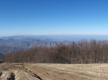
• Trail created by Club Alpino Italiano. alcuni passaggi con funi (scivoloso in caso di pioggia) Symbol: 260 on white...
3 Angezeigte Touren bei 3
Kostenlosegpshiking-Anwendung