![](/images/other/stat-length.png)
- Touren
- Zu Fuß
- Hungary
- Transdanubien
- Komitat Wesprim
Komitat Wesprim, Transdanubien, Zu Fuß: Die besten Touren, Trails, Trecks und Wanderungen
Komitat Wesprim : Entdecken Sie die besten Touren : 92 zu fuß. Alle diese Touren, Trails, Routen und Outdoor-Aktivitäten sind in unseren SityTrail-Apps für Smartphones und Tablets verfügbar.
Die besten Spuren (92)
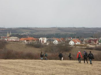
![Tour Zu Fuß Sirtz - Reguly Antal Emlékút-Zirc35 túraútvonal - Photo](https://media.geolcdn.com/t/350/260/be7e331e-d45d-4d53-bb2a-4781c957e5ee.jpeg&format=jpg&maxdim=2)
![Zu Fuß Zu Fuß](https://static1.geolcdn.com/sitytour/trail-icons/100.png)
Km
Zu Fuß
![](/images/other/stat-length.png)
![](https://static1.geolcdn.com/siteimages/upload/files/1508320355ic_sort_den_pos_24dp.png)
![](https://static1.geolcdn.com/siteimages/upload/files/1508320355ic_sort_den_neg_24dp.png)
![](https://static1.geolcdn.com/siteimages/upload/files/16400158638029165_repeat_loop_refresh_sync_direction_icon.png)
• Trail created by Erdélyi Baráti Kör, Zirc.
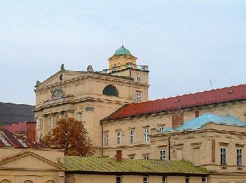
![Tour Zu Fuß Sirtz - P3 ( Zirc-Papod ) - Photo](https://media.geolcdn.com/t/350/260/1d832f23-6a2e-4a79-bb13-89f70415fa4a.jpeg&format=jpg&maxdim=2)
![Zu Fuß Zu Fuß](https://static1.geolcdn.com/sitytour/trail-icons/100.png)
Km
Zu Fuß
![](/images/other/stat-length.png)
![](https://static1.geolcdn.com/siteimages/upload/files/1508320355ic_sort_den_pos_24dp.png)
![](https://static1.geolcdn.com/siteimages/upload/files/1508320355ic_sort_den_neg_24dp.png)
![](https://static1.geolcdn.com/siteimages/upload/files/16400158638029165_repeat_loop_refresh_sync_direction_icon.png)
• Trail created by Zirc. Zirctől a piros sáv turistajelzésig nem igazán jó választás a piros háromszög, legközelebbi f...
![Tour Zu Fuß Nemesvámos - zT Katrabócza tanösvény - Photo](https://media.geolcdn.com/t/350/260/ea1d1b46-58f7-47e4-9ef2-4844f9a7121d.jpeg&format=jpg&maxdim=2)
![Zu Fuß Zu Fuß](https://static1.geolcdn.com/sitytour/trail-icons/100.png)
Km
Zu Fuß
![](/images/other/stat-length.png)
![](https://static1.geolcdn.com/siteimages/upload/files/1508320355ic_sort_den_pos_24dp.png)
![](https://static1.geolcdn.com/siteimages/upload/files/1508320355ic_sort_den_neg_24dp.png)
![](https://static1.geolcdn.com/siteimages/upload/files/16400158638029165_repeat_loop_refresh_sync_direction_icon.png)
• Trail created by Nemesvámos, Általános Iskola.
![Tour Zu Fuß Ugod - 009. sz. permanens IVV - Photo](https://media.geolcdn.com/t/350/260/23e6e443-e433-42f2-9f8c-dbf36e2861a3.jpeg&format=jpg&maxdim=2)
![Zu Fuß Zu Fuß](https://static1.geolcdn.com/sitytour/trail-icons/100.png)
Km
Zu Fuß
![](/images/other/stat-length.png)
![](https://static1.geolcdn.com/siteimages/upload/files/1508320355ic_sort_den_pos_24dp.png)
![](https://static1.geolcdn.com/siteimages/upload/files/1508320355ic_sort_den_neg_24dp.png)
![](https://static1.geolcdn.com/siteimages/upload/files/16400158638029165_repeat_loop_refresh_sync_direction_icon.png)
• Website: http://www.bakonyibakancsos.hu/permanens-ivv
![Tour Zu Fuß Ugod - Z+ (Bakonybé)l - Photo](https://media.geolcdn.com/t/350/260/e3bb87f9-59b4-4702-9050-67f87ba26978.jpeg&format=jpg&maxdim=2)
![Zu Fuß Zu Fuß](https://static1.geolcdn.com/sitytour/trail-icons/100.png)
Km
Zu Fuß
![](/images/other/stat-length.png)
![](https://static1.geolcdn.com/siteimages/upload/files/1508320355ic_sort_den_pos_24dp.png)
![](https://static1.geolcdn.com/siteimages/upload/files/1508320355ic_sort_den_neg_24dp.png)
![](https://static1.geolcdn.com/siteimages/upload/files/16400158638029165_repeat_loop_refresh_sync_direction_icon.png)
• Symbol: green cross
![Tour Zu Fuß Eikau - S+ (Ajka, Bányász Múzeum - Kis-rét) - Photo](https://media.geolcdn.com/t/350/260/6129d601-4b63-42d5-9c02-bf834b56d4ee.jpeg&format=jpg&maxdim=2)
![Zu Fuß Zu Fuß](https://static1.geolcdn.com/sitytour/trail-icons/100.png)
Km
Zu Fuß
![](/images/other/stat-length.png)
![](https://static1.geolcdn.com/siteimages/upload/files/1508320355ic_sort_den_pos_24dp.png)
![](https://static1.geolcdn.com/siteimages/upload/files/1508320355ic_sort_den_neg_24dp.png)
![](https://static1.geolcdn.com/siteimages/upload/files/16400158638029165_repeat_loop_refresh_sync_direction_icon.png)
• Trail created by Veszprém Megyei Múzeumi Igazgatóság.
![Tour Zu Fuß Kapolcs - S+ (Kapolcs, am. - Kecske-kő - Alsó-erdő - Kettős-tó) - Photo](https://media.geolcdn.com/t/350/260/3b008ab3-44cb-444e-905b-5e08510be810.jpeg&format=jpg&maxdim=2)
![Zu Fuß Zu Fuß](https://static1.geolcdn.com/sitytour/trail-icons/100.png)
Km
Zu Fuß
![](/images/other/stat-length.png)
![](https://static1.geolcdn.com/siteimages/upload/files/1508320355ic_sort_den_pos_24dp.png)
![](https://static1.geolcdn.com/siteimages/upload/files/1508320355ic_sort_den_neg_24dp.png)
![](https://static1.geolcdn.com/siteimages/upload/files/16400158638029165_repeat_loop_refresh_sync_direction_icon.png)
• Trail created by Veszprém Megyei Természetbarát Szövetség.
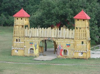
![Tour Zu Fuß Paloznak - Z+ (Veszprémfajszi Felső-erdő - Nosztori autósmozi am.) - Photo](https://media.geolcdn.com/t/350/260/aab7aeb8-2825-4b63-865b-3d095713d1f1.jpeg&format=jpg&maxdim=2)
![Zu Fuß Zu Fuß](https://static1.geolcdn.com/sitytour/trail-icons/100.png)
Km
Zu Fuß
![](/images/other/stat-length.png)
![](https://static1.geolcdn.com/siteimages/upload/files/1508320355ic_sort_den_pos_24dp.png)
![](https://static1.geolcdn.com/siteimages/upload/files/1508320355ic_sort_den_neg_24dp.png)
![](https://static1.geolcdn.com/siteimages/upload/files/16400158638029165_repeat_loop_refresh_sync_direction_icon.png)
• Trail created by Veszprém Megyei Természetbarát Szövetség. Symbol: green cross
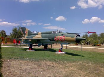
![Tour Zu Fuß Dörgicse - P+ - Photo](https://media.geolcdn.com/t/350/260/d634f1fc-8280-45a7-a75f-f794503d28e7.jpeg&format=jpg&maxdim=2)
![Zu Fuß Zu Fuß](https://static1.geolcdn.com/sitytour/trail-icons/100.png)
Km
Zu Fuß
![](/images/other/stat-length.png)
![](https://static1.geolcdn.com/siteimages/upload/files/1508320355ic_sort_den_pos_24dp.png)
![](https://static1.geolcdn.com/siteimages/upload/files/1508320355ic_sort_den_neg_24dp.png)
![](https://static1.geolcdn.com/siteimages/upload/files/16400158638029165_repeat_loop_refresh_sync_direction_icon.png)
• Trail created by Veszprém Megyei Természetbarát Szövetség. Symbol: red cross
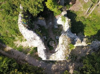
![Tour Zu Fuß Erewin - K▙ (Örvényes, v.mh. - Zádorvár) - Photo](https://media.geolcdn.com/t/350/260/43a67295-2914-4019-9b63-dd2f12578548.jpeg&format=jpg&maxdim=2)
![Zu Fuß Zu Fuß](https://static1.geolcdn.com/sitytour/trail-icons/100.png)
Km
Zu Fuß
![](/images/other/stat-length.png)
![](https://static1.geolcdn.com/siteimages/upload/files/1508320355ic_sort_den_pos_24dp.png)
![](https://static1.geolcdn.com/siteimages/upload/files/1508320355ic_sort_den_neg_24dp.png)
![](https://static1.geolcdn.com/siteimages/upload/files/16400158638029165_repeat_loop_refresh_sync_direction_icon.png)
• Trail created by Veszprém Megyei Természetbarát Szövetség. Symbol: blue L
![Tour Zu Fuß Bad Plattensee - S+ (Balatonfüred, Vörös templom - Sárkány-völgy) - Photo](https://media.geolcdn.com/t/350/260/21e8a7ac-b999-4922-b75c-f0eb484b0564.jpeg&format=jpg&maxdim=2)
![Zu Fuß Zu Fuß](https://static1.geolcdn.com/sitytour/trail-icons/100.png)
Km
Zu Fuß
![](/images/other/stat-length.png)
![](https://static1.geolcdn.com/siteimages/upload/files/1508320355ic_sort_den_pos_24dp.png)
![](https://static1.geolcdn.com/siteimages/upload/files/1508320355ic_sort_den_neg_24dp.png)
![](https://static1.geolcdn.com/siteimages/upload/files/16400158638029165_repeat_loop_refresh_sync_direction_icon.png)
• Trail created by Veszprém Megyei Természetbarát Szövetség.
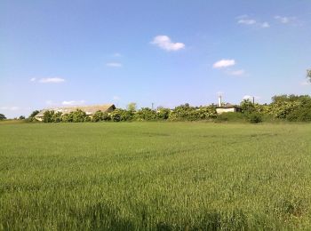
![Tour Zu Fuß Großwaschon - PL (Nagyvázsony - Csepelyi templomrom) - Photo](https://media.geolcdn.com/t/350/260/3d01767e-a31b-4433-bc28-2c70cfd8c2c0.jpeg&format=jpg&maxdim=2)
![Zu Fuß Zu Fuß](https://static1.geolcdn.com/sitytour/trail-icons/100.png)
Km
Zu Fuß
![](/images/other/stat-length.png)
![](https://static1.geolcdn.com/siteimages/upload/files/1508320355ic_sort_den_pos_24dp.png)
![](https://static1.geolcdn.com/siteimages/upload/files/1508320355ic_sort_den_neg_24dp.png)
![](https://static1.geolcdn.com/siteimages/upload/files/16400158638029165_repeat_loop_refresh_sync_direction_icon.png)
• Symbol: red L
![Tour Zu Fuß Balatonalmádi - S▲ (Felsőörs-Balatonalmádi út - Csere-hegy, Szabadság-kilátó) - Photo](https://media.geolcdn.com/t/350/260/d429e992-af36-48d7-b5ad-0eb865d9402c.jpeg&format=jpg&maxdim=2)
![Zu Fuß Zu Fuß](https://static1.geolcdn.com/sitytour/trail-icons/100.png)
Km
Zu Fuß
![](/images/other/stat-length.png)
![](https://static1.geolcdn.com/siteimages/upload/files/1508320355ic_sort_den_pos_24dp.png)
![](https://static1.geolcdn.com/siteimages/upload/files/1508320355ic_sort_den_neg_24dp.png)
![](https://static1.geolcdn.com/siteimages/upload/files/16400158638029165_repeat_loop_refresh_sync_direction_icon.png)
• Symbol: yellow triangle
![Tour Zu Fuß Köveskál - K+ (Csere-kút - Köveskál, monoszlói elágazó) - Photo](https://media.geolcdn.com/t/350/260/ee3bdc4b-3f3c-42a4-8ddd-2f3c53785c98.jpeg&format=jpg&maxdim=2)
![Zu Fuß Zu Fuß](https://static1.geolcdn.com/sitytour/trail-icons/100.png)
Km
Zu Fuß
![](/images/other/stat-length.png)
![](https://static1.geolcdn.com/siteimages/upload/files/1508320355ic_sort_den_pos_24dp.png)
![](https://static1.geolcdn.com/siteimages/upload/files/1508320355ic_sort_den_neg_24dp.png)
![](https://static1.geolcdn.com/siteimages/upload/files/16400158638029165_repeat_loop_refresh_sync_direction_icon.png)
• Trail created by Veszprém Megyei Természetbarát Szövetség.
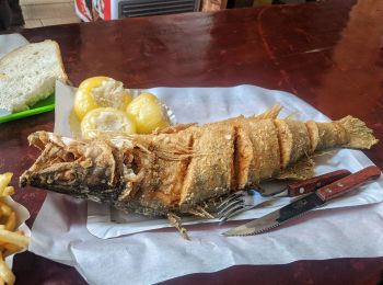
![Tour Zu Fuß Balatonalmádi - K▲ (Balatonalmádi - Óvári messzelátó - Öreg-park) - Photo](https://media.geolcdn.com/t/350/260/2b169442-039f-46ef-b48a-5428c0fbfccc.jpeg&format=jpg&maxdim=2)
![Zu Fuß Zu Fuß](https://static1.geolcdn.com/sitytour/trail-icons/100.png)
Km
Zu Fuß
![](/images/other/stat-length.png)
![](https://static1.geolcdn.com/siteimages/upload/files/1508320355ic_sort_den_pos_24dp.png)
![](https://static1.geolcdn.com/siteimages/upload/files/1508320355ic_sort_den_neg_24dp.png)
![](https://static1.geolcdn.com/siteimages/upload/files/16400158638029165_repeat_loop_refresh_sync_direction_icon.png)
• Trail created by Veszprém Megyei Természetbarát Szövetség.
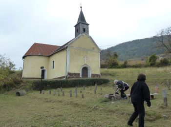
![Tour Zu Fuß Polan - S (Somló) - Photo](https://media.geolcdn.com/t/350/260/f686500f-ccdb-4766-a568-c0ec0e5031bd.jpeg&format=jpg&maxdim=2)
![Zu Fuß Zu Fuß](https://static1.geolcdn.com/sitytour/trail-icons/100.png)
Km
Zu Fuß
![](/images/other/stat-length.png)
![](https://static1.geolcdn.com/siteimages/upload/files/1508320355ic_sort_den_pos_24dp.png)
![](https://static1.geolcdn.com/siteimages/upload/files/1508320355ic_sort_den_neg_24dp.png)
![](https://static1.geolcdn.com/siteimages/upload/files/16400158638029165_repeat_loop_refresh_sync_direction_icon.png)
• Symbol: yellow bar
![Tour Zu Fuß Bakonybél - K+ (Bakonybél - Ugod) - Photo](https://media.geolcdn.com/t/350/260/d6b30e01-5269-43c0-a862-652a00400082.jpeg&format=jpg&maxdim=2)
![Zu Fuß Zu Fuß](https://static1.geolcdn.com/sitytour/trail-icons/100.png)
Km
Zu Fuß
![](/images/other/stat-length.png)
![](https://static1.geolcdn.com/siteimages/upload/files/1508320355ic_sort_den_pos_24dp.png)
![](https://static1.geolcdn.com/siteimages/upload/files/1508320355ic_sort_den_neg_24dp.png)
![](https://static1.geolcdn.com/siteimages/upload/files/16400158638029165_repeat_loop_refresh_sync_direction_icon.png)
• Trail created by Veszprém Megyei Természetbarát Szövetség.
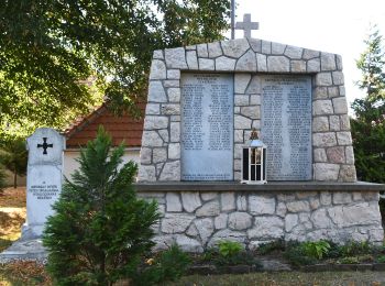
![Tour Zu Fuß Wallendorf - KT - Photo](https://media.geolcdn.com/t/350/260/c2ef2737-03cd-4d6c-b38e-426dbe1ec08a.jpeg&format=jpg&maxdim=2)
![Zu Fuß Zu Fuß](https://static1.geolcdn.com/sitytour/trail-icons/100.png)
Km
Zu Fuß
![](/images/other/stat-length.png)
![](https://static1.geolcdn.com/siteimages/upload/files/1508320355ic_sort_den_pos_24dp.png)
![](https://static1.geolcdn.com/siteimages/upload/files/1508320355ic_sort_den_neg_24dp.png)
![](https://static1.geolcdn.com/siteimages/upload/files/16400158638029165_repeat_loop_refresh_sync_direction_icon.png)
• Symbol: blue T
![Tour Zu Fuß Lindenbrunn - P4 - Photo](https://media.geolcdn.com/t/350/260/f51ecb76-e233-48eb-925c-2eb699956007.jpeg&format=jpg&maxdim=2)
![Zu Fuß Zu Fuß](https://static1.geolcdn.com/sitytour/trail-icons/100.png)
Km
Zu Fuß
![](/images/other/stat-length.png)
![](https://static1.geolcdn.com/siteimages/upload/files/1508320355ic_sort_den_pos_24dp.png)
![](https://static1.geolcdn.com/siteimages/upload/files/1508320355ic_sort_den_neg_24dp.png)
![](https://static1.geolcdn.com/siteimages/upload/files/16400158638029165_repeat_loop_refresh_sync_direction_icon.png)
• Symbol: red square
![Tour Zu Fuß Kischludt - K+ (Ajka - Városlőd) - Photo](https://media.geolcdn.com/t/350/260/e0ac41c5-7f3d-492c-abb1-d2a4d1681282.jpeg&format=jpg&maxdim=2)
![Zu Fuß Zu Fuß](https://static1.geolcdn.com/sitytour/trail-icons/100.png)
Km
Zu Fuß
![](/images/other/stat-length.png)
![](https://static1.geolcdn.com/siteimages/upload/files/1508320355ic_sort_den_pos_24dp.png)
![](https://static1.geolcdn.com/siteimages/upload/files/1508320355ic_sort_den_neg_24dp.png)
![](https://static1.geolcdn.com/siteimages/upload/files/16400158638029165_repeat_loop_refresh_sync_direction_icon.png)
• Symbol: blue cross
20 Angezeigte Touren bei 92
Kostenlosegpshiking-Anwendung
Aktivitäten
Nahegelegene Regionen
- Ábrahámhegy
- Aszófő
- Bad Plattensee
- Badacsonytomaj
- Badacsonytördemic
- Bakonybél
- Balatonakali
- Balatonalmádi
- Balatonfőkajár
- Banda
- Blaubrunn
- Csabrendek
- Csót
- Dewrenten
- Dörgicse
- Egyházaskesző
- Eikau
- Eppling
- Erewin
- Ganna
- Gentschdorf
- Großwaschon
- Hegymagas
- Herrendorf
- Homokbödöge
- Jauer im Buchenwald
- Kapolcs
- Kisapáti
- Kischludt
- Kornthal
- Köveskál
- Kup
- Lindenbrunn
- Mindszentkálla
- Monostorapáti
- Monoszló
- Nannau
- Nemesvámos
- Osslop
- Paloznak
- Polan
- Sankt Gall
- Sirtz
- Sitsch
- Somlóvásárhely
- Szentbékkálla
- Szigliget
- Tés
- Tihany
- Ugod
- Ukk
- Wallendorf
- Waschludt
- Wesprim
- Wirtshäusl
- Zeßnegg