![](/images/other/stat-length.png)
- Touren
- Zu Fuß
- Hungary
- Nördliche Große Tiefebene
- Komitat Tschongrad-Tschanad
Komitat Tschongrad-Tschanad, Nördliche Große Tiefebene, Zu Fuß: Die besten Touren, Trails, Trecks und Wanderungen
Komitat Tschongrad-Tschanad : Entdecken Sie die besten Touren : 7 zu fuß. Alle diese Touren, Trails, Routen und Outdoor-Aktivitäten sind in unseren SityTrail-Apps für Smartphones und Tablets verfügbar.
Die besten Spuren (7)
![Tour Zu Fuß Ópusztaszer - K+ Kistelek vá. – Ópusztaszer Nemzeti Történeti Emlékpark - Photo](https://media.geolcdn.com/t/350/260/192f45f3-19e4-4bbe-80a1-3e38a19a7762.jpeg&format=jpg&maxdim=2)
![Zu Fuß Zu Fuß](https://static1.geolcdn.com/sitytour/trail-icons/100.png)
Km
Zu Fuß
![](/images/other/stat-length.png)
![](https://static1.geolcdn.com/siteimages/upload/files/1508320355ic_sort_den_pos_24dp.png)
![](https://static1.geolcdn.com/siteimages/upload/files/1508320355ic_sort_den_neg_24dp.png)
![](https://static1.geolcdn.com/siteimages/upload/files/16400158638029165_repeat_loop_refresh_sync_direction_icon.png)
• Trail created by DÉMÁSZ Elektromos SE.
![Tour Zu Fuß Öttömös - S Petróczi iskola (AK) - Csongrád megye magaspontja - Öttömös - Photo](https://media.geolcdn.com/t/350/260/a82c7bfb-4361-4273-b4d7-09b6380ef5d1.jpeg&format=jpg&maxdim=2)
![Zu Fuß Zu Fuß](https://static1.geolcdn.com/sitytour/trail-icons/100.png)
Km
Zu Fuß
![](/images/other/stat-length.png)
![](https://static1.geolcdn.com/siteimages/upload/files/1508320355ic_sort_den_pos_24dp.png)
![](https://static1.geolcdn.com/siteimages/upload/files/1508320355ic_sort_den_neg_24dp.png)
![](https://static1.geolcdn.com/siteimages/upload/files/16400158638029165_repeat_loop_refresh_sync_direction_icon.png)
• Trail created by CSMTSZ. Symbol: Yellow bar on white background
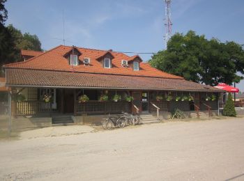
![Tour Zu Fuß Derekegyház - Zq (Derekegyház) - Photo](https://media.geolcdn.com/t/350/260/a69718e5-7796-47e5-b7b1-f4d6b6db2bc4.jpeg&format=jpg&maxdim=2)
![Zu Fuß Zu Fuß](https://static1.geolcdn.com/sitytour/trail-icons/100.png)
Km
Zu Fuß
![](/images/other/stat-length.png)
![](https://static1.geolcdn.com/siteimages/upload/files/1508320355ic_sort_den_pos_24dp.png)
![](https://static1.geolcdn.com/siteimages/upload/files/1508320355ic_sort_den_neg_24dp.png)
![](https://static1.geolcdn.com/siteimages/upload/files/16400158638029165_repeat_loop_refresh_sync_direction_icon.png)
• Trail created by Derekegyház ÖK. felhagyott turistaút
![Tour Zu Fuß Szatymaz - K3 - Photo](https://media.geolcdn.com/t/350/260/83a06bf3-a14d-40ef-a607-f6a7871acac8.jpeg&format=jpg&maxdim=2)
![Zu Fuß Zu Fuß](https://static1.geolcdn.com/sitytour/trail-icons/100.png)
Km
Zu Fuß
![](/images/other/stat-length.png)
![](https://static1.geolcdn.com/siteimages/upload/files/1508320355ic_sort_den_pos_24dp.png)
![](https://static1.geolcdn.com/siteimages/upload/files/1508320355ic_sort_den_neg_24dp.png)
![](https://static1.geolcdn.com/siteimages/upload/files/16400158638029165_repeat_loop_refresh_sync_direction_icon.png)
• Trail created by Bíbic TK.
![Tour Zu Fuß Ásotthalom - K+ Back-Kápolna – Ásotthalom - Photo](https://media.geolcdn.com/t/350/260/de4d4e3c-ebf1-4757-a120-635e29f48c49.jpeg&format=jpg&maxdim=2)
![Zu Fuß Zu Fuß](https://static1.geolcdn.com/sitytour/trail-icons/100.png)
Km
Zu Fuß
![](/images/other/stat-length.png)
![](https://static1.geolcdn.com/siteimages/upload/files/1508320355ic_sort_den_pos_24dp.png)
![](https://static1.geolcdn.com/siteimages/upload/files/1508320355ic_sort_den_neg_24dp.png)
![](https://static1.geolcdn.com/siteimages/upload/files/16400158638029165_repeat_loop_refresh_sync_direction_icon.png)
• Trail created by Crocus TK.
![Tour Zu Fuß Neumarkt an der Theiß - K↺ - Photo](https://media.geolcdn.com/t/350/260/89f1e238-f659-44d0-bf6c-fb5c84760f1a.jpeg&format=jpg&maxdim=2)
![Zu Fuß Zu Fuß](https://static1.geolcdn.com/sitytour/trail-icons/100.png)
Km
Zu Fuß
![](/images/other/stat-length.png)
![](https://static1.geolcdn.com/siteimages/upload/files/1508320355ic_sort_den_pos_24dp.png)
![](https://static1.geolcdn.com/siteimages/upload/files/1508320355ic_sort_den_neg_24dp.png)
![](https://static1.geolcdn.com/siteimages/upload/files/16400158638029165_repeat_loop_refresh_sync_direction_icon.png)
• Trail created by Hód-Mentor Sportegyesület.
![Tour Zu Fuß Ásotthalom - K4 AKT - Bűbáj-birtok - Ásotthalmi elágazás am - Photo](https://media.geolcdn.com/t/350/260/ext.jpg?maxdim=2&url=https%3A%2F%2Fstatic1.geolcdn.com%2Fsiteimages%2Fupload%2Ffiles%2F1545311037marcheuse_200dpi.jpg)
![Zu Fuß Zu Fuß](https://static1.geolcdn.com/sitytour/trail-icons/100.png)
Km
Zu Fuß
![](/images/other/stat-length.png)
![](https://static1.geolcdn.com/siteimages/upload/files/1508320355ic_sort_den_pos_24dp.png)
![](https://static1.geolcdn.com/siteimages/upload/files/1508320355ic_sort_den_neg_24dp.png)
![](https://static1.geolcdn.com/siteimages/upload/files/16400158638029165_repeat_loop_refresh_sync_direction_icon.png)
• Trail created by Crocus TK.
7 Angezeigte Touren bei 7
Kostenlosegpshiking-Anwendung