![](/images/other/stat-length.png)
Gespanschaft Zagreb, Unbekannt, Zu Fuß: Die besten Touren, Trails, Trecks und Wanderungen
Gespanschaft Zagreb : Entdecken Sie die besten Touren : 52 zu fuß. Alle diese Touren, Trails, Routen und Outdoor-Aktivitäten sind in unseren SityTrail-Apps für Smartphones und Tablets verfügbar.
Die besten Spuren (52)
![Tour Zu Fuß - Osredek - Beder - Photo](https://media.geolcdn.com/t/350/260/02f74ee7-f7a8-4cd6-a4f4-99b06a677f3c.jpeg&format=jpg&maxdim=2)
![Zu Fuß Zu Fuß](https://static1.geolcdn.com/sitytour/trail-icons/100.png)
Km
Zu Fuß
![](/images/other/stat-length.png)
![](https://static1.geolcdn.com/siteimages/upload/files/1508320355ic_sort_den_pos_24dp.png)
![](https://static1.geolcdn.com/siteimages/upload/files/1508320355ic_sort_den_neg_24dp.png)
![](https://static1.geolcdn.com/siteimages/upload/files/16400158638029165_repeat_loop_refresh_sync_direction_icon.png)
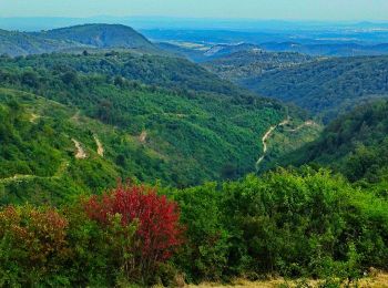
• Tour erstellt von PK Scout, Samobor. Osredek - Kostanjevec Podvrški - Vučica - (X) s 62 za Beder i Grdanjce
![Tour Zu Fuß - Grdanjci - Noršić selo - Photo](https://media.geolcdn.com/t/350/260/360e921b-97d3-4b67-9f69-dac3c02b0938.jpeg&format=jpg&maxdim=2)
![Zu Fuß Zu Fuß](https://static1.geolcdn.com/sitytour/trail-icons/100.png)
Km
Zu Fuß
![](/images/other/stat-length.png)
![](https://static1.geolcdn.com/siteimages/upload/files/1508320355ic_sort_den_pos_24dp.png)
![](https://static1.geolcdn.com/siteimages/upload/files/1508320355ic_sort_den_neg_24dp.png)
![](https://static1.geolcdn.com/siteimages/upload/files/16400158638029165_repeat_loop_refresh_sync_direction_icon.png)
• Tour erstellt von HPD Zanatlija, Zagreb. Grdanjci (a.p.) - Beder - Brnjice - Noršić Selo(Kapelišće)
![Tour Zu Fuß Samobor - Samobor - Veliki dol - Photo](https://media.geolcdn.com/t/350/260/21b94185-510f-4546-991c-c62af1c7bf3f.jpeg&format=jpg&maxdim=2)
![Zu Fuß Zu Fuß](https://static1.geolcdn.com/sitytour/trail-icons/100.png)
Km
Zu Fuß
![](/images/other/stat-length.png)
![](https://static1.geolcdn.com/siteimages/upload/files/1508320355ic_sort_den_pos_24dp.png)
![](https://static1.geolcdn.com/siteimages/upload/files/1508320355ic_sort_den_neg_24dp.png)
![](https://static1.geolcdn.com/siteimages/upload/files/16400158638029165_repeat_loop_refresh_sync_direction_icon.png)
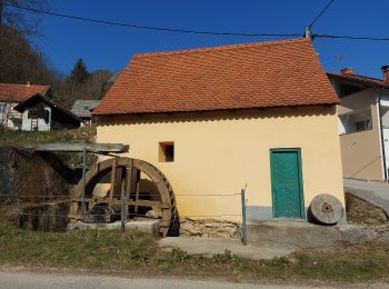
• Tour erstellt von HPD Željezničar, Zagreb. Samobor (most preko Gradne u blizini Samoborskog muzeja) - Vugrinščak - T...
![Tour Zu Fuß - Koretići - Poklek - Photo](https://media.geolcdn.com/t/350/260/d7fc09e4-b763-4816-8be1-38bb077973f8.jpeg&format=jpg&maxdim=2)
![Zu Fuß Zu Fuß](https://static1.geolcdn.com/sitytour/trail-icons/100.png)
Km
Zu Fuß
![](/images/other/stat-length.png)
![](https://static1.geolcdn.com/siteimages/upload/files/1508320355ic_sort_den_pos_24dp.png)
![](https://static1.geolcdn.com/siteimages/upload/files/1508320355ic_sort_den_neg_24dp.png)
![](https://static1.geolcdn.com/siteimages/upload/files/16400158638029165_repeat_loop_refresh_sync_direction_icon.png)
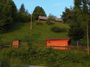
• Tour erstellt von PK Scout, Samobor.
![Tour Zu Fuß - Koretići - Kravljak - Photo](https://media.geolcdn.com/t/350/260/d7fc09e4-b763-4816-8be1-38bb077973f8.jpeg&format=jpg&maxdim=2)
![Zu Fuß Zu Fuß](https://static1.geolcdn.com/sitytour/trail-icons/100.png)
Km
Zu Fuß
![](/images/other/stat-length.png)
![](https://static1.geolcdn.com/siteimages/upload/files/1508320355ic_sort_den_pos_24dp.png)
![](https://static1.geolcdn.com/siteimages/upload/files/1508320355ic_sort_den_neg_24dp.png)
![](https://static1.geolcdn.com/siteimages/upload/files/16400158638029165_repeat_loop_refresh_sync_direction_icon.png)
• Tour erstellt von nepoznat. nepoznato
![Tour Zu Fuß - Gabrovica - Kravljak - Photo](https://media.geolcdn.com/t/350/260/052fddf2-4498-409b-a8ab-f02cb8a90db8.jpeg&format=jpg&maxdim=2)
![Zu Fuß Zu Fuß](https://static1.geolcdn.com/sitytour/trail-icons/100.png)
Km
Zu Fuß
![](/images/other/stat-length.png)
![](https://static1.geolcdn.com/siteimages/upload/files/1508320355ic_sort_den_pos_24dp.png)
![](https://static1.geolcdn.com/siteimages/upload/files/1508320355ic_sort_den_neg_24dp.png)
![](https://static1.geolcdn.com/siteimages/upload/files/16400158638029165_repeat_loop_refresh_sync_direction_icon.png)
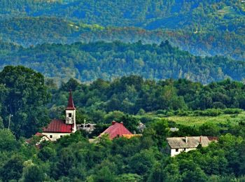
• Tour erstellt von HPD Vihor, Zagreb.
![Tour Zu Fuß - Kravljak - Stojdraga - Photo](https://media.geolcdn.com/t/350/260/ee1b2247-18e5-488b-8e88-33333aefa699.jpeg&format=jpg&maxdim=2)
![Zu Fuß Zu Fuß](https://static1.geolcdn.com/sitytour/trail-icons/100.png)
Km
Zu Fuß
![](/images/other/stat-length.png)
![](https://static1.geolcdn.com/siteimages/upload/files/1508320355ic_sort_den_pos_24dp.png)
![](https://static1.geolcdn.com/siteimages/upload/files/1508320355ic_sort_den_neg_24dp.png)
![](https://static1.geolcdn.com/siteimages/upload/files/16400158638029165_repeat_loop_refresh_sync_direction_icon.png)
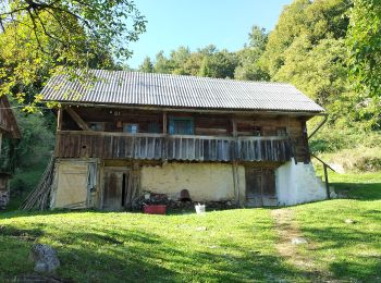
• Tour erstellt von Sveti Bernard, Samobor. (X) Kravljak (kapela) - (X) za Tušćak - livada Srbljeni - Stojdraga(a.p.)
![Tour Zu Fuß - Noršić Selo - Katin krč - Photo](https://media.geolcdn.com/t/350/260/b167355c-57af-49c1-ae87-931613543d0f.jpeg&format=jpg&maxdim=2)
![Zu Fuß Zu Fuß](https://static1.geolcdn.com/sitytour/trail-icons/100.png)
Km
Zu Fuß
![](/images/other/stat-length.png)
![](https://static1.geolcdn.com/siteimages/upload/files/1508320355ic_sort_den_pos_24dp.png)
![](https://static1.geolcdn.com/siteimages/upload/files/1508320355ic_sort_den_neg_24dp.png)
![](https://static1.geolcdn.com/siteimages/upload/files/16400158638029165_repeat_loop_refresh_sync_direction_icon.png)
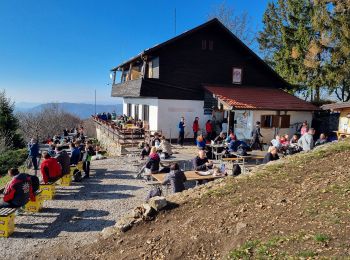
• Tour erstellt von HPD Japetić, Samobor. Noršić Selo (Kapelišće) (X) s 49 - Jarušje, (X) s 52 - Dragonoš, (X) s 58 - ...
![Tour Zu Fuß - Slani dol - Noršić Selo - Photo](https://media.geolcdn.com/t/350/260/360e921b-97d3-4b67-9f69-dac3c02b0938.jpeg&format=jpg&maxdim=2)
![Zu Fuß Zu Fuß](https://static1.geolcdn.com/sitytour/trail-icons/100.png)
Km
Zu Fuß
![](/images/other/stat-length.png)
![](https://static1.geolcdn.com/siteimages/upload/files/1508320355ic_sort_den_pos_24dp.png)
![](https://static1.geolcdn.com/siteimages/upload/files/1508320355ic_sort_den_neg_24dp.png)
![](https://static1.geolcdn.com/siteimages/upload/files/16400158638029165_repeat_loop_refresh_sync_direction_icon.png)
• Tour erstellt von HPD Japetić, Samobor. Slani Dol (a.p.) - Breganica - odvojak do špilje Vilinske jame (2 min) -Tuši...
![Tour Zu Fuß - Slani dol - Gostinjac Sv. Bernard - Photo](https://media.geolcdn.com/t/350/260/c97b8dc0-0e3a-4e26-bef6-8556ac70acf5.jpeg&format=jpg&maxdim=2)
![Zu Fuß Zu Fuß](https://static1.geolcdn.com/sitytour/trail-icons/100.png)
Km
Zu Fuß
![](/images/other/stat-length.png)
![](https://static1.geolcdn.com/siteimages/upload/files/1508320355ic_sort_den_pos_24dp.png)
![](https://static1.geolcdn.com/siteimages/upload/files/1508320355ic_sort_den_neg_24dp.png)
![](https://static1.geolcdn.com/siteimages/upload/files/16400158638029165_repeat_loop_refresh_sync_direction_icon.png)
• Tour erstellt von Sveti Bernard, Samobor. Zadnja stanica autobusa U Slanom Dolu - (X) odvojak za Smerovišće u Slanom...
![Tour Zu Fuß - Grgosova špilja - Slani dol - Photo](https://media.geolcdn.com/t/350/260/e1d74823-4105-4a56-acd7-4a4d2d506da5.jpeg&format=jpg&maxdim=2)
![Zu Fuß Zu Fuß](https://static1.geolcdn.com/sitytour/trail-icons/100.png)
Km
Zu Fuß
![](/images/other/stat-length.png)
![](https://static1.geolcdn.com/siteimages/upload/files/1508320355ic_sort_den_pos_24dp.png)
![](https://static1.geolcdn.com/siteimages/upload/files/1508320355ic_sort_den_neg_24dp.png)
![](https://static1.geolcdn.com/siteimages/upload/files/16400158638029165_repeat_loop_refresh_sync_direction_icon.png)
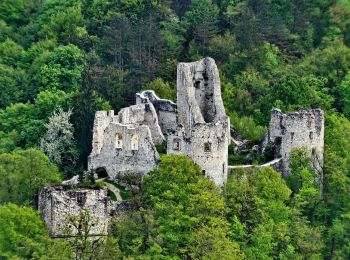
• Tour erstellt von HPD Japetić, Samobor. Grgosova špilja u Otruševcu (a.p.) - Lešće- Vratnik - Slani Dol (a.p.) - (X)...
![Tour Zu Fuß Samobor - Samobor (Hamor) - Slani dol - Photo](https://media.geolcdn.com/t/350/260/287cd65b-9650-4adb-ad52-53091d2e9f31.jpeg&format=jpg&maxdim=2)
![Zu Fuß Zu Fuß](https://static1.geolcdn.com/sitytour/trail-icons/100.png)
Km
Zu Fuß
![](/images/other/stat-length.png)
![](https://static1.geolcdn.com/siteimages/upload/files/1508320355ic_sort_den_pos_24dp.png)
![](https://static1.geolcdn.com/siteimages/upload/files/1508320355ic_sort_den_neg_24dp.png)
![](https://static1.geolcdn.com/siteimages/upload/files/16400158638029165_repeat_loop_refresh_sync_direction_icon.png)
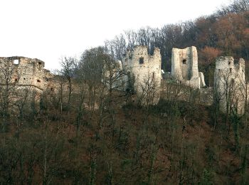
• Tour erstellt von HPD Japetić, Samobo. Samobor - a.p. Hamor (2,5 km od Samobora) - Gradišće - Draganje Selo - Slani ...
![Tour Zu Fuß - Gornje Rude - Poljanice - Photo](https://media.geolcdn.com/t/350/260/ecb25a92-c337-42e7-952b-54cc173d0117.jpeg&format=jpg&maxdim=2)
![Zu Fuß Zu Fuß](https://static1.geolcdn.com/sitytour/trail-icons/100.png)
Km
Zu Fuß
![](/images/other/stat-length.png)
![](https://static1.geolcdn.com/siteimages/upload/files/1508320355ic_sort_den_pos_24dp.png)
![](https://static1.geolcdn.com/siteimages/upload/files/1508320355ic_sort_den_neg_24dp.png)
![](https://static1.geolcdn.com/siteimages/upload/files/16400158638029165_repeat_loop_refresh_sync_direction_icon.png)
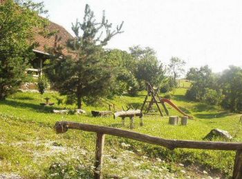
• Tour erstellt von HPD Zagreb-Matica, Zagreb. Rude (a.p. gornje Rude) - Bukovje - (X) 7A za Prekrižje - željezno rasp...
![Tour Zu Fuß - Rude - Plešivica - Photo](https://media.geolcdn.com/t/350/260/64d55e2e-dd75-4144-9e92-e25a189ac92c.jpeg&format=jpg&maxdim=2)
![Zu Fuß Zu Fuß](https://static1.geolcdn.com/sitytour/trail-icons/100.png)
Km
Zu Fuß
![](/images/other/stat-length.png)
![](https://static1.geolcdn.com/siteimages/upload/files/1508320355ic_sort_den_pos_24dp.png)
![](https://static1.geolcdn.com/siteimages/upload/files/1508320355ic_sort_den_neg_24dp.png)
![](https://static1.geolcdn.com/siteimages/upload/files/16400158638029165_repeat_loop_refresh_sync_direction_icon.png)
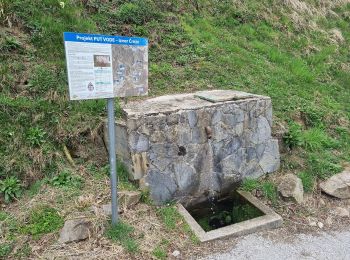
• Tour erstellt von HPD Japetić, Samobor. Rude (a.p. u centru) - Manja Vas - Kotari - Spoj s putom 12 iznad Kotara - (...
![Tour Zu Fuß - Sv. Martin - Okić - Photo](https://media.geolcdn.com/t/350/260/7c2964af-cb21-4dd5-adc5-50608cfeb479.jpeg&format=jpg&maxdim=2)
![Zu Fuß Zu Fuß](https://static1.geolcdn.com/sitytour/trail-icons/100.png)
Km
Zu Fuß
![](/images/other/stat-length.png)
![](https://static1.geolcdn.com/siteimages/upload/files/1508320355ic_sort_den_pos_24dp.png)
![](https://static1.geolcdn.com/siteimages/upload/files/1508320355ic_sort_den_neg_24dp.png)
![](https://static1.geolcdn.com/siteimages/upload/files/16400158638029165_repeat_loop_refresh_sync_direction_icon.png)
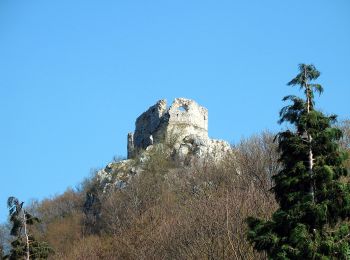
• Tour erstellt von HPD Kapela, Zagreb. Sv. Martin (a.p.) - Mihina staza - Podiščak - Klake (a.p.) - Jakopci (Etno kuć...
![Tour Zu Fuß Samobor - Samobor - Grgosova špilja - Photo](https://media.geolcdn.com/t/350/260/8fc87167-64f8-4dce-99f6-168edd44cd77.jpeg&format=jpg&maxdim=2)
![Zu Fuß Zu Fuß](https://static1.geolcdn.com/sitytour/trail-icons/100.png)
Km
Zu Fuß
![](/images/other/stat-length.png)
![](https://static1.geolcdn.com/siteimages/upload/files/1508320355ic_sort_den_pos_24dp.png)
![](https://static1.geolcdn.com/siteimages/upload/files/1508320355ic_sort_den_neg_24dp.png)
![](https://static1.geolcdn.com/siteimages/upload/files/16400158638029165_repeat_loop_refresh_sync_direction_icon.png)
• Tour erstellt von HPD Japetić, Samobor. Samobor (Trg kralja Tomislava) - Stražnik - Grgosova špilja u Otruševcu (a.p.)
![Tour Zu Fuß - Jastrebarsko - Žitnica - Photo](https://media.geolcdn.com/t/350/260/c97b8dc0-0e3a-4e26-bef6-8556ac70acf5.jpeg&format=jpg&maxdim=2)
![Zu Fuß Zu Fuß](https://static1.geolcdn.com/sitytour/trail-icons/100.png)
Km
Zu Fuß
![](/images/other/stat-length.png)
![](https://static1.geolcdn.com/siteimages/upload/files/1508320355ic_sort_den_pos_24dp.png)
![](https://static1.geolcdn.com/siteimages/upload/files/1508320355ic_sort_den_neg_24dp.png)
![](https://static1.geolcdn.com/siteimages/upload/files/16400158638029165_repeat_loop_refresh_sync_direction_icon.png)
• Tour erstellt von HPD Jastrebarsko, Jastrebarsko. Jastrebarsko (a.p.) - kapela Sv. Duha - Baliji - Pl. dom Žitnica n...
![Tour Zu Fuß - Šoićeva kuća - Japetić - Photo](https://media.geolcdn.com/t/350/260/b167355c-57af-49c1-ae87-931613543d0f.jpeg&format=jpg&maxdim=2)
![Zu Fuß Zu Fuß](https://static1.geolcdn.com/sitytour/trail-icons/100.png)
Km
Zu Fuß
![](/images/other/stat-length.png)
![](https://static1.geolcdn.com/siteimages/upload/files/1508320355ic_sort_den_pos_24dp.png)
![](https://static1.geolcdn.com/siteimages/upload/files/1508320355ic_sort_den_neg_24dp.png)
![](https://static1.geolcdn.com/siteimages/upload/files/16400158638029165_repeat_loop_refresh_sync_direction_icon.png)
• Tour erstellt von HPD Japetić, Samobor. Pl. dom Šoićeva kuća - (X) livada Leskovica - livada Duga draga - (X) livada...
![Tour Zu Fuß - Galgovo - Okić - Photo](https://media.geolcdn.com/t/350/260/02b13133-b05b-42c7-9042-0684cb5ca176.jpeg&format=jpg&maxdim=2)
![Zu Fuß Zu Fuß](https://static1.geolcdn.com/sitytour/trail-icons/100.png)
Km
Zu Fuß
![](/images/other/stat-length.png)
![](https://static1.geolcdn.com/siteimages/upload/files/1508320355ic_sort_den_pos_24dp.png)
![](https://static1.geolcdn.com/siteimages/upload/files/1508320355ic_sort_den_neg_24dp.png)
![](https://static1.geolcdn.com/siteimages/upload/files/16400158638029165_repeat_loop_refresh_sync_direction_icon.png)
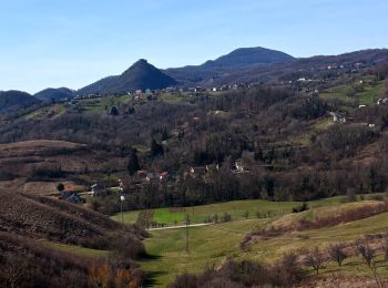
• Tour erstellt von PDS Velebit, Zagreb. Galgovo (a.p.) - Sv. Martin (a.p.) - X s Mihinom stazom - Podgrađe (a.p.) - D...
![Tour Zu Fuß - Draga - Žitnica - Photo](https://media.geolcdn.com/t/350/260/c97b8dc0-0e3a-4e26-bef6-8556ac70acf5.jpeg&format=jpg&maxdim=2)
![Zu Fuß Zu Fuß](https://static1.geolcdn.com/sitytour/trail-icons/100.png)
Km
Zu Fuß
![](/images/other/stat-length.png)
![](https://static1.geolcdn.com/siteimages/upload/files/1508320355ic_sort_den_pos_24dp.png)
![](https://static1.geolcdn.com/siteimages/upload/files/1508320355ic_sort_den_neg_24dp.png)
![](https://static1.geolcdn.com/siteimages/upload/files/16400158638029165_repeat_loop_refresh_sync_direction_icon.png)
• Tour erstellt von HPD Jastrebarsko, Jastrebarsko. Višoševićev mlin u Dragi - Grabarak - Pl. dom Žitnica na Japetiću
20 Angezeigte Touren bei 52
Kostenlosegpshiking-Anwendung