


10,6 km | 19 km-effort
Ota : Entdecken Sie die besten Touren : 1 zu fuß, 41 wandern und 1 pfad. Alle diese Touren, Trails, Routen und Outdoor-Aktivitäten sind in unseren SityTrail-Apps für Smartphones und Tablets verfügbar.
Wandern


Wandern
•
Wandern
Zu Fuß
Wandern

Wandern
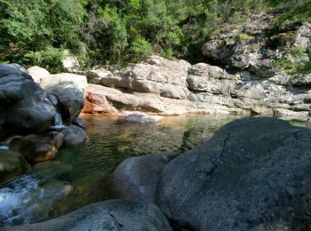
• passage à gué
Wandern
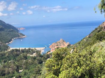
• Corniche de Porto boucle par Ghineparu
Wandern
Wandern

Wandern
Wandern

Wandern

Wandern
Wandern
Wandern
Wandern
Wandern
Wandern
Wandern
•
Wandern
• Huitième étape
20 Angezeigte Touren bei 43
Kostenlosegpshiking-Anwendung
 SityTrail
IGN / Geografische Institute
SityTrail World
Die Welt öffnet sich für Sie