


12,3 km | 17,7 km-effort
Lauret : Entdecken Sie die besten Touren : 2 zu fuß, 36 wandern und 1 laufen. Alle diese Touren, Trails, Routen und Outdoor-Aktivitäten sind in unseren SityTrail-Apps für Smartphones und Tablets verfügbar.

Wandern


Wandern
Wandern
Wandern
Wandern
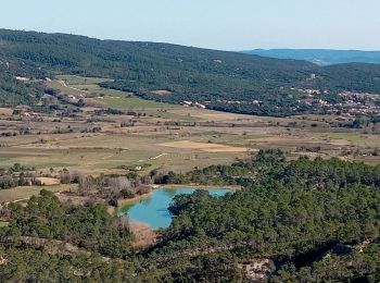
• Montée et descente pénible dans les cailloux - Jolis points de vue depuis le sommet et passage au Moulin très agréable
Wandern
Wandern
Wandern

Zu Fuß

Wandern
Wandern

Wandern

Wandern
Wandern
Wandern
Wandern
Wandern
• 2019-03-03
Wandern
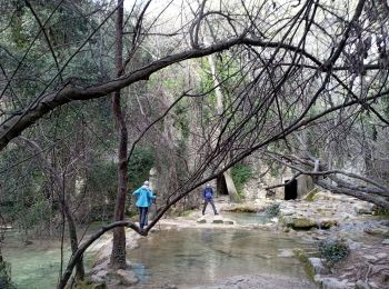
• passage riviere
Wandern
• 03/12/2017
Wandern
20 Angezeigte Touren bei 39
Kostenlosegpshiking-Anwendung
 SityTrail
IGN / Geografische Institute
SityTrail World
Die Welt öffnet sich für Sie