Châteauroux-les-Alpes, Hochalpen, Zu Fuß: Die besten Touren, Trails, Trecks und Wanderungen

5 kommentare

Châteauroux-les-Alpes : Entdecken Sie die besten Touren : 2 zu fuß, 58 wandern und 2 nordic walking. Alle diese Touren, Trails, Routen und Outdoor-Aktivitäten sind in unseren SityTrail-Apps für Smartphones und Tablets verfügbar.


Die besten Spuren (62)
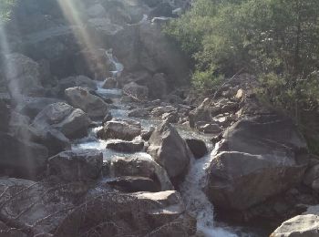
Tour Wandern Châteauroux-les-Alpes - boucle cascade de la pisse - Photo
Wandern 8.839
Km

Wandern

Sehr leicht
(1)
Châteauroux-les-Alpes, Provence-Alpes-Côte d'Azur, Hochalpen, France
8,8 km | 12,4 km-effort
2h 17min
269 m
270 m
Ja
gildascb

• randonnée familiale abritée dans les bois
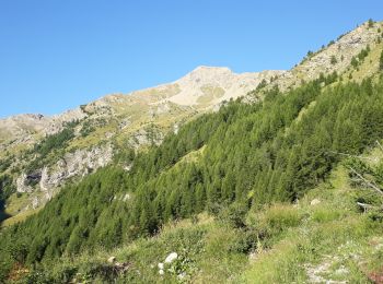
Tour Wandern Châteauroux-les-Alpes - Mourre Froid 01/09/18 - Photo
Wandern 15.958
Km
GUIDE

Wandern

Sehr schwierig
Châteauroux-les-Alpes, Provence-Alpes-Côte d'Azur, Hochalpen, France
16 km | 35 km-effort
6h 51min
1421 m
1420 m
Ja
R@ph

Tour Wandern Châteauroux-les-Alpes - la cascade de la Pisse  - Photo
Wandern 11.09
Km

Wandern

Medium
Châteauroux-les-Alpes, Provence-Alpes-Côte d'Azur, Hochalpen, France
11,1 km | 15,9 km-effort
4h 26min
358 m
358 m
Ja
GILOU440

Tour Wandern Châteauroux-les-Alpes - Vallon du Rabioux - Photo
Wandern 12.141
Km

Wandern

Einfach
Châteauroux-les-Alpes, Provence-Alpes-Côte d'Azur, Hochalpen, France
12,1 km | 22 km-effort
4h 5min
724 m
722 m
Ja
gildascb

Tour Wandern Châteauroux-les-Alpes - Cascade de la Pise Chateauroux - Photo
Wandern 10.964
Km

Wandern

Einfach
Châteauroux-les-Alpes, Provence-Alpes-Côte d'Azur, Hochalpen, France
11 km | 15,7 km-effort
3h 31min
353 m
357 m
Ja
Sorriaux

Tour Wandern Châteauroux-les-Alpes - Cascade de la pisse (un grand classique) - Photo
Wandern 10.927
Km

Wandern

Sehr leicht
Châteauroux-les-Alpes, Provence-Alpes-Côte d'Azur, Hochalpen, France
10,9 km | 16,2 km-effort
3h 31min
396 m
395 m
Ja
gildascb

Tour Wandern Châteauroux-les-Alpes - Rome-42-St Alban-Eygliers-20170913 - Photo
Wandern 17.938
Km

Wandern

Schwierig
Châteauroux-les-Alpes, Provence-Alpes-Côte d'Azur, Hochalpen, France
17,9 km | 26 km-effort
5h 12min
605 m
676 m
Nein
patrickdanilo

• ALTA-22-N°0408F42-GR653D

Tour Wandern Châteauroux-les-Alpes - l'ALPET: Chapelle St Pierre/ porte du Distroit ( La Mari Passe) - Photo
Wandern 3.574
Km

Wandern

Schwierig
Châteauroux-les-Alpes, Provence-Alpes-Côte d'Azur, Hochalpen, France
3,6 km | 10,4 km-effort
2h 58min
515 m
515 m
Ja
BLANCHET

• Tété de Clotinaille, tout droit dans le clapier; descente idem : une tuerie!
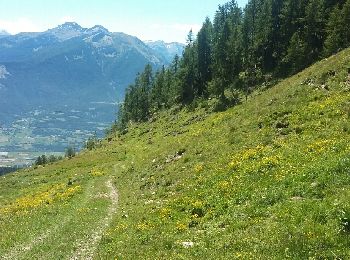
Tour Wandern Châteauroux-les-Alpes - Clos  Jaunier - cabane de Soleil Boeuf - Photo
Wandern 5.386
Km

Wandern

Einfach
Châteauroux-les-Alpes, Provence-Alpes-Côte d'Azur, Hochalpen, France
5,4 km | 10,8 km-effort
2h 3min
407 m
403 m
Ja
BLANCHET

• remise en jambes

Tour Wandern Châteauroux-les-Alpes - Le Distroit. par Pied Brun - Photo
Wandern 7.739
Km

Wandern

Schwierig
Châteauroux-les-Alpes, Provence-Alpes-Côte d'Azur, Hochalpen, France
7,7 km | 19 km-effort
4h 4min
973 m
446 m
Nein
BLANCHET

Tour Wandern Châteauroux-les-Alpes - pointe des Rougnous et Roc blanc  - Photo
Wandern 17.453
Km
GUIDE

Wandern

Medium
Châteauroux-les-Alpes, Provence-Alpes-Côte d'Azur, Hochalpen, France
17,5 km | 37 km-effort
8h 3min
1387 m
1594 m
Nein
orsel

Tour Wandern Châteauroux-les-Alpes - Cascade de la Pisse - Photo
Wandern 11.421
Km
GUIDE

Wandern

Einfach
Châteauroux-les-Alpes, Provence-Alpes-Côte d'Azur, Hochalpen, France
11,4 km | 17,4 km-effort
3h 3min
451 m
448 m
Ja
David25400

Tour Wandern Châteauroux-les-Alpes - Lac de la Dent et Vallon du Tissap - Photo
Wandern 13.366
Km

Wandern

Medium
Châteauroux-les-Alpes, Provence-Alpes-Côte d'Azur, Hochalpen, France
13,4 km | 26 km-effort
9h 28min
912 m
926 m
Ja
BLANCHET

• la montée est raide! La descente vers la cabane du Tissap se fait dans les casses . Il faut franchir plusieurs barres...
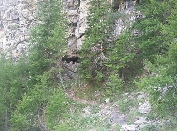
Tour Wandern Châteauroux-les-Alpes - Cabane du Couleau Groupe C  20/08/2015 - Photo
Wandern 7.532
Km

Wandern

Einfach
Châteauroux-les-Alpes, Provence-Alpes-Côte d'Azur, Hochalpen, France
7,5 km | 14,3 km-effort
3h 54min
509 m
498 m
Ja
BLANCHET

Tour Wandern Châteauroux-les-Alpes - La Reste - Oratoire de Clos Jaunier - Photo
Wandern 11.533
Km

Wandern

Medium
Châteauroux-les-Alpes, Provence-Alpes-Côte d'Azur, Hochalpen, France
11,5 km | 19,6 km-effort
4h 0min
604 m
603 m
Ja
BLANCHET

Tour Wandern Châteauroux-les-Alpes - Châteauroux village - refuge des Pinées - Photo
Wandern 8.038
Km

Wandern

Einfach
Châteauroux-les-Alpes, Provence-Alpes-Côte d'Azur, Hochalpen, France
8 km | 12,2 km-effort
2h 44min
312 m
316 m
Ja
BLANCHET

• c est une balade pas une rando. on peut manger au refuge. En été on évitera pas les voitures sur ma route de la ca...
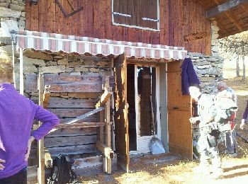
Tour Wandern Châteauroux-les-Alpes - chemin du facteur - Photo
Wandern 7.589
Km

Wandern

Sehr leicht
Châteauroux-les-Alpes, Provence-Alpes-Côte d'Azur, Hochalpen, France
7,6 km | 12,8 km-effort
3h 14min
368 m
469 m
Nein
BLANCHET

Tour Wandern Châteauroux-les-Alpes - l'Hivernet versant sud - Photo
Wandern 9.543
Km
GUIDE

Wandern

Medium
Châteauroux-les-Alpes, Provence-Alpes-Côte d'Azur, Hochalpen, France
9,5 km | 24 km-effort
7h 11min
1114 m
1110 m
Ja
orsel

Tour Wandern Châteauroux-les-Alpes - Chantal les balcons de la Durance - Photo
Wandern 8.318
Km

Wandern

Medium
Châteauroux-les-Alpes, Provence-Alpes-Côte d'Azur, Hochalpen, France
8,3 km | 12,2 km-effort
2h 30min
289 m
289 m
Ja
damlou

Tour Nordic Walking Châteauroux-les-Alpes - Le hameau de La reste Châteauroux Guillaine - Photo
Nordic Walking 7.319
Km

Nordic Walking

Einfach
Châteauroux-les-Alpes, Provence-Alpes-Côte d'Azur, Hochalpen, France
7,3 km | 12 km-effort
1h 56min
353 m
350 m
Ja
damlou

20 Angezeigte Touren bei 62

Kostenlosegpshiking-Anwendung

Logo SityTrail SityTrail

IGN / Geografische Institute

SityTrail aus dem App Store herunterladen SityTrail von Google Play herunterladen

Logo SityTrail SityTrail World

Die Welt öffnet sich für Sie

SityTrail aus dem App Store herunterladen SityTrail von Google Play herunterladen SityTrail auf Huawei AppGallery herunterladen

Aktivitäten

Schließen
Meine Abonnements