Le Saix, Hochalpen, Zu Fuß: Die besten Touren, Trails, Trecks und Wanderungen

5 kommentare

Le Saix : Entdecken Sie die besten Touren : 1 zu fuß, 25 wandern und 1 laufen. Alle diese Touren, Trails, Routen und Outdoor-Aktivitäten sind in unseren SityTrail-Apps für Smartphones und Tablets verfügbar.


Die besten Spuren (27)

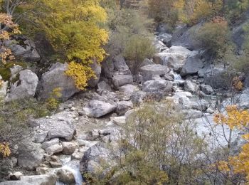
Tour Wandern Le Saix - R08 La boucle des cascades jaunes - Photo
Wandern 5.461
Km
GUIDE+

Wandern

Sehr leicht
(1)
Le Saix, Provence-Alpes-Côte d'Azur, Hochalpen, France
5,5 km | 10,3 km-effort
2h 10min
365 m
365 m
Ja
Camping Les Rives du Lac

Tour Wandern Le Saix - R07   le fai - Photo
Wandern 5.143
Km
GUIDE+

Wandern

Einfach
(4)
Le Saix, Provence-Alpes-Côte d'Azur, Hochalpen, France
5,1 km | 8 km-effort
1h 42min
218 m
217 m
Ja
Camping Les Rives du Lac

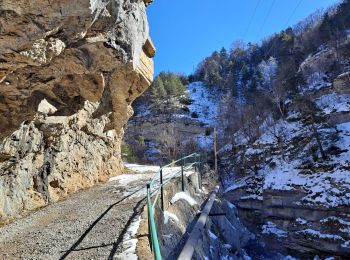
• Une randonnée partant du joli petit village du Saix. Le défilé de Gouravour est impressionant. La pause à la ferme du...
Tour Wandern Le Saix - Lac de Peyssier - Photo
Wandern 12.761
Km
GUIDE

Wandern

Medium
Le Saix, Provence-Alpes-Côte d'Azur, Hochalpen, France
12,8 km | 19,6 km-effort
4h 27min
513 m
515 m
Ja
Marco05

Tour Wandern Le Saix - Montagne d'Aujour - Photo
Wandern 16.443
Km
GUIDE

Wandern

Medium
Le Saix, Provence-Alpes-Côte d'Azur, Hochalpen, France
16,4 km | 30 km-effort
5h 33min
1027 m
948 m
Nein
nadd73

Tour Laufen Le Saix - Trail 10 - La Traversée d'Aujour - Photo
Laufen 16.403
Km
GUIDE+

Laufen

Schwierig
Le Saix, Provence-Alpes-Côte d'Azur, Hochalpen, France
16,4 km | 31 km-effort
3h 0min
1122 m
1118 m
Ja
Camping Les Rives du Lac

Tour Wandern Le Saix - R36 - Aujour depuis Clausonne - Photo
Wandern 11.919
Km
GUIDE+

Wandern

Schwierig
Le Saix, Provence-Alpes-Côte d'Azur, Hochalpen, France
11,9 km | 22 km-effort
4h 27min
770 m
771 m
Ja
Camping Les Rives du Lac

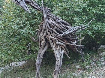
• Magnifique randonnée au départ de l’Abbaye de Clausonne (attention, route forestière raide, étroite et avec des à pic...
Tour Wandern Le Saix - Le saix 1032 18kms aujour - Photo
Wandern 17.692
Km
GUIDE

Wandern

Schwierig
Le Saix, Provence-Alpes-Côte d'Azur, Hochalpen, France
17,7 km | 31 km-effort
8h 56min
1032 m
1040 m
Ja
Danielba

Tour Wandern Le Saix - Montagne d'Aujour en boucle - Photo
Wandern 16.969
Km

Wandern

Sehr schwierig
Le Saix, Provence-Alpes-Côte d'Azur, Hochalpen, France
17 km | 31 km-effort
7h 14min
1032 m
1021 m
Ja
PapouBertrand

Tour Wandern Le Saix - LE SAIX Abbaye de Claussonne n f  - Photo
Wandern 12.506
Km

Wandern

Medium
Le Saix, Provence-Alpes-Côte d'Azur, Hochalpen, France
12,5 km | 19,9 km-effort
3h 44min
558 m
558 m
Ja
RobinMicheline

Tour Wandern Le Saix - lac Peyssier - Photo
Wandern 12.418
Km

Wandern

Sehr leicht
Le Saix, Provence-Alpes-Côte d'Azur, Hochalpen, France
12,4 km | 19,7 km-effort
4h 16min
545 m
537 m
Ja
gibello

Tour Wandern Le Saix - Boucle Le Saix - Le Faï - Photo
Wandern 11.685
Km

Wandern

Einfach
Le Saix, Provence-Alpes-Côte d'Azur, Hochalpen, France
11,7 km | 19,1 km-effort
1h 44min
553 m
561 m
Ja
kurt-vh

Tour Wandern Le Saix - Col de Combe Escure Crête de la Pousterle - Photo
Wandern 17.279
Km

Wandern

Sehr schwierig
Le Saix, Provence-Alpes-Côte d'Azur, Hochalpen, France
17,3 km | 27 km-effort
6h 2min
757 m
753 m
Ja
Jean-AlainVorgeat

Tour Wandern Le Saix - Aujour Col d'Armande par les cretes - Photo
Wandern 16.347
Km

Wandern

Sehr schwierig
Le Saix, Provence-Alpes-Côte d'Azur, Hochalpen, France
16,3 km | 28 km-effort
4h 42min
869 m
857 m
Ja
Jean-AlainVorgeat

Tour Zu Fuß Le Saix - le Saix (1) - Photo
Zu Fuß 11.142
Km

Zu Fuß

Medium
Le Saix, Provence-Alpes-Côte d'Azur, Hochalpen, France
11,1 km | 18 km-effort
4min
517 m
511 m
Ja
RobinMicheline

Tour Wandern Le Saix - Lac de Peyssier depart Le Saix - Photo
Wandern 6.958
Km

Wandern

Schwierig
Le Saix, Provence-Alpes-Côte d'Azur, Hochalpen, France
7 km | 12,4 km-effort
2h 46min
523 m
53 m
Nein
claude nier

Tour Wandern Le Saix - Montagne d'Aujour - Photo
Wandern 25.106
Km

Wandern

Medium
Le Saix, Provence-Alpes-Côte d'Azur, Hochalpen, France
25 km | 40 km-effort
8h 20min
1132 m
1138 m
Ja
arno55v

Tour Wandern Le Saix - Montagne d'Aujour - Photo
Wandern 17.551
Km

Wandern

Medium
Le Saix, Provence-Alpes-Côte d'Azur, Hochalpen, France
17,6 km | 31 km-effort
4h 42min
1039 m
1034 m
Ja
frederique.marti@laposte.net

Tour Wandern Le Saix - Grand Tour d'Aujour - Photo
Wandern 18.514
Km

Wandern

Schwierig
Le Saix, Provence-Alpes-Côte d'Azur, Hochalpen, France
18,5 km | 33 km-effort
6h 40min
1057 m
1047 m
Ja
jlv05

Tour Wandern Le Saix - lac de Peyssier - Photo
Wandern 6.888
Km

Wandern

Medium
Le Saix, Provence-Alpes-Côte d'Azur, Hochalpen, France
6,9 km | 11,7 km-effort
Unbekannt
469 m
30 m
Nein
coureau

Tour Wandern Le Saix - Clausonne - Photo
Wandern 9.289
Km

Wandern

Einfach
Le Saix, Provence-Alpes-Côte d'Azur, Hochalpen, France
9,3 km | 15,8 km-effort
2h 58min
491 m
485 m
Ja
jlv05

20 Angezeigte Touren bei 27

Kostenlosegpshiking-Anwendung

Logo SityTrail SityTrail

IGN / Geografische Institute

SityTrail aus dem App Store herunterladen SityTrail von Google Play herunterladen

Logo SityTrail SityTrail World

Die Welt öffnet sich für Sie

SityTrail aus dem App Store herunterladen SityTrail von Google Play herunterladen SityTrail auf Huawei AppGallery herunterladen

Aktivitäten

Schließen
Meine Abonnements