![](/images/other/stat-length.png)
- Touren
- Zu Fuß
- Germany
- Niedersachsen
- Heidekreis
- Munster
Munster, Heidekreis, Zu Fuß: Die besten Touren, Trails, Trecks und Wanderungen
Munster : Entdecken Sie die besten Touren : 4 zu fuß. Alle diese Touren, Trails, Routen und Outdoor-Aktivitäten sind in unseren SityTrail-Apps für Smartphones und Tablets verfügbar.
Die besten Spuren (4)
![Tour Zu Fuß Munster - Örtzeweg - Photo](https://media.geolcdn.com/t/350/260/25b42615-0518-4ae3-a43c-5dff790a005a.jpeg&format=jpg&maxdim=2)
![Zu Fuß Zu Fuß](https://static1.geolcdn.com/sitytour/trail-icons/100.png)
Km
Zu Fuß
![](/images/other/stat-length.png)
![](https://static1.geolcdn.com/siteimages/upload/files/1508320355ic_sort_den_pos_24dp.png)
![](https://static1.geolcdn.com/siteimages/upload/files/1508320355ic_sort_den_neg_24dp.png)
![](https://static1.geolcdn.com/siteimages/upload/files/16400158638029165_repeat_loop_refresh_sync_direction_icon.png)
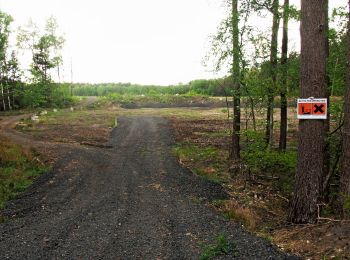
• Trail created by Munster Touristik. Symbol: Drei weiße Wellen auf blauem Grund
![Tour Zu Fuß Munster - Fischeweg - Photo](https://media.geolcdn.com/t/350/260/a16896c5-938e-411c-bcef-447906b5f820.jpeg&format=jpg&maxdim=2)
![Zu Fuß Zu Fuß](https://static1.geolcdn.com/sitytour/trail-icons/100.png)
Km
Zu Fuß
![](/images/other/stat-length.png)
![](https://static1.geolcdn.com/siteimages/upload/files/1508320355ic_sort_den_pos_24dp.png)
![](https://static1.geolcdn.com/siteimages/upload/files/1508320355ic_sort_den_neg_24dp.png)
![](https://static1.geolcdn.com/siteimages/upload/files/16400158638029165_repeat_loop_refresh_sync_direction_icon.png)
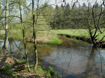
• Trail created by Munster Touristik. Symbol: Weisser Fisch auf grünem Grund
![Tour Zu Fuß Munster - Kartoffelweg - Photo](https://media.geolcdn.com/t/350/260/f36a72c8-90a0-4b20-af32-a7401c392de2.jpeg&format=jpg&maxdim=2)
![Zu Fuß Zu Fuß](https://static1.geolcdn.com/sitytour/trail-icons/100.png)
Km
Zu Fuß
![](/images/other/stat-length.png)
![](https://static1.geolcdn.com/siteimages/upload/files/1508320355ic_sort_den_pos_24dp.png)
![](https://static1.geolcdn.com/siteimages/upload/files/1508320355ic_sort_den_neg_24dp.png)
![](https://static1.geolcdn.com/siteimages/upload/files/16400158638029165_repeat_loop_refresh_sync_direction_icon.png)
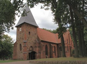
• Trail created by Munster Touristik. Symbol: Braun-Gelbe Kartoffel auf weißem Grund
![Tour Zu Fuß Munster - Zapfenweg - Photo](https://media.geolcdn.com/t/350/260/387b2ae0-23f5-41ff-abe0-0efdb6d86ee8.jpeg&format=jpg&maxdim=2)
![Zu Fuß Zu Fuß](https://static1.geolcdn.com/sitytour/trail-icons/100.png)
Km
Zu Fuß
![](/images/other/stat-length.png)
![](https://static1.geolcdn.com/siteimages/upload/files/1508320355ic_sort_den_pos_24dp.png)
![](https://static1.geolcdn.com/siteimages/upload/files/1508320355ic_sort_den_neg_24dp.png)
![](https://static1.geolcdn.com/siteimages/upload/files/16400158638029165_repeat_loop_refresh_sync_direction_icon.png)
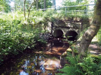
• Trail created by Kulturraum Oberes Örzetal. Symbol: Weisser Zapfen auf braunem Grund
4 Angezeigte Touren bei 4
Kostenlosegpshiking-Anwendung